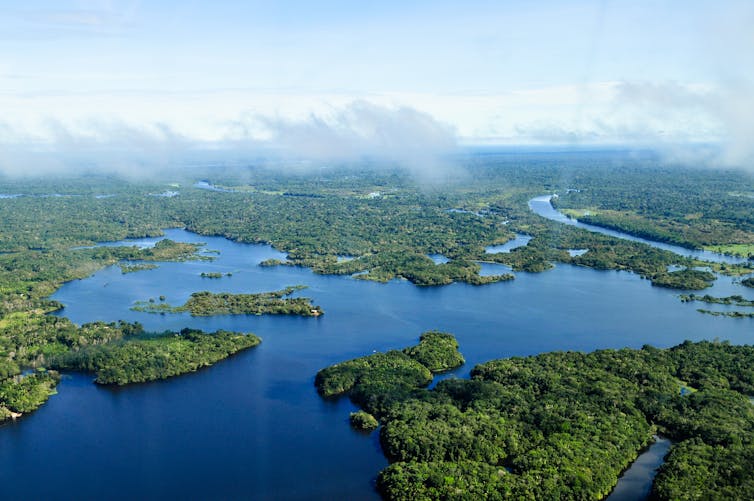
In the heart of the Amazon Rainforest, a group of young indigenous activists gathered to co-produce strategies for fostering community engagement through audiovisual production to combat climate change. Funded by the Cabot Institute for the Environment and the National Institute of Science and Technology for Amazon Biodiversity Synthesis, the voices of various indigenous peoples found collective strength to develop these strategies in the Lower Tapajós region in the city of Santarém at the Federal University of Western Pará.
This activity took place during the National Seminar of the Tapajós National Forest, which is celebrating its 50th anniversary. The organization of this workshop with young indigenous people began with Kumaruara indigenous leaders who participated in the Amazon Policy Synthesis Project (SynPAm) funded by the Cabot Institute and Policy Bristol at the University of Bristol. This project aimed to identify conservation strategies and gaps in knowledge production related to the Amazon region’s biodiversity. The project involved over 100 stakeholders (researchers, representatives of Non-Governmental Organizations, decision-makers, community leaders, indigenous and quilombola leaders) who engaged in interviews, focus groups, and participatory workshops. One of the suggestions from these various stakeholders was to develop activities where indigenous peoples would also facilitate knowledge production and mobilization processes.
Thus, one of the indigenous activists from the Kumaruara people proposed the development of a participatory workshop to create community engagement strategies through audiovisual production to the Kumaruara Territory Indigenous Council (@povokumaruara). The Indigenous Council collectively deliberated that they could co-facilitate the development of the workshop with the presence of some young indigenous leaders from different territories (see photo below).

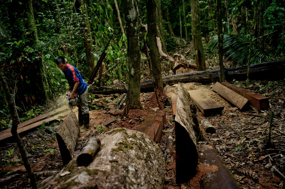
This activity was the only one co-facilitated by indigenous leaders at the National Seminar. The workshop was conducted collaboratively. The indigenous leaders began with a moment of connection and respect for the sacred spirituality present in the Lower Tapajós territory. With the blessings of the sacred beings, we proceeded to discuss how climate change has been affecting the different territories of the participants. Most of the workshop participants were indigenous people from other ethnic groups, with a small number of non-indigenous participants. A consensus among all present was that climate change is affecting different regions of the Amazon. They commented on how the regions are now drier, hotter, and with fewer fish in the rivers. There is also a greater presence of irregular fires in the region. They pointed out that there is a strong presence of agribusiness, mining, and illegal logging. These factors contribute to the worsening scenario related to climate change.

After this collective sharing moment, it was evaluated how we could produce strategies to promote community engagement to combat climate change. The participants identified that the collective production of audiovisual content could be an important strategy for community mobilization, denouncing human degradation actions in the territories, and raising awareness to fight climate change. The indigenous leaders commented that this struggle is collective. It requires the engagement of both indigenous and non-indigenous people to bring about a transformation in the ways of life of our society. Excessive consumption, waste production, and economic development models were identified as factors promoting global warming. The Kumuaruara indigenous people provided examples of some audiovisual productions they have developed in the territory (see more of these productions here: https://youtu.be/c0atRyk640k?si=Ksnwek1TblnMoPRe; https://youtu.be/i29UR49wwdo?si=3PW5JVKjn_mpf6F9).
Participatory activities took place with the organization of two subgroups, including indigenous and non-indigenous people. They reflected on the need to engage people about the impacts of climate change in the territories. A walk was facilitated on the Campus of the Federal University of Western Pará to identify possible causes and impacts of climate change. Participants reflected on the importance of being attentive to small actions that can increase global warming. They also highlighted the need to understand the impacts of large agribusiness, logging, and mining companies operating in the region. They said that the native forest, along with the rivers, has been destroyed by soybean plantations, cattle raising, illegal logging, and mining activities. Thus, the participants created audiovisual productions demonstrating these relationships, from small personal actions to the significant impacts of the logging, mining, and agribusiness sectors in the region. It is necessary to have a critical and attentive view of the entire production chain to identify whether that specific product being sold in the supermarket is not related to environmental degradation and deforestation in different parts of the world.

The indigenous peoples of the Amazon, represented by young Kumaruara leaders, call on everyone to combat climate change through daily actions. These actions involve raising awareness of the impacts of climate change on our lives. They highlight the need to compare our contexts over the years and evaluate temperature, vegetation, and climatic events. Furthermore, with this more attentive understanding, we must change habits in a more sustainable and supportive way. Thus, we must understand the production chain of manufactured products and identify if a particular company has been associated with environmental degradation actions. Similarly, we should reduce our need to consume these products and try to consume with less excess. Finally, we must support the actions of indigenous communities worldwide and in the Amazon, which have historically worked on environmental conservation and mitigating climate change.
——————————
This blog is written by Cabot Institute for the Environment members Dr James Moura, Community psychologist, Senior Research Associate of the Synthesis for Policy in Amazonia in the School of Biological Sciences; Dr Filipe França, Lecturer in the School of Biological Sciences; and Dr James Palmer, School of Geographical Sciences, University of Bristol.