UK peatlands are being destroyed to grow mushrooms, lettuce and houseplants – here’s how to stop it

Peat is a natural carbon sink but is often found in house plants and other retail products, particularly within the food and farming industry.
New Africa/Shutterstock

During the long, solitary days of lockdown, I found solace in raising houseplants. Suddenly stuck at home, I had more time to perfect the watering routine of a fussy Swiss cheese plant, and lovingly train our devil’s ivy to delicately frame the bookcases.

But I started noticing that these plants, sourced online, often arrived in the post with a passport. Most had travelled from all over Europe, with one common tagline: contains peat.

As a peatland scientist, these labels instantly filled me with horror. Hidden Peat, a new campaign launched by The Wildlife Trusts, is now highlighting the presence of peat in all sorts of consumer products, including house plants.

Peatlands, such as bogs and fens, store more carbon than all of the world’s forests combined. They trap this carbon in the ground for centuries, preventing it from being released into the atmosphere as greenhouse gases that would further warm the climate.

Peatlands have multiple environmental benefits. They are havens for wildlife, providing habitat for wetland birds, insects and reptiles. They supply more than 70% of our drinking water and help protect our homes from flooding.

So why on earth is peat being ripped from these vital ecosystems and stuffed inside plant pots?

From sink to source

Despite their importance, peatlands have been systematically drained, farmed, dug up and sold over the last century. In the UK, only 1% of lowland peat remains in its natural state.

Instead of acting as a carbon sink, it has become one of the largest sources of greenhouse gas emissions in the UK’s land use sector. When waterlogged peat soils are drained, microbes decompose the plant material within it and that results in the release of greenhouse gases such as methane into the air.

Most of the peat excavated, bagged up and sold in the UK is used as a growing medium for plants. Gardeners have become increasingly aware of this problem. Peat-free alternatives have been gaining popularity and major retailers have been phasing out peat-based bagged compost in recent years.

Indeed, the UK government announced they would ban sales of all peat-based compost by 2024. But this legislation has not yet been written and it seems unlikely it will be enacted before the end of the current parliament.

Even if brought in to law, this ban would only stop the sales of peat-based bagged compost of the type you might pick up in the garden centre. Legislation for commercial growers is not expected until 2030 at the earliest. So the continued decimation of the UK’s peatlands could remain hidden in supply chains long after we stop spreading peat on our gardens.

Hide and seek peat

For consumers, it’s almost impossible to identify products that contain peat or use peat in their production. All large-scale commercial mushroom farming involves peat and it is used for growing most leafy salads. It gives that characteristic peaty aroma to whisky, and, as I found out, is a popular growing medium for potted plants.

But you’d struggle to find a peat-free lettuce in the supermarket. The Hidden Peat campaign asks consumers to call for clear labelling that would enable shoppers to more easily identify peat-containing products. Shoppers are also encouraged to demand transparency from retailers on their commitment to removing peat from their supply chains.

You can ask your local supermarket about how they plan to phase out peat from their produce. Some supermarkets are actively investing in new technologies for peat-free mushroom farming.

Make informed purchases by checking the labels on garden centre potted plants or source plants from peat-free nurseries. The Royal Horticultural Society lists more than 70 UK nurseries dedicated to peat-free growing.

You can write to your MP to support a ban on peat extraction and, crucially, the sale of peat and peat-containing products in the UK. That ensures that peat wouldn’t just get imported from other European countries.

Pilots and progress

The UK government recently announced £3.1m funding for pilot projects to rewet and preserve lowland peat, with peat restoration seen as a cornerstone of net zero ambitions. This campaign calls for further acceleration of peatland restoration across the UK.

As a research of the science behind peatland restoration, I see firsthand the enormous effort involved in this: the installation of dams to block old agricultural drainage ditches, the delicate management of water levels and painstaking monitoring of the peat wetness.

I spend a lot of time taking samples, monitoring the progress, feeding results back to the land managers. Like many other conservationists, I work hard to find ways to preserve these critical habitats.

But sometimes, there may be a digger in the adjacent field doing more damage in a day than we could undo in a lifetime. That’s the reality, and the insanity, of the UK’s current peatland policies.

We heavily invest in restoring peatlands, yet fail to ban its extraction – the one action that would have the most dramatic impact. By demanding that peat is not only eradicated from garden compost, but weeded out of our supply chains, we can keep peat in the ground, not in pots.

—————————-

This blog is written by Cabot Institute for the Environment member, Dr Casey Bryce, Senior Lecturer, School of Earth Sciences, University of Bristol.

This article is republished from The Conversation under a Creative Commons license. Read the original article.

Casey Bryce
Casey Bryce

Climate change is threatening Madagascar’s famous forests – our study shows how serious it is

Urgent action is needed to protect Madagascar’s forests.
Rijasolo/AFP via Getty Images

Global climate change doesn’t only cause the melting of polar ice caps, rising sea levels and extreme weather events. It also has a direct effect on many tropical habitats and the animals and plants that inhabit them. As fossil fuel emissions continue to drive climate change, large areas of land are forecast to become much hotter and drier by the end of this century.

Many ecosystems, including tropical forests, wetlands, swamps and mangroves, will be unable to cope with these extreme climatic conditions. It is highly likely that the extent and condition of these ecosystems will decline. They will become more like deserts and savanna.

The island nation of Madagascar is of particular concern when it comes to climate change. Of Madagascar’s animal species, 85% cannot be found elsewhere on Earth. Of its plant species, 82% are unique to the island. Although a global biodiversity hotspot, Madagascar has experienced the highest rates of deforestation anywhere in the world. Over 80% of its original forest cover has already been cleared by humans.

This has resulted in large population declines in many species. For example, many species of lemurs (Madagascar’s flagship group of animals) have undergone rapid population decline, and over 95% of lemur species are now classified as threatened on the International Union for Conservation of Nature (IUCN) Red List.

Drier conditions brought about by climate change have already resulted in widespread bush fires throughout Madagascar. Drought and famine are increasingly severe for the people living in the far south and south-western regions of the island.

Madagascar’s future will likely depend profoundly on how swiftly and comprehensively humans deal with the current climate crisis.

What we found

Our study investigated how future climate change is likely to affect four of Madagascar’s key forest habitat types. These four forest types are the dry deciduous forests of the west, humid evergreen forests of the east, spiny bush forests of the arid south, and transitional forests of the north-west corner of the island.

Using computer-based modelling, we simulated how each forest type would respond to climate change from the current period up to the year 2080. The model used the known distribution of each forest type, and current and future climatic data.

We did this under two different conditions: a mitigation scenario, assuming human reliance on greenhouse gas reduces according to climate commitments already made; and an unmitigated scenario, assuming greenhouse gas emissions continue to increase at their current rate.

Our results suggest that unmitigated climate change will result in declines of Madagascar’s forests. The area of land covered by humid forest, the most extensive of the four forest types, is predicted to decrease by about 5.66%. Dry forest and spiny bush are also predicted to decline in response to unmitigated climate change. Transitional forest may actually increase by as much as 5.24%, but this gain will almost certainly come at the expense of other forest types.

We expected our model to show that mitigating climate change would result in net forest gain. Surprisingly, our results suggest entirely the opposite. Forest occurrence will decrease by up to 5.84%, even with efforts to mitigate climate change. This is because global temperatures are forecast to increase under both mitigated and unmitigated scenarios.

These predicted declines are in addition to the huge losses of forest already caused by ongoing deforestation throughout the island.

It looks as if the damage has already been done.

Climate change, a major threat

The results of our research highlight that climate change is indeed a major threat to Madagascar’s forests and likely other ecosystems worldwide. These findings are deeply concerning for the survival of Madagascar’s animals and plants, many of which depend entirely on forest habitat.

Not only will climate change decrease the size of existing forests, changes in temperature and rainfall will also affect the amount of fruit that trees produce.

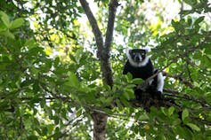
A Lemur on tree in the forest.
Madagascar lemurs and other animal and plant species may become extinct if the forests disappear.
Rijasolo/AFP

Many of Madagascar’s animals, such as its lemurs, rely heavily on fruit for food. Changes in fruit availability will have serious impact on the health, reproductive success and population growth of these animals. Some animals may be able to adapt to changes in climate and habitat, but others are very sensitive to such changes. They are unlikely to survive in a hot, arid environment.

This will also have serious knock-on effects for human populations that depend on forests and animals for eco-tourism income. Approximately 75% of Madagascar’s population depends on the forest and subsistence farming for survival, and the tourism sector contributes over US$600 million towards the island’s economy annually.

To ensure that Madagascar’s forests survive, immediate action is needed to end deforestation, protect the remaining patches of forest, replant and restore forests, and mitigate global carbon emissions. Otherwise these remarkable forests will eventually disappear, along with all the animals and plants that depend on them.The Conversation

——————————

This blog is written by Daniel Hending, Postdoctoral Research Assistant Animal Vibration Lab, University of Oxford and Cabot Institute for the Environment member Marc Holderied, Professor in Sensory Biology, University of BristolThis article is republished from The Conversation under a Creative Commons license. Read the original article.

Marc Holderied


Why I’m mapping the carbon stored in regrowing Amazonian forests

As we navigate our way out of the global medical pandemic, many are calling for a “green economic recovery”. This green recovery should be at the forefront of many discussions as world leaders, policy makers, scientists and organisations are preparing for the 26th Conference of the Parties (COP26) due to take place in November this year in Glasgow, UK. This conference will once again try to unite the world to help tackle the next and even larger global emergency, the Climate Emergency.

In recent years, the conversations around the Climate Emergency have increased dramatically with many individuals, groups, companies and governments aiming to tackle this emergency, in part, through replanting, restoring and reforesting large areas of land.

But what if we let forests regrow back naturally? How much carbon can they absorb from the atmosphere? 

As part of my PhD research at the University of Bristol, I have been looking at naturally regrowing forests in the Brazilian Amazon rainforest. These forests are known as “Secondary forests” and regrow on land that has previously been deforested and used for agricultural or other purposes and has since been abandoned, allowing the natural vegetation to return.

Figure 1: Secondary Forest in the Tapajos region of the Brazillian Amazon (credit Ricardo Dalagnol)

Secondary Forests in the Brazilian Amazon are expected to play a key role in achieving the goals of the Paris Agreement. They have a large climate mitigation potential, given their ability to absorb carbon up to 11 times faster than old-growth forests. However, the regrowth of these secondary forests is not uniform across the Amazon and is influenced by regional and local-scale environmental drivers and human disturbances like fires and repeated deforestations.

I worked with numerous scientists from Brazil and the UK to determine the impact of different drivers on the regrowth rates of the secondary forests, using a combination of satellite data. The key datasets we needed were:

What we did

We combined the satellite data maps and overlayed them to extract information on the carbon stored in relation to the forest age to model the regrowth rate with increasing age. We overlayed the information of key environmental drivers and human disturbances to see if and how these factors impact the regrowth rates.

What we found out

Overall, we found that the environmental conditions in Western Amazon enable secondary forests to regrow faster. Here the land received lots of rainfall and does not experience much drought. In the eastern parts of the Amazon, where the climate is drier and experiences more drought, the regrowth rates were up to 60% lower.

Figure 2: Schematic summary of the main results from the paper, highlighting the spatial patterns of regrowth dependent on both climate and human disturbances. The map in the middle shows the regions of secondary forest in the Brazillian Amazon and the four panels correspond to these regions.

In addition to this, we found that the regrowth rates were reduced even further by as much as 80% in eastern regions if the forests were subject to human activities like burning and repeated deforestations before the land was finally abandoned.

What it all means

Our results show the importance of protecting and expanding secondary forest areas to help us meet the Paris Agreement Targets. Our regrowth models can be used to help determine the contribution of current and future regrowing forests in the Brazilian Amazon in a spatial manner.

We found that in 2017, the secondary forests in the Brazilian Amazon stored about 294 Terragrams Carbon aboveground (that excludes carbon stored in roots and soils). However, this number is equivalent to about 0.25% of the carbon that is already stored in Amazon’s old-growth forests. Limiting carbon emissions through deforestation and degradation through burning of old-growth forests is therefore extremely important to help tackle the Climate Emergency.

We calculated that the annual carbon absorbed by the present secondary forest area in the Amazon is enough to contribute to about 5% of Brazil’s pledged contribution to the Paris Agreement by 2030. This number may seem small, but the area covered by the Amazonian secondary forests is currently equivalent to less than 2% of the whole of Brazil. If the area of secondary forest were to be expanded this would bring with it numerous co-benefits such as generating income to landowners and re-establishing ecosystem services.

In December 2020, many countries submitted updates to their so-called Nationally Determined Contributions (NDC), a country’s individual contributions to the Paris Agreement, this included Brazil. However, Brazil’s updated NDC no longer includes a clear position on reforestation, restoration and eliminating illegal deforestation.

At a time when we have all seen and felt the impacts of a true global emergency such as the COVID-19 pandemic, it becomes easier to imagine the potential impacts of climate change if left at the back of politician’s agendas. In the run up to COP26 it is now more important than ever to raise, not lower ambitions as we continue to tackle the global Climate Emergency.

You can read the full paper and download the data here: https://rdcu.be/cg4um.

——————————-

This blog is written by Cabot Institute member Viola Heinrich, School of Geographical Sciences, University of Bristol.

Viola Heinrich

The Sarstoon-Temash National Park, Belize: forest communities and conservation

This is the second blog post from former Environmental Policy MSc student Rachel Simon. During her time at the University Rachel was a member of the Fossil Free Bristol University group. Following the completion of her MSc in 2016 Rachel spent time with an indigenous conservation organisation in Belize, recording voices of land rights activists for the Latin American Bureau’s [http://lab.org.uk/] forthcoming book, Voices of Latin America.


The previous blog post in this series is available here.
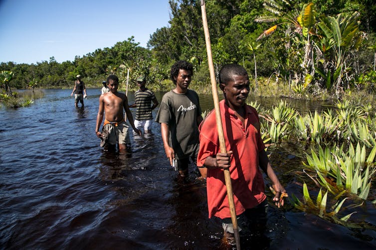
Back in the SATIIM office in Punta Gorda, I’m invited on a patrol into the Sarstoon Temash National Park led by Maya and Garifuna community members. These monthly forest patrols are an important way of monitoring illegal logging and poaching. They also gather data on the forest’s rich ecosystems, which spread across over 40,000 acres of broadleaf, wetland and mangrove forest, and ten miles of coast in the Gulf of Honduras, a wetlands designated of international importance under the Ramsar Convention.

SATIIM and the Belize Government used to manage the area under a co-management agreement. But when SATIIM took a stance against oil drilling in the park the government terminated their funding and their partnership (see my previous blog post ‘Whose land, whose development?’ http://cabot-institute.blogspot.com.co/2017/01/the-sarstoon-temash-national-park.html)

However SATIIM continues to patrol and monitor the park, providing reports to the government and new funders such as Global Forest Watch [http://www.globalforestwatch.org/] an initiative of the World Resources Institute which works to collect and disseminate data about deforestation.
 

Map of the Sarstoon-Temash National Park and drill site by Amandala Newspaper

 
So early one morning seven men from the surrounding villages and I set off from the coastal town of Punta Gorda in a speed boat loaded up with three days’ camping equipment and supplies. We pull south round the coast on the glinting waters of the Bay of Honduras, speed past the Garifuna village of Barranco, before pulling into the darker stiller mouth of the Sarstoon River, the border with Guatemala. Tensions between the two countries over the boundary have been high over the years, and Guatemala has been uncooperative over conservation efforts – some SATIIM patrols have even been intercepted and detained by the Guatemalan military. A newish Belize Defence Force (BDF) outpost marks the Belizean side of the Sarstoon, and this has helped to discourage poachers and loggers crossing the river from Guatemala, as well as maintaining Belize’s claim over the area. We pull into the BDF check-point to report our trip. The commander informs us shortly that he can’t do anything to protect us if we stray from the Belizean to the Guatemalan side of the river. With that we start the patrol.


Marking sites of deforestation

 
Cruising the banks of the Sarstoon we count numerous lines and trails cut through the mangroves and forest cover, signs that poachers have come in to hunt, fish, and log hardwoods and comfre palms.


Illegal logging of Santa Teresa and Sapodilla hardwoods

 
On this patrol SATIIM are piloting a new tablet and app provided by Global Forest Watch to help them track deforestation more easily. The app is pre-loaded with maps highlighting “threats”: patches of fragmentation or breaks in forest cover identified from satellite imagery using algorithms. The patrol is then able to navigate to these areas using GPS in order to investigate. However on reaching our first “threat”, somewhere inland alongside the bank of the Sarstoon, it’s a pleasant surprise to find undisturbed mangroves and thick forest cover. It seems that the app’s algorithms need a little tweaking, and may be mis-coding some changes in vegetation or colouration as deforestation.

Unfortunately most “threats” are simply too far away to investigate, as trekking through the forest cover is slow and heavy work, and back in the office SATIIM’s Director muses that it might be better to pilot a drone which could zoom over the wetlands and photograph the areas we can’t reach.

On the second day we dock on the bank of the Temash River, in order to survey US Capital Energy’s main drill site, a couple of acres of dust and sand amid the vibrant forest cover. Martin Cus, the leader of the patrol tells me that the numbers of illegal incidents in the forest have increased dramatically after the government granted the company oil exploration contracts. Our 300m crawl from the river bank through mangrove, dense forest swamp and wetland takes 20 minutes – but the major road on the opposite side of the drill site, snaking north out through the forest, means there is now a much easier journey into its heart. Along with the company’s seismic testing lines, this has opened up the forest to more extractive activities, intensifying fragmentation of the forest cover and endangering its ecosystems. The company also ignored warnings about the drill site’s position in a low-lying and swampy area. Containing spills in this wetland would be near impossible, with run-off quickly contaminating the surrounding swamp, mangroves, and rivers out into the Bay of Honduras – as well as impacting the villages upstream which use the rivers as water sources.


US Capital  Energy’s drill site, and road through the forest
Aside from monitoring threats to the forest, we spend a good deal of time using GPS coordinates to note down bird and animal sightings. The boat’s captain Roberto seems to have an encyclopaedic knowledge of bird species, but SATIIM is looking for scientists and data gatherers to carry out a more comprehensive review of the park, to help them evidence the value of its eco-systems.

Forest dependent communities
A week later, staying in the Mayan village of Crique Sarco, I’m able to learn more about the communities’ dependency on the forest. Many Maya subsist on milpa farming, a form of slash and burn agriculture. The forest is where they get most of their protein, hunting gibnut and other creatures for much of the year, while respecting the animals’ gestation periods. Communities have used the forest sustainably in this area for almost 150 years. Juan Choc, Village Council Leader, explains that the area around US Capital’s drill site used to be rich with animal life, but the company’s construction and working noise drove them away.


Juan Choc, Crique Sarco

 
Making the land more resistant to encroachment and the forest less vulnerable to resource extraction is now a vital project for the survival of these communities’ livelihoods. Juan Choc explains their communal land ownership model which prevents land from being gradually sold off and becoming fragmented, and that the village is now georeferencing their boundary in order to get more solid legal recognition. Land demarcation will offer better protection from outside corporate interests, empower the community, and safeguard the land for the younger generation.