Climate change is threatening Madagascar’s famous forests – our study shows how serious it is

Urgent action is needed to protect Madagascar’s forests.
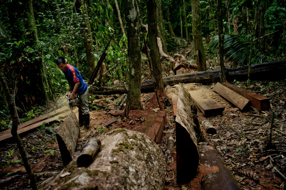
Rijasolo/AFP via Getty Images

Global climate change doesn’t only cause the melting of polar ice caps, rising sea levels and extreme weather events. It also has a direct effect on many tropical habitats and the animals and plants that inhabit them. As fossil fuel emissions continue to drive climate change, large areas of land are forecast to become much hotter and drier by the end of this century.

Many ecosystems, including tropical forests, wetlands, swamps and mangroves, will be unable to cope with these extreme climatic conditions. It is highly likely that the extent and condition of these ecosystems will decline. They will become more like deserts and savanna.

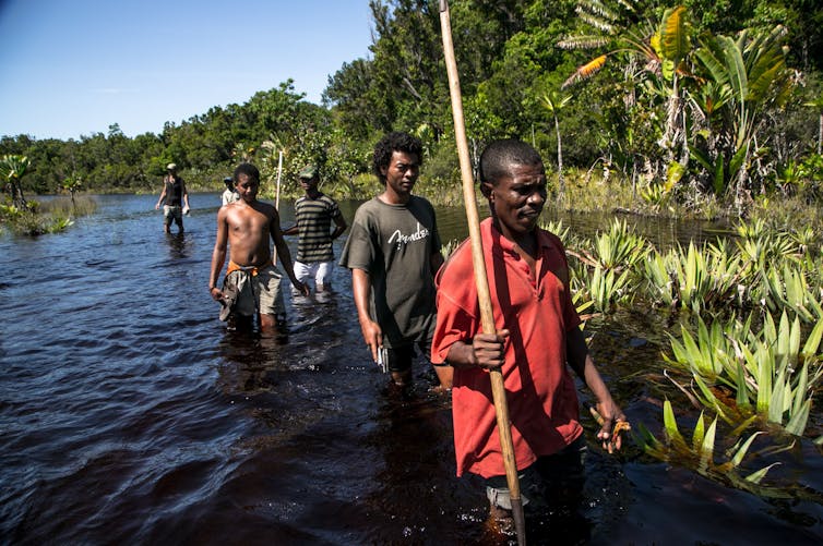
The island nation of Madagascar is of particular concern when it comes to climate change. Of Madagascar’s animal species, 85% cannot be found elsewhere on Earth. Of its plant species, 82% are unique to the island. Although a global biodiversity hotspot, Madagascar has experienced the highest rates of deforestation anywhere in the world. Over 80% of its original forest cover has already been cleared by humans.

This has resulted in large population declines in many species. For example, many species of lemurs (Madagascar’s flagship group of animals) have undergone rapid population decline, and over 95% of lemur species are now classified as threatened on the International Union for Conservation of Nature (IUCN) Red List.

Drier conditions brought about by climate change have already resulted in widespread bush fires throughout Madagascar. Drought and famine are increasingly severe for the people living in the far south and south-western regions of the island.

Madagascar’s future will likely depend profoundly on how swiftly and comprehensively humans deal with the current climate crisis.

What we found

Our study investigated how future climate change is likely to affect four of Madagascar’s key forest habitat types. These four forest types are the dry deciduous forests of the west, humid evergreen forests of the east, spiny bush forests of the arid south, and transitional forests of the north-west corner of the island.

Using computer-based modelling, we simulated how each forest type would respond to climate change from the current period up to the year 2080. The model used the known distribution of each forest type, and current and future climatic data.

We did this under two different conditions: a mitigation scenario, assuming human reliance on greenhouse gas reduces according to climate commitments already made; and an unmitigated scenario, assuming greenhouse gas emissions continue to increase at their current rate.

Our results suggest that unmitigated climate change will result in declines of Madagascar’s forests. The area of land covered by humid forest, the most extensive of the four forest types, is predicted to decrease by about 5.66%. Dry forest and spiny bush are also predicted to decline in response to unmitigated climate change. Transitional forest may actually increase by as much as 5.24%, but this gain will almost certainly come at the expense of other forest types.

We expected our model to show that mitigating climate change would result in net forest gain. Surprisingly, our results suggest entirely the opposite. Forest occurrence will decrease by up to 5.84%, even with efforts to mitigate climate change. This is because global temperatures are forecast to increase under both mitigated and unmitigated scenarios.

These predicted declines are in addition to the huge losses of forest already caused by ongoing deforestation throughout the island.

It looks as if the damage has already been done.

Climate change, a major threat

The results of our research highlight that climate change is indeed a major threat to Madagascar’s forests and likely other ecosystems worldwide. These findings are deeply concerning for the survival of Madagascar’s animals and plants, many of which depend entirely on forest habitat.

Not only will climate change decrease the size of existing forests, changes in temperature and rainfall will also affect the amount of fruit that trees produce.

A Lemur on tree in the forest.
Madagascar lemurs and other animal and plant species may become extinct if the forests disappear.
Rijasolo/AFP

Many of Madagascar’s animals, such as its lemurs, rely heavily on fruit for food. Changes in fruit availability will have serious impact on the health, reproductive success and population growth of these animals. Some animals may be able to adapt to changes in climate and habitat, but others are very sensitive to such changes. They are unlikely to survive in a hot, arid environment.

This will also have serious knock-on effects for human populations that depend on forests and animals for eco-tourism income. Approximately 75% of Madagascar’s population depends on the forest and subsistence farming for survival, and the tourism sector contributes over US$600 million towards the island’s economy annually.

To ensure that Madagascar’s forests survive, immediate action is needed to end deforestation, protect the remaining patches of forest, replant and restore forests, and mitigate global carbon emissions. Otherwise these remarkable forests will eventually disappear, along with all the animals and plants that depend on them.The Conversation

——————————

This blog is written by Daniel Hending, Postdoctoral Research Assistant Animal Vibration Lab, University of Oxford and Cabot Institute for the Environment member Marc Holderied, Professor in Sensory Biology, University of BristolThis article is republished from The Conversation under a Creative Commons license. Read the original article.

Marc Holderied


Five satellite images that show how fast our planet is changing


Stocktrek Images, Inc. / Alamy

You have probably seen satellite images of the planet through applications like Google Earth. These provide a fascinating view of the surface of the planet from a unique vantage point and can be both beautiful to look at and useful aids for planning. But satellite observations can provide far more insights than that. In fact, they are essential for understanding how our planet is changing and responding to global heating and can do so much more than just “taking pictures”.

It really is rocket science and the kind of information we can now obtain from what are called Earth observation satellites is revolutionising our ability to carry out a comprehensive and timely health check on the planetary systems we rely on for our survival. We can measure changes in sea level down to a single millimetre, changes in how much water is stored in underground rocks, the temperature of the land and ocean and the spread of atmospheric pollutants and greenhouse gases, all from space.

Here I have selected five striking images that illustrate how Earth observation data is informing climate scientists about the changing characteristics of the planet we call home.

1. The sea level is rising – but where?

Map showing global sea level rise
The sea is rising quickly – but not evenly.
ESA/CLS/LEGOS, CC BY-SA

Sea level rise is predicted to be one of the most serious consequences of global heating: under the more extreme “business-as-usual” scenario, a two-metre rise would flood 600 million people by the end of this century. The pattern of sea surface height change, however, is not uniform across the oceans.

This image shows mean sea level trends over 13 years in which the global average rise was about 3.2mm a year. But the rate was three or four times faster in some places, like the south western Pacific to the east of Indonesia and New Zealand, where there are numerous small islands and atolls that are already very vulnerable to sea level rise. Meanwhile in other parts of the ocean the sea level has barely changed, such as in the Pacific to the west of North America.

2. Permafrost is thawing

Source: ESA

Permafrost is permanently frozen ground and the vast majority of it lies in the Arctic. It stores huge quantities of carbon but when it thaws, that carbon is released as CO₂ and an even more potent greenhouse gas: methane. Permafrost stores about 1,500 billion tonnes of carbon – twice as much as in the whole of the atmosphere – and it is incredibly important that carbon stays in the ground.

This animation combines satellite, ground-based measurements of soil temperature and computer modelling to map the permafrost temperature at depth across the Arctic and how it is changing with time, giving an indication of where it is thawing.

3. Lockdown cleans Europe’s skies

Source: ESA

Nitrogen dioxide is an atmospheric pollutant that can have serious health impacts, especially for those who are asthmatic or have weakened lung function, and it can increase the acidity of rainfall with damaging effects on sensitive ecosystems and plant health. A major source is from internal combustion engines found in cars and other vehicles.

This animation shows the difference in NO₂ concentrations over Europe before national pandemic-related lockdowns began in March 2020 and just after. The latter shows a dramatic reduction in concentration over major conurbations such as Madrid, Milan and Paris.

4. Deforestation in the Amazon

Credits: ESA/USGS/Deimos Imaging

Tropical forests have been described as the lungs of the planet, breathing in CO₂ and storing it in woody biomass while exhaling oxygen. Deforestation in Amazonia has been in the news recently because of deregulation and increased forest clearing in Brazil but it had been taking place, perhaps not so rapidly, for decades. This animation shows dramatic loss of rainforest in the western Brazilian state of Rondonia between 1986 and 2010, as observed by satellites.

5. A megacity-sized iceberg

Source: ESA

The Antarctic Ice Sheet contains enough frozen water to raise global sea level by 58 metres if it all ended up in the ocean. The floating ice shelves that fringe the continent act as a buffer and barrier between the warm ocean and inland ice but they are vulnerable to both oceanic and atmospheric warming.

This animation shows the break-off of a huge iceberg dubbed A-74, captured by satellite radar images that have the advantage they can “see” through clouds and operate day or night and are thus unaffected by the 24 hours of darkness that occurs during the Antarctic winter. The iceberg that forms is 1,270 km² in area which is about the same size as Greater London.

These examples illustrate just a few ways in which satellite data are providing unique, global observations of key components of the climate system and biosphere that are essential for our understanding of how the planet is changing. We can use this data to monitor those changes and improve models used to predict future change. In the run up to the vitally important UN climate conference, COP26 in Glasgow this November, colleagues and I have produced a briefing paper to highlight the role Earth observation satellites will play in safeguarding the climate and other systems that we rely on to make this beautiful, fragile planet habitable.The Conversation

————————–

This blog is written by Cabot Institute for the Environment member Jonathan Bamber, Professor of Physical Geography, University of Bristol.

This article is republished from The Conversation under a Creative Commons license. Read the original article.

Jonathan Bamber

Why I’m mapping the carbon stored in regrowing Amazonian forests

As we navigate our way out of the global medical pandemic, many are calling for a “green economic recovery”. This green recovery should be at the forefront of many discussions as world leaders, policy makers, scientists and organisations are preparing for the 26th Conference of the Parties (COP26) due to take place in November this year in Glasgow, UK. This conference will once again try to unite the world to help tackle the next and even larger global emergency, the Climate Emergency.

In recent years, the conversations around the Climate Emergency have increased dramatically with many individuals, groups, companies and governments aiming to tackle this emergency, in part, through replanting, restoring and reforesting large areas of land.

But what if we let forests regrow back naturally? How much carbon can they absorb from the atmosphere? 

As part of my PhD research at the University of Bristol, I have been looking at naturally regrowing forests in the Brazilian Amazon rainforest. These forests are known as “Secondary forests” and regrow on land that has previously been deforested and used for agricultural or other purposes and has since been abandoned, allowing the natural vegetation to return.

Figure 1: Secondary Forest in the Tapajos region of the Brazillian Amazon (credit Ricardo Dalagnol)

Secondary Forests in the Brazilian Amazon are expected to play a key role in achieving the goals of the Paris Agreement. They have a large climate mitigation potential, given their ability to absorb carbon up to 11 times faster than old-growth forests. However, the regrowth of these secondary forests is not uniform across the Amazon and is influenced by regional and local-scale environmental drivers and human disturbances like fires and repeated deforestations.

I worked with numerous scientists from Brazil and the UK to determine the impact of different drivers on the regrowth rates of the secondary forests, using a combination of satellite data. The key datasets we needed were:

What we did

We combined the satellite data maps and overlayed them to extract information on the carbon stored in relation to the forest age to model the regrowth rate with increasing age. We overlayed the information of key environmental drivers and human disturbances to see if and how these factors impact the regrowth rates.

What we found out

Overall, we found that the environmental conditions in Western Amazon enable secondary forests to regrow faster. Here the land received lots of rainfall and does not experience much drought. In the eastern parts of the Amazon, where the climate is drier and experiences more drought, the regrowth rates were up to 60% lower.

Figure 2: Schematic summary of the main results from the paper, highlighting the spatial patterns of regrowth dependent on both climate and human disturbances. The map in the middle shows the regions of secondary forest in the Brazillian Amazon and the four panels correspond to these regions.

In addition to this, we found that the regrowth rates were reduced even further by as much as 80% in eastern regions if the forests were subject to human activities like burning and repeated deforestations before the land was finally abandoned.

What it all means

Our results show the importance of protecting and expanding secondary forest areas to help us meet the Paris Agreement Targets. Our regrowth models can be used to help determine the contribution of current and future regrowing forests in the Brazilian Amazon in a spatial manner.

We found that in 2017, the secondary forests in the Brazilian Amazon stored about 294 Terragrams Carbon aboveground (that excludes carbon stored in roots and soils). However, this number is equivalent to about 0.25% of the carbon that is already stored in Amazon’s old-growth forests. Limiting carbon emissions through deforestation and degradation through burning of old-growth forests is therefore extremely important to help tackle the Climate Emergency.

We calculated that the annual carbon absorbed by the present secondary forest area in the Amazon is enough to contribute to about 5% of Brazil’s pledged contribution to the Paris Agreement by 2030. This number may seem small, but the area covered by the Amazonian secondary forests is currently equivalent to less than 2% of the whole of Brazil. If the area of secondary forest were to be expanded this would bring with it numerous co-benefits such as generating income to landowners and re-establishing ecosystem services.

In December 2020, many countries submitted updates to their so-called Nationally Determined Contributions (NDC), a country’s individual contributions to the Paris Agreement, this included Brazil. However, Brazil’s updated NDC no longer includes a clear position on reforestation, restoration and eliminating illegal deforestation.

At a time when we have all seen and felt the impacts of a true global emergency such as the COVID-19 pandemic, it becomes easier to imagine the potential impacts of climate change if left at the back of politician’s agendas. In the run up to COP26 it is now more important than ever to raise, not lower ambitions as we continue to tackle the global Climate Emergency.

You can read the full paper and download the data here: https://rdcu.be/cg4um.

——————————-

This blog is written by Cabot Institute member Viola Heinrich, School of Geographical Sciences, University of Bristol.

Viola Heinrich

In the Amazon, forest degradation is outpacing full deforestation

Deforestation in the Brazilian Amazon has increased abruptly in the past two years, after having been on a downward trajectory for more than a decade. With the country’s president Jair Bolsonaro notoriously enthusiastic about expanding into the rainforest, new deforestation data regularly makes global headlines.

But what fewer people realise is that even forests that have not been cleared, or fully “deforested”, are rarely untouched. Indeed, just 20% of the world’s tropical forests are classified as intact. The rest have been impacted by logging, mining, fires, or by the expansion of roads or other human activities. And all this can happen undetected by the satellites that monitor deforestation.

These forests are known as “degraded”, and they make up an increasingly large fraction of the world’s remaining forest landscapes. Degradation is a major environmental and societal challenge. Disturbances associated with logging, fire and habitat fragmentation are a significant source of CO₂ emissions and can flip forests from carbon sinks to sources, where the carbon emitted when trees burn or decompose outweighs the carbon taken from the atmosphere as they grow.

Forest degradation is also a major threat to biodiversity and has been shown to increase the risk of transmission of emerging infectious diseases. And yet despite all of this, we continue to lack appropriate tools to monitor forest degradation at the required scale.

A man chainsaws a tree trunk in Amazon rainforest
Degraded – but not deforested.
CIFOR / flickr, CC BY-NC-SA

The main reason forest degradation is difficult to monitor is that it’s hard to see from space. The launch of Nasa’s Landsat programme in the 1970s revealed – perhaps for the first time – the true extent of the impact that humans have had on the world’s forests. Today, satellites allow us to track deforestation fronts in real time anywhere in the world. But while it’s easy enough to spot where forests are being cleared and converted to farms or plantations, capturing forest degradation is not as simple. A degraded forest is still a forest, as by definition it retains at least part of its canopy. So, while old-growth and logged forests may look very different on the ground, seen from above they can be hard to tell apart in a sea of green.

Degradation detectives

New research published in the journal Science by a team of Brazilian and US researchers led by Eraldo Matricardi has taken an important step towards tackling this challenge. By combining more than 20 years of satellite data with extensive field observations, they trained a computer algorithm to map changes in forest degradation through time across the entire Brazilian Amazon. Their work reveals that 337,427 km² of forest were degraded across the Brazilian Amazon between 1992 and 2014, an area larger than neighbouring Ecuador. During this same period, degradation actually outpaced deforestation, which contributed to a loss of a further 308,311 km² of forest.

The researchers went a step further and used the data to tease apart the relative contribution of different drivers of forest degradation, including logging, fire and forest fragmentation. What these maps reveal is that while overall rates of degradation across the Brazilian Amazon have declined since the 1990s – in line with decreases in deforestation and associated habitat fragmentation – rates of selective logging and forest fires have almost doubled. In particular, in the past 15 years logging has expanded west into a new frontier that up until recently was considered too remote to be at risk.

Map of deforestation and degradation in the Brazilian Amazon, 1992-2014.
The Brazilian Amazon, shaded in grey, covers an area larger than the European Union.
Matricardi et al

By putting forest degradation on the map, Matricardi and colleagues have not only revealed the true extent of the problem, but have also generated the baseline data needed to guide action. Restoring degraded forests is central to several ambitious international efforts to curb climate change and biodiversity loss, such as the UN scheme to pay developing countries to keep their forests intact. If allowed to recover, degraded forests, particularly those in the tropics, have the potential to sequester and store large amounts of CO₂ from the atmosphere – even more so than their intact counterparts.

Simply allowing forests to naturally regenerate can be a very effective strategy, as biomass stocks often recover within decades. In other cases, active restoration may be a preferable option to speed up recovery. Another recent study, also published in the journal Science, showed how tree planting and cutting back lianas (large woody vines common in the tropics) can increase biomass recovery rates by as much as 50% in south-east Asian rainforests. But active restoration comes at a cost, which in many cases exceeds the prices that are paid to offset CO₂ emission on the voluntary carbon market. If we are to successfully implement ecosystem restoration on a global scale, governments, companies and even individuals need to think carefully about how they value nature.The Conversation

———————————-

This blog is written by Cabot Institute member Dr Tommaso Jucker, Research Fellow and Lecturer, School of Biological Sciences, University of BristolThis article is republished from The Conversation under a Creative Commons license. Read the original article.

Tommaso Jucker


Belo Monte: there is nothing green or sustainable about these mega-dams


File 20180807 191041 1xhv2ft.png?ixlib=rb 1.1
Google Maps

There are few dams in the world that capture the imagination as much as Belo Monte, built on the “Big Bend” of the Xingu river in the Brazilian Amazon. Its construction has involved an army of 25,000 workers working round the clock since 2011 to excavate over 240m cubic metres of soil and rock, pour three million cubic metres of concrete, and divert 80% of the river’s flow through 24 turbines.


The dam is located about 200km before the 1,640km Xingu meets the Amazon. kmusserCC BY-SA

Costing R$30 billion (£5.8 billion), Belo Monte is important not only for the scale of its construction but also the scope of opposition to it. The project was first proposed in the 1970s, and ever since then, local indigenous communities, civil society and even global celebrities have engaged in numerous acts of direct and indirect action against it.

While previous incarnations had been cancelled, Belo Monte is now in the final stages of construction and already provides 11,233 megawatts of energy to 60m Brazilians across the country. When complete, it will be the largest hydroelectric power plant in the Amazon and the fourth largest in the world.

Indigenous protests against Belo Monte at the UN’s sustainable development conference in Rio, 2012. Fernando Bizerra Jr / EPA

A ‘sustainable’ project?

The dam is to be operated by the Norte Energia consortium (formed of a number of state electrical utilities) and is heavily funded by the Brazilian state development bank, BNDES. The project’s supporters, including the governments of the Partido dos Trabalhadores (Workers’ Party) that held office between 2003 and 2011, have justified its construction on environmental grounds. They describe Belo Monte as a “sustainable” project, linking it to wider policies of climate change mitigation and a transition away from fossil fuels. The assertions of the sustainability of hydropower are not only seen in Brazil but can be found across the globe – with large dams presented as part of wider sustainable development agendas.

With hydropower representing 16.4% of total global installed energy capacity, hydroelectric dams are a significant part of efforts to reduce carbon emissions. More than 2,000 such projects are currently funded via the Clean Development Mechanism of the 1997 Kyoto Protocol – second only to wind power by number of individual projects.

While this provides mega-dams with an environmental seal of approval, it overlooks their numerous impacts. As a result, dams funded by the CDM are contested across the globe, with popular opposition movements highlighting the impacts of these projects and challenging their asserted sustainability.

Beautiful hill, to beautiful monster

Those standing against Belo Monte have highlighted its social and environmental impacts. An influx of 100,000 construction and service workers has transformed the nearby city of Altamira, for instance.

Hundreds of workers – unable to find employment – took to sleeping on the streets. Drug traffickers also moved in and crime and violence soared in the city. The murder rate in Altamira increased by 147% during the years of Belo Monte construction, with it becoming the deadliest city on earth in 2015.

In 2013, police raided a building near the construction site to find 15 women, held against their will and forced into sex work. Researchers later found that the peak hours of visits to their building – and others – coincided with the payday of those working on Belo Monte. In light of this social trauma, opposition actors gave the project a new moniker: Belo Monstro, meaning “Beautiful Monster”.

The construction of Belo Monte is further linked to increasing patterns of deforestation in the region. In 2011, deforestation in Brazil was highest in the area around Belo Monte, with the dam not only deforesting the immediate area but stimulating further encroachment.

In building roads to carry both people and equipment, the project has opened up the wider area of rainforest to encroachment and illegal deforestation. Greenpeace has linked illegal deforestation in indigenous reserves – more than 200km away – to the construction of the project, with the wood later sold to those building the dam.

Brazil’s past success in reversing deforestation rates became a key part of the country’s environmental movement. Yet recently deforestation has increased once again, leading to widespread international criticism. With increasing awareness of the problem, the links between hydropower and the loss of the Amazon rainforest challenge the continued viability of Belo Monte and similar projects.

Big dams, big problems

While the Clean Development Mechanism focuses on the reduction of carbon emissions, it overlooks other greenhouse gases emitted by hydropower. Large dams effectively emit significant quantities of methane for instance, released by the decomposition of plants and trees below the reservoir’s surface. While methane does not stay in the atmosphere for as long as carbon dioxide (only persisting for up to 12 years), its warming potential is far higher.

Belo Monte has been linked to these methane emissions by numerous opposition actors. Further research has found that the vegetation rotting in the reservoirs of dams across the globe may emit a million tonnes of greenhouse gases per year. As a result, it is claimed that these projects are – in fact – making a net contribution to climate change.

Far from providing a sustainable, renewable energy solution in a climate-changed world, Belo Monte is instead cast as exacerbating the problem that it is meant to solve.

The ConversationBelo Monte is just one of many dams across the globe that have been justified – and funded – as sustainable pursuits. Yet, this conflates the ends with the means. Hydroelectricity may appear relatively “clean” but the process in which a mega-dam is built is far from it. The environmental credentials of these projects remain contested, with Belo Monte providing just one example of how the sustainability label may finally be slipping.

———————————
This blog is written by Cabot Institute member Ed Atkins, Senior Teaching Associate, School of Geographical Sciences, University of Bristol.  This article was originally published on The Conversation. Read the original article.

Ed Atkins

Forest accounting rules put EU’s climate credibility at risk, say leading experts

**Article re-posted from EURACTIV **


Forest mitigation should be measured using a scientifically-objective approach, not allowing countries to hide the impacts of policies that increase net emissions, writes a group of environmental scientists led by Dr Joanna I House.

Dr Joanna I House is a reader in environmental science and policy at the Cabot Institute, University of Bristol, UK. She co-signed this op-ed with other environmental scientists listed at the bottom of the article.

From an atmospheric perspective, a reduction in the forest sink leads to more CO2 remaining in the atmosphere and is thus effectively equivalent to a net increase in emissions. [Yannik S/Flickr]

When President Trump withdrew from the Paris Agreement, the EU’s Climate Commissioner, Miguel Arias Cañete spoke for all EU Member States when he said that, “This has galvanised us rather than weakened us, and this vacuum will be filled by new broad committed leadership.” The French President, Emmanuel Macron, echoed him by tweeting, “Make our planet great again”.

But as the old saying goes, ‘If you talk the talk, you must walk the walk,’ and what better place to start than the very laws the EU is currently drafting to implement its 2030 climate target under the Paris Agreement. This includes a particularly contentious issue that EU environment leaders will discuss on 19 June, relating to the rules on accounting for the climate impact of forests.

Forests are crucial to limiting global warming to 2 degrees Celsius. Deforestation is responsible for almost one tenth of anthropogenic carbon dioxide (CO2) emissions, while forests remove almost a third of CO2 emissions from the atmosphere.

In the EU, forests currently grow more than they are harvested.  As a result, they act as a net ‘sink’ of CO2 removing more than 400 Mt CO2 from the atmosphere annually, equivalent to 10% of total EU greenhouse gas (GHG) emissions.

New policies adopted or intended by Member States will likely drive them to harvest more trees (e.g. for the bioeconomy and bioenergy), reducing the sink. The controversy is, in simple terms, if forests are taking up less CO2 due to policies, should this be counted?

Based on lessons learnt from the Kyoto Protocol, the European Commission proposed that accounting for the impacts of forests on the atmosphere should be based on a scientifically robust baseline. This baseline (known as the ‘Forest Reference Level’) should take into account historical data on forest management activities and forest dynamics (age-related changes). If countries change forest management activities going forward, the atmospheric impact of these changes would be fully accounted based on the resulting changes in GHG emissions and sinks relative to the baseline. This approach is consistent with the GHG accounting of all other sectors.

Subsequently, some EU member states have proposed that any increase in harvesting, potentially up to the full forest growth increment, should not be penalised. This would be achieved by including this increase in harvesting, and the related change in the net carbon sink, in the baseline.

As land-sector experts involved in scientific and methodological reports (including for the Intergovernmental Panel on Climate Change, IPCC), in the implementation of GHG inventory reports, and in science advice to Governments, we have several scientific concerns with this approach.

From an atmospheric perspective, a reduction in the forest sink leads to more CO2 remaining in the atmosphere and is thus effectively equivalent to a net increase in emissions. This is true even if forests are managed “sustainably”, i.e. even if harvest does not exceed forest growth.

This is further complicated as the issues are cross-sectoral. Higher harvest rates may reduce the uptake of CO2 by forests, but use of the harvested wood may lead to emissions reductions in other sectors e.g. through the substitution of wood for other more emissions-intensive materials (e.g. cement) or fossil energy. These emission reductions will be implicitly counted in the non-LULUCF sectors.  Therefore, to avoid bias through incomplete accounting, the full impact of increased harvesting must be also accounted for.

Including policy-related harvest increases in the baseline could effectively hide up to 400 MtCO2/yr from EU forest biomass accounting compared to the “sink service” that EU forests provide today, or up to 300 MtCO2/yr relative to a baseline based on a scientific approach (up to two thirds of France’s annual emissions).

If policy-related impacts on net land carbon sinks are ignored or discounted, this would:
 

  • Hamper the credibility of the EU’s bioenergy accounting: Current IPCC guidance on reporting emissions from bioenergy is not to assume that it is carbon neutral, but rather any carbon losses should to be reported under the ‘Land Use, Land-Use Change and Forestry’ (LULUCF) sector rather than under the energy sector (to avoid double counting). EU legislation on bioenergy similarly relies on the assumption that carbon emissions are fully accounted under LULUCF.
  • Compromise the consistency between the EU climate target and the IPCC trajectories. The EU objective of reducing GHG emissions of -40% by 2030 (-80/95% by 2050) compared to 1990 is based on the IPCC 2°C GHG trajectory for developed countries. This trajectory is based not just on emissions, but also on land-sinks. Hiding a decrease in the land sink risks failure to reach temperature targets and would require further emission reductions in other sectors to remain consistent with IPCC trajectories.
  • Contradict the spirit of the Paris Agreement, i.e., that “Parties should take action to conserve and enhance sinks”, and that Parties should ensure transparency in accounting providing confidence that the nationally-determined contribution of each country (its chosen level of ambition in mitigation) is met without hiding impacts of national policies.
  • Set a dangerous precedent internationally, potentially leading other countries to do the same (e.g. in setting deforestation reference levels). This would compromise the credibility of the large expected forest contribution to the Paris Agreement.

The Paris Agreement needs credible and transparent forest accounting and EU leaders are about to make a decision that could set the standard.   Including policy-driven increases in harvest in baselines means the atmospheric impacts of forest policies will be effectively hidden from the accounts (while generating GHG savings in other sectors). Basing forest accounting on a scientifically-objective approach would ensure the credibility of bioenergy accounting, consistency between EU targets and the IPCC 2°C trajectory, and compliance with the spirit of Paris Agreement. The wrong decision would increase the risks of climate change and undermine our ability to “make the planet great again”.

Disclaimer: the authors express their view in their personal capacities, not representing their countries or any of the institutions they work for.

***

Signatories:

Joanna I House, Reader in Environmental Science and Policy, Co-Chair Global Environmental Change, Cabot Institute, University of Bristol, UK
Jaana K Bäck, Professor in Forest – atmosphere interactions, Chair of the EASAC Forest multifunctionality report, University of Helsinki, Finland
Valentin Bellassen, Researcher in Agricultural and Environmental Economics, INRA, France
Hannes Böttcher, Senior Researcher at Oeko-Institut.
Eric Chivian M.D., Founder and Former Director, Center for Health and the Global Environment Harvard Medical School
Pep Canadell, Executive Director of the Global Carbon Project
Philippe Ciais, scientist at Laboratoire des Sciences du Climat et de l’Environnement, Gif sur Yvette, France
Philip B. Duffy, President and Executive Director Woods Hole Research Center, USA
Sandro Federici, Consultant on MRV and accounting for mitigation in the Agriculture and land use sector
Pierre Friedlingstein, Chair, Mathematical Modelling of Climate Systems, University of Exeter, UK.
Scott Goetz, Professor, Northern Arizona University
Nancy Harris, Research Manager, Forests Program, World resources Institute.
Martin Herold, Professor for Geoinformation Science and Remote Sensing and co-chair of Global Observations of Forest Cover and Land Dynamics (GOFC-GOLD), Wageningen University and Research, The Netherlands
Mikael Hildén, Professor, Climate Change Programme and the Resource Efficient and Carbon Neutral Finland Programme, Finnish Environment Institute and the Strategic Research Council, Finland
Richard A. Houghton, Woods Hole Research Centre USA
Tuomo Kalliokoski University of Helsinki, Finland
Janne S. Kotiaho, Professor of Ecology, University of Jyväskylä, Finland
Donna Lee, Climate and Land Use Alliance
Anders Lindroth, Lund University, Sweden
Jari Liski, Research Professor, Finnish Meteorological Institute, Finland
Brendan Mackey, Director, Griffith Climate Change Response Program, Griffith University, Australia
James J. McCarthy, Harvard University, USA
William R. Moomaw, Co-director Global Development and Environment Institute, Tufts University, USA
Teemu Tahvanainen, University of Eastern Finland
Olli Tahvonen, Professor forest economics and policy, University of Helsinki, Finland
Keith Pausitan, University Distinguished Professor, Colorado State University, USA
Colin Prentice, AXA Chair in Biosphere and Climate Impacts, Imperial College London, UK
N H Ravindranath, Centre for Sustainable Technologies (CST), Indian Institute of Science, India
Laura Saikku, Senior Scientist, Finnish Environment Institute
Maria J Sanchez, Scientific Director of BC3 (Basque Center for Climate Change), Spain
Sampo Soimakallio, Senior Scientist, Finnish Environment Institute
Zoltan Somogyi, Hungarian Forest Research Institute, Budapest, Hungary
Benjamin Smith, Professor of Ecosystem Science, Lund University, Sweden
Pete Smith, Professor of Soils & Global Change, University of Aberdeen, UK
Francesco N. Tubiello, Te Leader, Agri-Environmental Statistics, FAO
Timo Vesala, Professor of Meteorology, University of Helsinki, Finland
Robert Waterworth
Jeremy Woods, Imperial College London, UK
Dan Zarin, Climate and Land Use Alliance

The Sarstoon-Temash National Park, Belize: forest communities and conservation

This is the second blog post from former Environmental Policy MSc student Rachel Simon. During her time at the University Rachel was a member of the Fossil Free Bristol University group. Following the completion of her MSc in 2016 Rachel spent time with an indigenous conservation organisation in Belize, recording voices of land rights activists for the Latin American Bureau’s [http://lab.org.uk/] forthcoming book, Voices of Latin America.


The previous blog post in this series is available here.
Back in the SATIIM office in Punta Gorda, I’m invited on a patrol into the Sarstoon Temash National Park led by Maya and Garifuna community members. These monthly forest patrols are an important way of monitoring illegal logging and poaching. They also gather data on the forest’s rich ecosystems, which spread across over 40,000 acres of broadleaf, wetland and mangrove forest, and ten miles of coast in the Gulf of Honduras, a wetlands designated of international importance under the Ramsar Convention.

SATIIM and the Belize Government used to manage the area under a co-management agreement. But when SATIIM took a stance against oil drilling in the park the government terminated their funding and their partnership (see my previous blog post ‘Whose land, whose development?’ http://cabot-institute.blogspot.com.co/2017/01/the-sarstoon-temash-national-park.html)

However SATIIM continues to patrol and monitor the park, providing reports to the government and new funders such as Global Forest Watch [http://www.globalforestwatch.org/] an initiative of the World Resources Institute which works to collect and disseminate data about deforestation.
 

Map of the Sarstoon-Temash National Park and drill site by Amandala Newspaper

 
So early one morning seven men from the surrounding villages and I set off from the coastal town of Punta Gorda in a speed boat loaded up with three days’ camping equipment and supplies. We pull south round the coast on the glinting waters of the Bay of Honduras, speed past the Garifuna village of Barranco, before pulling into the darker stiller mouth of the Sarstoon River, the border with Guatemala. Tensions between the two countries over the boundary have been high over the years, and Guatemala has been uncooperative over conservation efforts – some SATIIM patrols have even been intercepted and detained by the Guatemalan military. A newish Belize Defence Force (BDF) outpost marks the Belizean side of the Sarstoon, and this has helped to discourage poachers and loggers crossing the river from Guatemala, as well as maintaining Belize’s claim over the area. We pull into the BDF check-point to report our trip. The commander informs us shortly that he can’t do anything to protect us if we stray from the Belizean to the Guatemalan side of the river. With that we start the patrol.


Marking sites of deforestation

 
Cruising the banks of the Sarstoon we count numerous lines and trails cut through the mangroves and forest cover, signs that poachers have come in to hunt, fish, and log hardwoods and comfre palms.


Illegal logging of Santa Teresa and Sapodilla hardwoods

 
On this patrol SATIIM are piloting a new tablet and app provided by Global Forest Watch to help them track deforestation more easily. The app is pre-loaded with maps highlighting “threats”: patches of fragmentation or breaks in forest cover identified from satellite imagery using algorithms. The patrol is then able to navigate to these areas using GPS in order to investigate. However on reaching our first “threat”, somewhere inland alongside the bank of the Sarstoon, it’s a pleasant surprise to find undisturbed mangroves and thick forest cover. It seems that the app’s algorithms need a little tweaking, and may be mis-coding some changes in vegetation or colouration as deforestation.

Unfortunately most “threats” are simply too far away to investigate, as trekking through the forest cover is slow and heavy work, and back in the office SATIIM’s Director muses that it might be better to pilot a drone which could zoom over the wetlands and photograph the areas we can’t reach.

On the second day we dock on the bank of the Temash River, in order to survey US Capital Energy’s main drill site, a couple of acres of dust and sand amid the vibrant forest cover. Martin Cus, the leader of the patrol tells me that the numbers of illegal incidents in the forest have increased dramatically after the government granted the company oil exploration contracts. Our 300m crawl from the river bank through mangrove, dense forest swamp and wetland takes 20 minutes – but the major road on the opposite side of the drill site, snaking north out through the forest, means there is now a much easier journey into its heart. Along with the company’s seismic testing lines, this has opened up the forest to more extractive activities, intensifying fragmentation of the forest cover and endangering its ecosystems. The company also ignored warnings about the drill site’s position in a low-lying and swampy area. Containing spills in this wetland would be near impossible, with run-off quickly contaminating the surrounding swamp, mangroves, and rivers out into the Bay of Honduras – as well as impacting the villages upstream which use the rivers as water sources.


US Capital  Energy’s drill site, and road through the forest
Aside from monitoring threats to the forest, we spend a good deal of time using GPS coordinates to note down bird and animal sightings. The boat’s captain Roberto seems to have an encyclopaedic knowledge of bird species, but SATIIM is looking for scientists and data gatherers to carry out a more comprehensive review of the park, to help them evidence the value of its eco-systems.

Forest dependent communities
A week later, staying in the Mayan village of Crique Sarco, I’m able to learn more about the communities’ dependency on the forest. Many Maya subsist on milpa farming, a form of slash and burn agriculture. The forest is where they get most of their protein, hunting gibnut and other creatures for much of the year, while respecting the animals’ gestation periods. Communities have used the forest sustainably in this area for almost 150 years. Juan Choc, Village Council Leader, explains that the area around US Capital’s drill site used to be rich with animal life, but the company’s construction and working noise drove them away.


Juan Choc, Crique Sarco

 
Making the land more resistant to encroachment and the forest less vulnerable to resource extraction is now a vital project for the survival of these communities’ livelihoods. Juan Choc explains their communal land ownership model which prevents land from being gradually sold off and becoming fragmented, and that the village is now georeferencing their boundary in order to get more solid legal recognition. Land demarcation will offer better protection from outside corporate interests, empower the community, and safeguard the land for the younger generation. 

Guest blog: Let’s reach the Size of England

The Size of England is an amazing new charity working to raise £13 million to safeguard 13 million hectares of rainforest, which is the size of England, and coincidentally the area of rainforest that is cut down every year globally.

To us, safeguarding is not about owning land – it’s about encouraging those who need the land to use it sustainably and to empower local people and indigenous communities. It’s about establishing local rights to the land and providing alternatives for fuel and initiating tree planting programs to restore habitats.

We know that Size of England can be successful. Last year, the Size of Wales team reached their target of raising £2 million to safeguard 2 million hectares of rainforest. But as you know, we want to raise the game. However in order to do this we need help.

At the moment we are raising money for a start-up fund via a crowdfunding webpage. This is so we can register as a charity and start doing amazing things for the rainforest and the local community. We already have support from brilliant organisations such as Cool Earth, the Prince’s Rainforest Project, WWF and the Crees Foundation, but we can never have enough! We hope, through communication that we can raise the sum whilst also spreading the word of what we want to do, and getting people to ‘like’, ‘follow’ and ‘friend’ the project as it develops.

There are currently three of us, all volunteers with big ideas and ambitions. What we’re asking is can you help the Size of England campaign in other ways? Are you a great fundraiser? Could you improve our website? Have you got legal experience? We’d love to crowd-source skills as well as cash.

Check out our Facebook and Twitter pages. Also take a look at our crowdfunding site if you fancy and pass it on to anyone else who may find it interesting!

Feel free to message me if you have any questions or email me at olivia@sizeofengland.org.uk

————————————-
This guest blog is written by Olivia Reddy of Size of England.
Olivia Reddy