Hydrological modelling and pizza making: why doesn’t mine look like the one in the picture?

Is this a question that you have asked yourself after following a recipe, for instance, to make pizza?

You have used the same ingredients and followed all the steps and still the result doesn’t look like the one in the picture…

Don’t worry: you are not alone! This is a common issue, and not only in cooking, but also in hydrological sciences, and in particular in hydrological modelling.

Most hydrological modelling studies are difficult to reproduce, even if one has access to the code and the data (Hutton et al., 2016). But why is this?

In this blog post, we will try to answer this question by using an analogy with pizza making.

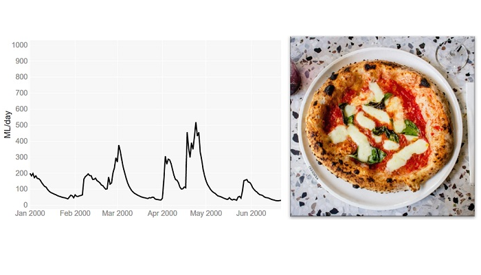
Let’s imagine that we have a recipe together with all the ingredients to make pizza. Our aim is to make a pizza that looks like the one in the picture of the recipe.

This is a bit like someone wanting to reproduce the results reported in a scientific paper about a hydrological “rainfall-runoff” model. There, one would need to download the historical data (rainfall, temperature and river flows) and the model code used by the authors of the study.

However, in the same way as the recipe and the ingredients are just the start of the pizza making process, having the input data and the model code is only the start of the modelling process.

To get the pizza shown in the picture of the recipe, we first need to work the ingredients, i.e. knead the dough, proof and bake. And to get the simulated river flows shown in the study, we need to ‘work’ the data and the model code, i.e. do the model calibration, evaluation and final simulation.

Using the pizza making analogy, these are the correspondences between pizza making and hydrological modelling:

Pizza making                         Hydrological modelling

kitchen and cooking tools computer and software

ingredients                         historical data and computer code for model simulation

recipe                                 modelling process as described in a scientific paper or in a computer                                                         script / workflow

Step 1: Putting the ingredients together

Dough kneading

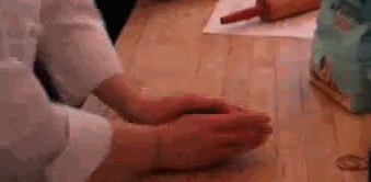
So, let’s start making the pizza. According to the recipe, we need to mix well the ingredients to get a dough and then we need to knead it. Kneading basically consists of pushing and stretching the dough many times and it can be done either manually or automatically (using a stand mixer).

The purpose of kneading is to develop the gluten proteins that create the structure and strength in the dough, and that allow for the trapping of gases and the rising of the dough.The recipe recommends using a stand mixer for the kneading, however if we don’t have one, we can do it manually.

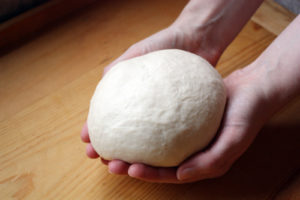
The recipe says to knead until the dough is elastic and looks silky and soft. We then knead the dough until it looks like the one in the photo shown in the recipe.

Model calibration

Now, let’s start the modelling process. If the paper does not report the values of the model parameters, we can determine them through model calibration. Model calibration is a mathematical process that aims to tailor a general hydrological model to a particular basin. It involves running the model many times under different combinations of the parameter values, until one is found that matches well the flow records available for that basin. Similarly to kneading, model calibration can be manual, i.e. the modeller changes manually the values of the model parameters trying to find a combination that captures the patterns in the observed flows (Figure 1), or it can be automatic, i.e. a computer algorithm is used to search for the best combination of parameter values more quickly and comprehensively.

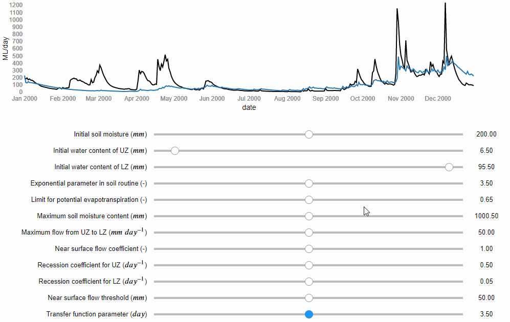
Figure 1 Manual model calibration. The river flows predicted by the model are represented by the blue line and the observed river flows by the black line (source: iRONS toolbox)

According to the study, the authors used an algorithm implemented in an open source software for the calibration. We can download and use the same software. However, if any error occurs and we cannot install it, we could decide to calibrate the model manually. According to the study, the Nash-Sutcliffe efficiency (NSE) function was used as numerical criteria to evaluate the calibration obtaining a value of 0.82 out of 1. We then do the manual calibration until we obtain NSE = 0.82.

(source: iRONS toolbox)

Step 2: Checking our work

Dough proofing

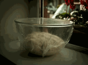
In pizza making, this step is called proofing or fermentation. In this stage, we place the dough somewhere warm, for example close to a heater, and let it rise. According to the recipe, the proofing will end after 3 hours or when the dough has doubled its volume.

The volume is important because it gives us an idea of how strong the dough is and how active the yeast is, and hence if the dough is ready for baking. We let our dough rise for 3 hours and we check. We find out that actually it has almost tripled in size… “even better!” we think.

Model evaluation

In hydrological modelling, this stage consists of running the model using the parameter values obtained by the calibration but now under a different set of temperature and rainfall records. If the differences between estimated and observed flows are still low, then our calibrated model is able to predict river flows under meteorological conditions different from the one to which it was calibrated. This makes us more confident that it will work well also under future meteorological conditions. According to the study, the evaluation gave a NSE = 0.78. We then run our calibrated model fed by the evaluation data and we get a NSE = 0.80… “even better!” we think.

Step 3: Delivering the product!

Pizza baking

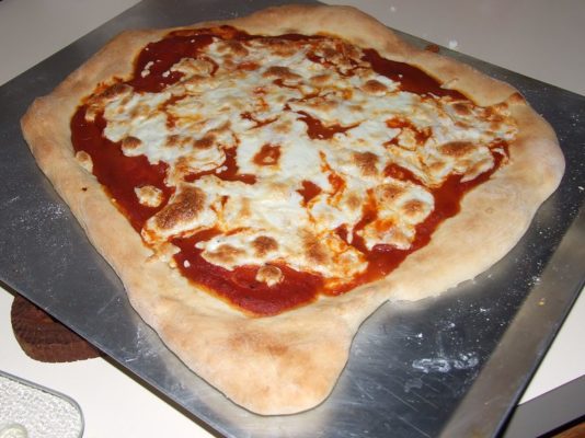
Finally, we are ready to shape the dough, add the toppings and bake our pizza. According to the recipe, we should shape the dough into a round and thin pie. This takes some time as our dough keeps breaking when stretched, but we finally manage to make it into a kind of rounded shape. We then add the toppings and bake our pizza.

Ten minutes later we take the pizza out of the oven and… it looks completely different from the one in the picture of the recipe! … but at least it looks like a pizza…

(Source: flickr.com)

River flow simulation

And finally, after calibrating and evaluating our model, we are ready to use it to simulate recreate the same river flow predictions as shown in the results of the paper. In that study, they forced the model with seasonal forecasts of rainfall and temperature that are available from the website of the European Centre for Medium-range Weather Forecasts (ECMWF).

Downloading the forecasts takes some time because we need to write two scripts, one to download the data and one to pre-process them to be suitable for our basin (so called “bias correction”). After a few hours we are ready to run the simulation and… it looks completely different from the hydrograph shown in the study! … but at least it looks like a hydrograph…

Why we never get the exact same result?

Here are some possible explanations for our inability to exactly reproduce pizzas or modelling results:

  • We may have not kneaded the dough enough or kneaded it too much; or we may have thought that the dough was ready when it wasn’t. Similarly, in modelling, we may have stopped the calibration process too early or too late (so called “over-fitting” of the data).
  • The recipe does not provide sufficient information on how to test the dough; for example, it does not say how wet or elastic the dough should be after kneading. Similarly, in modelling, a paper may not provide sufficient information about model testing as, for instance, the model performance for different variables and different metrics.
  • We don’t have the same cooking tools as those used by the recipe’s authors; for example, we don’t have the same brand of the stand mixer or the oven. Similarly, in modelling we may use a different hardware or operating system, which means calculations may differ due to different machine precision or slightly different versions of the same software tools/dependencies.
  • Small changes in the pizza making process, such as ingredients quantities, temperature and humidity, can lead to significant changes in the final result, particularly because some processes, such as kneading, are very sensitive to small changes in conditions. Similarly, small changes in the modelling process, such as in the model setup or pre-processing of the data, can lead to rather different results.

In conclusion…

Setting up a hydrological model involves the use of different software packages, which often exist in different versions, and requires many adjustments and choices to tailor the model to a specific place. So how do we achieve reproducibility in practice? Sharing code and data is essential, but often is not enough. Sufficient information should also be provided to understand what the model code does, and whether it does it correctly when used by others. This may sound like a big task, but the good news is that we have increasingly powerful tools to efficiently develop rich and interactive documentation. And some of these tools, such as R Markdown or Jupyter Notebooks, and the online platforms that support them such as Binder, enable us not only to share data and code but also the full computational environment in which results are produced – so that others have access not only to our recipes but can directly cook in our kitchen.

—————————

This blog has been reposted with kind permission from the authors, Cabot Institute for the Environment members Dr Andres Peñuela, Dr Valentina Noacco and Dr Francesca Pianosi. View the original post on the EGU blog site.

Andres Peñuela is a Research Associate in the Water and Environmental Engineering research group at the University of Bristol. His main research interest is the development and application of models and tools to improve our understanding on the hydrological and human-impacted processes affecting water resources and water systems and to support sustainable management and knowledge transfer


Valentina Noacco is a Senior Research Associate in the Water and Environmental Engineering research group at the University of Bristol. Her main research interest is the development of tools and workflows to transfer sensitivity analysis methods and knowledge to industrial practitioners. This knowledge transfer aims at improving the consideration of uncertainty in mathematical models used in industry


Francesca Pianosi is a Senior Lecturer in Water and Environmental Engineering at the University of Bristol. Her expertise is in the application of mathematical modelling to hydrology and water systems. Her current research mainly focuses on two areas: modelling and multi-objective optimisation of water resource systems, and uncertainty and sensitivity analysis of mathematical models.


World Water Day: Water scarcity challenges under climate change in East African drylands

Climate change presents great challenges for dryland regions, especially in communities where socioeconomic livelihoods are tied to the consistency of seasonal rainfall. In the dryland regions of East Africa, drought is a major threat to rainfed agriculture and to drinking water supplies, and regional climate is projected to increase drought frequency and severity.

Since 2000 alone East Africa has been struck by 10 droughts, which generated three severe famines affecting millions of people in the region. Although there is often consensus about the growing regional threat posed by drought, there is a major disconnect between the climate science (meteorological drought) and assessments of usable water resources (hydrological drought) that support livelihoods.

Affected communities need straightforward answers to a practical set of questions: How will regional climate change affect soil moisture required to grow crops or the water table in wells that provide precious drinking water in a parched landscape? How will the water stores change season by season and over coming decades? Furthermore, what adaptation strategies are available to address this challenge?

Through a series of funded projects, we have been working at better understanding how climate and climate change translates into useable water in the ground in East African dryland regions, and how people use and access relevant information to make livelihood decisions towards adaptation. We have developed an interdisciplinary team comprised of dryland hydrologists, climatologists, hydrometeorologists, computer scientists, pastoralist experts, and social scientists (both in the UK and Kenya, Somalia and Ethiopia) to develop a holistic perspective on both the physical and social aspects of drought. We are developing new regional modelling tools that convert past and future rainfall trends into soil moisture and groundwater. These models will underpin a new mobile phone app that aims to deliver forecasts of crop yields and soil moisture to remote agro-pastoralists. Simultaneously we are working with drought-affected communities in Kenya and Ethiopia to better understand barriers and opportunities for improving resilience to climate change, information use, and feasible adaptation strategies.

We hope that through these research endeavours we can contribute to improved climate adaptation efforts in these dryland regions and to long-term societal resilience to climate change.

Read more about Katerina’s work.

———————————-
This blog is written by Dr Katerina Michaelides, Head of Dryland Research Group at the School of Geographical Sciences and Cabot Institute for the Environment, University of Bristol.

Katerina Michaelides

Quality through Equality – tackling gender issues in hydrology

Quality through Equality organising committee (l-r Dr Francesca Pianosi, Dr Valentina Noacco, Sebastian Gnann, Lina Stein, Dr Maria Pregnolato, Elisa Coraggio, Melike Kiraz, Lina Wang)

Results of a 1-day workshop organised by the Bristol University’s Water Engineering Group

A professor asked our group of PhD students last year, “Who here thinks of staying in academia after finishing their PhD?” Of the 10 male students present, 4 or 5 said they could imagine continuing in academia. None of the 5 female students raised their hand. When asked for their reasons for not wanting to stay in academia, some of the things mentioned were the challenge of combining family and academia, a lack of role models or different career aspirations.

This experience started the idea of organising a workshop on gender issues in hydrology, with the aim of raising awareness of unconscious biases, offer role models and discuss ideas on how to make the hydrologic community more diverse. Although the focus of the workshop was on gender diversity, most things we learned apply as well to issues related to misrepresentation of ethnic minorities or disabled scientists.

To achieve the aims mentioned above, the workshop included: three invited speakers (Prof Hannah Cloke, Dr Joshua Larsen, Prof Elena Toth) who shared their experiences regarding gender issues in hydrology; a talk and a training on unconscious biases (Prof Havi Carel); and a group discussion. The workshop was attended by 44 hydrologists, mainly PhD students, of which 28 were female and 16 were male.

One highlight of the day was the presentation of Hannah Cloke talking about her career progress to full professor while at the same time raising four kids. Together with Elena Toth and Joshua Larsen, she agreed that combining academia and raising a family is possible, because academia offers one of the most flexible work environments possible. However, it does need a supportive stance of the university to enable that flexibility (flexitime working hours, childcare facilities, flexible childcare support for conferences) and supportive colleagues. Hannah finished with good advice for all PhD students, but especially women or members of minorities: A work-family-life balance is essential. Say no before you are overwhelmed and exhausted, but: be brave! Say yes to opportunities that scare you and do great science! And encourage each other to be brave. This is definitely advice I will try to implement in my life.

The afternoon included an unconscious bias training by Professor Havi Carel (watch her TED talk about unconscious bias) and group discussions around how academia can become more diverse and how we can create an enjoyable academic environment.

Some of the topics we discussed were:

What can senior and peer colleagues do?

Often postgraduate and early career researchers suffer from lack of communication at their institutions. Peer-to-peer mentoring or senior-to-junior mentoring may offer opportunities for discussion to take place, particularly about equality/inclusion/diversity issues. When exclusion/discrimination problems are experienced/witnessed, having a range of peer and senior people to discuss with becomes very important, and facilitates reporting to leadership if needed. These meetings and discussions will also give opportunities to people who may otherwise feel their problems are overlooked, to find support, be empowered and build up their self-confidence.

What can leadership do?

To specifically include researchers with caring responsibilities some attendees mentioned that it would be helpful if institutions could improve access to affordable childcare – this may include nurseries at University as well as more flexible reimbursement for childcare during specific events, such as conferences, where children cannot be brought along by parents.

What is the role of role models?

The attendees agreed that role models can be vital in shaping career pathways as they inspire, work as advisors and can start or change career aspirations. Role models should be relatable (by gender, ethnicity, etc.) and are thus not always available in less diverse environments. However, if role models do not exist new ways to develop them can be used and should be encouraged. For example, Twitter or other social media can offer a great selection of diverse role models from all over the world.

What is success in academia (or in life)?

Success can be defined in many ways. Some people want to make a difference, some want to publish high quality material, some want a good work-family-life balance, and some want all of those together. This highlights how important it is for line managers, supervisors, and colleagues to accept and nurture this diversity. A redefinition of success should be flexible and shaped according to the people in a certain work environment. This will hopefully lead to a more enjoyable and a more productive work environment.

The feedback we received from the day was overwhelmingly positive. This includes both talking to attendees and evaluating questionnaires people filled out at the end of the day. The discussions about the topics and the opportunity to share experiences with others were found the highlights of the workshop. A large part of the participants felt more aware about biases and more empowered to tackle them. Some changes are already happening as a result of the workshop, for example our research group is diversifying social activities to be more inclusive, and both the British Hydrological Society as well as the Young Hydrologic Society have appointed EDI (Equality, Diversity & Inclusion) champions now! With one third of the 44 attendees being male, the workshop demonstrated that not just women are interested to learn about biases and discuss their experiences.

We thank the GW4 Water Security Alliance, the Cabot Institute and the School of Engineering of Bristol University for funding this event. A big thank you to our three speakers and Havi Carel who conducted the training, and to all attendees for creating an inclusive and productive atmosphere. Now it is our task to implement what we have learned and communicate the results as widespread as possible. And on a personal note, I definitely feel there is a future in academia for me now.

If you are interested in organising a similar event at your institution and have any questions, feel free to contact us: hydro-equality2019@bristol.ac.uk

Further information and material can be found on our website.

Some further reading about the topic of diversity and bias in STEM, including a list of scientific literature documenting the challenges women and minorities face in STEM subjects.

———————————-
This blog was written by Cabot Institute member Lina Stein and other members of the organising committee, a hydrology PhD student in the Department of Civil Engineering at the University of Bristol.

UK Climate Projections 2018: From science to policy making

On a sunny day earlier this week, I attended the UK Climate Projections 2018: From science to policy making, meeting in Westminster on behalf of the Cabot Institute. Co-hosted by the All-Party Parliamentary Climate Change Group and the UK Met Office, the main purpose of this event was to forge discussions between scientists involved in producing the latest UK Climate Projections (UKCP18) and users from various sectors about the role of UKCP18 in increasing the UK’s preparedness of future climate change.

Many people in my constituency come and ask about climate change every day.

The event began with an opening remark by Rebecca Pow, the MP for Taunton Deane in Somerset. Somerset has seen some devastating floods over the years, and a new land drainage bill was passed a week prior to manage flood risk in the area. Constantly faced with questions from her constituents about climate change, Rebecca is particularly interested in regional climate change, both at present and in the future, and any opportunities that may arise from it.

Everyone would like a model of their back garden.

Prof Sir Brian Hoskins, the Founding Director and Chair of the Grantham Institute for Climate Change and the Environment, and Professor in Meteorology at the University of Reading, gave an overview on climate projection. He listed three main sources of uncertainty in 21st century climate projection: internal variability, model uncertainty, and human activity uncertainty. Climate scientists deal with these uncertainties by using large ensembles of simulations, a range of climate models, and a range of climate scenarios. However, there is always tension between model resolution, complexity and the need for many model runs in global climate projections due to constraints in computer resources. Regional climate models can be embedded in global domains to provide local weather and climate information, but they cannot correct large scale errors. The peer-reviewed UKCP18 provide both the statistics of global climate by combining data from different climate models and runs, and regional daily data for the UK and Europe.

A greater chance of warmer, wetter winters and hotter, drier summers.

This was one of the headline results from UKCP18 shown by Prof Jason Lowe, Head of Climate Services for Government at the Met Office Hadley Centre. UKCP18 is an update from its predecessor, UKCP09, but with constraints from new observations and data from more climate models from around the world. The horizontal resolution of regional climate projections for the UK and Europe has increased from 25 km in UKCP09 to 12 km in UKCP18, with an even higher resolution (2.2 km) dataset coming out in summer 2019. UKCP18 results show that all areas of the UK are projected to experience warming, with greater warming in the summer than the winter. Summer rainfall is expected to decrease in the UK, whereas winter precipitation is expected to increase. However, when it rains in summer it may rain harder. Sea-level rise will continue under all greenhouse gas emission scenarios at all locations around the UK, impacting extreme water levels in the future.

Heat and health inter-connections are complex.

Prof Sarah Lindley, Professor of Geography at the University of Manchester, shared how UKCP18 could be used to study the health effects of climate change and urban heat in the UK. Many of us would remember how hot it was last summer; by 2050, hot summers of that type may happen every other year, even under a low greenhouse gas emission scenario. The most extreme heat-related hazards are in cities due to the Urban Heat Island effect (UHI), i.e. urban areas are often warmer than surrounding rural areas. For instance, Manchester’s UHI intensity (difference between urban and rural temperatures) has increased significantly since the late 1990s. By the end of this century, the city of Manchester is projected to be 2.4ºC warmer than its surrounding rural area in a UKCP09 medium emission scenario. With an aging population, UK’s vulnerability to heat may increase in the future. Both exposure and vulnerability to heat contribute to heat disadvantage. High-resolution UKCP18 data, together with social vulnerability maps of the UK, provide new opportunities to heat disadvantage and adaptation research.

European birds will need to shift about 550 km north-east under 3ºC warming.

The next speaker was Dr Olly Watts, Senior Climate Change Policy Officer for the RSPB, the largest nature conservation charity in the UK. Climate adaptation is an important aspect of nature conservation work, as it should be in everyone’s work. The Climatic Atlas of European Breeding Birds finds that not only will European birds shift 550 km under a likely 3ºC increase in global average temperature, but also a quarter of the bird species will be at high risk. Currently 5000 bird species are changing species distribution, and they face an uncertain future. The UKCP18 data of 2-4ºC warmer worlds could be used to derive qualitative strategies to build wildlife resilience against climate change. Adaptation strategies including informing nature reserve management will be in place across the RSPB conservation programme. The RSPB will also use UKCP18 data to raise public awareness of climate change.

Water demand can increase by 30% on a hot day.

Dr Geoff Darch, Water Resources Strategy Manager at Anglian Water, began his talk by highlighting the inherent climate vulnerabilities in water management in the East of England. It is a “water stressed” region that has low lying and extensive coastline, sensitive habitats, and vulnerable soils. On a hot day, water demand can go up by 30%. Climate change alone is expected to have a total impact of 55 Ml/day on water supplies in the region by 2045. A growing risk of severe drought means an additional impact of 26 Ml/day is expected, not to mention the impacts of population growth. The water industry is proactively adapting to these challenges by setting up plans to reduce leakage and install smart meters for customers. UKCP09 has been used extensively for climate change risk assessment across the water sector; the latest UKCP18 could be used in hydrological modelling, demand modelling, storm impact modelling, flood risk assessment, and sensitivity testing to assess the robustness of water resources management solutions under a range of climate scenarios.

————————————-
This blog was written by Cabot Institute member Dr Eunice Lo, from the School of Geographical Sciences at the University of Bristol. Her research focusses on climate change, extreme weather and human health.

Dr Eunice Lo


Interrogating land and water use change in the Colombian Andes

Socio-ecological tensions, farming and habitat conservation in Guantiva-La Rusia

Highlighting the Cabot Institute’s commitment to growing the evidence base for water-based decision making, Dr Maria Paula Escobar-Tello (Co-Investigator) and Dr Susan Conlon (Post Doctoral Research Assistant) introduce the social science component of an exciting three-year project called PARAGUAS, an interdisciplinary collaboration between UK and Colombian researchers to investigate how plants and people influence the water storage capacity of the Colombian Páramos…

In June 2018, the Natural Environment Research Council (NERC) and the Arts and Humanities Research Council (AHRC) jointly awarded funding to five UK projects under the Newton-Caldas funded Colombia-Bio programme. The Colombian Department of Science, Technology and Innovation (Colciencias) subsequently awarded funding to 24 smaller Colombian projects under the same programme. PARAGUAS – How do the Páramos store water? The role of plants and people” is one of the five UK-funded projects.

Páramos are crucial for the livelihoods and wellbeing of millions of people (Photo © María Paula Escobar-Tello, University of Bristol)

Crucial source of land and water

The páramos are tropical mountain wetlands found between 3000m and 4500m of elevation in the Andes. Known for their extreme water storage and regulation capacity, they generate exceptionally high and sustained water supplies to farmland, settlements and cities downstream. They are also an important repository of biodiversity. Páramos have been historically inhabited; first by pre-Colombian indigenous communities and nowadays by heterogeneous campesino communities who depend on them as a primary source of water crucial for their livelihoods and wellbeing.  In the last few decades, several political, economic and armed conflict dynamics have pushed the agricultural frontier to increasingly higher elevations. The combined pressure of land use and climate change has already degraded many páramo areas and their potential demise has generated widespread concern across all levels of governance in Colombia, as well as within the NGO sector and research community.

Growing tensions in water conservation

A diversity of actors – government, NGO, community organisations, farmers – are interacting in the conservation of water in the Guantiva-La Rusia páramo, each with their own knowledges and understandings of the water storage function of the páramo, as well as contrasting views on who should benefit from this function and on the political economy of conservation efforts. Our team began to explore two sets of dynamics where these contrasting views were manifest during a pre-fieldwork campaign in January 2019.

In the first dynamic, local populations experience national and regional conservation efforts to address land and water degradation through the delimitation of the páramos – a controversial ongoing land management process whereby government authorities seek to map the areas they believe should be conserved to protect the páramos. One approach in these new land management policies and plans is to extend national park land under protection through land acquisition, which overlaps with complex pre-existing land ownership arrangements. In addition, the Ley de Páramos 233, 2018 (Páramos Law 233) prohibits farmers from carrying out productive activities on formerly-used land, which is now defined as páramos by authorities, and tasks local authorities with negotiating with farmers and supporting them in finding alternative economic activities.  While this ban may sound ecologically necessary, multiple actors question the processes that have defined the páramo borderline for several reasons including its implications on farmers’ livelihoods, identities and ecosystem knowledges.

In the second dynamic, water conservation policies and plans prioritise the channelling of water from the páramos to the aqueducts that supply the populations downstream through land purchases that lead to changes in land use and the piping of springs and streams. These processes are equally contested and have led to community-level forms of organisation, representation and resistance; as well as to multi-scale and multi-issue conflicts between different campesino sectors; between local, regional and national-level political and environmental authorities; and between different discourses about environmentalism and modernisation.

Our project goals

As the social science component of PARAGUAS, we want to explore these different sets of socio-cultural and political tensions. We will do this by investigating how and why land and water use has changed in the Guantiva-La Rusia páramo and how this is related to public policy decisions that have shaped (or not) how local páramo inhabitants, particularly crop and livestock farmers, interact currently with the páramo through their day-to-day farming practices. Our aim for this part is to expose lesser heard voices in the conservation debate and listen to how local inhabitants articulate their understanding of the water regulation function of the páramo.

We are busy preparing for the first round of fieldwork in May 2019 and are designing our methodology of interviews, focus groups and digital storytelling techniques in close collaboration with our colleagues at Loughborough University. Watch this space for further updates!

————————————————
The PARAGUAS project is supported by the Newton-Caldas Fund and funded by the NERC and AHRC [grant number NE/R017654/1].  PARAGUAS is led by Principal Investigator Dr France Gerard (Centre for Ecology & Hydrology) and Co-Investigators Dr Ed Rowe (Centre  for Ecology & Hydrology), Mauricio Diazgranados (The Royal Botanic Gardens, Kew), David Large (University of Nottingham), Wouter Buytaert (Imperial College London), Maria Paula Escobar-Tello (University of Bristol), Dominic Moran (University of Edinburgh), Michael Wilson (Loughborough University) and supported by the research group ‘Biología para la conservación’ of the Universidad Pedagógica Tecnologica de Colombia (UPTC) – Dr Liliana Rosero-Lasprilla and Dr Adriana Janneth Espinosa Ramirez, the Instituto de Investigación de Recursos Biológicos Alexander von Humboldt (IAvH) – Dr Susana Rodríguez-Buriticá, The Universidad Nacional de Colombia (UN) – Prof Conrado de Jesus Tobon Marin and the Institute of Hydrology, Meteorology and Environmental Studies (IDEAM) – Dr Liz Johanna Diaz.
NERC Programme: Exploring and Understanding Colombian Bio Resources
Newton-Caldas Fund
———————————————–

This blog is written by Cabot Institute members Dr Maria Paula Escobar-Tello nd Dr Susan Conlon from the School of Veterinary Sciences at the University of Bristol.

Dr Maria Paula Escobar-Tello


World Water Day: How can research and technology reduce water use in agriculture?

Record breaking temperatures in 2018 led to drought in many European countries. Image credit Wikimedia Domain Mimikry11.

World Water Day draws attention to the global water crisis and addresses why so many people are being left behind when it comes to having access to safe water. The UN estimates that globally 80% of people who have to use unsafe and unprotected water sources live in rural areas. This can leave households, schools, workplaces and farms struggling to survive. On farms water is vital for the production of food and is used in a huge range of processes, including irrigation and watering livestock. In this blogpost I will lightly review the current issues around water in agriculture and highlight some exciting research projects that may offer potential solutions.

What is the water crisis?

The UN Sustainable Development Goal 6 is to ensure that all people have access to sustainable, safe water by 2030. Unfortunately, we’re a long way off achieving this goal as a recent report from UNICEF/WHO estimates that there are currently 2.1 billion people living without access to safe water in their homes and workplaces. Another report estimates that 71% of the global population experiences severe water scarcity during at least one month of the year. In recent years we have seen water risks increase, with severe droughts in Africa, China, Europe, India and the US. In sub-Saharan Africa, the number of record breaking dry months increased by 50% from 1980 to 2013. Unfortunately droughts, floods and rising sea levels are predicted to continue and become more unpredictable under climate change scenario models and as the global population continues to grow, there will be increasing demands on water supplies. Increases in water scarcity are likely to lead to increases in political and economic instability, conflict and migration.

Why is water important to agriculture?

In agriculture, water is vital for growing crops and sustaining livestock. Farmers use water to irrigate, apply pesticides and fertilizer and protect from heat and frost. This heavy reliance means that when water supplies run out, farmers are unable to effectively maintain their crops and livestock, leading to food insecurity. Drought stress can result in yield losses of 64% in rice, 50% in chickpea, 18 – 32% in potato. Drought has particularly devastating effects in tropical and sub-tropical regions, where climate change is predicted to have the biggest impact.

The amount of water it takes to produce food and drink products is pretty shocking. Beef production in particular is associated with high levels of water usage. It is estimated that the global average water footprint of a 150g beef burger is 2350 litres; despite producing just 5% of the world’s food calories, beef production is reported to create 40% of the water scarcity burden. Although there are big variations in the environmental impacts of beef farming, with grassland fed, rotational systems being less intensive than grain fed herds on deforested land.

Where does water used for agriculture come from?

The water that is used in agriculture comes from a range of sources, including surface and ground water supplies, rivers and streams, open canals, ponds, reservoirs and municipal systems. Globally, the FAO estimates that agriculture accounts for 70% of freshwater withdrawals, which is predominately used for irrigation. In many areas the high level of groundwater used for irrigation is unsustainable, leading to depletion. For instance, the OECD estimates that groundwater supplies 60% of India’s agricultural water needs but groundwater sources are suffering from depletion and pollution in 60% of states. A big problem is that irrigation is often highly inefficient; in the US the FAO estimates that the amount of irrigated water that is actually used by plants is only 56%. Large amounts of energy are also needed to withdraw, treat and supply agricultural water, leading to significant greenhouse gas (GHG) emissions.

What happens to agricultural water after use?

As well as depleting freshwater supplies, agriculture can also pollute them, with runoff containing large quantities of nutrients, antibiotics, growth hormones and other chemicals. This in turn has big affects on human health through contamination of surface and ground water with heavy metals, nitrate and pathogens and in the environment; it can cause algal blooms, dead zones and acidification of waterways. Combined these issues mean that better management of water in agriculture has huge potential for improving sustainability, climate resilience and food security, whilst reducing emissions and pollution.

What are the potential solutions?

Thankfully there are many innovative projects that are working to improve issues around water in agriculture. Below are a few examples that I find particularly promising.

How can technology help?

To reduce water wastage on farms, agri-technology is being developed whereby multiple wireless sensors detect soil moisture and evapotranspiration. The sensors feed this information to a cloud-based system that automatically determines precisely how much water to use in different parts of the field, leading to increased yields and saving water. Farmers can get water management recommendations via a smartphone app and the information automatically instructs irrigation systems. At a larger scale, these data systems can feed into a regional crop water demand model to inform decision-making on agricultural policies and management practices, and to provide early warnings of potential flood and drought risks.

Sensor that detects leaf moisture levels. Image credit: Wikimedia Domain Massimiliano Lincetto

Irrigation systems are also being made more efficient; one study found that simply changing from surface sprinklers to drip irrigation that applies water directly to plant roots through low-pressure piping, reduced non-beneficial water wastage by 76%, while maintaining yield production. In arid areas these systems can be used for a technique called partial root drying, whereby water is supplied to alternate side of the roots, the water stressed side then sends signals to close stomatal pores which reduces water lost through evapotranspiration.

These efficient precision irrigation systems are becoming cheaper and easier for farmers to use. However in tropical and sub-tropical areas, the technology can be difficult to apply smallholder farming, where there is often insufficient Internet connectivity, expertise, capital investment, and supply of energy and water. Several precision agriculture projects are working to overcome these challenges to promote efficient use of irrigation water, including in the semi-arid Pavagada region of India, the Gash Delta region of Sudan and São Paulo, Brazil. In Nepal, a Water Resources Information System has been established that collects data to inform river management, whereas in Bangladesh hundreds of solar-fuelled irrigation pumps have been installed that simultaneously reduce reliance on fossil fuels and reduce GHG emissions.

Hydroponic systems whereby plants are grown in water containing nutrients are becoming increasingly popular; the global market for hydroponics is projected to reach £325 million by 2020. Compared with land-based agriculture, hydroponics uses less land; causes less pollution and soil erosion and so these systems are less vulnerable to climate change. Critically they also reduce water use; once the initial water requirements are met, the closed-system recycles water and there is less evapotranspiration. The adoption of these systems is predicted to occur predominately in water stressed regions of the Middle East and Africa and in highly urbanised countries such as Israel, Japan and the Netherlands.

How can researching traditional approaches help?

It’s not just about agri-tech; there are relatively simple, traditional ways to tackle water issues in agriculture. To protect against drought, farmers can harvest and store rainwater during heavy downpours by building ponds and storage reservoirs. To reduce water wastage, farmers can improve the ability of soil to absorb and hold water through reducing tillage and using rotational livestock grazing, compost, mulch and cover crops. Wetlands, grasslands and riparian buffers can be managed to protect against floods, prevent waterlogging of crops and improve water quality. Increasingly these traditional methods valued and research is being done to optimise them. For instance a novel forage grass hybrid has been developed that is more resilient to water stress and can reduce runoff by 43 – 51% compared with conventional grass cultivars.

A small-scale farmer in Kenya who is harvest rainwater. Image credit: Wikimedia Domain Timothy Mburu.

How can crop and livestock breeding help?

In the past, crop and livestock varieties have been selected for high productivity. However, these varieties are often severely affected by changes in climate and extreme weather events such as drought and require high levels of water and nutrients. To improve resilience and sustainability, breeders increasingly need to also select for stress responses and resource use efficiency. In crops, drought resilience and water use efficiency is influenced by many traits, including root and shoot architecture, stomatal density and thickness of the waxy cuticle that covers leaves and reduces evapotranspiration. The complexity of these traits makes breeding crops for drought resilience challenging, as many different groups of genes need to be selected for. To deal with this, the International Rice Research Institute’s Green Super Rice project has been crossing high-yielding parent lines with hundreds of diverse varieties to produce new high-yielding varieties that require less water, fertilisers and pesticides. These varieties are now being delivered to farmers in countries across Asia and Africa. Similarly, climate change resilience is also vital for current and future livestock farming. Projects run by Professor Eileen Wall (SRUC) have identified novel traits and genes associated with drought and heat resilience in UK and African dairy cattle, which can be incorporated into breeding programmes.

What are the incentives?

Although these projects might sound promising, without incentives to drive their uptake it may take a long time for real impacts to come to fruition. Unfortunately, in some countries such as India there can be a lack of monetary incentives that would effectively enable farmers to take up new water management technology and practices. In the EU, the Common Agricultural Policy (CAP) has allocated funds to support farmers in complying with ‘greening rules’ that improve sustainability, preserve ecosystems and efficient use of natural resources, including water. Farmers across the EU receive CAP payments for environmentally friendly farming practices, such as crop diversification and maintaining permanent grassland.

In many European countries, there is increasing consumer demand for sustainably farmed food products. This is driving large and small manufacturers to seek out sustainable suppliers and so farmers are incentivised to improve the sustainability of their farming practices so that they can be certified.  For instance the Sustainable Farming Assurance Programme requires farmers to follow good agricultural and environmental protection practices, including sustainable water use. In the coming years, more food products are likely to have water foot print labels that provide the consumer with information on the amount of water used during production and processing. This places considerable power in the hands of the consumer and large manufacturers are responding. For instance, by 2020 Kellogg has pledged to buy ten priority ingredients (corn, wheat, rice, potatoes, sugar and cocoa) only from farms that prioritise protecting water supplies, as well as using fertilizers safely, reducing emissions, and improving soil health. And Pepsico has created sustainable agriculture sourcing programmes that aim to help farmers improve water and soil resource management, protect water supplies, minimise emissions and improve soil health.

What can we do?

There are ways to take responsibility for reducing our own water footprints, including reducing meat and animal production consumption, reducing food wastage and buying sustainably farmed products. Finally, we can all get involved with communicating and promoting the importance of water in agriculture so that more people are aware of the issues. Head to the World Water Day website to find out about resources and events that may be happening near you.

——————————
This blog is written by Caboteer Dr Katie Tomlinson, who recently completed her PhD at the University of Bristol on cassava brown streak disease. Katie is now an Innovation and Skills manager at the BBSRC and is running the Sustainable Agriculture Research and Innovation Club. Views presented in this blog are her own. You can follow Katie on Twitter: @KatieTomlinson4.

Dr Katie Tomlinson


Local students + local communities = action on the local environment

As part of Green Great Britain Week, supported by BEIS, we are posting a series of blogs throughout the week highlighting what work is going on at the University of Bristol’s Cabot Institute for the Environment to help provide up to date climate science, technology and solutions for government and industry.  We will also be highlighting some of the big sustainability actions happening across the University and local community in order to do our part to mitigate the negative effects of global warming. Today our blog will look at ‘Climate action in communities.

Geography students from the University of Bristol spent February 2018 working on air, soil and water quality research projects for local organisations and community groups, including Bristol Green Capital Partnership members. Below is a summary of each project, the findings and next steps.

Bristol City Council – Bristol Urban Heat Island effect

Students investigated the effects of urban and suburban heat islands within Bristol compared to local rural areas. Urban Heat Island can impact human health, air and water quality and energy demand in the City with implications for future planning and city resilience. This project aimed to provide early groundwork for Bristol City Council in developing a better understanding of the Urban Heat Island in the city. The group used fifteen Tinytags across the city to collect temperature data and gained secondary data from local weather stations and building management systems. The group used a contour graph (see image below) to illustrate the UHIs they found, there was significant differences (c.1.3C) between rural sites, such as Fenswood Farm, Long Ashton compared to urban sites in close proximity, such as Hotwells Road. Bristol City Council will be using this data and other insights generated through participation in the project to inform i) the co-development of an urban temperature monitoring network and ii) further research into the Urban Heat Island effect.

Malago Valley Conservation Group – water pollution in the River Malago

Students investigated how water quality varied along the River Malago in Bishopsworth and what biological impact the dam has on microplastics and pollution in the river. Initially the group collected GPS data to map the river course and used water quality samples from 40 sites along the river to record nutrient, chlorophyll and microplastic data. The team found that some microplastic build up was evident before dams and weirs along the river and nitrate concentrations increased downstream through nitrification which suggests there may be impacts on the ecology of the river. Overall the river was found to be relatively healthy according to DEFRA and Environment Agency data, but there were recommended actions to protect its health in the future. The Malago Valley Conservation Group will be using the findings to plan conversation work programmes with their volunteers.

Bristol Avon Rivers Trust – water pollution in Three Brooks Lake

Students investigated the Three Brooks Lake and accompanying urban brooks in North Bristol to see if there was a difference in pollution levels entering the lake from two brooks from separate local residential areas. The group collected twenty water samples from the site and secondary data from the Environment Agency to examine variations in the pH, nutrient concentrations, turbidity (cloudiness of the water) and microplastics levels at the site. The findings suggested that there is likely to be a difference in the water quality of the two brooks and that the lake may be a sink for water pollution in the area. The Three Brooks Nature Reserve group will use the findings to support the development of a local management plan and the Bristol Avon Rivers Trust will be using the findings to contribute to their existing knowledge base for the catchment and to search for funding to develop the research further and to undertake any necessary improvements.

Friends of Badock’s Wood – wildflower cultivation in Badock’s Wood

Students investigated the soil conditions in Badock’s Wood to support the cultivation of wildflower meadows. The group collected soil cores from three meadows and a control meadow to analyse the soil moisture and organic matter content in the lab. Most wildflower species prefer calcareous soils (>15% calcium) with low phosphorous and high nitrogen content to grow optimally. Findings showed that two meadows have calcareous soils and two were on the borderline, all meadows had low phosphorus and low nitrogen content. In the present conditions, although some wildflowers do grow, the soil isn’t optimal to sustain the growth of many species but measures could be taken to improve the soil and more robust wildflowers could be selected to cope with soil conditions. The Friends of Badock’s Wood will be using the findings to revise their management plan for the site.

Dundry and Hartcliffe Wildlife Conservation Group – water pollution in Pigeonhouse stream tributaries

Students investigated water quality variances in five tributaries of the Pigeonhouse stream in Hartcliffe and whether this is influenced by land use in the area. The group collected samples to analyse the pH, nutrient content and temperature of the streams. The findings showed that the tributaries were healthy and unlikely to be contributing to water pollution levels in the Pigeonhouse stream and further downstream in the River Malago. The group suggested that high levels of nitrate in one tributary and Pigeonhouse stream were likely to be a result of run-off from neighbouring fertilised agricultural fields. E. Coli was prolific in all areas, the source of this will be a subject for future students to investigate. Dundry and Hartcliffe Wildlife Conservation Group will present the findings to the local neighbourhood partnership group.

Dundry and Hartcliffe Wildlife Conservation Group – effects of urban development and refuse on the Pigeonhouse Stream

Students investigated water quality along the Pigeonhouse stream in Hartcliffe. The group collected water samples to analyse for pH, nutrient content, turbidity and microplastic levels in the stream. Findings showed that microplastic pollution increased and turbidity (water cloudiness) decreased downstream as urbanisation increased. Ammonia and nitrogen concentrations were found to be high in the stream, but average compared to other streams in the region and within DEFRA safety standards. In-flow pipes from the surrounding urban areas are likely to be influencing the water quality in the stream. Dundry and Hartcliffe Wildlife Conservation Group will use the report to work with Bristol Waste to reduce fly-tipping in the area and with the local neighbourhood partnership to develop strategies to reduce pollution from the in-flow pipes.

Friends of Bristol Harbourside Reed Bed – impacts of reed beds on water quality in Bristol Floating Harbour

Students investigated spatial variation in water quality across the reed bed. The group collected twenty-one water samples and analysed for E.Coli, heavy metals, pH and nutrient content. Findings showed usual levels of heavy metals, except for zinc which was ten times higher than expected. There was no evidence that the reed bed influenced nutrient concentrations or pH levels, but this may be different if the research was conducted in summer during peak growing season. High levels of chlorophyll were found over the reed bed which can result in algae blooms. The group recommended that the reed beds should be cut back annually in autumn, this will reduce the amount of dead plant matter in the water to maintain healthy levels of zinc and chlorophyll in the reed bed. Friends of Bristol Harbourside Reed Bed will be using the findings to inform their management plan of the reed bed.

Friends of Bristol Harbourside Reed Bed – the health of the Bristol Floating Harbour reed bed

Students investigated concentrations of heavy metals and microplastics in the reed bed which would impact the reed bed ecology. The group collected ten sediment samples and five reed samples to test in the lab. Findings showed usual nitrate and phosphate levels, but zinc and potassium levels were higher than in comparable rivers which may be due to houseboats dumping excrement in the water. Microplastics were prolific in the sediment samples and identified as a major pollutant in the reed bed. The reed beds were filtering some pollutants in the water, particularly potassium, but these will re-enter the ecological system if the reeds are left to die back. The group recommended that reeds were cut back annually to reduce pollutants in the water. Friends of Bristol Harbourside Reed Bed will be using the findings to inform their management plan of the reed bed.

Bristol Zoo – air pollution at Bristol Zoo

Students investigated CO2 levels as an indicator of air pollution levels at Bristol Zoo. The group collected data using CO2 probes and gas samples at five sites at Bristol Zoo and two control sites at Fenswood Farm, Long Ashton and Bear Pit Roundabout, City Centre. The analysis accounted for environmental factors such as temperature and windspeed. Findings showed that air pollution was higher at the boundaries of Bristol Zoo than in the centre, but not as high as in the city centre. The group suggested further investigations into the impact of the high boundary wall and roadside vegetation on air pollution at Bristol Zoo would be useful. Bristol Zoo will be using the findings to as a baseline for more research into air pollution at the site.

Narroways Millennium Green Trust

Students investigated the impacts of firepits on soil pollution and compaction at the Narroways Hill conservation site in St Werburghs. The group collected twenty soil samples to test in the lab. Findings showed that soil compaction was high in some areas of the site, but no evidence linked this to firepits at the site. Soil moisture was found to increase further from the firepits. There was not significant evidence to show heavy metal pollutants at the sites, except for arsenic which the group are investigating further. Narroways Millennium Green Trust will be using the findings to inform public communications around fires at the site.

———————-
This blog is written by Amy Walsh from Skills Bridge. If your organisation would benefit from similar research, please email amy@bristolgreencapital.org.


Read other blogs in this Green Great Britain Week series:
1. Just the tip of the iceberg: Climate research at the Bristol Glaciology Centre
2. Monitoring greenhouse gas emissions: Now more important than ever?
3. Digital future of renewable energy
4. The new carbon economy – transforming waste into a resource
5. Systems thinking: 5 ways to be a more sustainable university
6. Local students + local communities = action on the local environment

Belo Monte: there is nothing green or sustainable about these mega-dams


File 20180807 191041 1xhv2ft.png?ixlib=rb 1.1
Google Maps

There are few dams in the world that capture the imagination as much as Belo Monte, built on the “Big Bend” of the Xingu river in the Brazilian Amazon. Its construction has involved an army of 25,000 workers working round the clock since 2011 to excavate over 240m cubic metres of soil and rock, pour three million cubic metres of concrete, and divert 80% of the river’s flow through 24 turbines.


The dam is located about 200km before the 1,640km Xingu meets the Amazon. kmusserCC BY-SA

Costing R$30 billion (£5.8 billion), Belo Monte is important not only for the scale of its construction but also the scope of opposition to it. The project was first proposed in the 1970s, and ever since then, local indigenous communities, civil society and even global celebrities have engaged in numerous acts of direct and indirect action against it.

While previous incarnations had been cancelled, Belo Monte is now in the final stages of construction and already provides 11,233 megawatts of energy to 60m Brazilians across the country. When complete, it will be the largest hydroelectric power plant in the Amazon and the fourth largest in the world.

Indigenous protests against Belo Monte at the UN’s sustainable development conference in Rio, 2012. Fernando Bizerra Jr / EPA

A ‘sustainable’ project?

The dam is to be operated by the Norte Energia consortium (formed of a number of state electrical utilities) and is heavily funded by the Brazilian state development bank, BNDES. The project’s supporters, including the governments of the Partido dos Trabalhadores (Workers’ Party) that held office between 2003 and 2011, have justified its construction on environmental grounds. They describe Belo Monte as a “sustainable” project, linking it to wider policies of climate change mitigation and a transition away from fossil fuels. The assertions of the sustainability of hydropower are not only seen in Brazil but can be found across the globe – with large dams presented as part of wider sustainable development agendas.

With hydropower representing 16.4% of total global installed energy capacity, hydroelectric dams are a significant part of efforts to reduce carbon emissions. More than 2,000 such projects are currently funded via the Clean Development Mechanism of the 1997 Kyoto Protocol – second only to wind power by number of individual projects.

While this provides mega-dams with an environmental seal of approval, it overlooks their numerous impacts. As a result, dams funded by the CDM are contested across the globe, with popular opposition movements highlighting the impacts of these projects and challenging their asserted sustainability.

Beautiful hill, to beautiful monster

Those standing against Belo Monte have highlighted its social and environmental impacts. An influx of 100,000 construction and service workers has transformed the nearby city of Altamira, for instance.

Hundreds of workers – unable to find employment – took to sleeping on the streets. Drug traffickers also moved in and crime and violence soared in the city. The murder rate in Altamira increased by 147% during the years of Belo Monte construction, with it becoming the deadliest city on earth in 2015.

In 2013, police raided a building near the construction site to find 15 women, held against their will and forced into sex work. Researchers later found that the peak hours of visits to their building – and others – coincided with the payday of those working on Belo Monte. In light of this social trauma, opposition actors gave the project a new moniker: Belo Monstro, meaning “Beautiful Monster”.

The construction of Belo Monte is further linked to increasing patterns of deforestation in the region. In 2011, deforestation in Brazil was highest in the area around Belo Monte, with the dam not only deforesting the immediate area but stimulating further encroachment.

In building roads to carry both people and equipment, the project has opened up the wider area of rainforest to encroachment and illegal deforestation. Greenpeace has linked illegal deforestation in indigenous reserves – more than 200km away – to the construction of the project, with the wood later sold to those building the dam.

Brazil’s past success in reversing deforestation rates became a key part of the country’s environmental movement. Yet recently deforestation has increased once again, leading to widespread international criticism. With increasing awareness of the problem, the links between hydropower and the loss of the Amazon rainforest challenge the continued viability of Belo Monte and similar projects.

Big dams, big problems

While the Clean Development Mechanism focuses on the reduction of carbon emissions, it overlooks other greenhouse gases emitted by hydropower. Large dams effectively emit significant quantities of methane for instance, released by the decomposition of plants and trees below the reservoir’s surface. While methane does not stay in the atmosphere for as long as carbon dioxide (only persisting for up to 12 years), its warming potential is far higher.

Belo Monte has been linked to these methane emissions by numerous opposition actors. Further research has found that the vegetation rotting in the reservoirs of dams across the globe may emit a million tonnes of greenhouse gases per year. As a result, it is claimed that these projects are – in fact – making a net contribution to climate change.

Far from providing a sustainable, renewable energy solution in a climate-changed world, Belo Monte is instead cast as exacerbating the problem that it is meant to solve.

The ConversationBelo Monte is just one of many dams across the globe that have been justified – and funded – as sustainable pursuits. Yet, this conflates the ends with the means. Hydroelectricity may appear relatively “clean” but the process in which a mega-dam is built is far from it. The environmental credentials of these projects remain contested, with Belo Monte providing just one example of how the sustainability label may finally be slipping.

———————————
This blog is written by Cabot Institute member Ed Atkins, Senior Teaching Associate, School of Geographical Sciences, University of Bristol.  This article was originally published on The Conversation. Read the original article.

Ed Atkins

The muddy debate: Is the Severn Estuary biologically productive?

Severn Bridge by Philippa Long

Traditionally, the Severn Estuary has been mistaken for an expansive, featureless landscape, dominated by fast-flowing muddy waters that prevent any pelagic biological activity. Although the latter could be true in terms of phytoplankton development, new research has shed light on the vital role that the benthic algal system has on controlling nutrient dynamics in the estuary.

Estuaries form at the margins between the land and the sea. The complex movement and mixing of freshwater and seawater governed by the tide, along with the trapping and recycling of continentally supplied nutrients and sediment, makes estuaries some of the most ecologically viable ecosystems in the world, in line with the biological productivity of coral reefs and tropical rainforests.

The Severn, the largest of 133 estuaries in the UK, has a mosaic distribution of intertidal mudflats, saltmarshes and wetlands, making it a unique habitat for a wide range of species. Alongside nationally scarce plant species, important wildfowl, wader populations and migratory European birds inhabit and refuel in the biologically-rich banks of the estuary. The estuarine waters are also home to over 100 fish species that use the estuary as a nursery, supporting many of the UK’s commercial fish stocks. With such a wide socio-ecological and economic importance, it is clear why the Severn was designated a Special Area of Conservation in 2009.

However, it’s less obvious as to why it has been over two decades since there have been systematic sampling studies in the Severn. Reviews have come and gone during this time, widely associated with renewable energy projects such as the Severn Barrage, but have often repeated findings from the 1990s. Furthermore, any commercially driven studies and their findings are often not disclosed to researchers or the public. This has left, in many aspects, knowledge of the Severn and its current ecosystem condition in a state of limbo. One aspect that’s often overlooked in many hydrological systems and is often overshadowed by carbon, nitrogen and phosphorus, is the element silicon, which may be one of the most important nutrients in the Severn’s environment.

Sand Bay by Holly Welsby

Why is silicon important?

Dissolved silicon is an important nutrient in aquatic environments, and is essential to siliceous organisms, for example, photosynthetic diatoms, which use dissolved silicon to form their shells (or frustules) made from biogenic silica. Diatoms are broadly categorised as ‘centric’ (round), usually occupying the surface oceans, and ‘pennate’ (long and thin), inhabiting coastal and seafloor environments, including sea ice, and intertidal mudflats such as those in the Severn Estuary.

Despite their small size, diatoms are an important group in supporting most food webs, and due to their abundance, contribute close to half of all surface ocean productivity! Diatoms are a key factor in affecting climate change due to this high productivity, as they remove the greenhouse gas carbon dioxide out of the atmosphere and export the organic carbon from the surface ocean to the seafloor when they die. Dissolved silicon and biogenic silica have been widely used to study marine silicon cycles but the impact that diatoms may have on estuarine cycles, and the potential influence on river silicon inputs to the ocean, has only recently come to light.

Silicon cycling in the Severn Estuary: new research

After the receding of the tide, large intertidal mudflats form along the shores of the Severn Estuary, which has the second largest tidal range in the world! These nutrient-rich intertidal mudflats are inhabited by pennate diatoms that live in microbial mats, called biofilms, on the mudflat surface. These biofilms, which are visible to the naked eye (the golden-brown shimmer that can be observed on the mudflats at low tide), are low in biodiversity but high in diatom abundance. Biofilms are an important food source to many mud-dwelling creatures, such as estuarine ragworm and laver spire snails, and migratory visitors such as the whimbrel and ringed plover. These ‘sticky’ mats also contribute to sediment stabilization, through the production of an organic rich network around sediment grains, and control nutrient fluxes to the overlying water.

Biofilm on the intertidal mudflats of the Severn by Holly Welsby

Compared to the well-studied carbon, nitrogen and phosphorus cycles, the importance of silicon in the Severn Estuary is less well understood. New research that has been carried out at the University of Bristol has aimed to tackle this gap, with an in-depth, seasonal study of silicon cycling along the Severn river-estuary-marine continuum. Each season in 2016, the surface and bottom waters of the Severn were sampled aboard Cardiff University’s research vessel.

It was found that the strong tidal forces and seasonal river flow fluctuations controlled dissolved silicon and other associated nutrients. In line with previous studies, the high mud water content – referred to as turbidity – limited water column primary productivity by blocking out light. This meant that there was minimal biogenic silica production in the water column itself. Instead, biogenic silica depended on the suspended particulate matter, and displayed seasonal cycles associated with benthic biogenic silica production by the diatom biofilms on the mudflats. In other words, the suspended sediment in the Severn not only originated from the rivers discharging into the estuary, but also from the erosion of the intertidal mudflats. This erosion of the mudflats in this high energy system, led to the suspension of the diatom biofilms, and so increased the biogenic silica concentrations in the water column.

This research has shown that since the 1990s reports, diatom biofilm biomass (i.e. their presence) has increased on the mudflats. These diatoms were also efficient at photosynthesis, resulting in a high potential to cycle silicon. These biofilms break up and reform rapidly between tides meaning that a large amount of silica is shuttled from the mudflats to the water column every day. This benthic biogenic silica export, which is transported further compared to dissolved silicon, could dissolve and replenish the Celtic Sea, with the dissolved silicon ready to be used by plankton that supports our commercial fish stocks.

Severn River in winter by Tim Gregory

Looking ahead

The Severn Estuary – in all its natural wonders – is a valuable resource in terms of renewable energy, tourism and business. Many of us also call it home. But what does the future hold for these diatom biofilms on the mudflats of the Severn Estuary? In many ways, their prospects are low. With extreme weather events, erosion and coastal squeezing causing a loss to our mudflat and saltmarsh habitats, influx of microplastics and associated toxins, alongside proposals for large construction projects that may alter sediment/nutrient loadings and deposition patterns, the future of these biofilms hangs is in the balance. But based on recent findings, these diatoms are tolerant to the mudflats harsh environmental conditions, which suggests they have the capability to adapt to these adverse conditions. Diatoms are a miraculous species, and their benefits to the estuary is not fully recognised.

We are beginning to understand that there is a limit to the degree that we can modify our environment, but if we could only assign an economic value to this biologically productive system, perhaps the benthic diatoms future on the Severn Estuary mudflats could be aided.

————————————-
This blog has been written by Cabot Institute member Holly Welsby, from the School of Earth Sciences at the University of Bristol.

Water City Bristol!

Foot selfie at secret swimming spot

If you don’t fix things in words, they might float away. So, briefly, a skeletal accounting —

  • 3 open-water swims
  • 2 workshops in maritime writing
  • 1 public lecture
  • 1 trip up the canal locks to Saltford
  • 2 days at #MT2018 (Marine Transgressions Conference)
  • 2 keynotes
  • ~ 12 panels
  • 1 Blue Humanities roundtable
  • 2 receptions
  • [a poetry reading that I missed]
  • And many half-garbled memories, starting in the middle —
The Llandoger Trow, where Daniel Defoe met Alexander Selkirk

Toxicity, the Ocean, and Urban Space (Wednesday)

I was trying some new things for this public lecture, knowing that the audience would swirl together academics with non-academics, be mostly composed of city-dwellers, and further include mostly those with a particular interest in the sea. Unpicking the knots of writing and thinking I’ve been chasing down in the wake of Oceanic New York, my talk splashed through some recent watery adventures, included images of Thanos the purple God of demonic Malthusianism, strayed into verse in three of my own poems, and — maybe? — crossed wild water to make landfall with hopeful gestures toward Ocean citizenship. How can our Cities and our bodies prepare themselves for and live with rising waters? I’d like to speak that as a not-only tragic story.

Public lecture at the University of Bristol

The Henleaze Swimming Club (Monday)

On Monday afternoon, jet-lagged and still-missing my baggage from the overnight flight in via Dublin, I bought a replacement suit & goggles from the hotel & Uber’d up to Henleaze, a former quarry that’s been a private swimming club since 1919. This gorgeous, narrow, fresh-watered lake now overflows with people, half with swimmers and half fisherfolk. What better anti-jet lag tonic can be?

Underwater Bristol (Tuesday)

Building on the perpetual inspiration of underwaternewyork.com, I hatched a plot with members of the U of Bristol English faculty to incubate some to-emerge-later responses to Bristol’s waterways. So many glorious things! A sailboat named Svendgar that I spotted a few days later for sale in the harbor. Brown mudflats. The kayaks that were paddled around the Bay by the Inuits kidnapped in Frobisher’s Second Voyage to Newfoundland in 1577. A football pitch next to a Cadbury Chocolate Factory that I’d seen earlier that morning while riding a canal boat up five locks to Saltford. Plastic. Breeding eels. What will they all become?

Brunel’s suspension bridge over the Avon

A secret monastic pool (Wednesday)

Having been promised a bit of true English wild swimming on the condition that I not mention the name or location of the waters in which I would plunge, I suppose I was a bit surprised to come around the corner of the quiet country lane to discover maybe sixty students lining the pool’s far bank, sunning themselves in post-exam freedom. The secluded pool, built “in the Middle Ages” to store fish for the Abbey of St. Augustine (founded 1140), now hosts lily pads, a gorgeous 15-foot tall purple rhododendron, supposedly a few tench, and — alas! — some horseflies that enjoyed landing on my bald head. It’s an excellent place for an afternoon’s swim. Thanks to my hosts for taking me there!

Bristol Harbour on the last night

Sea-themed creative writing workshop (Wednesday)

I was deeply impressed by the almost-dozen enthusiastic  Bristol undergrads who submitted maritime poetry and prose works for an post-term bonus workshop. I was joined also by Shakespearean Laurence Publicover and poet David Punter, and we spent a thrilling two hours wrestling with the joys and frustrations of writing with and into oceanic spaces. The student writing was gorgeous and wonderfully ambitious, from a narrative built from fragments of a diary from the S.S. Great Britain to a brilliantly post-Agatha Christie cruise montage, a boat-launching story, several quite lovely lyrics about blue spaces, and a hashing of Pip’s dream of drowning from Moby-Dick that spoke to my Melvillean core.

Clevedon Marine Lake (Fri)

Diving into Clevedon Marine Lake

Located as far upstream as big boats could travel the tidal Avon, Bristol today is water-filled but brackish rather than salt. Much of my time there was semi-marine, from the walks along the harbour to the floating bar the Marine Transgressions Conference decamped to after our final keynote. But though the Avon is tidal for a long distance and boasts (I am reliably assured by tide-guru Owain Jones from the Environmental Humanities department at Bath Spa) the second-highest tides in the world, there’s not a lot of open salt water in the city. I wanted to swim in the Bristol Channel (still known in Wales as the Severn Sea), so the morning of the conference’s last day I met swimographer Vanessa at an early hour that precluded other swimming companions, and we Uber’d out to the Clevedon Marine Lake. I’ve seldom or never seen a more starkly ideal swimscape. The pool is built, framed in by concrete and stone, but at high tide the swell tops the wall and fills the pool with ocean water. The tide was near the ebb when we arrived that morning, and over 100 yards of brown mudflat extended below the “lake,” reflecting the gray sky up toward us. The water was perfect — cool but not cold, salty but not bitter, manageable even though I’d forgotten my goggles in the hotel, and a generous 250m per lake-length. One of the few other swimmers who was also there on a grey misty morning was a man training for 70km in Lake Geneva. He churned in slow circles around the lake and planned to swim through dinner time. We had panels to rush back to in Bristol, but I was tempted just to keep swimming.

#MT2018 Marine Transgressions Conference (Thursday & Friday)

In front of Nancy Farmer tiles with Vanessa Daws at Clevedon

My visit to Bristol was fortuitously timed with an interdisciplinary conference on Marine Transgressions — a geologic term of art for moments in which the sea invades the land. Packed in to the last two days of my stay, the conference’s turbulent energy kept me going even when my own energy flagged. From Helen Rozwadowski’s amazing opening keynote on Jacques Cousteau and utopian fantasies of homo aquaticus in the 1950s and ’60s all the way through Tim Dee’s gorgeously lyrical evocation of the human and avian intertwinings of gulls and landfills, #MT2018 was an stirring mixture. I can’t do justice to all the great panels and papers that I heard over the two days, but I was struck by the variety of disciplinary perspectives — lots of poetics, history, and environmental humanities, but also marine law, policy, science, technological remediation, and other things. All these were joined together by a shared passion for the oceanic “blue” — though of course we all know, and we repeated as a kind of refrain over two days, that the ocean is also and meaningfully green, gray, purple, and many other colors — including gold, in the memorable image of the geochemist Kate Hendry describing the glimmer of microscopic diatoms on the salt flats of the Severn estuary at low tide.

Blue Humanities Round Table (Friday)

The best parts of a small conference come from listening to new things, and also from catching an extension of someone’s work over a beer at the floating bar after the day’s sessions. But in addition to many great discoveries, I’ve seldom had more fun at an academic presentation than I did chairing a Blue Humanities Round Table near the end of the second day. The amazing panel of disparate thinkers and makers included Owain Jones, whose hydrocitizenship project connects Bristol’s to its people and its past; Vanessa Daws, swimographer and immersive artist; Kate Hendry, a biogeochemist whose fields work takes her to both the Arctic and Antarctic ice fields; and my friend from the CT Shoreline Helen Rozwadowski, historian of science and founder of the Maritime Studies Program at UConn Avery Point. I started us out with a general question — “What can you do because of your focus on the sea that you could not do otherwise?” — and our conversation waterfalled down through several memorable twists and turns into a fantastic question period. With thanks to Alexandra Campbell and her twitter-agility, here’s a partial reconstruction of the ship we built as we sailed along:

  • The sea is not a metaphor (quoting Hester Blum) — except that sometimes it is, and sometimes its metaphors rub against and into the real salt water.
  • The sea is history (not-quite-remembering to quote Derek Walcott) — and given a few generations of blue humanities historical scholarship it should hopefully become more richly historicized.
  • The sea disorients and distorts, always and relentlessly, even as humans respond partially to that disorientation.
  • Is water alien? Does it come from outer space or from inside the earth’s core? Why might it matter? (in dialogue with Lindy Elkins-Tanton)
  • The sea’s lack of visibility redoubles its its moral challenge, informs the cultural history of its monstrous depths, and increases the force of its alien elements. (I rambled here about the “Creature from the Black Lagoon” poster art on the walls of Catch-22, the fish & chips place where I ate my first Bristol meal.)
  • Does the weakness of human eyesight underwater attenuate our moral connection with sea creatures? (A Levinas-ian question, though we didn’t mention his name)
  • Can science “illuminate” (Kate’s word) the sea in ways that increase its ethical claims on human subjects?
  • What are the politics of the interdisciplinary ocean? How can the sea speak to social justice, especially remembering the twin horrors of the slave trade and transoceanic capitalism (which two things might actually be parts of the same thing)?
  • Can the sea be a space of hope? (Last question, I think? We said yes. But I’m not sure that we’re sure.)


Selfie with mermaid and Vanessa Daws in Clevedon

“Under the sea everything is moral”

The hardest and most evocative phrase of the conference came when Helen quoted Cousteau or one of his fellow sea-utopians in her opening keynote. What might it mean for “everything” to be “moral” beneath the waves? “It’s all subtle and submarine,” says Walcott, thinking about Atlantic slavery and Caribbean beauty. Owain quite rightly objected that the underwater industriousness for which Cousteau was a booster has fouled our waters. The panel speculated together about the morality that emerges from the shared vulnerability of terrestrial human bodies in deep waters. I thought about, but did not share, a terrifying vision of drowning and struggle from Macbeth —

Doubtful it stood / As two spent swimmers that do cling together / And choke their art (1.2)

There’s another way, it occurs to me now as my big green metal bird arcs past the southern tip of Greenland, in which the undersea might be “moral.” It’s not that all undersea activities are permitted or approved, but that the questions we face — what we talk about when we talk about oceans — become starkly and painfully ethical. As mer-scholars, academic selkies, blue humanists, we swim into hard questions about disorientation, about buoyancy, about living-with alien lives. We face questions of social justice and tragic history, of oceanic dislocation and ongoing violence. Moral urgencies splash into marine lakes in the West Country and haunt overcrowded refugee boats in the Eastern Med.

The sea supports and threatens human life. What moral dilemmas fix us from the cold glaze of a fish’s eyes?

Floating bar

Thanks to all who were there this week, and in particular to my hosts at the University of Bristol, the Perspectives on the Sea cluster run by Laurence Publicover, the Brigstow and Cabot Institutes, and all the people who made Marine Transgressions possible! I’m looking forward to my next visit to Bristol already.

—————————-
This blog has been written by Professor Steve Mentz, St John’s University, New York. The blog has been reposted with kind permission from Steve’s original blog.