Climate change isn’t just making cyclones worse, it’s making the floods they cause worse too – new research

People take refuge on a sports ground following flooding caused by Cyclone Idai in Mozambique.
DFID/Flickr, CC BY-SA

Laurence Hawker, University of Bristol; Dann Mitchell, University of Bristol, and Natalie Lord, University of Bristol

Super cyclones, known as hurricanes or typhoons in different parts of the world, are among the most destructive weather events on our planet.

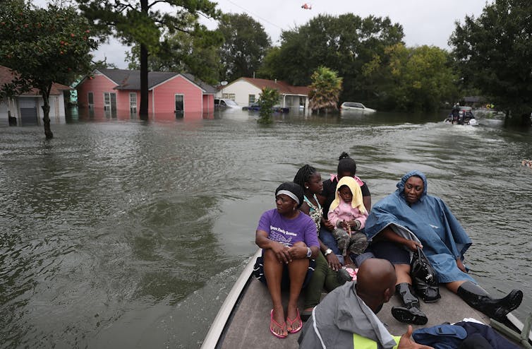
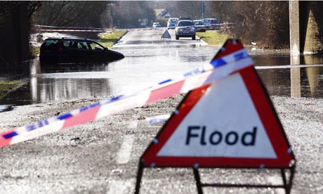
Although wind speeds within these storms can reach 270 km/h, the largest loss of life comes from the flooding they cause – known as a “storm surge” – when sea water is pushed onto the coast. Climate change is predicted to worsen these floods, swelling cyclone clouds with more water and driving rising sea levels that allow storm surges to be blown further inland.

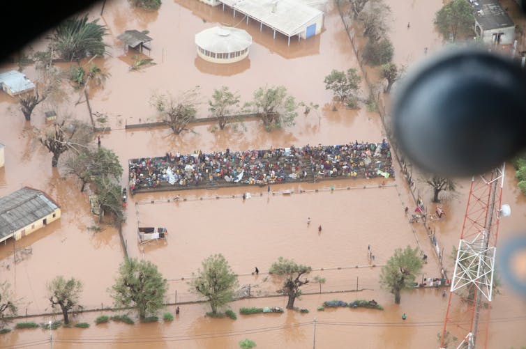
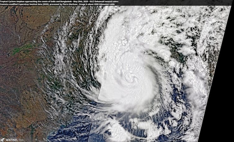
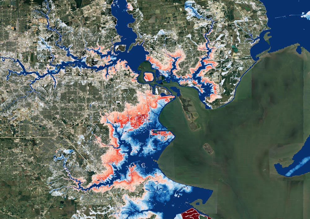
In May 2020, Super Cyclone Amphan hit the India-Bangladesh border, bringing heavy rainfall and strong winds and affecting more than 13 million citizens. The cyclone also caused storm surges of 2-4 metres, flooding coastal regions in the Bay of Bengal.

While over the ocean, this category five storm – that’s a storm’s highest possible rating – became the strongest cyclone to have formed in the Bay of Bengal since 1999, reaching wind speeds of up to 260 km/h. Although it weakened to a category two storm following landfall, it remained the strongest cyclone to hit the Ganges Delta since 2007.

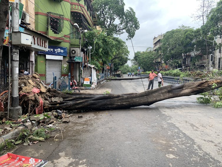
Amphan had severe consequences for people, agriculture, the local economy and the environment. It tragically resulted in more than 120 deaths, as well as damaging or destroying homes and power grids: leaving millions without electricity or communication in the midst of an ongoing pandemic.

Relief and aid efforts were hampered by flood damage to roads and bridges, as well as by coronavirus restrictions. Large areas of crops including rice, sesame and mangos were damaged, and fertile soils were either washed away or contaminated by saline sea water. Overall, Super Cyclone Amphan was the costliest event ever recorded in the North Indian Ocean, resulting in over $13 billion (£10 billion) of damage.

Two people assess a tree that has fallen across a road
In Kolkata, India, Super Cyclone Amphan caused widespread damage.
Indrajit Das/Wikimedia

In a recent study led by the University of Bristol and drawing on research from Bangladesh and France, we’ve investigated how the effects of storm surges like that caused by Amphan on the populations of India and Bangladesh might change under different future climate and population scenarios.

Amphan: Mark II

Rising sea levels – thanks largely to melting glaciers and ice sheets – appear to be behind the greatest uptick in future risk from cyclone flooding, since they allow storm surges to reach further inland. It’s therefore key to understand and predict how higher sea levels might exacerbate storm-driven flooding, in order to minimise loss and damage in coastal regions.

Our research used climate models from CMIP6, the latest in a series of projects aiming to improve our understanding of climate by comparing simulations produced by different modelling groups around the world. First we modelled future sea-level rise according to different future emissions scenarios, then we added that data to storm surge estimates taken from a model of Super Cyclone Amphan.

We ran three scenarios: a low emission scenario, a business-as-usual scenario and a high emission scenario. And in addition to modelling sea-level rise, we also estimated future populations across India and Bangladesh to assess how many more people storm surges could affect. In most cases, we found that populations are likely to rise: especially in urban areas.

Our findings were clear: exposure to flooding from cyclone storm surges is extremely likely to increase. In India, exposure increase ranged from 50-90% for the lowest emission scenario, to a 250% increase for the highest emission scenario. In Bangladesh, we found a 0-20% exposure increase for the lowest emission scenario and a 60-70% increase for the highest emission scenario. The difference in exposure between the two countries is mostly due to declining coastal populations as a result of urban migration inland.

Imagine we’re now in 2100. Even in a scenario where we’ve managed to keep global emissions relatively low, the local population exposed to storm surge flooding from an event like Amphan will have jumped by ~350,000. Compare this to a high emission scenario, where an extra 1.35 million people will now be exposed to flooding. And for flood depths of over one metre – a depth that poses immediate danger to life – almost half a million more people will be exposed to storm surge flooding in a high emission scenario, compared to a low emission scenario.

A composite satellite image of a large white cyclone
A satellite image shows Amphan approaching the coasts of India and Bangladesh.
Pierre Markuse/Wikimedia

This research provides yet more support for rapidly and permanently reducing our greenhouse gas emissions to keep global warming at 1.5°C above pre-industrial levels.

Although we’ve focused on storm surge flooding, other cyclone-related hazards are also projected to worsen, including deadly heatwaves following cyclones hitting land. And in the case of Amphan, interplay between climate change and coronavirus likely made the situation for people on the ground far worse. As the world warms, we mustn’t avoid the reality that pandemics and other climate-related crises are only forecast to increase.

Urgent action on emissions is vital to protect highly climate-vulnerable countries from the fatal effects of extreme weather. Amphan Mark II need not be as destructive as we’ve projected if the world’s governments act now to meet Paris agreement climate goals.The Conversation

—————————–

This blog is written by Cabot Institute for the Environment members Dr Laurence Hawker, Senior Research Associate in Geography, University of Bristol; Professor Dann Mitchell, Professor of Climate Science, University of Bristol, and Dr Natalie Lord, Honorary Research Associate in Climate Science, University of Bristol

This article is republished from The Conversation under a Creative Commons license. Read the original article.

New flood maps show US damage rising 26% in next 30 years due to climate change alone, and the inequity is stark


Coastal cities like Port Arthur, Texas, are at increasing risk from flooding during storms.
Joe Raedle/Getty Images

Climate change is raising flood risks in neighborhoods across the U.S. much faster than many people realize. Over the next three decades, the cost of flood damage is on pace to rise 26% due to climate change alone, an analysis of our new flood risk maps shows.

That’s only part of the risk. Despite recent devastating floods, people are still building in high-risk areas. With population growth factored in, we found the increase in U.S. flood losses will be four times higher than the climate-only effect.

Our team develops cutting-edge flood risk maps that incorporate climate change. It’s the data that drives local risk estimates you’re likely to see on real estate websites.

In the new analysis, published Jan. 31, 2022, we estimated where flood risk is rising fastest and who is in harm’s way. The results show the high costs of flooding and lay bare the inequities of who has to endure America’s crippling flood problem. They also show the importance of altering development patterns now.

The role of climate change

Flooding is the most frequent and costliest natural disaster in the United States, and its costs are projected to rise as the climate warms. Decades of measurements, computer models and basic physics all point to increasing precipitation and sea level rise.

As the atmosphere warms, it holds about 7% more moisture for every degree Celsius that the temperature rises, meaning more moisture is available to fall as rain, potentially raising the risk of inland flooding. A warmer climate also leads to rising sea levels and higher storm surges as land ice melts and warming ocean water expands.

Yet, translating that understanding into the detailed impact of future flooding has been beyond the grasp of existing flood mapping approaches.

A map of Houston showing flooding extending much farther inland.
A map of Houston shows flood risk changing over the next 30 years. Blue areas are today’s 100-year flood-risk zones. The red areas reflect the same zones in 2050.
Wing et al., 2022

Previous efforts to link climate change to flood models offered only a broad view of the threat and didn’t zoom in close enough to provide reliable measures of local risk, although they could illustrate the general direction of change. Most local flood maps, such as those produced by the Federal Emergency Management Agency, have a different problem: They’re based on historical changes rather than incorporating the risks ahead, and the government is slow to update them.

Our maps account for flooding from rivers, rainfall and the oceans – both now and into the future – across the entire contiguous United States. They are produced at scales that show street-by-street impacts, and unlike FEMA maps, they cover floods of many different sizes, from nuisance flooding that may occur every few years to once-in-a-millennium disasters.

While hazard maps only show where floods might occur, our new risk analysis combines that with data on the U.S. building stock to understand the damage that occurs when floodwaters collide with homes and businesses. It’s the first validated analysis of climate-driven flood risk for the U.S.

The inequity of America’s flood problem

We estimated that the annual cost of flooding today is over US$32 billion nationwide, with an outsized burden on communities in Appalachia, the Gulf Coast and the Northwest.

When we looked at demographics, we found that today’s flood risk is predominantly concentrated in white, impoverished communities. Many of these are in low-lying areas directly on the coasts or Appalachian valleys at risk from heavy rainfall.

But the increase in risk as rising oceans reach farther inland during storms and high tides over the next 30 years falls disproportionately on communities with large African American populations on the Atlantic and Gulf coasts. Urban and rural areas from Texas to Florida to Virginia contain predominantly Black communities projected to see at least a 20% increase in flood risk over the next 30 years.

Historically, poorer communities haven’t seen as much investment in flood adaptation or infrastructure, leaving them more exposed. The new data, reflecting the cost of damage, contradicts a common misconception that flood risk exacerbated by sea level rise is concentrated in whiter, wealthier areas.

A woman carries a child past an area where flood water surrounds low-rise apartment buildings.
Hurricane Florence’s storm surge and extreme rainfall flooded towns on North Carolina’s Neuse River many miles inland from the ocean in 2018.
Chip Somodevilla/Getty Images

Our findings raise policy questions about disaster recovery. Prior research has found that these groups recover less quickly than more privileged residents and that disasters can further exacerbate existing inequities. Current federal disaster aid disproportionately helps wealthier residents. Without financial safety nets, disasters can be tipping points into financial stress or deeper poverty.

Population growth is a major driver of flood risk

Another important contributor to flood risk is the growing population.

As urban areas expand, people are building in riskier locations, including expanding into existing floodplains – areas that were already at risk of flooding, even in a stable climate. That’s making adapting to the rising climate risks even more difficult.

A satellite image of Kansas City showing flood risk overlaid along the rivers.
A Kansas City flood map shows developments in the 100-year flood zone.
Fathom

Hurricane Harvey made that risk painfully clear when its record rainfall sent two reservoirs spilling into neighborhoods, inundating homes that had been built in the reservoirs’ flood zones. That was in 2017, and communities in Houston are rebuilding in risky areas again.

We integrated into our model predictions how and where the increasing numbers of people will live in order to assess their future flood risk. The result: Future development patterns have a four times greater impact on 2050 flood risk than climate change alone.

On borrowed time

If these results seem alarming, consider that these are conservative estimates. We used a middle-of-the-road trajectory for atmospheric greenhouse gas concentrations, one in which global carbon emissions peak in the 2040s and then fall.

Importantly, much of this impact over the next three decades is already locked into the climate system. While cutting emissions now is crucial to slow the rate of sea level rise and reduce future flood risk, adaptation is required to protect against the losses we project to 2050.

[Over 140,000 readers rely on The Conversation’s newsletters to understand the world. Sign up today.]

If future development was directed outside of the riskiest areas, and new construction met higher standards for flood mitigation, some of these projected losses could be avoided. In previous research, we found that for a third of currently undeveloped U.S. floodplains it is cheaper to buy the land at today’s prices and preserve it for recreation and wildlife than develop it and pay for the inevitable flood damages later.

The results stress how critical land use and building codes are when it comes to adapting to climate change and managing future losses from increasing climate extremes. Protecting lives and property will mean moving existing populations out of harm’s way and stopping new construction in flood-risk areas.The Conversation

——————————-

This blog is written by Cabot Institute for the Environment members Dr Oliver Wing, Research Fellow, and Paul Bates, Professor of Hydrology, School of Geographical Sciences, University of Bristol; and Carolyn Kousky, Executive Director, Wharton Risk Center, University of Pennsylvania and Jeremy Porter, Professor of Quantitative Methods in the Social Sciences, City University of New York.

This article is republished from The Conversation under a Creative Commons license. Read the original article.

Canada’s flood havoc after summer heatwave shows how climate disasters combine to do extra damage

People living in British Columbia will feel like they have had more than their fair share of climate disasters in 2021. After a record-breaking heatwave in June, the state in western Canada has been inundated by intense rain storms in November. It’s also likely the long-lasting effects of the heatwave made the results of the recent rainfall worse, causing more landslides – which have destroyed highways and railroads – than would otherwise have happened.

In June 2021, temperature records across western North America were shattered. The town of Lytton in British Columbia registered 49.6°C, breaking the previous Canadian national record by 5°C. The unprecedented weather was caused by a high pressure system, a so-called “heat dome”, which sat over the region for several days.

Heat intensified within the dome as the high pressure compressed the air. Dry ground conditions forced temperatures even higher, as there was less water evaporating to cool things down. Although unconfirmed, it’s estimated that the heatwave caused over 400 deaths in British Columbia alone.

A helicopter flies over a burning pine forest beneath a blue sky.
Wildfires ravaged British Columbia during the hot and dry summer of 2021.
EB Adventure Photography/Shutterstock

The hot and dry weather also sparked wildfires. Just days after recording the hottest national temperature ever, the town of Lytton burned to the ground. The summer’s fires and drought left the ground charred and barren, incapable of absorbing water. These conditions make landslides more likely, as damaged tree roots can no longer hold soil in place. It also ensures water flows over the soil quicker, as it cannot soak into the baked ground.

The huge rain storm which lasted from Saturday November 13 to Monday 15 was caused by an atmospheric river – a long, narrow, band of moisture in the atmosphere stretching hundreds of miles. When this band travels over land it can generate extreme rainfall, and it did: in 48 hours, over 250mm of rain fell in the town of Hope, 100km east of Vancouver.

This much rainfall on its own would probably cause extensive flooding. But combined with the parched soil, the results have been catastrophic. Landslides have destroyed many of the region’s transport links, leaving Vancouver cut off by rail and road. But the bad news doesn’t end there; sediment washed away by these floods could make future floods this winter even worse.

British Columbia is in the grip of what scientists call a compound climate disaster. The effects of one extreme weather event, like a heatwave, amplify the effects of the next one, like a rain storm. Instead of seeing floods and wildfires as discrete events, compound disasters force us to comprehend the cascading crises which are likely to multiply as the planet warms.

How to understand compound climate disasters

The port of Vancouver is the busiest in Canada, moving US$550 million worth of cargo every day. Because rail links are damaged, ships laden with commodities sit offshore. Canada’s mining and farming industries are having to divert exports through the US. Depending on how quickly the rail links recover, significant economic impacts are possible.

Both the June heatwave and the November rainstorm are unprecedented, record-breaking events, but is their occurrence in the same year just bad luck? A rapid attribution study found that the heatwave was virtually impossible without climate change. The atmospheric river which brought the deluge is also likely to become more common and intense in a warming climate.

In British Columbia, future flooding is almost guaranteed to be more frequent and severe. This is life at 1.2°C above the pre-industrial temperature average, yet most politicians don’t seem too worried about taking the necessary action to prevent warming beyond 1.5°C – the limit which countries agreed in 2015 is a threshold beyond which catastrophic climate change becomes more likely.

Western Canada’s year of weather extremes did not come from nowhere. Past trends and future projections tell us to expect hotter summers and wetter winters in this part of the world, and record-shattering climate extremes are on the rise.

Worldwide, compound climate disasters are becoming more common as climate change accelerates. Risk assessments typically measure the impacts of one event at a time, like the damage caused by intense rain storms, without considering how the earlier drought influenced it. This leads to scientists and insurers underestimating the overall damage. With so many combinations of climate extremes – flooding following wildfires, hurricanes passing as cold spells arrive – we must prepare for every possibility.The Conversation

————————-

This blog is written by Cabot Institute for the Environment member Dr Vikki Thompson, Senior Research Associate in Geographical Sciences, University of Bristol.

This article is republished from The Conversation under a Creative Commons license. Read the original article.

Vikki Thompson

Climate-driven extreme weather is threatening old bridges with collapse

The recent collapse of a bridge in Grinton, North Yorkshire, raises lots of questions about how prepared we are for these sorts of risks. The bridge, which was due to be on the route of the cycling world championships in September, collapsed after a month’s worth of rain fell in just four hours, causing flash flooding.

Grinton is the latest in a series of such collapses. In 2015, first Storm Eva and then Storm Frank caused flooding which collapsed the 18th century Tadcaster bridge, also in North Yorkshire, and badly damaged the medieval-era Eamont bridge in nearby Cumbria. Floods in 2009 collapsed or severely damaged 29 bridges in Cumbria alone.

With climate change making this sort of intense rainfall more common in future, people are right to wonder whether we’ll see many more such bridge collapses. And if so – which bridges are most at risk?

In 2014 the Tour de France passed over the now-destroyed bridge near Grinton. Tim Goode/PA

We know that bridges can collapse for various reasons. Some are simply old and already crumbling. Others fall down because of defective materials or environmental processes such as flooding, corrosion or earthquakes. Bridges have even collapsed after ships crash into them.

Europe’s first major roads and bridges were built by the Romans. This infrastructure developed hugely during the industrial revolution, then much of it was rebuilt and transformed after World War II. But since then, various factors have increased the pressure on bridges and other critical structures.
For instance, when many bridges were first built, traffic mostly consisted of pedestrians, animals and carts – an insignificant load for heavy-weight bridges. Yet over the decades private cars and trucks have got bigger, heavier and faster, while the sheer number of vehicles has massively increased.

Different bridges run different risks

Engineers in many countries think that numerous bridges could have reached the end of their expected life spans (between 50-100 years). However, we do not know which bridges are most at risk. This is because there is no national database or method for identifying structures at risk. Since different types of bridges are sensitive to different failure mechanisms, having awareness of the bridge stock is the first step for an effective risk management of the assets.


Newcastle’s various bridges all have different risks. Shaun Dodds / shutterstock

In Newcastle, for example, seven bridges over the river Tyne connect the city to the town of Gateshead. These bridges vary in function (pedestrian, road and railway), material (from steel to concrete) and age (17 to 150 years old). The risk and type of failure for each bridge is therefore very different.

Intense rain will become more common

Flooding is recognised as a major threat in the UK’s National Risk Register of Civil Emergencies. And though the Met Office’s latest set of climate projections shows an increase in average rainfall in winter and a decrease in average rainfall in summer, rainfall is naturally very variable. Flooding is caused by particularly heavy rain so it is important to look at how the extremes are changing, not just the averages.

Warmer air can hold more moisture and so it is likely that we will see increases in heavy rainfall, like the rain that caused the flash floods at Grinton. High resolution climate models and observational studies also show an intensification of extreme rainfall. This all means that bridge collapse from flooding is more likely in the future.

To reduce future disasters, we need an overview of our infrastructure, including assessments of change of use, ageing and climate change. A national bridge database would enable scientists and engineers to identify and compare risks to bridges across the country, on the basis of threats from climate change.


This blog is written by Cabot Institute member Dr Maria Pregnolato, Lecturer in Civil Engineering, University of Bristol and Elizabeth Lewis, Lecturer in Computational Hydrology, Newcastle University.  This article is republished from The Conversation under a Creative Commons license. Read the original article.

UK Climate Projections 2018: From science to policy making

On a sunny day earlier this week, I attended the UK Climate Projections 2018: From science to policy making, meeting in Westminster on behalf of the Cabot Institute. Co-hosted by the All-Party Parliamentary Climate Change Group and the UK Met Office, the main purpose of this event was to forge discussions between scientists involved in producing the latest UK Climate Projections (UKCP18) and users from various sectors about the role of UKCP18 in increasing the UK’s preparedness of future climate change.

Many people in my constituency come and ask about climate change every day.

The event began with an opening remark by Rebecca Pow, the MP for Taunton Deane in Somerset. Somerset has seen some devastating floods over the years, and a new land drainage bill was passed a week prior to manage flood risk in the area. Constantly faced with questions from her constituents about climate change, Rebecca is particularly interested in regional climate change, both at present and in the future, and any opportunities that may arise from it.

Everyone would like a model of their back garden.

Prof Sir Brian Hoskins, the Founding Director and Chair of the Grantham Institute for Climate Change and the Environment, and Professor in Meteorology at the University of Reading, gave an overview on climate projection. He listed three main sources of uncertainty in 21st century climate projection: internal variability, model uncertainty, and human activity uncertainty. Climate scientists deal with these uncertainties by using large ensembles of simulations, a range of climate models, and a range of climate scenarios. However, there is always tension between model resolution, complexity and the need for many model runs in global climate projections due to constraints in computer resources. Regional climate models can be embedded in global domains to provide local weather and climate information, but they cannot correct large scale errors. The peer-reviewed UKCP18 provide both the statistics of global climate by combining data from different climate models and runs, and regional daily data for the UK and Europe.

A greater chance of warmer, wetter winters and hotter, drier summers.

This was one of the headline results from UKCP18 shown by Prof Jason Lowe, Head of Climate Services for Government at the Met Office Hadley Centre. UKCP18 is an update from its predecessor, UKCP09, but with constraints from new observations and data from more climate models from around the world. The horizontal resolution of regional climate projections for the UK and Europe has increased from 25 km in UKCP09 to 12 km in UKCP18, with an even higher resolution (2.2 km) dataset coming out in summer 2019. UKCP18 results show that all areas of the UK are projected to experience warming, with greater warming in the summer than the winter. Summer rainfall is expected to decrease in the UK, whereas winter precipitation is expected to increase. However, when it rains in summer it may rain harder. Sea-level rise will continue under all greenhouse gas emission scenarios at all locations around the UK, impacting extreme water levels in the future.

Heat and health inter-connections are complex.

Prof Sarah Lindley, Professor of Geography at the University of Manchester, shared how UKCP18 could be used to study the health effects of climate change and urban heat in the UK. Many of us would remember how hot it was last summer; by 2050, hot summers of that type may happen every other year, even under a low greenhouse gas emission scenario. The most extreme heat-related hazards are in cities due to the Urban Heat Island effect (UHI), i.e. urban areas are often warmer than surrounding rural areas. For instance, Manchester’s UHI intensity (difference between urban and rural temperatures) has increased significantly since the late 1990s. By the end of this century, the city of Manchester is projected to be 2.4ºC warmer than its surrounding rural area in a UKCP09 medium emission scenario. With an aging population, UK’s vulnerability to heat may increase in the future. Both exposure and vulnerability to heat contribute to heat disadvantage. High-resolution UKCP18 data, together with social vulnerability maps of the UK, provide new opportunities to heat disadvantage and adaptation research.

European birds will need to shift about 550 km north-east under 3ºC warming.

The next speaker was Dr Olly Watts, Senior Climate Change Policy Officer for the RSPB, the largest nature conservation charity in the UK. Climate adaptation is an important aspect of nature conservation work, as it should be in everyone’s work. The Climatic Atlas of European Breeding Birds finds that not only will European birds shift 550 km under a likely 3ºC increase in global average temperature, but also a quarter of the bird species will be at high risk. Currently 5000 bird species are changing species distribution, and they face an uncertain future. The UKCP18 data of 2-4ºC warmer worlds could be used to derive qualitative strategies to build wildlife resilience against climate change. Adaptation strategies including informing nature reserve management will be in place across the RSPB conservation programme. The RSPB will also use UKCP18 data to raise public awareness of climate change.

Water demand can increase by 30% on a hot day.

Dr Geoff Darch, Water Resources Strategy Manager at Anglian Water, began his talk by highlighting the inherent climate vulnerabilities in water management in the East of England. It is a “water stressed” region that has low lying and extensive coastline, sensitive habitats, and vulnerable soils. On a hot day, water demand can go up by 30%. Climate change alone is expected to have a total impact of 55 Ml/day on water supplies in the region by 2045. A growing risk of severe drought means an additional impact of 26 Ml/day is expected, not to mention the impacts of population growth. The water industry is proactively adapting to these challenges by setting up plans to reduce leakage and install smart meters for customers. UKCP09 has been used extensively for climate change risk assessment across the water sector; the latest UKCP18 could be used in hydrological modelling, demand modelling, storm impact modelling, flood risk assessment, and sensitivity testing to assess the robustness of water resources management solutions under a range of climate scenarios.

————————————-
This blog was written by Cabot Institute member Dr Eunice Lo, from the School of Geographical Sciences at the University of Bristol. Her research focusses on climate change, extreme weather and human health.

Dr Eunice Lo


Why partnerships are so vital to the University of Bristol and the Cabot Institute (part 2)

Launching VENTURE during Bristol 2015

VENTURE is a new collaborative partnership with some of our major corporate partners.  It is the latest in a series of announcements (including Bristol is Open, the UK Collaboration for Research and Infrastructure and Cities, and the launch of a new project on Re-Distributed Manufacturing and the Resilient, Sustainable City) that represent a step change in how we are engaging with the city and region during 2015.  In my previous article, I discussed the ethos that underpins our drive to build partnerships – across the city, the region, national and globally.  In this follow-up, I want to share some of the very exciting activities that are currently happening, many of them catalysed by the efforts to win the European Green Capital award.

**********
For the Cabot Institute, one of the great opportunities of Bristol 2015 has been a stronger relationship with organisations across the city. Many of our 2015 activities are the culmination of our past partnership ambitions, but it is also the opportunity to make a step change towards broader and deeper collaboration.

The nature of our University and the Cabot Institute and the scope of global environmental challenges has always dictated diverse partnerships with national and international agencies – we study melting ice sheets with the British Antarctic Survey, develop climate models with the Met Office, predict floods with the Environment Agency and advise the Government Office of Science on the ash cloud crisis.  We work with DFID and the United Nations, with the Somalian government to develop grassroots security and with small island developing nations to help them adapt to climate change – and to learn from their experiences.

Cabot Institute scientist Isabel Nias working with the British Antarctic Survey in Antarctica.
Dame Pearlette Louisy at the Small Island States: Living at the sharp end of
uncertainty conference in Bristol, July 2014.
  Image credit: Amanda Woodman-Hardy

Working globally never stopped Cabot Institute researchers from also working locally; we have collaboratively studied housing and education in our city, partnered on new innovations such as Bristol Green Doors, worked with Voscur on equality issues and with the Knowle West Media Centre on numerous digital engagement projects.

And yet we could have been doing so much more….

Our commitment to the Green Capital arose from a recognition that we could do more and that we had to do more if we wanted to learn from the vibrant experimentation occurring in our own backyard. To that end, the Cabot Institute Manager, Philippa Bayley was an early member of the Bristol Green Capital Partnership and was elected with Liz Zeidler to be the first co-director after the award.

The Wills Memorial Building, which
will be lit green in the evening throughout 2015

Since then, we have put on numerous events, worked with the 2015 Company on the launch and with the Festival of Ideas on the Coleridge Lectures and the Summits, and contributed to the Arts Programme.  Moving ahead, we are keen to include all of the city, with events planned at Hamilton House and with local schools.  That engagement has mirrored the University’s pledges and contributions.  We are aiming to become a net carbon neutral campus by 2030; bringing in a series of working practice incentives to decrease our transport footprint; including social and environmental considerations into our procurement process; and ensuring that all students have the opportunity to encounter Education for Sustainable Development at the University. We are doing far more than just turning Wills Memorial Tower green for the year!

So this year is a culmination of ever-growing engagement over the past decade…. Not just for the researchers of the Cabot Institute but for the whole city.  But more importantly, it is the platform for newer and much deeper partnership.

Implicitly, the University’s fifth and most important pledge is to be the best possible partner with our city.  That includes our students who have committed 100,000 volunteer hours to the City and who are driving new initiatives such as BrisBikes.  It includes our commitment to spend £60,000 pounds to plant trees across Bristol.  It includes working with BCC and the NHS to create a new district energy supply, key to realizing our carbon neutral ambitions.  And it includes a commitment from the Cabot Institute to do more coordinated research – with everyone in the city.

To empower that, we have launched VENTURE and we have worked very closely with the Partnership.  We have also aggressively appointed new people: Andy Gouldson, who studies urban resiliency and sustainability; Clive Sabel, who uses big data to study health and well-being; Sean Fox, who investigates urban governance; a whole swathe of experts on flooding and water quality in both urban and rural environments; Justin Dillon, the new head of our School of Education and who is passionate about ‘learning outside the classroom’; and many, many more.  These people have been hired because they are brilliant and because they are keen to work with people in the city and region.

Wildflower meadow in Bedminster.
Image credit: Julia Kole

We are also funding our research students and colleagues to work with our City.  Caroline Bird has been supported to work with the Bristol Energy Network and is now coordinating our community to better engage with the Green Capital legacy. We have asked many of you across the city to propose projects for our brilliant Masters Students, yielding great projects conducted by students like Julia Kole who studied how to improve biodiversity in Bedminster; seeds soil and social change. Dr Kath Baldock and Professor Jane Memmott and many others have been studying pollinators in Bristol and the surrounding countryside – which has led to the Urban Pollinators Project and Get Bristol Buzzing.  Dr Trevor Thompson and his team are working with local GPs, to help their practices become more efficient and sustainable.

These are all part of an ongoing and continuous buzz of activity and we will work hard to ensure that these are not just one-off successes but instead a step change in how we work with Bristol.

Big new initiatives

On the 27th of January, we launched Bristol is Open with the Bristol City Council.  This is the first joint venture between the city council and the University of Bristol and it combines University research and advanced technology (our investment in high performance computing, computational innovations by Professor Dimitra Simeonidou and wireless technology developed by Professor Andy Nix and industry collaborators) with council-owned infrastructure.  The company will develop an innovative high-performance, high-speed network in Bristol, that will be open for all to use and put Bristol at the forefront in the UK.  It is a bold experiment not just in technology but hopefully in democracy, insofar that it empowers the citizens of the city to communicate with one another and explore the urban landscape. (And if you want to know more, visit the refurbished and re-opened Planetarium!)

More recently, the government announced funding for the UK Collaboration for Research and Infrastructure and Cities (UKCRIC), and a partnership between the University, Bristol industry and the City Council is at the heart of that.  UKCRIC will apply globally important research to ensure that the UK’s infrastructure is resilient and responsive to environmental and economic impacts. In doing so, according to Prof Colin Taylor, the Bristol UKCRIC lead, ‘It will ensure that our infrastructure is resilient to future change while also avoiding conservative over-engineering thereby saving hundreds of billions of pounds.’  At the heart of the Cabot Institute’s contribution to the bid is the University’s Earthquake Engineering and Simulation Laboratory in the Faculty of Engineering.  Via enhanced world-leading experimental capabilities, the Laboratory will develop unique techniques to improve the performance and reduce the costs of foundations of buildings, bridges, ports and nuclear facilities. UKCRIC will also ensure that our innovative City Operating System is funded and fully capable of supporting Bristol is Open.

On 22 April we launched a new collaborative research project to determine how highly adaptable manufacturing processes, capable of operating at small scales (re-distributed manufacturing), can contribute to a sustainable and resilient future for the City of Bristol and its hinterland. I am particularly excited about this project as it is so fundamentally…. Bristol.  Our city is a champion of the power of localism, whether it be food production, launching our own energy company or the Bristol Pound. And we have a strong upcycling and maker culture. Why not extend these brilliant initiatives to how we manufacture the goods on which we depend.  New technology now allows manufacturing to be downscaled, redistributed and decentralised, making it more sustainable and also more resilient.  This new project, led by Prof Chris McMahon, will explore exactly how to do that.

These are exciting times and we are proud of our Cabot Institute colleagues working on these projects.  But we do recognised that there remain challenges.  As a climate change scientist, I have always argued that many of the sustainability and resilience challenges that Bristol wants to address are issues of fairness and equality. Those who profit from our current fossil fuel, water, nutrient, and wildlife consumption are least vulnerable to climate change and diminishing resources.  As such, racial, ethnic, gender and class diversity is also high on our agenda and our partners must reflect that diversity.  Fortunately, we are based in a city with an outstanding variety of leaders.  The City and University recognise that we have a long way to go, but there is no lack of energy and wisdom.

We are not even halfway through 2015, but I think that Bristol is in the midst of building something from its historic strengths to create something new and position it as a model of global leadership.  For me, personally, the year has been exhilarating.  I love Bristol and have done so since arriving 15 years ago and attending my first Ashton Court Festival; and I have always known of the innovative creatives and social enterprises that thrive here.  But I have not had the opportunity to partner with them – my own research tends to take me to distant lands and eons into the past, as far away from Bristol you can go and still be on our planet!   But this year, I have finally engaged with them – with you – in a professional context and the ideas and wisdom have exceeded all of my expectations. The Cabot Institute would strive to build partnerships no matter what City it called home; fortunately, we are in Bristol and the partnerships are opening up opportunities that you could not find anywhere else in the world.

———————————

This blog is by Prof Rich Pancost, Director of the Cabot Institute at the University of Bristol.

Prof Rich Pancost

Read part one of this blog.
For further information on VENTURE please email cabot-business@bristol.ac.uk

Bringing science and art together – part 2

The Somerset Levels and Moors are a low lying region prone to frequent flooding due to a range of environmental and human factors. The history of drainage and flooding in the Levels is rich and unique, yet its present condition is unstable and its future uncertain. Winter 2013-14 for example saw extensive floods in the Levels that attracted significant media attention and triggered debate on how such events can be mitigated in the future. The Land of the Summer People Science & Art project brings together engineering PhD students with local artists to increase public awareness and understanding of the Somerset floods. Scientific understanding and traditional engineering tools are combined with the artists’ creativity to prompt discussions about the area’s relationship with floods in a medium designed to be accessible and enjoyable.

Having worked on the early stages of this project researching the history and hydrology of flooding and drainage in the Somerset Levels I thought I was well prepared for the art stages to follow. I was decidedly wrong! The first workshop involved making a standard engineering-style poster containing information in the area our group had chosen to focus on; in my case the future of flooding in the region. This was a pretty standard summary of climate change impacts, land use change and a critique on the present policy which will shape the region over the next 5-20 years.

The next workshop saw us transform this information into a more ‘arty’ format. We chose a newspaper style article from 5 years in the future. In civil engineering (my undergraduate background) there’s a strong perception that the public don’t know anything about engineering and that they demand only bottom-up management towards their own interests; and this was definitely present in my article. Regardless of the truth or fallacy in this assumption, taking this attitude will not gain you public support for your project and, importantly, you will very likely miss out on important information that stakeholders could provide you with.

Each group began work with a Somerset artist to create art out of their topics and ideas. Our group is currently putting together a ‘flood survival kit’ containing items which aim to bring together ideas about the impacts and mechanisms behind flooding. Putting this together has been constant interplay between engineers looking to add purpose to items and our artist looking to reduce purpose with a much heavier use of metaphors/symbolism. Items include purpose-heavy hand-made water filters (from drinking bottles and sand!) and metaphor-heavy sponges and boats (made from Somerset clay).

Additionally our group will be inscribing rocks around Somerset with a text-number which will provide flood relevant proverbs or information when a message is sent to them. This was inspired by tsunami warning rocks in Japan!

An original tsunami warning rock in Japan
courtesy of the Huffington Post, 4th June 2011.

On 25th March, all the groups presented their projects in an exhibition in the Exeter Community Centre.

Our most valuable return on these projects are the skills in working with the public we will gain. After all, even capital projects designed with a stakeholder’s desires and demands in mind won’t work if the stakeholder rejects them. The pre-industrial history of the Somerset Levels illustrates this perfectly as drainage works in the region have typically been vandalised and prevented from working due to public opposition (an interesting contrast to the present dredging-heavy mentality!).

————————-
This blog has been reproduced with kind permission from the Bristol Doctoral College blog. It is written by Barney Dobson and Wouter Knoben who are currently studying engineering PhDs at the University of Bristol.

Read part one of this blog.

More about Land of the Summer People

This event was organised by Cabot Institute members Seila Fernández Arconada and Thorsten Wagener.  Read more.

Bringing science and art together – part 1

The Somerset Levels and Moors are a low lying region prone to frequent flooding due to a range of environmental and human factors. The history of drainage and flooding in the Levels is rich and unique, its present condition is unstable and its future uncertain. Winter 2013-14 for example saw extensive floods in the Levels that attracted a great deal of media attention and conflicting opinions on what to do how to prevent this from happening again. The Science & Art project brings engineering PhD students together with local artists, to increase public awareness and understanding of the Somerset floods. Scientific understanding and traditional engineering tools are combined with the artists’ creativity, in an effort to make discussions about the area’s history, present and future more accessible and enjoyable.

Coming from an engineering background, the prospect outlined above slightly scared me at first. As an engineer, you rarely use art as a tool in your work and, funnily enough, doesn’t appear during your university courses either. The few interactions with artists (as colleagues in a bar) and art (sporadic museum visits) left me very sceptic as to the success of this cooperation. Sure, art can be nice to look at, but what is the point of it when you’re trying to convey the results of your studies on flood risk?

This project is divided into a couple of workshops, and the differences between engineers and artists was apparent right from the start. We (the engineers) tried to convey as much knowledge about the Somerset Levels as we could cram onto our posters. Dates, history, water safety plans, references, whatever information was available. The artists then showed us some of their work. We saw sketches of landscapes reflecting in water, paintings of local soldiers in shoe polish and visual representations of sound waves to name a few things.

For the next workshop we were asked to change our original posters in any way we saw fit, based on the things we picked up from our first art workshop. This turned out to be not as easy as we’d hoped. After years of being trained to present information in a thorough and accurate way, making the necessary switch to create something that could be called artistic is difficult. We mostly managed to present the, admittedly dry, material on the posters into a somewhat more appealing way. The idea to do something else than conveying information was still difficult to bring into practice.

As the artists kept reminding us, it is not always necessary to convey knowledge to the viewer of our work. Sometimes it is enough to make someone think about a certain topic you think is important, or to simply present some specific theme in an intriguing, appealing or interesting way. In the third workshop we began to form ideas based on this line of thinking. Transferring information and creating knowledge for the viewer are still important parts of the work, but they have become secondary rather than primary objectives. Now we’re hard at the work to make our ideas become reality!

These workshops have been good to show some perspective. As a specialist, you would normally want to present as much of your gathered information and knowledge as you possibly can, but this quickly becomes overwhelming for someone unfamiliar to the topic. Collaborating with artists can be a good way to introduce a specialised topic to a wider audience in an entertaining and accessible way, while at the same time teaching us how laypeople might think about our subjects.
———————————
This blog has been reproduced with kind permission from the Bristol Doctoral College blog. It is written by Barney Dobson and Wouter Knoben who are currently studying engineering PhDs at the University of Bristol.

Read part two of this blog.

More about Land of the Summer People

This event was organised by Cabot Institute members Seila Fernández Arconada and Thorsten Wagener.  Read more.

Climate change in the media

This winter, devastating floods and extreme weather have battered the UK.  Similarly, we have been battered by an endless barrage of news, opinion and political grandstanding.  Encouragingly, a narrative is beginning to emerge that now is the time for disaster management not a complete dissection of our short- and long-term flood defense system (an opinion we have advocated ourselves). That is encouraging.

It is vital that the issue of climate change be a central part of that discussion. Climate change is one of the most profound challenges facing humanity – a challenge recognised by scientists, politicians, lawyers, businesses and even the military. However, it is a challenge associated with uncertain and complex consequences, with the most pernicious concerns not necessarily being climate change itself but how it exacerbates other issues, such as flooding but also food security, access to resources, the spread of disease and fostering conflict.  It cannot sit in isolation from the rest of the news, and it demands nuanced exploration by the media that facilitates the responsible formation of opinion and policy.

UK aid supplies are loaded onto HMS
Daring by UK military personnel in the
Philippines after Typhoon Haiyan.
Credit: Simon Davis/DFID/Flickr

Experts (including but certainly not limited to academics), the public and the media form a triangle around policy makers, ultimately influencing the decisions that our governments make.  Most government decision makers genuinely want to enact policies that will be beneficial, but they must make those decisions in a sometimes confusing storm of information and misinformation, opinions and ideology, and short-term political imperatives.  Therefore, experts, the public and the media should work together – although the members of the Cabot Institute provide advice directly to government, we must also help foster the political climate that allows the best, evidence-based decisions to be made.

Given the complexity of climate change issues, I have been pleased to see some parts of the media adopting a more sophisticated discussion of the topic. For example, fewer journalists have asked whether climate change ‘caused’ Typhoon Haiyan or the UK’s severe winter storms and more have asked how climate change might affect such events in the future and how that might impact food prices. More are discussing how the extreme winter will exacerbate the refugee crisis in Syria. These are subtle but important expansions of the media conversation that reveal an increasing understanding of probability and the multiplication of risk.

Credit: Jackl

However, media sins persist, many of them specific to climate change but arising more generally from the external factors that have transformed the entire industry over the past two decades: a need for ratings, a need to entertain, and (most damaging in the case of environmental issues) a rapid news cycle that is better at responding to current events than in depth analysis and long-term considerations.  This has been particularly illustrated by both the media and political reaction to the floods of this past winter.

Most frustrating is the persistence by some parts of the media in creating a debate on the scientific evidence for climate change – a debate that does not exist but presumably enhances the entertainment value of the discussion.  I’m not opposed to debate.  In fact, I am eager for more rigorous, fact-based debate on this and other issues.  This is where the academic community and media could come together and bring real value to our community. But it is deeply frustrating to become entrained in non-debates regarding the underlying physics of global warming and the greenhouse effect, when there are important discussions about how much warming will occur, what the consequences will be and the cost-benefit of different policy decisions.  To its credit, media coverage is increasingly moving in that direction and ongoing coverage much better reflects the balance of scientific opinion.

However, in the aftermath of big climate news events, such as the release of the Intergovernmental Panel on Climate Change (IPCC) report or a spate of unusually cold weather, this non-debate is resurrected.  At these times, it is frustrating that the media rarely acts as a moderator of baseless and factually incorrect claims – on both sides of the topic.  Lobbyists and pundits are allowed to repeatedly state that the IPCC report is ‘mumbo jumbo’  or that the science of climate change is a ‘conspiracy’.  It is not entirely the climate deniers who abuse evidence; some advocates for climate change action, with whom I am sympathetic, describe a ‘climate apocalypse’ or ‘climate breakdown’, fearsome concepts that upon scrutiny mean nothing scientifically.  Unfortunately, the policy of some organisations (I’m looking at you, USA Today) mandates that any editorial comment on climate change requires equal space for the opposite opinion; it is analogous to an editorial on the space programme being counterbalanced by an opinion from the Flat Earth Society. Some media agencies are adapting; Paul Thornton, the LA Times letters editor, refuses to run letters in the newspaper from some climate sceptics in order ‘to keep errors of fact off the letters page.’  There are important discussions to be had, but these will be forgotten if we become mired in debates over putative hoaxes, conspiracies or divine judgement of our hedonistic lifestyle.

One way forward is to bring more creativity to the conversation by bringing in new expert voices.  As with many other policy debates, the climate change discussion has become ossified into rather turgid and unhelpful patterns: scientists vs sceptics, environmentalists vs business.  These are poor representations of the actual issue.  Insurance companies are deeply concerned about climate change.  Our military believes that climate change could exacerbate future conflicts.  Religious leaders believe that preventing climate change that disproportionately harms the poorest of the planet is an ethical issue.  I would urge the media to ignore the uninformed but highly opinionated partisans who put themselves out there, and instead seek out the quiet but knowledgable voices of those who truly understand the challenges facing us and have firsthand understanding of the economic and social consequences.  Similarly, I would urge the academic community to focus not only on our expertise – expertise that while deep is often narrow –and explore collective expertise with some of our partners.  We should be doing our part to invigorate the conversation by bringing together different cohorts of knowledge.

The most pernicious challenge, however, and one exemplified by the media coverage of the devastating floods that we have experienced this winter, is the fickle nature of the news cycle.  Climate change is covered in a sporadic and ad hoc manner – in the aftermath of a severe storm or the release of a new finding.  Climate change should not be headline news once a year but rather a continuous part of the news cycle, reflecting its widespread impact on our environment and lives. Encouragingly, this is the trend; a quick survey of the BBC website reveals that articles reflecting on climate change are published every few days.  What is missing is a more long-term perspective – how will climate change make typhoons worse in twenty years, how could it exacerbate unrest in parts of the world already stressed by ethnic or religious tensions, will it cause greater instability in global food markets? This is the information the public needs in order to make informed personal and political decisions.

Tamsin Edwards

This change in dialogue also requires a change within the academic community.  We tend to think about engagement in the same way that we think about our other academic outputs – discrete publications containing discrete results and leading to discrete press releases.  With a few notable exceptions, such as our own Tamsin Edwards, we are less skilled in commenting on the wider issues.  This partly occurs in IPCC reports, but that alone is insufficient because it is infrequent and a synthesis of the literature, such that it is less engaged with current events or specific ongoing policy decisions.

In short, academics need to recognise our roles as well-informed experts and enter the public dialogue.  There is an ongoing and legitimate debate whether climate change scientists should comment on specific policy, but it is glaringly evident that we should be injecting climate change into the conversation where it is relevant, on topics as far-ranging as flooding, land use and planning, sustainable energy, global insecurity and agricultural strategies.  We do not have all of the answers.  Sometimes our most important contribution is raising unasked questions.  We do not have to work alone; we can build coalitions of knowledge.   But no matter how we do it, we must work with the media – all parts of the media – to share what we have learned.

This blog is by Prof Rich Pancost, Director of the Cabot Institute.

Prof Rich Pancost

Do not make policy during the middle of a flood crisis

Across the country, we have seen our neighbours’ homes and farms devastated by the floods.  We understand their anger and frustration.  We understand their demands for swift action.

What they have been given is political gamesmanship.  Blame shifting from party to party, minister to minister, late responses, dramatic reversals of opinion.  It reached its well-publicised nadir this past weekend, with Eric Pickles’ appearance on the Andrew Marr show:

‘I apologise unreservedly and I’m really sorry that we took the advice; we thought we were dealing with experts.’

Throwing your own government experts to the wolves is not an apology.

This political vitriol, at least with respect to the Somerset Levels, all appears to come down to a relatively simple question – should we have been dredging?

This is not a simple question.  

It is an incredibly complex question, in the Somerset Levels and elsewhere, and this simplistic discussion does the people of those communities a great disservice.

Image by Juni

But more fundamentally, this is not the time to be deciding long-term flood mitigation strategy.  In times of disaster, you do disaster management.  Later, you learn the lessons from that disaster.  And finally, informed by evidence and motivated by what has happened, you set policy.  And that, to me, is the most frustrating aspect of the current political debate.  In an effort to out-manoeuvre one another, our leaders are making promises to enact policy for which the benefits appear dubious.

So, what are some of the issues, both for Somerset and in general?

First, the reason the rivers are flooding is primarily the exceptional rainfall – January was the wettest winter month in almost 250 years. This rain occurred after a fairly damp period, so that the soil moisture content was already high. However, these issues are exacerbated by how we have changed our floodplains, with both agricultural and urban development reducing water storage capacity.

Second, as the 2013-2014 flooding crisis has illustrated, much of our nation is flood-prone; however, those floods come in a variety of forms and have a range of exacerbating causes – some have been due to coastal storm surges, some due to flash floods caused by rapid flow from poorly managed lands and some due to sustained rain and soil saturation. We have a wet and volatile climate, 11,073 miles of coastline and little geographical room to manoeuvre on our small island.  Our solutions have to consider all of these issues, and they must recognise that any change in a river catchment will affect our neighbours downstream.

Flooding on West Moor, Somerset Levels
Image by Nigel Mykura

Third, returning to the specific challenge of the Somerset Levels, it is unclear what benefit dredging will have. The Somerset Levels sit near sea level, such that the river to sea gradient is very shallow.  Thus, rivers will only drain during low tide even if they are dredged.  And widening the channels will actually allow more of the tide to enter. Some have argued that in the past, dredging was more common and flooding apparently less so.  However, this winter has seen far more rain and our land is being used in very different ways: the memories of three decades ago are not entirely relevant.

Fourth, where dredging is done, it is being made more costly and challenging by land use practices elsewhere in the catchment. The rivers are filling with sediment that has eroded from intensively farmed land in the headwaters of the catchments and from the levels themselves. Practices that have greatly accelerated erosion include: heavy machinery operations in wet fields; placement of gates at the bottom of hillslopes so that sediment eroded from the field is very efficiently transported to impermeable road surfaces, and thence to streams downslope; cultivation of arable crops on overly steep slopes (increasing the efficiency of sediment transport from land to stream); overwintering of livestock on steep slopes; and excessive stocking densities on land vulnerable to erosion.

Image by Nicholas Howden

Nutrient enrichment from livestock waste and artificial fertilisers (when used in excess of crop requirements) also contribute to the dredging problem.  The nutrient loading often exceeds the system’s recycling capacity, such that nutrients flow into ditches and waterways, stimulating growth of aquatic plants that can readily clog up the minor ditches and waterways. With less space to dissipate water within the network, it is forced into the main channel.  In other words, some of these floods are a subsidised cost of agriculture – and by extension the low costs we demand of our UK-produced food.

And finally, if we are going to consider long-term planning, we must consider climate change impacts. Flooding will become worse due to sea level rise, which has already risen by about 12cm in the last 100 years, with a further 11-16cm of sea level rise projected by 2030.   It is less clear how climate change will affect the intensity and frequency of these particularly intense rainfall events. Although almost all projections indicate that dry areas will become dryer and wet areas will become wetter, predictions for specific geographical regions are highly uncertain.  And our historical records are not long enough to unravel long-term trends in the frequency of uncommon but high impact weather events. This should not be reassuring – it is another major element of uncertainty in an already complex problem.

As challenging as these issues are, they are not intractable. The solutions will involve stronger planning control and scientifically informed planning decisions (including allowing some areas to flood), a reconsideration of some intensive farming practices, some dredging in key areas, some controlled flooding in others, and better disaster management strategy for when the inevitable flooding does occur.  But now is not the time to resolve such a complicated knot of complex issues.  It is certainly not the time to offer false promises or miracle cures.

Now is the time to help our neighbours in distress, listen to their stories, and remember them when the floodwaters recede.  And then we should let our experts get on with their jobs.

This blog is co-written by Professor Paul Bates, Professor Penny Johnes (Geographical Sciences), Professor Rich Pancost (Chemistry) and Professor Thorsten Wagener (Engineering), all of whom are senior members of the Cabot Institute at the University of Bristol.

This blog post was first published in the Guardian on 12/02/2014, titled Flood crisis: Dredging is a simplistic response to a complex problem.

If you have any media queries relating to this blog, please contact Paul Bates or Rich Pancost (contact details in links above).

Prof Paul Bates, Head of
Geographical Sciences
Prof Rich Pancost, Director of the
Cabot Institute