Detectable impacts of Climate Change in the UK; a new review for the next Climate Change Risk Assessment

2022 was another year of “unprecedented” weather. Provisional figures indicate that it was the warmest so far recorded, with almost every month hotter than average. Much of the country had a notably mild New Year, despite the cold snap in mid-December. This was preceded by the third warmest autumn on record, and that by a scorching summer, with the hottest day ever recorded in July. But summer’s heat waves were also accompanied by a rise in the number of daily deaths across the country. People around the world are becoming increasingly more aware of events like these, and their impact in the UK is particularly concerning amidst the ongoing cost-of-living, energy, and NHS crises.

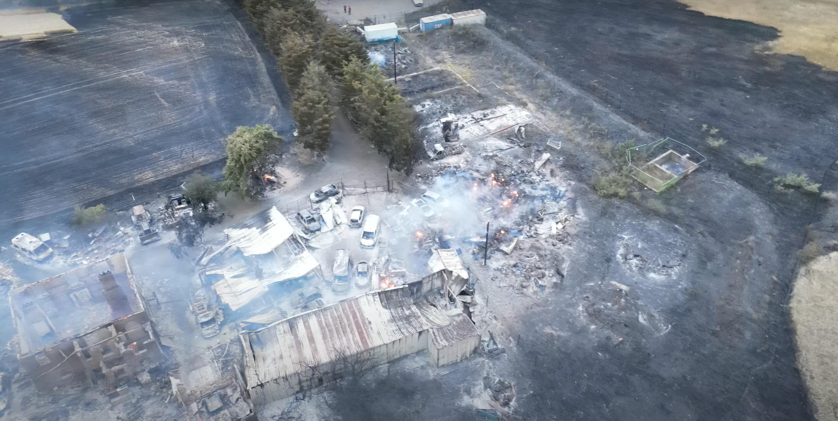
Aerial view of the Wennington wildfire, London, 19 July 2022. Source: Harrison Healey, Wikimedia Commons (CC BY 3.0).

Ahead of the Fourth UK Climate Change Risk Assessment (CCRA4), the Climate Change Committee (CCC) are asking what we know about the impact of past and present climate change on natural and human systems here in the UK specifically. At the global level, the 2021 IPCC sixth assessment working group I (AR6 WGI) report concluded: “It is unequivocal that human influence has warmed the atmosphere, ocean and land.” This single sentence has been informed by decades of research by people at the cutting edge of climate science, and the evidence to support it has grown stronger in every IPCC report since they began. The report goes on to say: “Human-induced climate change is already affecting many weather and climate extremes in every region across the globe.” In last year’s follow-up AR6 WGII report on impacts, adaptation, and vulnerability, an extensive assessment of the science led to the conclusion that the magnitude and proliferation of extremes caused by human-induced climate change were having widespread, adverse impacts on both nature and people. Last summer’s heatwaves, and the concurrent dangers to health, homes, and the environment, were a graphic illustration of the nature of such human-induced impacts.

The study of impacts that informed this conclusion is the remit of climate scientists who specialise in “detection and attribution”. This is about looking at what is changing around us and being able to pinpoint the cause(s) – and particularly, whether human-induced climate change is at the root. To inform CCRA4, the CCC have commissioned a joint Bristol and Exeter University team to conduct a comprehensive review of the detection and attribution of climate change in the UK. The first part will cover the detection and attribution of weather and climate changes in the UK, relevant to specific “Climate Impact Drivers”. The second will cover attribution of impacts on societal, infrastructural, economic, and biodiversity sectors. We aim to find out what studies have been done so far, where the gaps are, and whether they can be filled, or if they would require substantial new methodological or data advances. We aim to identify variables which are key drivers of multiple impacts, and, importantly, where further attribution analysis is needed – especially when the impacts are critical for UK risk.

Detection and attribution is a rapidly evolving field, with focus only relatively recently moving from meteorological attribution (e.g., weather extremes) to impact attribution (e.g., consequences for humans and ecosystems). Our systematic review of the literature and final report will be key to tying it all together, especially with the UK focus required by the CCC. But to be able to present the most up-to-date findings, and thus make informed recommendations, we need to ensure that we have considered all relevant studies. So, if you, or someone you know, has published on this topic – whether UK specific or not – we’d like to know about it! Help shape and inform the next UK Climate Change Risk Assessment.

————————-

This blog was written by Regan Mudhar, Professor Dann Mitchell (University of Bristol), Professor Richard Betts and Professor Peter Stott (University of Exeter/UK Met Office).

Climate change will not impact everyone the same way; but we do not know how

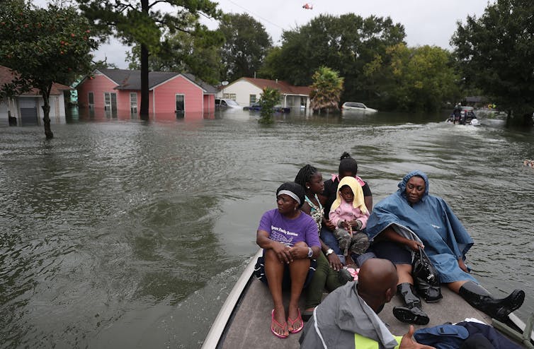
The National Guard rescuing a flood victim. Credit The National Guard, Flickr, CC BY 2.0.

Climate change is affecting the lives of billions of people. The impacts range from water scarcity and food production to health and wellbeing. Climate change impacts are felt in the cities and settlements where people live. We have heard many times that we need to ensure no one is left behind in climate change adaptation and mitigation. To ensure that every voice matters, the impacts of climate change on different groups have to be taken into account. Many individuals or groups are disproportionately affected by climate change as they have less capacity to prepare for, respond to, and recover from climate-related hazards. Worldwide, there are more than one billion persons with disabilities, 15% of the world’s population. The preamble of the Paris Agreement states that parties should respect, promote and consider their respective obligations on human rights and the rights of persons with disabilities, when taking action to address climate change.

Hence, IPCC working group II (WGII) 6th assessment report which was released earlier this year emphasizes not only the warming, drought and floods, but also how much we are exposed to these hazards. There is a renewed focus on vulnerability to climate change which varies strongly between regions and groups of people.

Germany currently holds the G7 presidency, an inter-governmental political forum consisting of several large global north industrial nations. The German Federal Government Commissioner for the Interests of the Disabled called for an Inclusion summit, the first of its kind, in September in Berlin. The main aim was to address questions around impacts of COVID-19, Artificial Intelligence, and climate change on persons with disabilities.

I have never before taken part in such an event, and it was a steep learning curve. Not only were there bilateral meetings between nations, but also the Internal Disability Alliance (IDA), had bilateral meetings with the academics who were invited to speak. The presentations were translated to international sign language, subtitled, and we implemented guidance to make these more accessible. Presenting to a group where many of the participants had visual impairments is different to the typical presentations a natural scientist is focusing on.

The climate change research was presented by Sebastien Jodoin (from McGill) and myself. Sebastien focused on the lack of inclusion of disability rights in the climate emergency. Fewer than one in four countries mentioned disabled people in their national climate plans. My contribution focused on pointing out the lack of knowledge on impacts of and adaptation to climate change in the context of persons with disability. The limited research in the climate change context focusses on heat and other extreme events. Vulnerability to climate change of persons with disabilities is not covered in the literature and therefore not assessed in the report. Disability is therefore only discussed as a category of vulnerability, as part of lists of old people, young people, marginalized and disabled. But these groups have different challenges and vulnerabilities.

So what was the outcome? IDA emphasized the importance of inclusion as a driver for change. The Chairs summary emphasized the importance of comprehensive statistical and research data to inform the design of policy aiming to identify and address barriers faced by persons with disabilities in exercising their rights.

Environmental justice ensures that socially vulnerable segments of the population should not be disproportionately affected by adverse environmental impacts or hazards. Often actions start at a local scale. In Bristol the Bristol Disability and Equality Forum is working towards inclusion on the city scale, based on their community climate action plan. Emma Green, their climate action coordinator, helped me to consider costs and benefits of climate adaptation more broadly than I did before. Environmental justice asks us all to make sure we consider the needs of everyone while we adapt to and mitigate to climate change. Subregional disaggregation will allow us to determine groups who have the information, skills and funds to implement climate adaptation and reduce their vulnerability, and those who will need support.

———————————

This blog is written by Cabot Institute for the Environment member Professor Daniela Schmidt, School of Earth Sciences, University of Bristol. Daniela is an IPCC report lead author and lead on the recent IPCC WGII chapter on Europe.

Professor Daniela Schmidt


Engaging with visions of mobilities within the landscape of risk

When describing the commercial port land of Felixstowe (fig. I) as a ‘nerve ganglion of capitalism’ in 2006, a proto-nostalgic horizon ‘blighted by cargo ships’, Mark Fisher was describing a vision of the natural’s collision course with the monetary in words that ooze forth from the ascetic expanse he walked us through, right up to the journey’s reposeful end point, the burial ground at Sutton Hoo (fig. II). Here, in this space, palpable is the sense that the increasingly unseen in today’s world is seen so lucidly that upon listening closer, Beowulf’s verses may come rushing forth upon the Deben mists to play amongst the ancient mounds and time-worn grasses.

Figures I (top) & II (bottom): Felixstowe container port (top) the largest of its kind in the United Kingdom, a point of arrival and nerve ganglion of capitalism responsible for the distribution of material commodities across the land along established networks of commerce. By contrast, the ‘sunlit planetary quality of serenity’ offered at Sutton Hoo (bottom) engages with a vision of departure, two different points within a geography that speaks to themes of migration, mobility, and the conflict of boundary in space and time. (sources: Institution of Civil Engineers (top) & thesuffolkcoast.co.uk (bottom)).

In a space as innately human as this, the purpose of the city, the urban, and what it means to exist in it becomes overwritten in the victorious verse and rhythm of nature and the environment, yet there is an eeriness inherent in this vision. A sense of disconnection and immobility that is increasingly disassociated with the ever-expanding urban centres across the world. This is a sense that many might argue is, itself, becoming increasingly overwritten through development and, possibly more directly, through proliferating networks of digital visualisation and communication.

More of us are living in urban settings and more of us are moving to them, what drives this flight to the city, the deeper motivations can only be described as, much like the conditions of the British weather, myriad. What this mobilisation and migration looks like is relatively more straight forward to describe: a need for access to resources through labour, coupled with a space in which to live and be at home, to rest. Mirrored perfectly in Fisher’s visions from Felixstowe to Sutton Hoo, a seamless cross section of the Anthropocene. Capturing the stillness afforded by a space so radically different to the city, where the scale of achievement, to simply occupy a space with as much concrete matter as is condensed into the wondrous square miles of London, Birmingham, and Manchester, amongst many others, by comparison to that which does not occupy the vastness of Suffolk is astonishing. Historically, progress for those who have settled in these cityscapes has, in many senses, been assured, simply through an increased likelihood of encountering streams of revenue and capital, or so goes the utopian visions of the upwardly mobile Mondeo Men and Worcester Women.

Loosely this might be described as the enabling of capital progress, however these connections, patterns and trends underpinning, however loosely, such stereotypical visions of city living have become much more distant for most within the current global climate. A crude utilisation of Tobler’s first law of geography would, when coupled with Mark Fisher’s nerve ganglion metaphor, lead us to deduce that those closest to capital, to the contemporary capital markets of the city, are not as readily likely to benefit from this proximity as they might once have. This sense of capital mobility associated with the city is now fundamentally more precarious and is visually very different from that seen in the past, offering the first glimpse of the landscape of risk.

Of course, this form of mobility is not completely linear as the city has long also been associated with a flux of capital mobility represented by a great, and growing, disparity between those operating at the top of the metropolitan hierarchy, in gleaming beglassed monoliths, and those looking up at them from the mosaic of avenues and streets below. This structural and spatial inequality of the cityscape is as symbolic of the urban as it is of the human condition it embodies, where products of value are exchanged for labour and where, as David Harvey explained in Social Justice and The City, ‘capitalism annihilates space to ensure its own reproduction.’ Historically facilitated by barbaric internal mechanisms in the West, from blockbusting and redlining amongst a spectrum of variable living standards that extend from unthinkable to the decadent, urbanisation and urban expansion reassembling the natural spaces in the pursuit of capital will naturally enhance and further facilitate the growth of inequity and thus, further strengthen the boundaries of the risk landscape.

This does come down to a fundamental connection between capital and risk, where risk is largely framed in the context of ‘asset loss’ but the landscape in which it is most acutely observed, where capital value is most apparent, the city, is where it is, and will continue to be, predominant. Harvey concludes his vision on the engagement with political process as fundamental to traversing the forms of inequality and injustice generated and facilitated through ties to this form of ‘development’. Consequent of the unprecedented recent times we have lived in, and now continue to live through, together, the public inquisitions regarding the moral constitution of those responsible for overseeing political processes challenges any desire for engagement. Age old theoretical undercoats of societal constitution and modernity begin to peel away under the searing heat of growing public discontent whilst those at the very zenith continue to profit financially.

The risk landscape is one fraught with conflict and is perpetually in crisis. However, were this crisis to be wholly one of capital, it would affect everyone. Capital and inequity are one facet of the greater conflict the risk landscape has with the environment at large, as even when this crisis is framed in the context of equity, it finds equilibrium in the continuation of the trend that, depending on where you are categorised within the social hierarchy of the city, you will continue to be worse off from here on out and no amount of ‘levelling up’ will bring about a truly positive change to this course. We are beginning to feel this at home, on a personal scale now through a volatile geopolitical landscape, but that doesn’t mean that labour is any less abundant. The boundaries of the risk landscape will continue to expand beyond this and find a continuing but ultimately existential conflict with the natural environment, generating an accelerated form of risk that is much more linear in outcome. The general message related to this is clear: ‘Adaptation of current modes and systems to emergent environmental risk is needed, with further mitigation required to prevent the acceleration of this risk

The modern human age is liquid, where change and continuity are seen to different degrees and operate at various tempos across time. Were I to define which of the processes discussed throughout this missive are representative of change and continuity, I would posit that the ultimate defining factor of both lie in the hands of nature and not my own. Whilst social categories become redefined through mechanisms closely tied to the city, overwriting of old landscape structures through the proliferation of the urban over time generates a legacy of risk through reparation and over expansion. In appropriating space that is not in the interest of that which inhabits that space, be it the development of floodplains to accommodate homes, the utilisation, or lack, of land due to pollution from past industry, processes of land reclamation, we are clutching at straws. Yet, capital is generated and claimed with little interest for the longevity or safety of those inhabiting these new spaces, asserting a dynamic of equitability for whom exactly?

It is in this dissection of value, it’s definition and by whom (or what), that the vision of the risk landscape becomes truly material. How these values shift, and to what benefit, must continue to be explored if we are to make a sustainable vision of the city into a liveable environment, equitable for all who will call it home. If our mobility within this exploration could be versed in the cognitive, as Mark Fisher did for us, then we are becoming more aware of the trends that connect the naturally seen and unseen with the landscape of risk. Supporting us in the delineation of what is really of and for us against that which appears to be, revealing what it is to be truly of and for the natural.

—————————-

This blog is written by Cabot Institute for the Environment member, Dr. Thomas O’Shea. Dr O’Shea is a postdoctoral research associate with the University of Bristol School of Sociology, Politics and International Studies. The primary focus of his research is on developing understanding of the human-water interface with specific interests in the application of social theory, urban and hybrid geographies towards shaping narratives and strategies of sustainability.

This blog is the final blog in the Migration, Mobilities and the Environment blog series, in conjunction with Migration Mobilities Bristol.

New flood maps show US damage rising 26% in next 30 years due to climate change alone, and the inequity is stark


Coastal cities like Port Arthur, Texas, are at increasing risk from flooding during storms.
Joe Raedle/Getty Images

Climate change is raising flood risks in neighborhoods across the U.S. much faster than many people realize. Over the next three decades, the cost of flood damage is on pace to rise 26% due to climate change alone, an analysis of our new flood risk maps shows.

That’s only part of the risk. Despite recent devastating floods, people are still building in high-risk areas. With population growth factored in, we found the increase in U.S. flood losses will be four times higher than the climate-only effect.

Our team develops cutting-edge flood risk maps that incorporate climate change. It’s the data that drives local risk estimates you’re likely to see on real estate websites.

In the new analysis, published Jan. 31, 2022, we estimated where flood risk is rising fastest and who is in harm’s way. The results show the high costs of flooding and lay bare the inequities of who has to endure America’s crippling flood problem. They also show the importance of altering development patterns now.

The role of climate change

Flooding is the most frequent and costliest natural disaster in the United States, and its costs are projected to rise as the climate warms. Decades of measurements, computer models and basic physics all point to increasing precipitation and sea level rise.

As the atmosphere warms, it holds about 7% more moisture for every degree Celsius that the temperature rises, meaning more moisture is available to fall as rain, potentially raising the risk of inland flooding. A warmer climate also leads to rising sea levels and higher storm surges as land ice melts and warming ocean water expands.

Yet, translating that understanding into the detailed impact of future flooding has been beyond the grasp of existing flood mapping approaches.

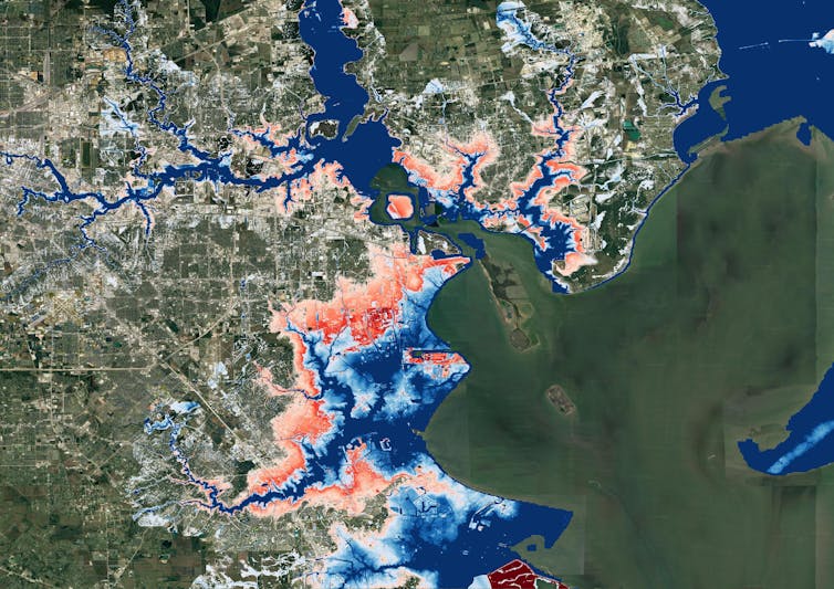
A map of Houston showing flooding extending much farther inland.
A map of Houston shows flood risk changing over the next 30 years. Blue areas are today’s 100-year flood-risk zones. The red areas reflect the same zones in 2050.
Wing et al., 2022

Previous efforts to link climate change to flood models offered only a broad view of the threat and didn’t zoom in close enough to provide reliable measures of local risk, although they could illustrate the general direction of change. Most local flood maps, such as those produced by the Federal Emergency Management Agency, have a different problem: They’re based on historical changes rather than incorporating the risks ahead, and the government is slow to update them.

Our maps account for flooding from rivers, rainfall and the oceans – both now and into the future – across the entire contiguous United States. They are produced at scales that show street-by-street impacts, and unlike FEMA maps, they cover floods of many different sizes, from nuisance flooding that may occur every few years to once-in-a-millennium disasters.

While hazard maps only show where floods might occur, our new risk analysis combines that with data on the U.S. building stock to understand the damage that occurs when floodwaters collide with homes and businesses. It’s the first validated analysis of climate-driven flood risk for the U.S.

The inequity of America’s flood problem

We estimated that the annual cost of flooding today is over US$32 billion nationwide, with an outsized burden on communities in Appalachia, the Gulf Coast and the Northwest.

When we looked at demographics, we found that today’s flood risk is predominantly concentrated in white, impoverished communities. Many of these are in low-lying areas directly on the coasts or Appalachian valleys at risk from heavy rainfall.

But the increase in risk as rising oceans reach farther inland during storms and high tides over the next 30 years falls disproportionately on communities with large African American populations on the Atlantic and Gulf coasts. Urban and rural areas from Texas to Florida to Virginia contain predominantly Black communities projected to see at least a 20% increase in flood risk over the next 30 years.

Historically, poorer communities haven’t seen as much investment in flood adaptation or infrastructure, leaving them more exposed. The new data, reflecting the cost of damage, contradicts a common misconception that flood risk exacerbated by sea level rise is concentrated in whiter, wealthier areas.

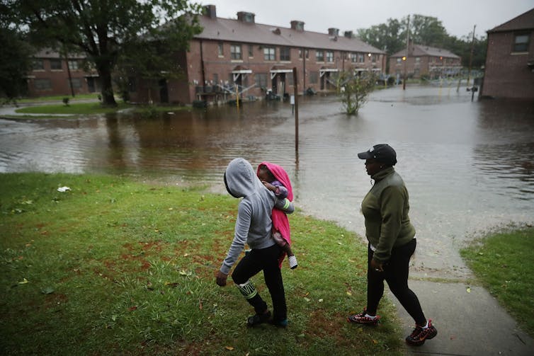
A woman carries a child past an area where flood water surrounds low-rise apartment buildings.
Hurricane Florence’s storm surge and extreme rainfall flooded towns on North Carolina’s Neuse River many miles inland from the ocean in 2018.
Chip Somodevilla/Getty Images

Our findings raise policy questions about disaster recovery. Prior research has found that these groups recover less quickly than more privileged residents and that disasters can further exacerbate existing inequities. Current federal disaster aid disproportionately helps wealthier residents. Without financial safety nets, disasters can be tipping points into financial stress or deeper poverty.

Population growth is a major driver of flood risk

Another important contributor to flood risk is the growing population.

As urban areas expand, people are building in riskier locations, including expanding into existing floodplains – areas that were already at risk of flooding, even in a stable climate. That’s making adapting to the rising climate risks even more difficult.

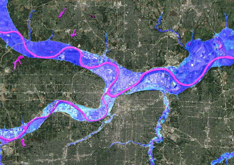
A satellite image of Kansas City showing flood risk overlaid along the rivers.
A Kansas City flood map shows developments in the 100-year flood zone.
Fathom

Hurricane Harvey made that risk painfully clear when its record rainfall sent two reservoirs spilling into neighborhoods, inundating homes that had been built in the reservoirs’ flood zones. That was in 2017, and communities in Houston are rebuilding in risky areas again.

We integrated into our model predictions how and where the increasing numbers of people will live in order to assess their future flood risk. The result: Future development patterns have a four times greater impact on 2050 flood risk than climate change alone.

On borrowed time

If these results seem alarming, consider that these are conservative estimates. We used a middle-of-the-road trajectory for atmospheric greenhouse gas concentrations, one in which global carbon emissions peak in the 2040s and then fall.

Importantly, much of this impact over the next three decades is already locked into the climate system. While cutting emissions now is crucial to slow the rate of sea level rise and reduce future flood risk, adaptation is required to protect against the losses we project to 2050.

[Over 140,000 readers rely on The Conversation’s newsletters to understand the world. Sign up today.]

If future development was directed outside of the riskiest areas, and new construction met higher standards for flood mitigation, some of these projected losses could be avoided. In previous research, we found that for a third of currently undeveloped U.S. floodplains it is cheaper to buy the land at today’s prices and preserve it for recreation and wildlife than develop it and pay for the inevitable flood damages later.

The results stress how critical land use and building codes are when it comes to adapting to climate change and managing future losses from increasing climate extremes. Protecting lives and property will mean moving existing populations out of harm’s way and stopping new construction in flood-risk areas.The Conversation

——————————-

This blog is written by Cabot Institute for the Environment members Dr Oliver Wing, Research Fellow, and Paul Bates, Professor of Hydrology, School of Geographical Sciences, University of Bristol; and Carolyn Kousky, Executive Director, Wharton Risk Center, University of Pennsylvania and Jeremy Porter, Professor of Quantitative Methods in the Social Sciences, City University of New York.

This article is republished from The Conversation under a Creative Commons license. Read the original article.

Canada’s flood havoc after summer heatwave shows how climate disasters combine to do extra damage

People living in British Columbia will feel like they have had more than their fair share of climate disasters in 2021. After a record-breaking heatwave in June, the state in western Canada has been inundated by intense rain storms in November. It’s also likely the long-lasting effects of the heatwave made the results of the recent rainfall worse, causing more landslides – which have destroyed highways and railroads – than would otherwise have happened.

In June 2021, temperature records across western North America were shattered. The town of Lytton in British Columbia registered 49.6°C, breaking the previous Canadian national record by 5°C. The unprecedented weather was caused by a high pressure system, a so-called “heat dome”, which sat over the region for several days.

Heat intensified within the dome as the high pressure compressed the air. Dry ground conditions forced temperatures even higher, as there was less water evaporating to cool things down. Although unconfirmed, it’s estimated that the heatwave caused over 400 deaths in British Columbia alone.

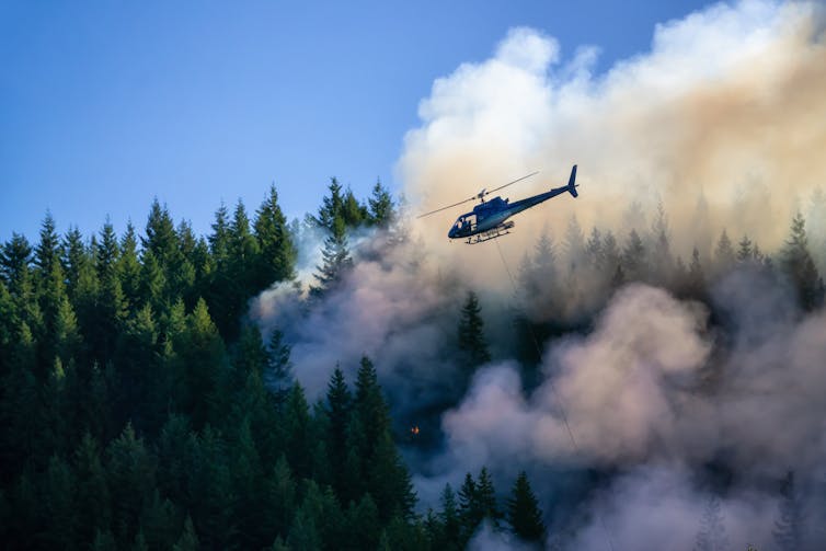
A helicopter flies over a burning pine forest beneath a blue sky.
Wildfires ravaged British Columbia during the hot and dry summer of 2021.
EB Adventure Photography/Shutterstock

The hot and dry weather also sparked wildfires. Just days after recording the hottest national temperature ever, the town of Lytton burned to the ground. The summer’s fires and drought left the ground charred and barren, incapable of absorbing water. These conditions make landslides more likely, as damaged tree roots can no longer hold soil in place. It also ensures water flows over the soil quicker, as it cannot soak into the baked ground.

The huge rain storm which lasted from Saturday November 13 to Monday 15 was caused by an atmospheric river – a long, narrow, band of moisture in the atmosphere stretching hundreds of miles. When this band travels over land it can generate extreme rainfall, and it did: in 48 hours, over 250mm of rain fell in the town of Hope, 100km east of Vancouver.

This much rainfall on its own would probably cause extensive flooding. But combined with the parched soil, the results have been catastrophic. Landslides have destroyed many of the region’s transport links, leaving Vancouver cut off by rail and road. But the bad news doesn’t end there; sediment washed away by these floods could make future floods this winter even worse.

British Columbia is in the grip of what scientists call a compound climate disaster. The effects of one extreme weather event, like a heatwave, amplify the effects of the next one, like a rain storm. Instead of seeing floods and wildfires as discrete events, compound disasters force us to comprehend the cascading crises which are likely to multiply as the planet warms.

How to understand compound climate disasters

The port of Vancouver is the busiest in Canada, moving US$550 million worth of cargo every day. Because rail links are damaged, ships laden with commodities sit offshore. Canada’s mining and farming industries are having to divert exports through the US. Depending on how quickly the rail links recover, significant economic impacts are possible.

Both the June heatwave and the November rainstorm are unprecedented, record-breaking events, but is their occurrence in the same year just bad luck? A rapid attribution study found that the heatwave was virtually impossible without climate change. The atmospheric river which brought the deluge is also likely to become more common and intense in a warming climate.

In British Columbia, future flooding is almost guaranteed to be more frequent and severe. This is life at 1.2°C above the pre-industrial temperature average, yet most politicians don’t seem too worried about taking the necessary action to prevent warming beyond 1.5°C – the limit which countries agreed in 2015 is a threshold beyond which catastrophic climate change becomes more likely.

Western Canada’s year of weather extremes did not come from nowhere. Past trends and future projections tell us to expect hotter summers and wetter winters in this part of the world, and record-shattering climate extremes are on the rise.

Worldwide, compound climate disasters are becoming more common as climate change accelerates. Risk assessments typically measure the impacts of one event at a time, like the damage caused by intense rain storms, without considering how the earlier drought influenced it. This leads to scientists and insurers underestimating the overall damage. With so many combinations of climate extremes – flooding following wildfires, hurricanes passing as cold spells arrive – we must prepare for every possibility.The Conversation

————————-

This blog is written by Cabot Institute for the Environment member Dr Vikki Thompson, Senior Research Associate in Geographical Sciences, University of Bristol.

This article is republished from The Conversation under a Creative Commons license. Read the original article.

Vikki Thompson

Are you a journalist looking for climate experts? We’ve got you covered

We’ve got lots of media trained climate change experts. If you need an expert for an interview, here is a list of Caboteers you can approach. All media enquiries should be made via Victoria Tagg, our dedicated Media and PR Manager at the University of Bristol. Email victoria.tagg@bristol.ac.uk or call +44 (0)117 428 2489.

Climate change / climate emergency / climate science / climate-induced disasters

Dr Eunice Lo – expert in changes in extreme weather events such as heatwaves and cold spells, and how these changes translate to negative health outcomes including illnesses and deaths. Follow on Twitter @EuniceLoClimate.

Professor Daniela Schmidt – expert in the causes and effects of climate change on marine systems. Dani is also a Lead Author on the IPCC reports. Dani will be at COP26.

Dr Katerina Michalides – expert in drylands, drought and desertification and helping East African rural communities to adapt to droughts and future climate change. Follow on Twitter @_kmichaelides.

Professor Dann Mitchell – expert in how climate change alters the atmospheric circulation, extreme events, and impacts on human health. Dann is also a Met Office Chair. Dann will be at COP26. Follow on Twitter @ClimateDann.

Professor Dan Lunt – expert on past climate change, with a focus on understanding how and why climate has changed in the past and what we can learn about the future from the past. Dan is also a Lead Author on IPCC AR6. Dan will be at COP26. Follow on Twitter @ClimateSamwell.

Professor Jonathan Bamber – expert on the impact of melting land ice on sea level rise (SLR) and the response of the ocean to changes in freshwater forcing. Jonathan will be at COP26. Follow on Twitter @jlbamber

Professor Paul Bates CBE – expert in the science of flooding, risk and reducing threats to life and economic losses worldwide. Follow on Twitter @paul_d_bates

Professor Tony Payne – expert in the effects of climate change on earth systems and glaciers.

Dr Matt Palmer – expert in sea level and ocean heat content research at the Met Office Hadley Centre and University of Bristol. Follow on Twitter @mpclimate.

Net Zero / Energy / Renewables

Professor Valeska Ting – Engineer and expert in net zero, low carbon technologies, low carbon energy and flying. Also an accomplished STEM communicator, is an BAME Expert Voice for the BBC Academy. Follow on Twitter @ProfValeskaTing.

Professor Philip Taylor – Expert in net zero, energy systems, energy storage, utilities, electric power distribution. Also Pro-Vice Chancellor at the University of Bristol. Philip will be at COP26. Follow on Twitter @rolyatlihp.

Dr Colin Nolden – expert in sustainable energy policy, regulation and business models and interactions with secondary markets such as carbon markets and other sectors such as mobility. Colin will be at COP26.

Climate finance

Dr Rachel James – Expert in climate finance, damage, loss and decision making. Also has expertise in African climate systems and contemporary and future climate change. Follow on Twitter @_RachelJames

Climate justice

Dr Alix Dietzel – climate justice and climate policy expert. Focusing on the global and local scale and interested in how just the response to climate change is and how we can ensure a just transition. Alix will be at COP26. Follow on Twitter @alixdietzel

Dr Ed Atkins – expert on environmental and energy policy, politics and governance and how they must be equitable and inclusive. Also interested in local politics of climate change policies and energy generation and consumption. Follow on Twitter @edatkins_.

Climate activism / Extinction Rebellion

Dr Oscar Berglund – expert on climate change activism and particularly Extinction Rebellion (XR) and the use of civil disobedience. Follow on Twitter @berglund_oscar.

Air pollution / Greenhouse gases

Dr Aoife Grant – expert in greenhouse gases and methane. Has set up a monitoring station at Glasgow for COP26 to record emissions.

Professor Matt Rigby – expert on sources and sinks of greenhouse gases and ozone depleting substances. Follow on Twitter @TheOtherMRigby.

Land, nature and food

Dr Jo House – expert on land and climate interactions, including emissions of carbon dioxide from land use change (e.g. deforestation), climate mitigation potential from the land (e.g. afforestation, bioenergy), and implications of science for policy. Previously Government Office for Science’s Head of Climate Advice. Follow on Twitter @Drjohouse.
Dr Taro Takahashi – expert on farming, livestock production systems as well as progamme evaluation and general equilibrium modelling of pasture and livestock-based economies.

Climate change and infrastructure

Dr Maria Pregnolato – expert on effects of climate change and flooding on infrastructure. Follow on Twitter @MariaPregnolat1.

Plastic and the environment

Dr Charlotte Lloyd – expert on the fate of chemicals in the terrestrial environment, including plastics, bioplastics and agricultural wastes. Follow on Twitter @DrCharlLloyd.

What else the Cabot Institute for the Environment is up to for COP26

Find out what we’re doing for COP26 on our website at bristol.ac.uk/cabot/cop26.
Watch our Cabot Conversations – 10 conversations between 2 experts on a climate change issue, all whilst an artist listens in the background and interprets the conversation into a beautiful piece of art in real time. Find out more at bristol.ac.uk/cabot/conversations.
——————————
This blog was written by Amanda Woodman-Hardy, Communications and Engagement Officer at the Cabot Institute for the Environment. Follow on Twitter @Enviro_Mand and @cabotinstitute.
 

Tackling urban landslides in an uncertain future

One of the challenges of the 21st century is how to reconcile global urban growth with the prevention and mitigation of environmental disasters, such as those caused by landslides. Every year 300 million people are exposed to landslides worldwide, with over 4,000 fatalities, 250,000 of people affected, and billions of US dollars of economic damage. However, impacts might be worse in the future for two main reasons. First, severe precipitations might become more frequent under climate change, causing more rainfall-triggered landslides. Second, growing urban population will lead more people to live in areas exposed to landslides globally, and in particular in developing countries where low-income dwellers are starting to overcrowd landslide-prone areas such as steep slopes. With more hurricanes to come and more people at risk, understanding where and when landslides might occur is becoming increasingly crucial.

Current predictions are too uncertain to support decisions

One method to predict landslides in the future is to look at landslides in the past. The analysis of historical records allows the identification of those hillslopes that have failed in the past. Currently stable hillslopes where similar conditions exist (for example, similar slope gradients) are ‘tagged’ with high landslide probability. These areas might be then excluded for construction development or might be the first to be alerted when a severe precipitation is expected.

This approach to landslide prediction is, however, often insufficient. Landslides and rainfall records as well as data on hillslope properties are often affected by large errors or unavailable in sufficient detail. In addition, what happened in the past might not be representative of what may happen in the future, making historical records less useful for long-term projections. Climate and socio-economic models can be used to build scenarios of how rainfall patters and cities might look like in the future. Unfortunately, these scenarios can vary significantly because they depend on highly uncertain factors such as future carbon emissions. As a result, landslide estimates can also be very different and sometimes even contradictory – some predicting an increase and others a decrease in landslides occurrence – undermining their practical use for risk management.

From ‘predict then act’ to ‘act now with low regrets’

Instead of trying to predict how climate and urban expansion will evolve in the future, I used a different approach centred on decision making. I ask the question: how much climate and/or urban expansion needs to change before landslide hazard significantly increases?

The scientific method behind my analysis (Bozzolan et al. 2020, NHESS) first generates thousands of synthetic but realistic hillslopes representations of the study area. Then, it imposes hypothetical scenarios of increasing rainfall severities and urban expansion, also considering different construction features that could affect slope stability (for example, the presence or not of adequate slope drainage such as roof gutters on houses).

Finally, it uses a computer model to assess the stability of these virtual hillslopes, generating a new synthetic library of landslide records. By exploring the library is now possible to identify those combinations of rainfall and urban development conditions (e.g., with or without roof gutters) for which hillslopes are most likely to fail. ‘Low-regret’ mitigation actions will be those that perform well across scenarios and therefore should be prioritised even if future rainfall and urban predictions remain unknown.

A practical tool for decision makers

This new method which explores many ‘what if’ scenarios is a useful tool for decision makers in landslide risk management and reduction. For example, figure 1 shows how a map of landslide probability in Saint Lucia (Eastern Caribbean) might look like if the severity of a destructive rainstorm such as the 2010 Hurricane Tomas were to increase under climate change or if unregulated housing expanded on slopes susceptible to failure. The analysis also shows that when both scenarios are included landslide probability disproportionally increases, revealing that ‘the whole is greater than the sum of its parts’. This information could be used to assess the risk and damages associated with each scenario and to identify low-regret nation-wide risk reduction and risk transfer strategies.

Figure 1: Maps of landslide probability in Saint Lucia under different ‘what if’ scenarios. The percentage (+%) indicates the increase of areas with high landslide probability.

The same method can also be applied to quantify the cost-benefit ratio of different landslide mitigation options, such as improving urban drainage or tree planting at the community/household scale. In Freetown (Sierra Leone), for example, I collaborated with the engineering firm Arup to identify those landslide hazard mitigation actions that would lead to the largest reduction in landslide probability for certain locations or types of slopes, and should thus be prioritised. The information generated through this analysis not only provides evidence to governments and investors for informing urban planning, but it might also encourage landslide probability from low to high micro-insurance in disaster prevention, where insurers offer lower premiums to reward risk-reducing behaviours.

—————————–

This blog is written by Cabot Institute for the Environment member, Dr Elisa Bozzolan from the School of Civil Engineering at the University of Bristol.

The case for case studies: a natural hazards perspective

As I wander the streets of Easton, as I have done over the last 18 months, the landscape becomes more and more familiar. Same streets, same skies. Things seem flat and still.

Living in this mundane landscape, I find it hard to believe that we live on a turbulent, roiling planet. But the Earth is not flat or still! Natural events happen daily, and extreme climatic events continue to escalate – although all we see in England is a rainy July. Some people are more vulnerable to the Earth’s vicissitudes than others. Since 2021 began, volcanoes in the Democratic Republic of Congo, Italy, Guatemala, and Iceland have erupted, and hurricanes have already gathered pace in the Atlantic. Many of these events have caused disaster for people living in these areas, losing homes, livelihoods, and lives.

Disasters erode and destroy, they leave scars and memories. We are fascinated by them: we seek to understand and to explain. How can we best do that? The case study is one way. Because of its in-depth nature, a case study is well-suited to describe disasters caused by natural hazards (earthquakes, volcanoes, landslides, floods, droughts), allowing us to tell a rich and nuanced story of events. However, we have to be prudent. There are many more natural hazards than we have scope to investigate. A good subject for a case study offers the possibility of new insights that other, limited methods have missed. Many, many times an earthquake or flood does not cause disaster. In choosing a good subject for a case study, we are looking for that event which is particularly interesting to us, and which we hope can tell us new things.

I am currently working on three case studies of disasters in Guatemala. Why and how did the disasters happen?

Coming from an Earth Sciences background, I’m not sure where to begin. There are no obvious blueprints. Why is there so little guidance on how to do a case study in our field? I think there are two reasons. Earth Sciences has always generously included other physical and social sciences (physics, chemistry, mathematics, geography), while a disaster caused by natural hazards involves both physical and social factors. So while this supports disaster’s suitability to the case study method, both science and subject use multiple philosophies and methods. It’s harder to make a cookbook with mixed methods. Secondly, Earth Sciences looks at the mutual interaction between people and nature, who operate on different timescales. Tracing a disaster through a case study requires uniting these timescales in a single narrative. That union is a difficult task and often context-specific, so not generalizable to a single blueprint. (Strangely, in an interdisciplinary case study of a disaster it’s the physical scientists who seem to study events over shorter timescales, for example on the physical triggers of a volcanic eruption. A few years ago in my undergraduate I remember tracing the story of Earth’s evolution across billions of years; now we’re operating over days and hours!)

There have been many criticisms levelled at case study research: that you can’t generalize from a single case, that theoretical knowledge is more valuable than practical knowledge, that case studies tend to confirm the researcher’s biases [1]. I have also read that case studies are excellent for qualitative research (e.g., on groups or individuals), but less so for quantitative research (e.g. on events or phenomena) [2]. I think these points are rubbish.

“You can’t generalize from a single case”, goes the argument against case studies. But generalization is not the point of a case study. We want to go deeper, to know more intimately, to sense in full colour. “Particularization, not generalization” is the point [1], and  intimate knowledge is worthwhile in itself. However, I also think the argument is false. Because it is such a rich medium, the case study affords us a wealth of observations and thus interpretations that allow us to modify our existing beliefs. As an example, a case study of the Caribbean island of Montserrat during an eruptive crisis showed Montserratians entering the no-go zone, risking their lives from the volcano to care for their crops and cattle [3]. This strongly changed the existing reasoning that people would prioritize their life over their livelihood during a volcanic eruption. How could you deny that this finding is not applicable beyond the specific case study? True, it isn’t certain to happen elsewhere, but the finding reminds us to research with caution and to challenge our assumptions. A case study might not give us a totally new understanding of an event, but it might refine our understanding – and that’s how most science progresses, both social and natural. This ‘refinement’ is also a balm for people like me who might be approaching a new case study with trepidation, concerned we might be going over old ground. Sure we might, but here we might forge a new path, there dig up fresh insights.

On the grounds of theoretical versus practical knowledge – we learn by doing! We are practical animals!

Context-dependent knowledge and experience are at the very heart of expert activity.

(Flyvbjerg, 2006) 

Does a case study confirm what we already expect to find? I think the possibility of refining our existing understanding can encourage researchers to keep our eyes open to distortions and bias. I think this final criticism comes from a false separation between the physical and social sciences. Qualitative research is held up as a contrast to “objective” quantitative research in the physical sciences, focussed on hypothesis-testing and disinterested truth. But any PhD student will tell you that the scientific process doesn’t quite work that way. Hypotheses are revised, created, and abandoned with new data, similar to how grounded theory works. And you can find any number of anecdotes where two scientists with the same data and methods came to two different interpretations. There is always some subjective bias as a researcher because (a) you’re also a human, and (b) because the natural world is inherently uncertain. (I wonder if this is an appeal for those who study pure maths – it’s the only discipline I can think of that is really objective and value-free).  Maybe qualitative/quantitative has some difference in the degree of researcher subjectivity. This would be a fascinating subject to explicitly include in those interdisciplinary case studies that involve both types of researcher – how does each consider their inherent bias towards the subject?

After flattening those objections above, I really want to make three points as to why case studies are so great.

First, they have a narrative element that we find irresistible. As Margaret Atwood said,

You’re never going to kill storytelling because it’s built into the human plan. We come with it.

A case study is not just a story, but it does have a story woven into its structure. Narratives are always partial and partisan; our case studies will be too. That’s not to say they can’t be comprehensive, just that they cannot hope to be omniscient. I love this quotation:

A story has no beginning or end: arbitrarily one chooses that moment of experience from which to look back or from which to look ahead.

Graham Greene, The End Of The Affair 

It certainly applies to case studies, too. We may find the roots of a disaster in political machinations which began decades before, or that the journey of a mudslide was hastened by years of deforestation. Attempting to paint the whole picture is futile, but you have to start somewhere.

Second, a case study provides a beautiful chance to both understand and to explain – the aims of the qualitative and the quantitative researcher, respectively. Each may approach truth and theory differently: the first sees truth as value-laden and theory to be developed in the field; the second, as objective and to be known before work is begun. It’s precisely because it’s difficult to harmonize these worldviews that we should be doing it – and the disaster case study provides an excellent arena.

Finally, the process of building a case study creates a space for dialogue. Ideas grow through conversation and criticism, and the tangle of researchers trying to reconcile their different worldviews, and of researchers reconciling their priorities with other interested people, seems both the gristle and the fat of case study research. In the case of disasters, I think this is the most important point which case study research wins. Research can uncover the most wonderful things but if it is not important to the people who are at risk of disaster, we cannot hope to effect positive change. How can we understand, and then how can we make ourselves understood? For all the confusion and frustration that it holds, we need dialogue [4]. A really beautiful example of this is the dialogue between volcano-watchers and scientists at Tungurahua volcano in Ecuador: creating a shared language allowed for early response to volcanic hazards and a network of friendships [5].

I’ve grappled with what products we should make out of these case studies. What are we making, and who are we making it for? From the above point, a valuable product of a case study can be a new relationship between different groups of people. This is not really tangible, which is hard to deal with for the researchers (how do you publish a friendship?) But a case study can produce a relationship that benefits both parties and outlasts the study itself. I think I’ve experienced this personally, through my work at Fuego volcano. I have found the opportunity to share my research and also to be transformed in my workings with local people. This has lasted longer than my PhD, I am still in touch with some of these people.

I believe in the power of case study to its own end, to create dialogue, and to mutually transform researcher and subject. And, if a new relationship is a valuable product of the case study, it is made stronger still by continued work in that area. To do that, the relationships and the ties that bind need to be supported financially and socially across years and uncertainty, beyond the current grey skies and monotony. When we are out, we will be able to renew that dialogue in person and the fruits of our labour will blossom.

[1] Flyvbjerg, 2006

[2] Stake, 1995

[3] Haynes et al., 2005

[4] Barclay et al., 2015

[5] Armijos et al., 2017

——————————-

This blog is written by Cabot Institute for the Environment member Ailsa Naismith from the School of Earth Sciences at the University of Bristol. Ailsa studies volcanic hazards in Central America.

Ailsa Naismith


Is extreme heat an underestimated risk in Bristol?

Evidence that the Earth is warming at an alarming rate is indisputable, having almost doubled per decade since 1981 (relative to 1880-1981). In many countries, this warming has been accompanied by more frequent and severe heatwaves – prolonged periods of significantly above-average temperatures – especially during summer months.

Heatwaves pose significant threats to human health including discomfort, heatstroke and in extreme cases, death. In the summer of 2003 (one that I am sure many remember for its tropical temperatures), these threats were clear. A European heatwave event killed over 70,000 people across the continent – over 2,000 of these deaths were in England alone. As if these statistics weren’t alarming enough, projections suggest that by 2050, such summers could occur every other year and by 2080, a similar heatwave could kill three times as many people.

Cities face heightened risks

Heat-health risks are not equally distributed. Cities face heightened risks due to the urban heat island (UHI) effect, where urban areas exhibit warmer temperatures than surrounding rural areas. This is primarily due to the concentration of dark, impervious surfaces. In the event of a heatwave, cities are therefore not only threatened by even warmer temperatures, but also by high population densities which creates greater exposure to such extreme heat.

UHIs have been observed and modelled across several of the UK’s largest cities. For example, in Birmingham an UHI intensity (the difference between urban and rural temperatures) of 9°C has been recorded. Some estimates for Manchester and London reach 10°C. However, little research has been conducted into the UK’s smaller cities, including Bristol, despite their rapidly growing populations.

Heat vulnerability

In the UK an ageing population implies that heat vulnerability will increase, especially in light of warming projections. Several other contributors to heat vulnerability are also well-established, including underlying health conditions and income. However, the relative influence of different factors is extremely context specific. What drives heat vulnerability in one city may play an insignificant role in another, making the development of tailored risk mitigation policies particularly difficult without location-specific research.

Climate resilience in Bristol

In 2018, Bristol declared ambitious intentions to be climate resilient by 2030. To achieve this, several specific targets have been put in place, including:

  • The adaptation of infrastructure to cope with extreme heat
  • The avoidance of heat-related deaths

Yet, the same report that outlines these goals also highlights an insufficient understanding of hotspots and heat risk in Bristol. This poses the question – how will Bristol achieve these targets without knowing where to target resources?

Bristol’s urban heat island

Considering the above, over the summer I worked on my MSc dissertation with two broad aims:

  1. Quantify Bristol’s urban heat island
  2. Map heat vulnerability across Bristol wards

Using a cloud-free Landsat image from a heatwave day in June 2018, I produced one of the first high-resolution maps of Bristol’s UHI (see below). The results were alarming, with several hotspots of 7-9°C in the central wards of Lawrence Hill, Easton and Southville. Maximum UHI intensity was almost 12°C, recorded at a warehouse in Avonmouth and Lawrence Weston. Though this magnitude may be amplified by the heatwave event, these findings still suggest Bristol exhibits an UHI similar to that of much larger cities including London, Birmingham and even Paris.

Image credit: Vicky Norton

Heat vulnerability in Bristol

Exploratory statistics revealed two principal determinants of an individual’s vulnerability to extreme heat in Bristol:

  1. Their socioeconomic status
  2. The combined effects of isolation, minority status and housing type.

These determinants were scored for each ward and compiled to create a heat vulnerability index (HVI). Even more concerning than Bristol’s surprising UHI intensity is that wards exhibiting the greatest heat vulnerability coincide with areas of greatest UHI intensity – Lawrence Hill and Easton (see below).

What’s also interesting about these findings is the composition of heat vulnerability in Bristol. Whilst socioeconomic status is a common determinant in many studies, the influential role of minority status and housing type appears particularly specific to Bristol. Unlike general UK projections, old age was also deemed an insignificant contributor to heat vulnerability in Bristol. Instead, the prevalence of a younger population suggests those under five years of age are of greater concern.

Image credit: Vicky Norton

Implications

But what do these findings mean for Bristol’s climate resilience endeavours? Firstly, they suggest Bristol’s UHI may be a much greater concern than previously thought, necessitating more immediate, effective mitigation efforts. Secondly, they reiterate the context specific nature of heat vulnerability and the importance of conducting location specific research. Considering UHI intensity and ward-level heat vulnerability, these findings provide a starting point for guiding adaptive and mitigative resource allocation. If Bristol is to achieve climate resilience by 2030, initial action may be best targeted towards areas most at risk – Lawrence Hill and Easton – and tailored to those most vulnerable.

—————————

This blog is written by Vicky Norton, who has recently completed an MSc in Environmental Policy and Management run by Caboteer Dr Sean Fox.

Vicky Norton


Predicting the hazards of weather and climate; the partnering of Bristol and the Met Office

Image credit Federico Respini on Unsplash

When people think of the University of Bristol University, or indeed any university, they sometimes think of academics sitting in their ivy towers, researching into obscurities that are three stages removed from reality, and never applicable to the world they live in. Conversely, the perception of the Met Office is often one of purely applied science, forecasting the weather; hours, days, and weeks ahead of time. The reality is far from this, and today, on the rather apt Earth Day 2020, I am delighted to announce a clear example of the multidisciplinary nature of both institutes with our newly formed academic partnership.

This new and exciting partnership brings together the Met Office’s gold standard weather forecasts and climate projections, with Bristol’s world leading impact and hazard models. Our partnership goal is to expand on the advice we already give decision makers around the globe, allowing them to make evidence-based decisions on weather-related impacts, across a range of timescales.

By combining the weather and climate data from the Met Office with our hazard and impact models at Bristol, we could, for instance, model the flooding impact from a storm forecasted a week ahead, or estimate the potential health burden from heat waves in a decade’s time. This kind of advanced knowledge is crucial for decision makers in many sectors. For instance, if we were able to forecast which villages might be flooded from an incoming storm, we could prioritise emergency relief and flood defenses in that area days ahead of time. Or, if we projected that hospital admissions would increase by 10% due to more major heatwaves in London in the 2030s, then decision makers could include the need for more resilient housing and infrastructure in their planning. Infrastructure often lasts decades, so these sorts of decisions can have a long memory, and we want our decision makers to be proactive, rather than reactive in these cases.

While the examples I give are UK focussed, both the University of Bristol and the Met Office are internationally facing and work with stakeholders all over the world. Only last year, while holding a workshop in the Caribbean on island resilience to tropical cyclones; seeing the importance of our work the prime minister of Jamaica invited us to his residence for a celebration. While I don’t see this happening with Boris Johnson anytime soon, it goes to show the different behaviours and levels of engagement policy makers have in different countries. It’s all very well being able to do science around the world, but if you don’t get the culture, they won’t get your science. It is this local knowledge and connection that is essential for an international facing partnership to work, and that is where both Bristol and the Met Office can pool their experience.

To ensure we get the most out of this partnership we will launch a number of new joint Bristol-Met Office academic positions, ranging from doctoral studentships all the way to full professorships. These positions will work with our Research Advisory Group (RAP), made up of academics across the university, and be associated with both institutes. The new positions will sit in this cross-disciplinary space between theory and application; taking a combined approach to addressing some of the most pressing environmental issues of our time.

As the newly appointed Met Office Joint Chair I will be leading this partnership at Bristol over the coming years, and I welcome discussions and ideas from academics across the university; some of the best collaborations I’ve had have come from a random knock on the door, so don’t be shy in sharing your thoughts.

———————————
This blog is written by Dr Dann Mitchell – Met Office Joint Chair and co-lead of the Cabot Institute for the Environment’s Natural Hazards and Disaster Risk research.
You can follow him on Twitter @ClimateDann.

Dann Mitchell