The case for case studies: a natural hazards perspective

As I wander the streets of Easton, as I have done over the last 18 months, the landscape becomes more and more familiar. Same streets, same skies. Things seem flat and still.

Living in this mundane landscape, I find it hard to believe that we live on a turbulent, roiling planet. But the Earth is not flat or still! Natural events happen daily, and extreme climatic events continue to escalate – although all we see in England is a rainy July. Some people are more vulnerable to the Earth’s vicissitudes than others. Since 2021 began, volcanoes in the Democratic Republic of Congo, Italy, Guatemala, and Iceland have erupted, and hurricanes have already gathered pace in the Atlantic. Many of these events have caused disaster for people living in these areas, losing homes, livelihoods, and lives.

Disasters erode and destroy, they leave scars and memories. We are fascinated by them: we seek to understand and to explain. How can we best do that? The case study is one way. Because of its in-depth nature, a case study is well-suited to describe disasters caused by natural hazards (earthquakes, volcanoes, landslides, floods, droughts), allowing us to tell a rich and nuanced story of events. However, we have to be prudent. There are many more natural hazards than we have scope to investigate. A good subject for a case study offers the possibility of new insights that other, limited methods have missed. Many, many times an earthquake or flood does not cause disaster. In choosing a good subject for a case study, we are looking for that event which is particularly interesting to us, and which we hope can tell us new things.

I am currently working on three case studies of disasters in Guatemala. Why and how did the disasters happen?

Coming from an Earth Sciences background, I’m not sure where to begin. There are no obvious blueprints. Why is there so little guidance on how to do a case study in our field? I think there are two reasons. Earth Sciences has always generously included other physical and social sciences (physics, chemistry, mathematics, geography), while a disaster caused by natural hazards involves both physical and social factors. So while this supports disaster’s suitability to the case study method, both science and subject use multiple philosophies and methods. It’s harder to make a cookbook with mixed methods. Secondly, Earth Sciences looks at the mutual interaction between people and nature, who operate on different timescales. Tracing a disaster through a case study requires uniting these timescales in a single narrative. That union is a difficult task and often context-specific, so not generalizable to a single blueprint. (Strangely, in an interdisciplinary case study of a disaster it’s the physical scientists who seem to study events over shorter timescales, for example on the physical triggers of a volcanic eruption. A few years ago in my undergraduate I remember tracing the story of Earth’s evolution across billions of years; now we’re operating over days and hours!)

There have been many criticisms levelled at case study research: that you can’t generalize from a single case, that theoretical knowledge is more valuable than practical knowledge, that case studies tend to confirm the researcher’s biases [1]. I have also read that case studies are excellent for qualitative research (e.g., on groups or individuals), but less so for quantitative research (e.g. on events or phenomena) [2]. I think these points are rubbish.

“You can’t generalize from a single case”, goes the argument against case studies. But generalization is not the point of a case study. We want to go deeper, to know more intimately, to sense in full colour. “Particularization, not generalization” is the point [1], and  intimate knowledge is worthwhile in itself. However, I also think the argument is false. Because it is such a rich medium, the case study affords us a wealth of observations and thus interpretations that allow us to modify our existing beliefs. As an example, a case study of the Caribbean island of Montserrat during an eruptive crisis showed Montserratians entering the no-go zone, risking their lives from the volcano to care for their crops and cattle [3]. This strongly changed the existing reasoning that people would prioritize their life over their livelihood during a volcanic eruption. How could you deny that this finding is not applicable beyond the specific case study? True, it isn’t certain to happen elsewhere, but the finding reminds us to research with caution and to challenge our assumptions. A case study might not give us a totally new understanding of an event, but it might refine our understanding – and that’s how most science progresses, both social and natural. This ‘refinement’ is also a balm for people like me who might be approaching a new case study with trepidation, concerned we might be going over old ground. Sure we might, but here we might forge a new path, there dig up fresh insights.

On the grounds of theoretical versus practical knowledge – we learn by doing! We are practical animals!

Context-dependent knowledge and experience are at the very heart of expert activity.

(Flyvbjerg, 2006) 

Does a case study confirm what we already expect to find? I think the possibility of refining our existing understanding can encourage researchers to keep our eyes open to distortions and bias. I think this final criticism comes from a false separation between the physical and social sciences. Qualitative research is held up as a contrast to “objective” quantitative research in the physical sciences, focussed on hypothesis-testing and disinterested truth. But any PhD student will tell you that the scientific process doesn’t quite work that way. Hypotheses are revised, created, and abandoned with new data, similar to how grounded theory works. And you can find any number of anecdotes where two scientists with the same data and methods came to two different interpretations. There is always some subjective bias as a researcher because (a) you’re also a human, and (b) because the natural world is inherently uncertain. (I wonder if this is an appeal for those who study pure maths – it’s the only discipline I can think of that is really objective and value-free).  Maybe qualitative/quantitative has some difference in the degree of researcher subjectivity. This would be a fascinating subject to explicitly include in those interdisciplinary case studies that involve both types of researcher – how does each consider their inherent bias towards the subject?

After flattening those objections above, I really want to make three points as to why case studies are so great.

First, they have a narrative element that we find irresistible. As Margaret Atwood said,

You’re never going to kill storytelling because it’s built into the human plan. We come with it.

A case study is not just a story, but it does have a story woven into its structure. Narratives are always partial and partisan; our case studies will be too. That’s not to say they can’t be comprehensive, just that they cannot hope to be omniscient. I love this quotation:

A story has no beginning or end: arbitrarily one chooses that moment of experience from which to look back or from which to look ahead.

Graham Greene, The End Of The Affair 

It certainly applies to case studies, too. We may find the roots of a disaster in political machinations which began decades before, or that the journey of a mudslide was hastened by years of deforestation. Attempting to paint the whole picture is futile, but you have to start somewhere.

Second, a case study provides a beautiful chance to both understand and to explain – the aims of the qualitative and the quantitative researcher, respectively. Each may approach truth and theory differently: the first sees truth as value-laden and theory to be developed in the field; the second, as objective and to be known before work is begun. It’s precisely because it’s difficult to harmonize these worldviews that we should be doing it – and the disaster case study provides an excellent arena.

Finally, the process of building a case study creates a space for dialogue. Ideas grow through conversation and criticism, and the tangle of researchers trying to reconcile their different worldviews, and of researchers reconciling their priorities with other interested people, seems both the gristle and the fat of case study research. In the case of disasters, I think this is the most important point which case study research wins. Research can uncover the most wonderful things but if it is not important to the people who are at risk of disaster, we cannot hope to effect positive change. How can we understand, and then how can we make ourselves understood? For all the confusion and frustration that it holds, we need dialogue [4]. A really beautiful example of this is the dialogue between volcano-watchers and scientists at Tungurahua volcano in Ecuador: creating a shared language allowed for early response to volcanic hazards and a network of friendships [5].

I’ve grappled with what products we should make out of these case studies. What are we making, and who are we making it for? From the above point, a valuable product of a case study can be a new relationship between different groups of people. This is not really tangible, which is hard to deal with for the researchers (how do you publish a friendship?) But a case study can produce a relationship that benefits both parties and outlasts the study itself. I think I’ve experienced this personally, through my work at Fuego volcano. I have found the opportunity to share my research and also to be transformed in my workings with local people. This has lasted longer than my PhD, I am still in touch with some of these people.

I believe in the power of case study to its own end, to create dialogue, and to mutually transform researcher and subject. And, if a new relationship is a valuable product of the case study, it is made stronger still by continued work in that area. To do that, the relationships and the ties that bind need to be supported financially and socially across years and uncertainty, beyond the current grey skies and monotony. When we are out, we will be able to renew that dialogue in person and the fruits of our labour will blossom.

[1] Flyvbjerg, 2006

[2] Stake, 1995

[3] Haynes et al., 2005

[4] Barclay et al., 2015

[5] Armijos et al., 2017

——————————-

This blog is written by Cabot Institute for the Environment member Ailsa Naismith from the School of Earth Sciences at the University of Bristol. Ailsa studies volcanic hazards in Central America.

Ailsa Naismith


Turning knowledge of past climate change into action for the future

Arctic sea ice: Image credit NASA

It’s more helpful to talk about the things we can do, than
the problems we have caused.

Beth Shapiro,
a molecular biologist and author of How To Clone A Mammoth, gave a hopeful
response to an audience question about the recent UN report stating that one
million species are threatened with extinction.

I arrived at the International Union for Quaternary Research (INQUA) 2019
conference, held in Dublin at the end of July, keen to learn exactly that: what
climate scientists can do to mitigate the impact of our rapidly changing
climate. INQUA brings together earth, atmosphere and ocean scientists studying
the Quaternary, a period from 2.6 million years ago to the present day. The
Quaternary has seen repeated and abrupt periods of climate change, making it
the perfect analogue for our rapidly changing future.
In the case of extinctions, if we understand how species
responded to human and environmental pressures in the past, we may be better
equipped to protect them in the present day.

Protecting plants and polar bears

Heikki
Seppä
from the University of Finland and colleagues are using the fossil
record to better understand how polar bears adapt to climate change. The Arctic
bears survived the Holocene thermal maximum, between 10,000 and 6,000 years
ago, when temperatures were about 2.5°C warmer than today. Although rising
temperatures and melting sea ice drove them out of Scandinavia, fossil evidence
suggests they probably found a cold refuge around northwest Greenland. This is
an encouraging indicator that polar bears could survive the 1.5°C
warming projected by the IPCC to occur sometime
between 2030 and 2052
, if it continues to increase at the current rate.
Protecting animal species means preserving habitat, so it’s
just as important to study the effects of climate change on plants. Charlotte
Clarke
from the University of Southampton studies the diversity of plants
during times of abrupt climate change, using Russian lake records. Her results
show that although two thirds of Arctic plant species survived the same warm
period which forced the bears to leave Scandinavia, they too were forced to
migrate, probably moving upslope to colder areas.


If we understand how ecosystems respond to climate change,
we will be better prepared to protect them in the future. But what will future
climate change look like? Again, we can learn a lot by studying the past.

The past is the key to the future

To understand the impact of anthropogenic CO2
emissions on the climate, we must disentangle the effect of CO2 from
other factors, such as insolation (radiation from the Sun reaching the Earth’s
surface). This is the mission of Qiuzhen Yin from UC
Louvain, Belgium, who is studying the relative impact of CO2
on climate during five past warm interglacials
. Tim Shaw, from
Nanyang Technological University in Singapore, presented work on the mechanisms driving
past sea level change
. And Vachel
Carter
from the University of Utah is using charcoal as an analogue for
past fire activity
in the Rocky Mountains. By studying the pattern of fire
activity during past warm periods, we can determine which areas are most at
risk in the future.

The 2018 fire season in Colorado was one of the worst on record.

So Quaternary scientists have a lot to tell us about what
our rapidly changing planet might look like in the years to come. But how can
we translate this information into practical action? ‘Science as a human
endeavour necessarily encompasses a moral dimension’, says George Stone from Milwaukee
Area Technical College, USA. Stone’s passionate call to action is part of a
series of talks about how Quaternary climate research can be applied to
societal issues in the 21st Century.

One thing scientists can do is try to engage with
policymakers. Geoffrey
Boulton
of the International Science Council
is hopeful that by partnering with INQUA and setting up collaborations with
Quaternary scientists, it can help them do that. The International Science
Council has a history of helping to integrate science into major global climate
policy such as the Paris
Agreement
.

What can we do ourselves as scientists is to portray
scientific results in a way that is visually appealing and easy to understand,
so they are accessible to the public and to policymakers. Oliver Wilson and
colleagues from the University of Reading are a prime example, as they brought
along 3D printed giant pollen grains which they use for outreach and teaching
as part of the 3D
Pollen Project
.


Given that it’s easier than ever to publicise your own results,
through channels such as blogs and social media, hopefully a new generation of
Quaternary scientists will leave inspired to engage in outreach and use their
knowledge to make a difference.

—————————–
This blog is written by Cabot Institute member Jen
Saxby
, a PhD student in the School
of Earth Sciences
at the University of Bristol.

Jen Saxby


How to turn a volcano into a power station – with a little help from satellites

File 20171031 18735 1gapo0c.jpg?ixlib=rb 1.1
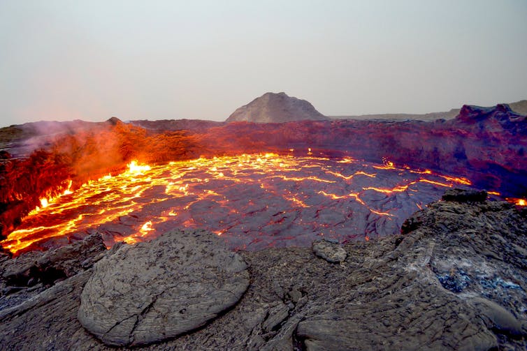
Erta Ale in eastern Ethiopia. mbrand85

Ethiopia tends to conjure images of sprawling dusty deserts, bustling streets in Addis Ababa or the precipitous cliffs of the Simien Mountains – possibly with a distance runner bounding along in the background. Yet the country is also one of the most volcanically active on Earth, thanks to Africa’s Great Rift Valley, which runs right through its heart.

Rifting is the geological process that rips tectonic plates apart, roughly at the speed your fingernails grow. In Ethiopia this has enabled magma to force its way to the surface, and there are over 60 known volcanoes. Many have undergone colossal eruptions in the past, leaving behind immense craters that pepper the rift floor. Some volcanoes are still active today. Visit them and you find bubbling mud ponds, hot springs and scores of steaming vents.

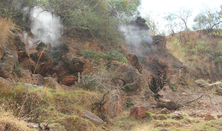
Steam rising at Aluto volcano, Ethiopia. William Hutchison

This steam has been used by locals for washing and bathing, but underlying this is a much bigger opportunity. The surface activity suggests extremely hot fluids deep below, perhaps up to 300°C–400°C. Drill down and it should be possible access this high temperature steam, which could drive large turbines and produce huge amounts of power. This matters greatly in a country where 77% of the population has no access to electricity, one of the lowest levels in Africa.

Geothermal power has recently become a serious proposition thanks to geophysical surveys suggesting that some volcanoes could yield a gigawatt of power. That’s the equivalent of several million solar panels or 500 wind turbines from each. The total untapped resource is estimated to be in the region of 10GW.

Converting this energy into power would build on the geothermal pilot project that began some 20 years ago at Aluto volcano in the lakes region 200km south of Addis Ababa. Its infrastructure is currently being upgraded to increase production tenfold, from 7MW to 70MW. In sum, geothermal looks like a fantastic low-carbon renewable solution for Ethiopia that could form the backbone of the power sector and help lift people out of poverty.


Scratching the surface

The major problem is that, unlike more developed geothermal economies like Iceland, very little is known about Ethiopia’s volcanoes. In almost all cases, we don’t even know when the last eruption took place – a vital question since erupting volcanoes and large-scale power generation will not make happy bedfellows.

In recent years, the UK’s Natural Environment Research Council (NERC) has been funding RiftVolc, a consortium of British and Ethiopian universities and geological surveys, to address some of these issues. This has focused on understanding the hazards and developing methods for exploring and monitoring the volcanoes so that they can be exploited safely and sustainably.

Teams of scientists have been out in the field for the past three years deploying monitoring equipment and making observations. Yet some of the most important breakthroughs have come through an entirely different route – through researchers analysing satellite images at their desks.

This has produced exciting findings at Aluto. Using a satellite radar technique, we discovered that the volcano’s surface is inflating and deflating. The best analogy is breathing – we found sharp “inhalations” inflating the surface over a few months, followed by gradual “exhalations” which cause slow subsidence over many years. We’re not exactly sure what is causing these ups and downs, but it is good evidence that magma, geothermal waters or gases are moving around in the depths some five km below the surface.

Taking the temperature

In our most recent paper, we used satellite thermal images to probe the emissions of Aluto’s steam vents in more detail. We found that the locations where gases were escaping often coincided with known fault lines and fractures on the volcano.

When we monitored the temperature of these vents over several years, we were surprised to find that most were quite stable. Only a few vents on the eastern margin showed measurable temperature changes. And crucially, this was not happening in synchronicity with Aluto’s ups and downs – we might have expected that surface temperatures would increase following a period of inflation, as hot fluids rise up from the belly of the volcano.

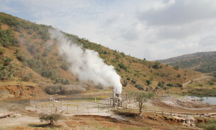
A productive geothermal well on Aluto. William Hutchison

It was only when we delved into the rainfall records that we came up with an explanation: the vents that show variations appear to be changing as a delayed response to rainfall on the higher ground of the rift margin. Our conclusion was that the vents nearer the centre of the volcano were not perturbed by rainfall and thus represent a better sample of the hottest waters in the geothermal reservoir. This obviously makes a difference when it comes to planning where to drill wells and build power stations on the volcano, but there’s a much wider significance.

This is one of the first times anyone has monitored a geothermal resource from space, and it demonstrates what can be achieved. Since the satellite data is freely available, it represents an inexpensive and risk-free way of assessing geothermal potential.

With similar volcanoes scattered across countries like Kenya, Tanzania and Uganda, the technique could allow us to discover and monitor new untapped geothermal resources in the Rift Valley as well as around the world. When you zoom back and look at the big picture, it is amazing what starts to come into view.
——————————-
This blog is written by William Hutchison, Research Fellow, University of St Andrews; Juliet Biggs, Reader in Earth Sciences and Cabot Institute member, University of Bristol, and Tamsin Mather, Professor of Earth Sciences, University of Oxford

This article was originally published on The Conversation. Read the original article.
——————————
Juliet Biggs is a member of the University of Bristol Cabot Institute.  She studies Continental Tectonics and Volcanic Deformation and has won numerous awards in her field.  Find out more about Juliet Biggs research.

Why is the UK interested in volcanoes? We don’t have any of our own!

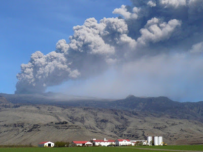
Eruption column from the explosive phase of the Eyjafjallajokull eruption drifting over a farm  – image by Bristol volcanologist Susanna Jenkins
The University of Bristol’s volcanology group has been awarded the Queen’s Anniversary Prize for its contribution to research excellenceThe Queens Anniversary Prize is the most prestigious form of national recognition an institution can receive. When I tell members of the public that, not only am I a volcanologist, but that I am part of the one of the largest and most successful volcanology groups in the world, the first reaction is always surprise: ‘Why is the UK interested in volcanoes? We don’t have any of our own!’

They are right of course, the Bristol volcanology group spends its time travelling all over the world to address volcanic risk in many countries, from the first to the third world. When one looks back on volcanic eruptions in recent history, especially the big, memorable ones like Mount St Helens, Eyjafjallajokull and Montserrat one realises that Bristol volcanologists were there at every stage.

There are, of course, many layers to handling a volcanic crisis. First there’s initial monitoring; will this volcano erupt at all? Often this involves going to volcanoes that have been little studied in remote places, or monitoring them from satellites: something which Bristol volcanology has taken in its stride, by trailblazing projects on understudied African volcanism.

InSAR image showing volcanic uplift in the Great Rift Valley as part of research by Bristol volcanologist Juliet Biggs
Then there’s handling eruptions as they happen. Who will be affected? What are the primary risks? How should we respond to the media? Bristol has a glowing history of aiding in volcanic crisis by supplying the information when the world needs it. During the 2010 Eyjafjallajokull ash and aviation crisis, Bristol led the way in supplying expert opinion on managing the situation.

Still there is no rest for our volcanologists. Afterwards there’s the post-eruption work: Working out what made the volcano erupt and understanding the physical processes surrounding an event. How does it fit into the wider setting? Are the volcanoes linked? These questions have been asked and answered by our volcanologists who have also reached out to form a global database with other institutions. This has resulted in more cohesion in the community, and a greater understanding of how volcanoes interact.

A wealth of different specialities have populated the group since it was started by Professor Steve Sparks  including petrologists, geophysicists and geochemists. It is a result of this diverse environment that Bristol has been able to excel in so many areas. With natural hazards occurring on a near-daily basis, it’s safe to say the group has played its part in reducing the uncertainty of volcanic hazard across the globe.  The Queen’s Anniversary Prize is an amazing recognition of the work that has been done over the years and a well-deserved reward for the hard work of the Bristol volcanologists.

——————————————————————–

This blog is written by Cabot Institute member Keri McNamara, a PhD student in the School of Earth Sciences at the University of Bristol.

Good Mooring!

Since the late 1990s, scientists at the Norwegian Polar Institute (NPI) have conducted annual cruises across the Fram Strait: the widest, deepest and most important exit point for sea ice in the Arctic. One of the main aims of the Fram Strait cruise (FS2015) is to recover, service and redeploy a sprinkling of oceanographic moorings- current profiling instruments and buoys tethered to hundreds of meters of cable, anchored to the seafloor. These have been continuously measuring the velocities of water masses within the East Greenland Current at preset depths. With continuous data over decadal timescales, the NPI are hoping to understand how the nature of the Arctic freshwater budget changes in an increasingly warming climate, how this will impact biological processes, and how it will affect other water masses on a broader scale as they interact in new ways.

1 of 6 oceanographic moorings being recovered for
servicing on FS2015.  Image credit: Laura de Steur /
Norwegian Polar Institute

I was lucky enough to lend a helping hand this September; my second cruise with the NPI after having had a blast working on the Norwegian Young Sea ICE 2015 (N-ICE2015) cruise for a month back in April 2015. After flying into Longyearbyen, Svalbard, and seeing the Research Vessel Lance waiting in the harbour for a second time, it felt very odd not seeing the ship surrounded by 1.3m thick pack-ice, which is how I’d left it after N-ICE2015. It wasn’t until I dropped my bag off in my cosy cabin and heard the familiar roar of the engines warming up (and having my room located right at the back of the ship I really mean roar…) that it felt like I was returning to my home away from home.

The mooring aspect of the cruise this time introduced a different dimension of risks that had to be accommodated: namely by the presence of sea ice above many of the moorings that needed to be recovered. This gave us an occupational risk that obviously only presents itself at the poles! On the N-ICE2015 cruise the engine didn’t have a huge part to play as we were passively drifting with the Arctic pack ice. This time round, whilst navigating the ice floes across Fram Strait towards Eastern Greenland, the Lance was actively smashing through and breaking up the ice above mooring sites to ensure that the mooring returned to the surface without being blocked on its ascent. As ice coverage can alter rapidly, it’s up to chance whether or not these moorings will be readily accessible. In the best case, there will be little to no coverage, so one only has to send a command to the mooring via radio signaling and the cable is released and brought to the surface- buoys and instruments attached. In a moderate case, ice will be extensive enough that the ship will have to meander round, breaking up the ice floes as best it can. For this reason underlying current speed and ascent rate of the mooring has to be considered carefully. It’s always a tense minute or two waiting for the buoys and expensive instrumentation to reach the surface, knowing it may never arrive if it gets stuck on an unfortunately located ice floe! In the worst case, the floes will be so thick and expansive that the mooring recovery process may have to be abandoned all together. For this reason, daily satellite images of ice extent were a very valuable necessity.

As well as observing the physical properties of the Atlantic and Polar Waters spilling southward into the Atlantic, extensive tracer sampling took place at and around the mooring locations by way of collecting water at standard depths. While it is common practice for oceanographers to measure parameters like salinity soon after the water is collected (the on-board salinometer quickly became a very close friend of mine, with 528 samples needing to be analysed during the cruise!) other tracers such as coloured dissolved organic matter (CDOM), nutrients, and 18Oxygen isotope will be analysed ashore. These tracers can tell us something about the source of this water, and by looking at its isotopic composition whether it comes from melted sea ice or from other meteoric sources- that is, water derived from precipitation and runoff. Precipitated water at high latitudes is strongly depleted in 18O, while sea ice meltwater is slightly enriched in it. By looking at the mass of ice loss in the Arctic and how much of it is flowing through the Fram Strait year after year, we’re able to gauge how much is entering the Atlantic or staying in the Arctic basin [1].

The thickness of the ice flowing through Fram Strait has decreased by about 1/3 since 1990 [2]. Part of this melting is related to inflowing, relatively warm Atlantic waters travelling northwards via the West Spitsbergen Current. However, the amount of melt-water that is exported through Fram Strait hasn’t changed very significantly in the past decade. Evidence suggests that the melt water is being stored in the Beaufort gyre- a clockwise-rotating mass of water in the Arctic [3]. While the flux of melt-water into the Arctic Basin has increased in the past couple of decades, tracer analyses tell us the main mechanisms by which fresh water is supplied is by runoff from North American and Eurasian rivers, and by relatively fresh Pacific inflow through the Bering Strait, between Russia and Alaska [1].

The large-scale circulation around the Arctic Ocean.
Figure: Paul Dodd / Norwegian Polar Institute.

It is possible that with inter-annual changes in Arctic wind forcing this growing reservoir of cold, fresh water could be directed southwards across Fram Strait, where it could disrupt the thermohaline circulation of the Atlantic.

Routine sea ice stations were also carried out on suitable ice floes, giving us the chance to stretch our legs and take some ice cores for further tracer sampling. Once analysed, these will allow us to see how the chemical compositions compare with that of the underlying waters. Working 6-hours on, 6-hours off could get pretty exhausting, so it was nice to unwind with the occasional sled race across the floe or by sharpening our ‘selfie skills’ to let the world of social media know how our research was going. All in the name of science…
The FS2015 team and I (centre), exploring an ice floe.
[1]: Dodd, P. A., B. Rabe, E. Hansen, E. Falck, A. Mackensen, E. Rohling, C. Stedmon, and S. Kristiansen (2012), The freshwater composition of the Fram Strait outflow derived from a decade of tracer measurements, J. Geophys. Res., 117, C11005, doi:10.1029/2012JC008011
———————————————
This blog is by Adam Cooper, Earth Sciences graduate at the University of Bristol.

How Bristol geologists are contributing to international development

Guatamala.  Credit: Geology for Global Development

It maybe isn’t immediately obvious how a pet-rock-owning earth scientist is able to change the world; the basement labs in the Wills Memorial Building seem a far cry from fighting global poverty. But the study of geology and having a knowledge of the earth and its resources is actually vitally important for the success of many international development projects.

Geology for global development: what is it all about?

Geology for Global Development (GfGD) is a national organisation that wants to bring awareness to the important position that geologists are in, to be able to make a difference. And it’s not just geologists that are involved here; GfGD recognises that through the collaboration of students from a wide range of disciplines, a positive and effective contribution to development can be made. For example, earth scientists can learn a lot from anthropologists about working alongside different communities whilst being sensitive to cultural differences.

This has been the first year for the GfGD society at Bristol and so far we think it has been a great success. We have held talks covering a whole variety of topics: from volcanic hazards in Guatemala, to sustainably procuring our world’s resources, to an overview of what it is actually like to be working in aid and development as a volunteer. We aim to offer earth scientists and geographers, and anyone else who is interested, an alternative view of the opportunities available to them, aside from the more traditional career paths that often flood everybody’s radars. And alongside this, we’re also trying to raise awareness of the social science skills that are necessary for successful and sustainable development projects.

This year’s focus: volcanic hazards in Guatemala

There is one project in particular that the national GfGD group is currently working on: strengthening volcanic resilience in Guatemala. At Bristol we’re perfectly placed to contribute to this because every year students on the MSc Volcanology course spend 3 weeks studying the volcanoes in this country and learning about the agencies that are set up to monitor them. To draw on all of their experiences we held a ‘Noche de Guatemala’ to learn about this beautiful country and hear how the people living in the shadows of volcanoes are in dire need of better resources and escape routes to ensure their safety in case of eruption. As part of this event we also introduced some cultural aspects of the country as well as the current socio-political situation to put the project into context. In the discussion session that followed we saw some great suggestions for strengthening resilience, from ways to make crops that aren’t affected by volcanic eruptions, to ideas for community involvement with volcano monitoring agencies. These ideas have been passed on to the director of the national GfGD group to help inform how the project might proceed.

Noche de Guatamala at the University of Bristol. Credit: Serginio Remmelzwaal.

As well as contributing to the Guatemala project through awareness and discussions, our group has also managed to raise a fantastic £279.36 towards GfGD’s £10,000 target. This money will be used to supply improved resources to the monitoring agencies and provide educational materials for the communities affected by volcanic hazards so the risks and evacuation procedures are better understood.

Mapping for humanitarian crises

As you will probably be aware, over 9,000 miles away from the volcanoes in Guatemala, another type of natural hazard stuck violently on the 25 April this year. The 7.8 magnitude Gorkha earthquake in Nepal caused the death of more than 9,000 people and left hundreds of thousands of people homeless. We wanted to do something that could really contribute to the relief effort so we decided to hold two ‘mapathons.’ This is where a group of people get together and use OpenStreetMap with satellite images to add buildings, roads and waterways to areas where this information doesn’t exist. This work is an enormous help to aid agencies that need to know all of this information to be able to help as many people as possible.


We’ve been busy this year and can’t wait to get even more people involved next year. We’ll be back in September with more talks, mapathons and hopefully some new style events to inspire anyone interested in earth processes to think again about how their knowledge could be used to bring about positive change in the developing world.

————————————————-
This blog has been written by Cabot Institute member Emily White, a postgraduate student in the School of Chemistry at the University of Bristol.

If you want to find out more about this society, request to join our Facebook group.

Email emily.white@bristol.ac.uk to join the mailing list.


Floes, leads and CTD’s: The state of the ice at 83°

The air at 82° 23’ North is crisp and still, and the afternoon sun blazes down on the ice floe we hope to call home for the next three months. The gentle hum of the Research Vessel (R/V) Lance’s engine some 300 metres away, and the regular click of the winch deploying our oceanographic profilers below the ice sheet, breaks the all-consuming silence in this seemingly barren wilderness. A walkie-talkie crackles into life from my pocket; a message from the ship! Norwegian isn’t my strong point, but one word in particular causes my ears to prick up in concern: ‘Isbjørn’, or, ‘Polar Bear’. For those aboard the Lance, this is a prime opportunity to grab a camera and be the envy of all their friends back home. For those of us ambling about on the ice, away from the cosy confines of our floating laboratory, pulses quicken as we try to withdraw our equipment without compromising the all-important data…

Constructing hole for on-ice CTD (Image
credit: Torbjørn Taskjelle, UiB)

The Norwegian Young Sea Ice Cruise (N-ICE2015) is a truly international effort, with researchers from over a dozen institutions coming together to gather data from the Arctic ice cap, as well as the surrounding atmospheric and oceanic currents. Initiated by the Norwegian Polar Institute, the R/V Lance plans to drift with the sea ice for six months, from January to June 2015. After a brief hiatus in Svalbard to change crew in March, I was able to join the ship as it steamed back into the ice, where it would get ‘refrozen’ for the remainder of the expedition.

It was never going to be plain sailing from Longyearbyen to our target latitude of 83° North. Battling against the wind, snow and pack ice in increasingly treacherous conditions had left those seeking warmer climes to put the ship’s impressive DVD collection to good use! That being said, efforts to measure this dynamic polar wilderness were already being undertaken from the offset.

Atmospheric scientists have been releasing weather balloons twice per day to profile the troposphere and stratosphere. Biologists collected water samples as we skimmed over the continental shelf off Svalbard, in order to divulge information on the bloom of primary producers found in shallower waters at this time of year. I managed to get better acquainted with my new friend for the month: the Conductivity-Temperature-Depth instrument, or CTD, which is deployed through the water to measure parameters such as salinity and temperature. With this information we can look at the width and depth of contrasting water masses, allowing us to track their progress at specific points.

As a member of the physical oceanography work package, I’m interested in how warm, salty Atlantic water, formed in the tropics off the eastern United States, travels north into the Arctic basin, and how its heat is distributed in the colder Arctic waters. By measuring the turbulence and temperature flux of this relatively shallow ‘tongue’ of Atlantic water (approximately 200m deep), I hope to glean information regarding how this may affect the melting of overlying sea ice.

Currently, the oceanographic models we have for the Arctic concern multi-year ice: that is, perennial ice that is built upon year after year. Now that this is being replaced by seasonal, or first-year ice, which is chemically and physically distinct to the longer-lived variety, the existing models are due for renewal. This cruise is particularly exciting, as data throughout the winter months are rare. Seeing how water masses affect, and respond to, a new first-year ice regime over this 6 month timescale is of paramount importance for the synthesis of more up-to-date heat exchange models.

Polar
bear inspecting our (thoroughly displaced!) survey line.
(Image credit: Markus
Kayser, AWI)

Working directly on the sea ice comes with its challenges. The Lance has been drifting in a predominantly southwestern direction towards Fram Strait, between Greenland and Svalbard where the majority of wind and ocean currents leave the Arctic. Accompanied by increasing temperatures, ice floe disintegration is a very real occupational hazard. It is a relief to gaze out the window every morning and see our little world still intact, though occasional cracks (or ‘leads’) through the ice threaten to tear our playground apart in a matter of minutes. Hundreds of metres of power cable have had to be hauled back onto the boat on more than one occasion, over where cracks spread, revealing the inky blue abyss of the ocean below.

Then we have the bears. Curious onlookers for the most part, we’ve managed to avoid any potential run-ins unscathed, thanks to our compulsory bear-guard system (pray that this continues!). Not all our equipment has been so lucky, with chewed cables and scuffed buoys occasionally appearing overnight. Though, with a chance to see these bumbling giants in their rapidly diminishing habitat, I’d still have jumped at the chance to work on the Lance even if it was as the dishwasher!

—————————————
This blog is written by Adam Cooper, recent Earth Sciences graduate at the University of Bristol.
Adam Cooper (right)

More information

Two weeks in the ‘Avenue of Volcanoes’

Workshops, conferences, field work – national and international travel is an essential part of many PhD programs. I’ve been lucky enough to see numerous new parts of the globe during my studies, and, less luckily, numerous different airport layovers (I’m currently writing this post from a corridor between terminals at Washington airport…!).

I’m on my way back to Bristol from a workshop in Ecuador on volcanic unrest, which culminated with an eruption simulation exercise. As my PhD is focused on unravelling the science behind volcanic unrest, these trips (this is the second of three with this specific aim) form a main focus for the real-world application of my research.

This workshop was split into 3 different parts. The first was a series of lectures on how volcanologists, social scientists, emergency managers, civil protection officials, and the general public interact during volcanic crises. Each specialist contributed their individual expertise, in my case as a volcanologist interpreting the signals that the volcano gives off, but the main message was that communication at all times between all parties must be especially clear. As with almost all lectures though, this part of the workshop obviously wasn’t the most exciting – especially with the inevitable jet-lagged tiredness kicking in for the first few days.

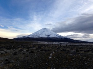
The second part of the workshop took us out into the field to explore two of Ecuador’s most famous volcanoes: Cotopaxi and Tungurahua. This was my favourite part! These are two quite epic volcanoes with the classical conical shape you imagine when you think of a volcano. By examining them in situ we learnt about the hazards they pose today to many nearby towns and cities. This really helps to put my research into perspective, as I know that by contributing to a better understanding of how volcanoes work I am helping to protect the people whose livelihood’s depend on the benefits the volcano brings them (for example, the more fertile soil).

Cotopaxi volcano, summit 5897 m ASL

The final part of the workshop took us to the Ecuadorian national centre for crisis management in Quito (cue vigilant security checks!). Here we conducted the volcanic unrest and eruption simulation. This is similar in some ways to a fire drill but a whole lot more complicated. Simulated monitoring ‘data’ from the volcano is fed to a team of volcanologists who have to quickly interpret what the data means and feed that information in a clear, coherent and understandable way to emergency managers, politicians and civil authorities. Upon the advice of the volcanologists, the decision makers can then choose how best to respond and mitigate a potential impending crisis. As this was just an exercise, different stages in the unrest crisis were dealt with all in one very busy day, with ‘data’ from the volcano arriving every couple of hours but representing several weeks or months in simulated time.

The final ‘update’ from the volcano: BIG eruption! I think we all could have predicted that – everyone likes a grand finale.

Despite the Hollywood firework finish, these exercises are crucial to prepare those individuals who will actually be in positions of responsibility when a true volcanic crisis develops. By playing out the different stages in as close to real-life as possible, strengths and weaknesses were highlighted that will allow for improvements to be made in the future. Improvements that may just save extra lives or livelihoods, and foster improved relationships between the public and the scientists trying to help them.

As one of those scientists, I was just happy enough to be able to take part.
——————
Cabot Institute member James Hickey is a final year PhD student in the School of Earth Sciences. His research is focused on unravelling the mechanisms that cause volcanoes to become restless prior to eruptions. Ultimately, the aim is to improve our understanding of precursory signals to enhance forecasting and mitigation efforts.

James Hickey

This blog has been republished with kind permission from the Bristol Doctoral College.  View the original blog post.


If you would like to study a PhD at the University of Bristol, please visit the Univeristy’s scholarships page

Implementing volcanic hazard assessment operationally

Following the 2010 eruption of the Eyjafjallajökull volcano in Iceland, the National Risk Register now lists volcanic hazards at the highest priority level. Volcanic hazard assessment draws together scientific knowledge of volcanic processes, observational evidence and statistical modelling to assess and forecast hazard and risk. Researchers at the University of Bristol have been central to the development of local, regional and global volcanic risk modelling over recent decades. One aspect of ongoing research is to develop a strategy for devising and implementing hazard assessments in an operational environment, to provide decision support during a volcanic crisis.

Cabot Professor Willy Aspinall
demonstrating the application of
Expert Elicitation in volcanic
hazard modelling at the OTVHA
workshop, Vienna, April 2014

Last week, I organised a workshop on Operational Techniques for Volcanic Hazard Assessment. The 2-day workshop, held in Vienna, Austria and supported by the European Geosciences Union and the Cabot Institute, brought together researchers from 11 institutions in eight countries to explore current practice in methods applied to operational and near-real time volcanic hazard assessment.  I was assisted in organising by Dr Jacopo Selva of INGV in Bolognia and speakers included Cabot Institute members Professor Willy Aspinall and Dr Thea Hincks, Dr Richard Luckett of the British Geological Survey and Dr Laura Sandri, of INGV, Italy.

There is a real gap between our ability to monitor and understand volcanic processes and our capacity to implement that understanding in a way that is useful operationally. In this workshop, we were able to bring together some of the leading researchers from around the world to explore how different tools and techniques are deployed. Better integration of these tools is essential for volcanic hazard forecasting to be useful for risk management.

The workshop involved discussion sessions and practical demonstrations of tools for real-time monitoring alerts, the use of expert judgment, Bayesian event tree scenario modelling and Bayesian belief network inference tools.  Dr Mike Burton from INGV Pisa, who took part in the workshop, said,

“It’s really important for volcanologists to engage with how our science can be adapted and incorporated in hazard assessments. The OTVHA workshop was a really useful exercise in exploring how our knowledge and uncertainty can be assimilated for real time decision support.”

Monitoring a volcano in Ethiopia

My research in Bristol concerns the interface between volcano monitoring data and hazard scenario models and I felt the workshop was a great success.  A few groups have developed approaches to modelling volcanic hazard and risk. This workshop provided a great forum for detailed discussion of how these tools and techniques can be combined and compared.  As scientists, we need to understand how to optimise and communicate our model output to be useful for decision makers.

Developing tools that are both scientifically and legally defensible is a major challenge in natural hazard science. The idea of organising the OTVHA workshop was to further explore the opportunities in addressing these challenges, which are central to the mission of the Cabot Institute. We’ve already started planning for the next workshop!

The OTVHA workshop was followed up with an associated session at the EGU General Assembly meeting, ‘Advances in Assessing Short-term Hazards and Risk from Volcanic Unrest or Eruption’, with a keynote presentation by Prof Chuck Connor on assessment of volcanic risk for nuclear facilities.

——————————–
This blog is written by Cabot Institute member Henry Odbert, School of Earth Sciences, University of Bristol.

———————————-

There are a few places left on the Cabot Institute Summer School on Risk and Uncertainty in Natural Hazards, featuring Willy Aspinall and other leading Cabot Institute academics.  Book your place now.