Downhill all the way: Monitoring landslides using geophysics

Developments in geophysical methods used to monitor surface and subsurface changes prior to landslides can lead to improved prediction and early warning.


Every year, landslides cause fatalities and destruction in locations worldwide. Nevertheless, what triggers them and when they occur can often be difficult to predict. A recent article in Reviews of Geophysics examined developments in landslide monitoring using insights and methods from geophysics. Here, one of the authors of the paper answers some questions about landslide monitoring and prediction.

Why is the monitoring of landslides important, and what role can geophysics play?

Sometimes the most effective option for mitigating the risk from landslides is monitoring.

In an ideal world, we would have the geotechnical and financial resources to be able to remove all landslide hazards through slope stabilization and remediation. In reality, this just isn’t possible, and sometimes the most effective option for mitigating the risk from a landslide is to monitor it.

Historically, this has been done by monitoring deformation at the surface and by looking at changes from localised points in the subsurface; for example, by measuring fluctuations in the water table in a borehole. Variations in these data may provide clues about when slope failure is imminent.
The advantage of geophysical methods is that they can not only monitor subsurface properties and how they change over time but can also do so at much higher spatial resolution and over a wider area than point sources of information, such as boreholes.

What are the different types of landslides and why are geophysical methods particularly useful for monitoring “moisture-induced” landslides?

“Landslide” is one of those words that sounds simple enough to define but in reality is very complex.

One of the distinctions we can make between landslide types is their triggering mechanism; most landslides are caused by the direct consequences of increased rainfall and shaking by earthquakes, but they can also be a result of secondary factors such as deforestation.


Between 2007 and 2016, 83% of landslides globally were triggered by rainfall or other hydrological events. This is why we use the term “moisture-induced” in our review article, as it reflects the complicated nature of all sources of water present in landslide systems, including rainfall, snow-melt, and groundwater, amongst others.

Introducing increased amounts of water into a landslide changes the properties of the subsurface, which leads to destabilization and, when a critical threshold is exceeded, slope failure. These changes in material properties can be monitored by geophysical methods and, by comparing data collected over time, it is possible to make inferences about the destabilizing processes that are occurring in the subsurface of the landslide system.
Changes in subsurface ground moisture derived from a semi-permanent, 3D electrical resistivity (ER) array at the Hollin Hill Landslide Observatory, North Yorkshire, UK. The left image shows wet winter conditions, in which the western lobe of the landslide has significantly more subsurface moisture than the eastern lobe. The right image shows drier summer conditions, showing subsurface drainage from the failing Whitby Mudstone Formation to the underlying Staithes Sandstone Formation, despite dry ground at the surface of the landslide. Credit: Uhlemann et al. [2017], Figure 11


What different geophysical methods are used to gather information about moisture-induced landslides?

The majority of studies used passive seismic and active geoelectrical methods.

Our review article looks at published case studies from the past 12 years to see what kinds of methods are being applied to monitor moisture-induced landslides. What struck us was that the majority of studies used one of two methods: passive seismic and active geoelectrical methods.


Passive seismic monitoring has been used for many decades in global seismological studies, but really only started to be scaled down to look at smaller scale features, such as landslides, in the mid-1990s.

Although passive seismic monitoring has been around longer, monitoring landslides using active geoelectrical methods, primarily electrical resistivity (ER), has really taken off in the last decade or so. There have been several studies in which ER technologies have been developed specifically for landslide monitoring approaches. Consequently, ER monitoring is currently able to provide more information than passive seismic monitoring on the pre-failure conditions of landslides.
Lower equipment costs and power consumption, combined with better data management and equipment durability, means we can collect more geophysical data for longer from landslides. Each of the points in this plot shows information gathered from published case studies about the length of time and amount of data acquired during a single geophysical monitoring campaign. Multiannual campaigns are becoming increasingly common compared to nearly a decade ago. Credit: Whiteley et al. [2018], Figure 6


What do these methods tell us about the subsurface conditions of landslides?

The two approaches provide an opportunity to better understand the variable nature of the subsurface in time and space.

Passive seismic and active geoelectrical approaches complement each other very well. First, they tell us about different aspects of the subsurface conditions beneath a landslide. Seismic methods are able to tell us about the strength of the ground, while ER methods provide information about subsurface moisture dynamics. Both of these aspects are very important when trying to predict landslide movements.


Second, passive approaches tend to have great temporal resolution, but their spatial coverage can be limited by the number of seismic sensors deployed on a slope, usually due to cost or power requirements. On the other hand, ER methods can provide very high spatial resolution, but as they are dependent on collecting a set of data from many measurements, their temporal resolution can be limited. Together, the two approaches provide an opportunity to better understand the variable nature of the subsurface in time and space.

What advances in equipment and data analysis have improved understanding of landslide processes?

The financial, computational, and energy cost of equipment is continually reducing, which means we can collect more data for longer periods, and send data from the field to the lab for near real-time analysis.

Also, data telemetry means we can send data from the field to the lab for near real-time analysis. Both of these are crucial when using geophysical methods for early-warning of landslide failure.

Recently, there has been an increase in the use of 3D surveys and petrophysical relationships linking geophysical The financial, computational and energy cost of equipment is continually reducing, which means we can collect more data for longer periods. Also, data telemetry means we can send data from the field to the lab for near real-time analysis. Both of these are crucial when using geophysical methods for early-warning of landslide failure.

In ER monitoring, movements in the electrode array would have historically produced errors in the resistivity model, but developments in ER data inversion can now use this source of “error” to track movements in the landslide. Similarly seismic “ambient noise” is being used in innovative ways to monitor landslides, even though these background signals would have traditionally been undesirable in seismological surveys.

Left: The “Automated time-Lapse Electrical Resistivity” (ALERT) geoelectrical monitoring system installed at Hollin Hill, North Yorkshire, UK. Right: Inside the cabinet, the system acquires geoelectrical, geotechnical and weather data. Collecting geophysical measurements alongside local displacement and environmental data allows for more robust interpretations of the changes in subsurface geoelectrical data over time. Credit: British Geological Survey

Where is the field of geophysical monitoring of moisture-induced landslide heading?

The challenge now is to start looking for clues to identify precursory conditions to slope failure and to develop geophysical thresholds to inform early-warning approaches. 

The great news is that this is a very active area of research! There is a lot of work being done in environmental seismology to increase the number of low-cost, low-power seismic sensors that can be deployed in landslide settings. This is important, as it will allow us to monitor landslides at very high-resolution in both the spatial and temporal domain.

Looking to the future, one can envision “smart sensor” sites that provide power, data storage, and telemetry, accommodating a wide range of integrated geophysical, geotechnical, and environmental monitoring methods. These could include seismic and electrical arrays, wireless sensor networks, and weather stations, with data relayed back to central processing sites for near-real time assessment, and early-warnings of impending failure based on calibrated geophysical thresholds.

———————————
This blog was written by Cabot Institute for the Environment member James Whitely, postgraduate researcher at University of Bristol’s School of Earth Science and the British Geological Society, with contributions from the articles co-authors. The blog was originally published by Editors’ Vox.


Original blog Citation: Whiteley, J. (2019), Downhill all the way: monitoring landslides using geophysics, Eos, 100 https://doi.org/10.1029/2019EO111065

Cancer and climate change


My Mother, Father, and I after my PhD Hooding in 2015


When I was growing up in Michigan, the man who lived across the street would tell me my dad saved his life. Walt and his wife were surrogate grandparents for my brother and I growing up; our grandparents lived across the country in California. Dad would always disagree about saving Walt’s life, try to deflect, talk about how it’s a team effort and he’s just one part. Walt was always insistent. 


My father is a world-renowned medical physicist. He works on how best to treat cancer with radiation, a pioneer in treating cancer in three dimensions. Hearing his colleagues talk about him, you can tell that he spent his career working primarily on two fronts: to make radiation treatment safer for both patients and the people who work with them, and to make that treatment more effective. My dad has spent his entire life harnessing a field of science with incredible destructive power to save people. 


Radiation physics started, in essence, with death. It was first self-inflicted, as prolonged exposure to radioactivity killed Marie Skłodowska-Curie, would have killed her husband except a horse-drawn cart got to him first, and killed her daughter and son-in-law. The Manhattan Project was primarily an output of the physics community, and that resulted in the deaths of tens of thousands. 

******

My drive to get into geology wasn’t high minded. I really liked Jurassic Park when I was a kid. That’s about it. I wasn’t trying to make money, wasn’t trying to save the planet, didn’t care about rocks, I just really really liked dinosaurs. The reason I liked dinosaurs, other people as well maybe, is because they capture our imaginations. They personify some narrative thread about the bizarre nature of past worlds. Giant reptilian creatures walking the Earth feels like a science fiction story, even though it’s simply science history.

Geology is at its best when telling stories. We can take people to weird locations, like the not-molten but constantly moving interior of the Earth. Amherst, Massachusetts, where I got my PhD, had a mile of ice on top of it in the geologically-recent past. We can tell you that where I grew up used to be a coral reef, if only millions of years ago. Dover used to be underwater and looked like the Bahamas. We use our stories, in paleoclimate, to unveil the past changes of Earth and put the future into context. Understanding the extinction that killed the dinosaurs and much of the other life on the planet, for example, helps explain how long it takes biodiversity to recover from severe and rapid events. Our science is experimental, only the experiments were run by the Earth long ago and we have to uncover what happened.

******

There’s a profound irony that radiation causes various forms of cancer in higher doses, and now is used to treat it. Radiation therapy essentially overdoses the cancer cells and causes them to die. If you don’t treat the cancer, which requires you to expose healthy cells, then there will be additional cancer.  There’s a duality there, or a careful balance between good (health) and bad (cancer). It’s unexpectedly poetic.


I, perhaps too hopefully and naively, view the development of radiation oncology as physics realizing it has profound tools it can use to heal. In its infancy physics used these tools for violent ends. Yes, people discuss a justification for the bombs being dropped at the end of World War II, but even if one accepts all of these arguments for their use without question, it remains a violent use of physics or radiation. I like to think that my dad, and his predecessors, his friends and colleagues, and those that will come after, chose to discard violence for healing. 

******

There’s a similar duality to geology – many of us embody it in the particular branch of geology that we study. I am a Micropaleontologist. That means that I study tiny fossils the size of a grain of sand. I’m more specifically a biostratigrapher and a paleoceanographer, among other things. Micropaleontologists in industry use microfossils to tell the age of sediments (biostratigraphy) or figure out what environments were forming, because the age and environment tell us a lot about if there’s oil in certain rocks. In academia we use those same tools to study the severity of past events to constrain the future. One side of the geosciences is extractive: it uses our stories to bring the past back. It brings fossil fuels to the surface. We rely on these fuels, and they’ve been important in the development of a variety of societies. It is, however, very clearly causing dramatic harm to our planet and our fellow humans.

Geology and physics are fundamentally different in a key way. Physics, at least Newtonian physics, is immediate. Throw a ball into the air, and it rises then falls. Start moving neutrons fast enough around Uranium-235 and it releases energy. Geology doesn’t have that sense of immediacy. Climate change is a slow-moving disaster. Each new generation is birthed into a time when the climate has already changed. It is perhaps not surprising that the general public doesn’t see this as a large problem. Living on human timescales, we only see some of the effects like larger storms.

Geology, however, should know better. We geologists know the rates of past changes in climate, and that CO2 is one of the most potent controls on climate. We have the long view of climate’s history, a view that encompasses billions of years. The stories that inform our future are hot and unpleasant.

I like to think that I’m on the right side with what I do. My research is on how a specific group of plankton (planktic foraminifera) evolve during past intervals of climate change, and I also use that same group to work on exactly how fast those past intervals of change happened. Even when all we want to do is talk about science at meetings, when I get together with other scientists we inevitably start talking about how to convince more people about the reality of increasing temperatures. I spent last year teaching in Texas and before that spent a year and a half at the Smithsonian National Museum of Natural History in Washington, D.C. doing frequent outreach programs. I spent a lot of time thinking about how best to reach folks who are hardened against hearing that the climate is changing and that it’s our fault. I spent weeks on my lectures when teaching climate science, going into the money, psychology, and politics of climate denial after spending days teaching about the physical science. I hope I’m not deluding myself when I say some of them changed their minds.

******

In a sense, Walt’s living past 50 was a direct consequence of my dad’s scientific output. I look up to my father. His scientific pursuits and those of his colleagues saved countless people from dying with cancer. Many of us have these choices, to work in a field or job that improves life on this planet, or, at best, continues a declining status quo. Do we build bombs, or do we save people from cancer? Do we make climate change worse, or do we use the past to educate people about our shared future? Science doesn’t operate in a vacuum. It’s easy to lose track of the human side of our pursuits.

My Dad and I playing our saxophones circa 1986
******

I understand the urge to go after a larger or stable paycheck. I have seen the house that having a hardworking and preternaturally lucky career in modern academia has earned me; it’s not a house it’s a flat, and it’s a rental so I can move every few months or few years. Despite that, my family has been lucky we’ve able to stitch together funding, and keep afloat through family loans when things get too tight. Others certainly don’t have that luxury. I’m from the United States, where we get our health insurance through our employers, and losing insurance is a constant concern when you have intermittent employment. I have a five year old daughter and am about to have another. Our five-year-old has lived in four different places: three states and another country, since she was born. One of the first things her teachers told us here in Bristol was “Wow, she adjusts to new circumstances fast.” She does, because the only permanency in her life are her parents and Skyping her grandparents and close friends from two moves ago. I continually reassess why I’m doing this. A big part of the reason is so that I hope both my daughters can look at me, and realize that I made the same choice my dad did.

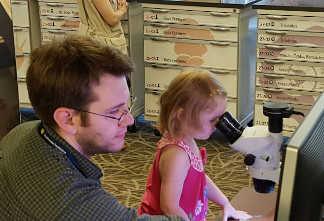
My first daughter and I working on a microscope
while I worked at the Smithsonian Institution – National Museum of Natural
History in 2016
******

Dad had a moment in his life, when working on his PhD, when he wasn’t sure exactly what he wanted to do with his life. He asked my mother and she told him he should, of course, 

Help people. Do something good. 

He clearly took that to heart. 

——————————-
This blog is written by Cabot Institute member Dr Andy Fraass from the University of Bristol School of Earth Sciences.

Andy Fraass

Participating and coaching at a risk communication ‘pressure cooker’ event

Anna Hicks (British Geological Survey) and BUFI Student (University of Bristol) Jim Whiteley reflect on their experiences as a coach and participant of a NERC-supported risk communication ‘pressure cooker’, held in Mexico City in May.

Jim’s experience….

When the email came around advertising “the Interdisciplinary Pressure Cooker on Risk Communication that will take place during the Global Facility for Disaster Reduction and Recovery (GFDRR; World Bank) Understanding Risk Forum in May 2018, Mexico City, Mexico” my thoughts went straight to the less studious aspects of the description:

‘Mexico City in May?’ Sounds great!
‘Interdisciplinary risk communication?’ Very à la mode! 
‘The World Bank?’ How prestigious! 
‘Pressure Cooker?’ Curious. Ah well, I thought, I’ll worry about that one later…

As a PhD student using geophysics to monitor landslides at risk of failure, communicating that risk to non-scientists isn’t something I am forced to think about too often. This is paradoxical, as the risk posed by these devastating natural hazards is the raison d’être for my research. As a geologist and geophysicist, I collect numerical data from soil and rocks, and try to work out what this tells us about how, or when, a landslide might move. Making sense of those numbers is difficult enough as it is (three and a half years’ worth of difficult to be precise) but the idea of having to take responsibility for, and explain how my research might actually benefit real people in the real world? Now that’s a daunting prospect to confront.

However, confront that prospect is exactly what I found myself doing at the Interdisciplinary Pressure Cooker on Risk Communication in May this year. The forty-odd group of attendees to the pressure cooker were divided in to teams; our team was made up of people working or studying in a staggeringly wide range of areas: overseas development in Africa, government policy in the US, town and city planning in Mexico and Argentina, disaster risk reduction (DRR) in Colombia, and of course, yours truly, the geophysicist looking at landslides in Yorkshire.

Interdisciplinary? Check.

One hour before the 4am deadline.

The possible issues to be discussed were as broad as overfishing, seasonal storms, population relocation and flooding. My fears were alleviated slightly, when I found that our team was going to be looking at hazards related to ground subsidence and cracking. Easy! I thought smugly. Rocks and cracks, the geologists’ proverbial bread and butter! We’ll have this wrapped up by lunchtime! But what was the task? Develop a risk communication strategy, and devise an effective approach to implementing this strategy, which should be aimed at a vulnerable target group living in the district of Iztapalapa in Mexico City, a district of 1.8 million people. Right.

Risk communication? Check.

It was around this time I realised that I glossed over the most imperative part of the email that had been sent around so many months before: ‘Pressure Cooker’. It meant exactly what it said on the tin; a high-pressure environment in which something, in this case a ‘risk communication strategy’ needed to be cooked-up quickly. Twenty-four hours quickly in fact. There would be a brief break circa 4am when our reports would be submitted, and then presentations were to be made to the judges at 9am the following morning. I checked the time. Ten past nine in the morning. The clock was ticking.

Pressure cooker? Very much check.

Anna’s experience….

What Jim failed to mention up front is it was a BIG DEAL to win a place in this event. 440 people from all over the world applied for one of 35 places. So, great job Jim! I was also really grateful to be invited to be a coach for one of the groups, having only just ‘graduated’ out of the age bracket to be a participant myself! And like Jim, I too had some early thoughts pre-pressure cooker, but mine were a mixture of excitement and apprehension in equal measures:

‘Mexico City in May?’ Here’s yet another opportunity to show up my lack of Spanish-speaking skills…
‘Interdisciplinary risk communication?’ I know how hard this is to do well…
‘The World Bank?’ This isn’t going to be your normal academic conference! 
‘Pressure Cooker?’ How on earth am I going to stay awake, let alone maintain good ‘coaching skills’?!

As an interdisciplinary researcher working mainly in risk communication and disaster risk reduction, I was extremely conscious of the challenges of generating risk communication products – and doing it in 24 hours? Whoa. There is a significant lack of evidence-based research about ‘what works’ in risk communication for DRR, and I knew from my own research that it was important to include the intended audience in the process of generating risk communication ‘products’. I need not have worried though. We had support from in-country experts that knew every inch of the context, so we felt confident we could make our process and product relevant and salient for the intended audience. This in part was also down to the good relationships we quickly formed in our team, crafted from patience, desire and ability to listen to each other, and for an unwavering enthusiasm for the task!

The morning after the night before.

So we worked through the day and night on our ‘product’ – a community based risk communication strategy aimed at women in Iztapalapa with the aim of fostering a community of practice through ‘train the trainer’ workshops and the integration of art and science to identify and monitor ground cracking in the area.

The following morning, after only a few hours’ sleep, the team delivered their presentation to fellow pressure-cooker participants, conference attendees, and importantly, representatives of the community groups and emergency management teams in the geographical areas in which our task was focused. The team did so well and presented their work with confidence, clarity and – bags of the one thing that got us through the whole pressure cooker – good humour.

It was such a pleasure to be part of this fantastic event and meet such inspiring people, but the icing on the cake was being awarded ‘Best Interdisciplinary Team’ at the awards ceremony that evening. ‘Ding’! Dinner served.

—————
This blog has been reposted with kind permission from James Whiteley.  View the original blog on BGS Geoblogy.   This blog was written by James Whiteley, a geophysicist and geologist at University of Bristol, hosted by British Geological Survey and Anna Hicks from the British Geologial Survey.

Deploying and Servicing a Seismic Network in Central Italy

From a scientific point of view, the seismicity that is hitting Central Italy presents itself as an unmissable opportunity for seismologists to analyse the triggering and the evolution of an earthquake sequence. From the tens of instruments installed in the affected area, a huge amount of data is being collected. Such a well-recorded sequence will allow us to produce a comprehensive seismic catalogue of events. On this big quantity of data, new algorithms will be developed and tested for the characterisation of even the smallest earthquakes. Moreover, they will enable the validation of more accurate and testable statistical and physics-based forecast models, which is the core objective of my Ph.D. project.
Seismicity map of the Amatrice-Norcia sequence updated 5 November 2016.
The Central Apennines are one of the most seismically hazardous areas in Italy and in Europe. Many destructive earthquakes have occurred throughout this region in the past, most recently the 2009 MW = 6.4 L’Aquila event. On August 24th, just 43 km North of the 2009 epicentre, an earthquake of magnitude 6.0 occurred and devastated the villages of Amatrice and Accumuli, leading to 298 fatalities, hundreds of injured and tens of thousands people affected. The mainshock was followed, in under an hour, by a MW = 5.4 aftershock. Two months later, on October 26th, the northern sector of the affected area was struck by two earthquakes of magnitude 5.4 and 5.9, respectively, with epicentres near the village of Visso. To make things even worse, on October 30th the city of Norcia was hit by a magnitude 6.5 mainshock, which has been the biggest event of the sequence to date and the strongest earthquake in Italy in the last 36 years. Building collapses and damages were very heavy for many villages and many historical heritage buildings have reported irreparable damages, such as the 14th century St. Benedict cathedral. Luckily, the has been no further fatalities since the very first event of August 24.
St. Benedict cathedral (Norcia), erected in the late 14th century and completely destroyed after the Mw 6.5 earthquake of October 30th.
Immediately after the first big event, an emergency scientific response team was formed by the British Geological Survey (BGS) and the School of GeoSciences at the University of Edinburgh, to support the rapid deployment of high-accuracy seismometers in collaboration with the Istituto Nazionale di Geofisica e Vulcanologia (INGV). The high detection capabilities, made possible by such a dense network, will let us derive a seismic catalogue with a great regional coverage and improved magnitude sensitivity. This new, accurate, catalogue will be crucial in developing operational forecast models. The ultimate aim is to understand the potential migration of seismic activity to neighbouring faults as well as the anatomy of the seismogenic structure and to shed light into the underlying physical processes that produce the hazard.
Thanks to the quick response of the National Environmental Research Council (NERC) and SEIS-UK, 30 broadband stations have been promptly dispatched from Leicester and arrived in less than 48 hours in Rome. There, a group of 9 people composed by INGV and BGS seismologists, technicians and Ph.D. students (including myself) from University of Bristol, Dublin Institute for Advanced Study (DIAS) and University of Ulster were ready to travel across the Apennines to deploy this equipment. The first days in Rome were all about planning; the location of each station was carefully decided so as to integrate the existing Italian permanent and temporary networks in the most appropriate way. After having performed the ‘huddle test’ in the INGV, which involves parallel checking of all the field instrumentation in order to ensure its correct functioning, we packed all the equipment and headed to the village of Leonessa, a location considered safe enough to be used as our base camp (despite the village being damaged and evacuated after the 30th October event).
Preparing instrumentation for the huddle test in one of INGV’s storage rooms.
In order to optimise time and resources, and to start recording data as soon as possible, we decided to split in 3 groups so that we could finish our work between the end of August and the first week of September. Each seismic station is composed of a buried sensor, a GPS antenna, a car battery, a regulator and two solar panels. The current deployment will stay for 1 year and will be collecting data continually. Each sensor had to be carefully buried and levelled to guarantee the highest quality of recording, which was a strenuous challenge when the ground was quite rocky!
Typical setting of our deployed stations. On the left, the buried sensor. Its cables, buried as well, connect it to the instrumentation inside the black box (a car battery, and a regulator). On the right, the solar panel (a second one was added in October service) and the white GPS antenna.
Aside from the scientific value of the expedition, the deployment week was a great opportunity to get to know each other, share opinions, ideas and, of course, get some training in seismology! At the end, we managed to install 24 stations around an area of approximately 2700 km2.
As this type of seismic station didn’t have telemetry, each needed to be revisited to retrieve data. For this purpose, from October 17th, David Hawthorn (BGS) and I flew to Italy again and stayed there for the following ten days to service the seismometers and to do the first data dump. Our goals were also  to check the quality of the first month of recordings, to add a second solar panel where needed, and to prepare the stations for the forthcoming winter. To do that, a lot of hammering and woodworking was needed. We serviced all the sites, raising the solar panels and GPS antennas on posts, which were securely anchored to the ground, to prevent snow from covering them. The stations were all in good conditions, with just minor damages due to some very snoopy cows.
David Hawthorn (BGS) servicing the stations – A second solar panel was added. Panels and GPS antennas were raised on posts anchored to the ground through timbers.
Dumping data from the stations using a netbook and specific hard drive.
On October 26, just the night before leaving for Rome, we experienced first-hand the frightening feeling of a mainshock just below our feet. Both the quakes of that evening surprised us while we were inside a building; the rumble just few seconds before the quake was shocking and the shaking was very strong. Fortunately, there were no severe damages in Leonessa but many people in the village refused to spend the night in their own houses. Also, it was impressive to see the local emergency services response: only a few minutes after the first quake, policemen were already out to patrol the inner village checking for any people experiencing difficulties.
The small village of Pescara del Tronto suffered many collapses and severe damages after the 24 August earthquakes. View from the motorway above.
Throughout our car transfers from one site to another we frequently found roads interrupted by a building collapse or by a landslide, but we could also admire the mountains with a mantle of beautiful autumnal colours and the spectacular landscapes offered by the Apennines, like the Monte Vettore, the Gran Sasso (the highest peak in the Apennines) and the breath-taking Castelluccio plain near Norcia.
View of the Norcia plain, near to the 24th August magnitude 5.4 and the 30th October magnitude 6.5 epicentres.
View of the Castelluccio plain. This picture was taken from the village of Castelluccio, just 5 days before it was totally destroyed by the magnitude 6.5 mainshock.
From my point of view, I learned a lot and really enjoyed this experience. I feel privileged to have started my Ph.D. in leading institutions like the University of Bristol and the BGS and, at the same time, to be able to spend time in my home country (yes, I am Italian…) with such interesting scientific questions. What I know for sure is that we will be back there again.

Blog written by Simone Mancini, 1st year Ph.D. student, University of Bristol and British Geological Survey.

Geology for Global Development: 4th Annual Conference

Sustainable mining, solar energy, seismic risk; the 4th Geology for Global Development Conference held at the Geological Society in London had it all.  Geology for Global Development is a charity set up to with the aim of relieving poverty through the power of geology. The charity is chasing the UN’s sustainable developing goals by inspiring a generation of young geologists to use their training as a tool for positive global change.

Figure 1. The UN’s sustainable Development goals (source:  http://www.unfoundation.org/features/globalgoals/the-global-goals.html
The charity is closely linked to several universities meaning the one-day event was awash with bright ideas from young geologists from every corner of the UK. Add to the mix experts in policy and communication including BBC presenter and academic Professor Iain Stewart and you have the recipe for a fascinating day.
Figure 2: GFGD founder Dr Joel Gill gives the opening address on Geology and the sustainable development goals
The programme was impressively diverse, jumping effortlessly from panel discussions on mining and sustainability to group discussions on exploring best practice. There were so many important messages I couldn’t regurgitate everything into a short blog, so I’ve made a super-summary of my favourite points:

Trade not Aid

This topic surfaced several times, and it’s something that I felt reflected the changing attitudes of many NGOs discussed on the day. It was mentioned by The Geological Society’s Nic Bilham in his opening remarks and raised in the groups discussions on best practice. In these discussions, ‘Scene’ Co-director Vijay Bhopal, related his experiences of delivering solar power supply to off-grid Indian villages. He emphasised the necessity to sell the solar technologies to those who need it, even if it is heavily subsidised, as opposed to gifting it. The only way to ensure longevity of solar powered systems was to build a market from the bottom up, he said, training technicians and providing a platform to sell and replace broken parts.  I this capacity, I felt geology has much to offer, developing industry in areas where help is needed is a more effective and sustainable way to provide aid- whether it be by sustainable mining, maintaining boreholes or lighting villages.

The opportunities are out there

The day wasn’t just about discussion, it was about getting involved. Representatives came from all over the country to encourage young geologists to sign up to schemes and events. Here’s a summary of just a few of the opportunities mentioned, along with the people in charge (more information can be found on the GfGd website):

Hazard communication and Geologists: a help or hindrance?

This topic was addressed by Professor Stewart in his keynote on the ethics of seismic risk communication. His core theme addressed the role geologist should play in saving lives in the event of a natural hazard. He used the example of his work in Istanbul, where a large and devastating earthquake is geologically likely in the future. He explored the role of the psyche in resident’s attitudes to the seismic risk they face. In many areas of high-risk, the picture is a complex one and the situation is often politically charged. In the case of Istanbul, the demolition of ‘dangerous’ buildings in high-risk areas was negated by the construction of reportedly unaffordable, earthquake-proof housing. Many residents believed that seismic risk was being used as a political tool to remove them from their neighbourhoods.

So where, asked Stewart, should the geologist slot into the picture? Are they only responsible for reporting the scientific information and exempt from decision-making and education? Or should they shoulder a sense of responsibility to ensure their results reach the people at risk? Should they help by educating about risk or is this really just a hindrance to those involved? In Stewart’s eyes, the geologist has an important part to play, but she must be appropriately trained in the method and timing of communication in order to be most successful. Hopefully, this is something GFGD may address in its capacity to inspire and influence a new generation of geologists.

Here my far-from-exhaustive summary ends. To finish would like to thoroughly encourage any geologists (or geologists-in-training) to get involved with GFGD. It was a really insightful day organised by a very deserving charity.

This blog is written by Cabot Institute member Keri McNamara, a PhD student in the School of Earth Sciences at the University of Bristol.

The Global Goals: How on Earth can geologists make a difference?

Image credit: Geological Society

On the 30th October the Bristol Geology for Global Development (GfGD) group trekked off to London to the grandeur of the Geological Society for the 3rd annual GfGD conference. Joel Gill, the director of GfGD, opened the conference with the bold claim: “Probably the world’s first meeting of geologists to discuss the Global Goals.” And it’s not an overstatement. Despite first appearances, geology has a crucially important role to play in many of the 17 goals internationally agreedby World Leaders in September this year. So why aren’t we talking about it? The conference acted as a platform for these discussions, it gave geologists a chance to learn how they can actually contribute to the success of these international development targets and it introduced us to new ways in which geology can help make a difference.

Soils and cities

 
Two scientists from the British Geological Survey touched on some particularly interesting examples of unlikely connections with geology and development.
We heard from Dr Michael Watts about how soil geochemistry is being used to maximise the potential to grow nutrient rich crops in places where people lack vital nutrients in their diets. In many areas of Malawi, people are suffering from selenium deficiency, which can cause a weakened immune system and an underactive thyroid. By increasing the alkalinity of the soil it may be possible to increase the amount of selenium in the plants that grow in that soil.
In a world that is becoming increasingly urbanised, Dr Katherine Royse stressed the importance of consulting geologists in urban developments. The subsurface is a finite resource and is being utilised in every possible way beneath cities, for transport, water works, electricity distribution and much more. In London, many infrastructure and building projects end up costing 50% more because developers weren’t aware of subsurface conditions from the outset.
These examples highlight the necessity for geologists to be included in discussions about health, about sustainable cities and about many other Global Goal themes. Geologists have much to bring to the table.

What did you say?

Of course, a big focus of the GfGD conference was about how we can communicate our science to people with no scientific background. If we want to use geology to help better prepare people for natural disasters, or to help make communities more resilient to climate change, explaining simple geological processes in a way that people understand is absolutely key. And often we need to take a step back to get exactly what angle the person we’re communicating to is coming from.

One particularly striking example of communication was introduced by Solmaz Mohadjer and related to children in Tajikistan who wondered why earthquakes were happening to them. Earthquakes happen all over the world and that seems obvious to us, but it’s not necessarily obvious to everyone. These children came up with all sorts of explanations for the earthquakes they were experiencing including that the Earth was balanced on a tower of elephants! 

Children came up with all sorts of explanations for the earthquakes
they were experiencing including that the Earth was balanced
on a tower of elephants!  Image credit S. Mohadjer (ParsQuake.org)

Through educational tools that the children, teachers and teacher trainers can understand, everyone can learn why earthquakes happen and how they can best protect themselves from them.

But we also need to remember we can’t just march in with all the answers. Jonathan Stone from TearFund encouraged us to be aware of what it is that makes someone an expert. The expert isn’t the person who comes along with the scientific explanation, ‘letting knowledge out like a dam’, the new expert is the person who encourages and inspires others to act for themselves.

Inspiring a new generation of geologists

Many Bristol GfGD members who came to the conference didn’t really know what to expect and went away with new perspectives on their subject. With ideas of how geology fits into all sorts of careers, not just the usual oil and mining sector. And with a view of how geology is one cog in the giant machine that is trying to tackle many of the world’s problems through the Global Goals.

The part of the conference that our group found most poignant were the views of early career geologists on how sustainability is integral to their job. In particular, we heard an account from exploration geologist, Sarah Craven, who was calling for people to become ambassadors for sustainability within the mining industry or indeed whichever sector they choose to go into.
Creating a generation of geologists who are mindful of their impact and who are aware of how they can use their skills to positively contribute to international development is at the heart of GfGD.
We lingered at the end of the conference, still in awe of our surroundings at the Geological Society. The buzz in the room was a tell tale sign that the 3rd Annual conference had achieved what it set out to do. Posing questions about how geology fits into the Global Goals, showing us what great work geologists are already doing and inspiring us to go after these opportunities ourselves. Let’s hope when the outcomes of the Global Goals are reviewed in 2030 that we’ll be able to say, “geologists helped to make that happen!”

————————————-
This blog has been written by Cabot Institute member Emily White, a postgraduate student in the School of Chemistry at the University of Bristol.

If you want to find out more about this society, request to join our Facebook group.

Bristol GfGD would like to thank the Bristol University Alumni Foundation for supporting this trip. 

For many of the resources from the conference, please go to the conference webpage.

To join the mailing list for Bristol GfGD, please follow this link.


How Bristol geologists are contributing to international development

Guatamala.  Credit: Geology for Global Development

It maybe isn’t immediately obvious how a pet-rock-owning earth scientist is able to change the world; the basement labs in the Wills Memorial Building seem a far cry from fighting global poverty. But the study of geology and having a knowledge of the earth and its resources is actually vitally important for the success of many international development projects.

Geology for global development: what is it all about?

Geology for Global Development (GfGD) is a national organisation that wants to bring awareness to the important position that geologists are in, to be able to make a difference. And it’s not just geologists that are involved here; GfGD recognises that through the collaboration of students from a wide range of disciplines, a positive and effective contribution to development can be made. For example, earth scientists can learn a lot from anthropologists about working alongside different communities whilst being sensitive to cultural differences.

This has been the first year for the GfGD society at Bristol and so far we think it has been a great success. We have held talks covering a whole variety of topics: from volcanic hazards in Guatemala, to sustainably procuring our world’s resources, to an overview of what it is actually like to be working in aid and development as a volunteer. We aim to offer earth scientists and geographers, and anyone else who is interested, an alternative view of the opportunities available to them, aside from the more traditional career paths that often flood everybody’s radars. And alongside this, we’re also trying to raise awareness of the social science skills that are necessary for successful and sustainable development projects.

This year’s focus: volcanic hazards in Guatemala

There is one project in particular that the national GfGD group is currently working on: strengthening volcanic resilience in Guatemala. At Bristol we’re perfectly placed to contribute to this because every year students on the MSc Volcanology course spend 3 weeks studying the volcanoes in this country and learning about the agencies that are set up to monitor them. To draw on all of their experiences we held a ‘Noche de Guatemala’ to learn about this beautiful country and hear how the people living in the shadows of volcanoes are in dire need of better resources and escape routes to ensure their safety in case of eruption. As part of this event we also introduced some cultural aspects of the country as well as the current socio-political situation to put the project into context. In the discussion session that followed we saw some great suggestions for strengthening resilience, from ways to make crops that aren’t affected by volcanic eruptions, to ideas for community involvement with volcano monitoring agencies. These ideas have been passed on to the director of the national GfGD group to help inform how the project might proceed.

Noche de Guatamala at the University of Bristol. Credit: Serginio Remmelzwaal.

As well as contributing to the Guatemala project through awareness and discussions, our group has also managed to raise a fantastic £279.36 towards GfGD’s £10,000 target. This money will be used to supply improved resources to the monitoring agencies and provide educational materials for the communities affected by volcanic hazards so the risks and evacuation procedures are better understood.

Mapping for humanitarian crises

As you will probably be aware, over 9,000 miles away from the volcanoes in Guatemala, another type of natural hazard stuck violently on the 25 April this year. The 7.8 magnitude Gorkha earthquake in Nepal caused the death of more than 9,000 people and left hundreds of thousands of people homeless. We wanted to do something that could really contribute to the relief effort so we decided to hold two ‘mapathons.’ This is where a group of people get together and use OpenStreetMap with satellite images to add buildings, roads and waterways to areas where this information doesn’t exist. This work is an enormous help to aid agencies that need to know all of this information to be able to help as many people as possible.


We’ve been busy this year and can’t wait to get even more people involved next year. We’ll be back in September with more talks, mapathons and hopefully some new style events to inspire anyone interested in earth processes to think again about how their knowledge could be used to bring about positive change in the developing world.

————————————————-
This blog has been written by Cabot Institute member Emily White, a postgraduate student in the School of Chemistry at the University of Bristol.

If you want to find out more about this society, request to join our Facebook group.

Email emily.white@bristol.ac.uk to join the mailing list.


Warming up the poles: how past climates assist our understanding of future climate

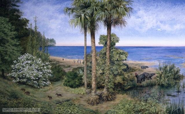
Eocene, by Natural History Museum London

The early Eocene epoch (56 to 48 million years ago), is thought to be the warmest period on Earth in the past 65 million years. Geological evidence from this epoch indicates that the polar regions were very warm, with mean annual sea surface temperatures of > 25°C measured from geological proxies and evidence of a wide variety of vegetation including palm trees and insect pollinated plants found on land. Unfortunately, geological data from the tropics is limited for the early Eocene, although the data that does exist indicates temperatures only slightly warmer than the modern tropics, which are ~28°C.  The reduced temperature difference between the tropics and the poles in the early Eocene and the implied global warmth has resulted in the label of an ‘equable’ climate.

Simulating the early Eocene equable climate with climate models, however, has not been straightforward. There have been remarkable model-data differences with simulated polar temperatures are too cool and / or tropical temperatures that are too hot; or the CO2 concentrations used for a reasonable model-data match being outside the range of those measured for the early Eocene.

There are uncertainties in both geological evidence and climate models, and whilst trying to resolve the early Eocene equable climate problem has resulted in an improved understanding of geological data, there are uncertain aspects of climate models that still need to be examined.  Climate processes for which knowledge is limited or measurements are difficult, such as clouds, or which have a small spatial and temporal range are often simplified in climate models or parameterised. These uncertain model parameters are then tuned to best-match the modern observational climate record. This approach is not ideal, but it is sometimes necessary and it has been shown that the modern values of some parameters, such as atmospheric aerosols, may not be representative of past climates such as the early Eocene, with their removal improved the model-data match.

However, a climate model that can simulate both the present day climate and past more extreme climates without significant modification potentially offers a more robust method of understanding modern and future climate processes in a warming world. We have conducted research in which uncertain climate parameters are varied within their modern upper and lower boundaries in order to examine whether any of these combinations is capable of the above. And we have found one simulation, E17, from a total of 115, which simulates the early Eocene equable climate and improves the model-data match whilst also simulating the modern climate and a past cold climate, the last Glacial Maximum reasonably well.

This work hopefully highlights how paleoclimate modelling is a valuable tool in understanding natural climate variability and how paleoclimates can provide a test bed for climate models, which are used to predict future climate change.

This blog has been written by Nav Sagoo, Geographical Sciences, University of Bristol.

Paul F. Hoffman visits the University of Bristol


Paul F Hoffman of Harvard

On the 24th and 25th of September, Professor Paul F Hoffman of Harvard University (USA) kindly offered to visit the University of Bristol for two days. Fresh from fieldwork in Namibia, Paul agreed to give two talks: one upon Cryogenian glaciations and another upon the interaction of climate scientists and geologists.

Snowball Earth – Image from COSMOS

Paul is perhaps most well known for his part in the development of the Snowball Earth theory, suggesting that during the Cryogenian (850 to 635 million years ago) ice covered the entire globe, from the poles to the tropics. This theory is based upon multiple strands of evidence including palaeomagnetics, sedimentology, isotopic analysis and numerical modelling. Paul succinctly summarised these ideas while also discussing some new results published in Science two years ago. The authors of this paper suggest that during the breakup of Rodinia, a proterozoic supercontinent, the eruption of the Franklin Large Igneous Province (LIP) in Canada (716Ma) may have produced a climatic state more susceptible to glaciation. Although there have been many critics of Snowball Earth, it seems Paul remains loyal to the theory.  A wine reception was held afterwards within the School of Geography and allowed for further discussion amongst staff and students.

Paul gave a second talk on 25th September to a selection of PhDs and PDRAs who attend the Climate Journal Club (see below for details). Paul chose to give a more anecdotal, but nonetheless interesting, talk on the co-evolution of climate scientists and geologists during the last 250 years. His talk focused upon the development of a theory: from indifference to hysteria, followed by rejection and then finally acceptance. I asked him where Snowball Earth stands. He replied that it was somewhere in between hysteria and rejection!

Maybe in 50 years time we will know whether Paul was right all along…

————————————————————————–
For more details, see the following references:

Hoffman, P.F., et al (1998) A neoproterozoic Snowball Earth. Science, 281, 1342
MacDonald, F.A., et al (2010) Calibrating the Crypogenian. Nature, 327, 1241

This blog was written by Gordon Inglis who runs the Climate Journal Club at the University of Bristol.

For more details on attending the Climate Journal Club (bimonthly event designed to allow PhD and PDRAs to discuss a selection of climate-themed paper), please email Gordon.Inglis@bristol.ac.uk