Hydrological hazards across timescales

University of Bristol – Met Office Academic Partnership Meeting 

From droughts and floods to water quality and water resource management, researchers at the University of Bristol and the Met Office are world-leaders in climate and hydrological research. Building on the new academic partnership between Bristol and the Met Office, the goal of this meeting was to foster new collaborations and strengthen existing partnerships between Bristol and the Met Office on the topic of weather, climate and hydrology. 

In total, we had 29 attendees attend the workshop, with 10 from the Met Office, 17 from the University of Bristol and 2 from Fathom including weather and climate scientists, catchment hydrologists and flood modellers at a wide range of career stages. 


The meeting explored two key themes, the first half of the meeting focused on ‘Exploiting convection permitting weather and climate models for flood and drought prediction’, while the second half focused on ‘Quantifying uncertainty in hydrological projections’. For each theme, there were two short plenary talks that highlighted existing research across the Met Office and University of Bristol and then a presentation focused on an exciting piece of research covering topics on exploiting convection permitting models for flood and drought prediction (Lizzie Kendon) and towards large ensembles of km-scale precipitation simulations using AI (Peter Watson and Henry Addison).  We also had eight lighting talks on topics ranging from tropical cyclones to pan-tropics convection-permitting climate simulations to compound wind and flood risk.  


Alongside the talks, there was time for attendees to discuss ideas and opportunities focused around five key discussion topics; uncertainty estimation, compound events and multi-hazard coupling, evaluation of weather and climate driving information for hydrology, exploiting higher resolution capabilities for hydrology and from hydrological predictions to ‘services’. 


Overall, the meeting was a success and we appreciated an in person meeting fuelled by coffee, cake and cheese! Tangible outputs from the day included contributions on a NERC proposal, making new connections, ideas for future collaborations, sharing of data and methodologies and the foundations for a collaborative climate and hydrology community 


Further details from the meeting can be requested from Gemma Coxon (gemma.coxon@bristol.ac.uk). 

New flood maps show US damage rising 26% in next 30 years due to climate change alone, and the inequity is stark


Coastal cities like Port Arthur, Texas, are at increasing risk from flooding during storms.
Joe Raedle/Getty Images

Climate change is raising flood risks in neighborhoods across the U.S. much faster than many people realize. Over the next three decades, the cost of flood damage is on pace to rise 26% due to climate change alone, an analysis of our new flood risk maps shows.

That’s only part of the risk. Despite recent devastating floods, people are still building in high-risk areas. With population growth factored in, we found the increase in U.S. flood losses will be four times higher than the climate-only effect.

Our team develops cutting-edge flood risk maps that incorporate climate change. It’s the data that drives local risk estimates you’re likely to see on real estate websites.

In the new analysis, published Jan. 31, 2022, we estimated where flood risk is rising fastest and who is in harm’s way. The results show the high costs of flooding and lay bare the inequities of who has to endure America’s crippling flood problem. They also show the importance of altering development patterns now.

The role of climate change

Flooding is the most frequent and costliest natural disaster in the United States, and its costs are projected to rise as the climate warms. Decades of measurements, computer models and basic physics all point to increasing precipitation and sea level rise.

As the atmosphere warms, it holds about 7% more moisture for every degree Celsius that the temperature rises, meaning more moisture is available to fall as rain, potentially raising the risk of inland flooding. A warmer climate also leads to rising sea levels and higher storm surges as land ice melts and warming ocean water expands.

Yet, translating that understanding into the detailed impact of future flooding has been beyond the grasp of existing flood mapping approaches.

A map of Houston showing flooding extending much farther inland.
A map of Houston shows flood risk changing over the next 30 years. Blue areas are today’s 100-year flood-risk zones. The red areas reflect the same zones in 2050.
Wing et al., 2022

Previous efforts to link climate change to flood models offered only a broad view of the threat and didn’t zoom in close enough to provide reliable measures of local risk, although they could illustrate the general direction of change. Most local flood maps, such as those produced by the Federal Emergency Management Agency, have a different problem: They’re based on historical changes rather than incorporating the risks ahead, and the government is slow to update them.

Our maps account for flooding from rivers, rainfall and the oceans – both now and into the future – across the entire contiguous United States. They are produced at scales that show street-by-street impacts, and unlike FEMA maps, they cover floods of many different sizes, from nuisance flooding that may occur every few years to once-in-a-millennium disasters.

While hazard maps only show where floods might occur, our new risk analysis combines that with data on the U.S. building stock to understand the damage that occurs when floodwaters collide with homes and businesses. It’s the first validated analysis of climate-driven flood risk for the U.S.

The inequity of America’s flood problem

We estimated that the annual cost of flooding today is over US$32 billion nationwide, with an outsized burden on communities in Appalachia, the Gulf Coast and the Northwest.

When we looked at demographics, we found that today’s flood risk is predominantly concentrated in white, impoverished communities. Many of these are in low-lying areas directly on the coasts or Appalachian valleys at risk from heavy rainfall.

But the increase in risk as rising oceans reach farther inland during storms and high tides over the next 30 years falls disproportionately on communities with large African American populations on the Atlantic and Gulf coasts. Urban and rural areas from Texas to Florida to Virginia contain predominantly Black communities projected to see at least a 20% increase in flood risk over the next 30 years.

Historically, poorer communities haven’t seen as much investment in flood adaptation or infrastructure, leaving them more exposed. The new data, reflecting the cost of damage, contradicts a common misconception that flood risk exacerbated by sea level rise is concentrated in whiter, wealthier areas.

A woman carries a child past an area where flood water surrounds low-rise apartment buildings.
Hurricane Florence’s storm surge and extreme rainfall flooded towns on North Carolina’s Neuse River many miles inland from the ocean in 2018.
Chip Somodevilla/Getty Images

Our findings raise policy questions about disaster recovery. Prior research has found that these groups recover less quickly than more privileged residents and that disasters can further exacerbate existing inequities. Current federal disaster aid disproportionately helps wealthier residents. Without financial safety nets, disasters can be tipping points into financial stress or deeper poverty.

Population growth is a major driver of flood risk

Another important contributor to flood risk is the growing population.

As urban areas expand, people are building in riskier locations, including expanding into existing floodplains – areas that were already at risk of flooding, even in a stable climate. That’s making adapting to the rising climate risks even more difficult.

A satellite image of Kansas City showing flood risk overlaid along the rivers.
A Kansas City flood map shows developments in the 100-year flood zone.
Fathom

Hurricane Harvey made that risk painfully clear when its record rainfall sent two reservoirs spilling into neighborhoods, inundating homes that had been built in the reservoirs’ flood zones. That was in 2017, and communities in Houston are rebuilding in risky areas again.

We integrated into our model predictions how and where the increasing numbers of people will live in order to assess their future flood risk. The result: Future development patterns have a four times greater impact on 2050 flood risk than climate change alone.

On borrowed time

If these results seem alarming, consider that these are conservative estimates. We used a middle-of-the-road trajectory for atmospheric greenhouse gas concentrations, one in which global carbon emissions peak in the 2040s and then fall.

Importantly, much of this impact over the next three decades is already locked into the climate system. While cutting emissions now is crucial to slow the rate of sea level rise and reduce future flood risk, adaptation is required to protect against the losses we project to 2050.

[Over 140,000 readers rely on The Conversation’s newsletters to understand the world. Sign up today.]

If future development was directed outside of the riskiest areas, and new construction met higher standards for flood mitigation, some of these projected losses could be avoided. In previous research, we found that for a third of currently undeveloped U.S. floodplains it is cheaper to buy the land at today’s prices and preserve it for recreation and wildlife than develop it and pay for the inevitable flood damages later.

The results stress how critical land use and building codes are when it comes to adapting to climate change and managing future losses from increasing climate extremes. Protecting lives and property will mean moving existing populations out of harm’s way and stopping new construction in flood-risk areas.The Conversation

——————————-

This blog is written by Cabot Institute for the Environment members Dr Oliver Wing, Research Fellow, and Paul Bates, Professor of Hydrology, School of Geographical Sciences, University of Bristol; and Carolyn Kousky, Executive Director, Wharton Risk Center, University of Pennsylvania and Jeremy Porter, Professor of Quantitative Methods in the Social Sciences, City University of New York.

This article is republished from The Conversation under a Creative Commons license. Read the original article.

Tackling urban landslides in an uncertain future

One of the challenges of the 21st century is how to reconcile global urban growth with the prevention and mitigation of environmental disasters, such as those caused by landslides. Every year 300 million people are exposed to landslides worldwide, with over 4,000 fatalities, 250,000 of people affected, and billions of US dollars of economic damage. However, impacts might be worse in the future for two main reasons. First, severe precipitations might become more frequent under climate change, causing more rainfall-triggered landslides. Second, growing urban population will lead more people to live in areas exposed to landslides globally, and in particular in developing countries where low-income dwellers are starting to overcrowd landslide-prone areas such as steep slopes. With more hurricanes to come and more people at risk, understanding where and when landslides might occur is becoming increasingly crucial.

Current predictions are too uncertain to support decisions

One method to predict landslides in the future is to look at landslides in the past. The analysis of historical records allows the identification of those hillslopes that have failed in the past. Currently stable hillslopes where similar conditions exist (for example, similar slope gradients) are ‘tagged’ with high landslide probability. These areas might be then excluded for construction development or might be the first to be alerted when a severe precipitation is expected.

This approach to landslide prediction is, however, often insufficient. Landslides and rainfall records as well as data on hillslope properties are often affected by large errors or unavailable in sufficient detail. In addition, what happened in the past might not be representative of what may happen in the future, making historical records less useful for long-term projections. Climate and socio-economic models can be used to build scenarios of how rainfall patters and cities might look like in the future. Unfortunately, these scenarios can vary significantly because they depend on highly uncertain factors such as future carbon emissions. As a result, landslide estimates can also be very different and sometimes even contradictory – some predicting an increase and others a decrease in landslides occurrence – undermining their practical use for risk management.

From ‘predict then act’ to ‘act now with low regrets’

Instead of trying to predict how climate and urban expansion will evolve in the future, I used a different approach centred on decision making. I ask the question: how much climate and/or urban expansion needs to change before landslide hazard significantly increases?

The scientific method behind my analysis (Bozzolan et al. 2020, NHESS) first generates thousands of synthetic but realistic hillslopes representations of the study area. Then, it imposes hypothetical scenarios of increasing rainfall severities and urban expansion, also considering different construction features that could affect slope stability (for example, the presence or not of adequate slope drainage such as roof gutters on houses).

Finally, it uses a computer model to assess the stability of these virtual hillslopes, generating a new synthetic library of landslide records. By exploring the library is now possible to identify those combinations of rainfall and urban development conditions (e.g., with or without roof gutters) for which hillslopes are most likely to fail. ‘Low-regret’ mitigation actions will be those that perform well across scenarios and therefore should be prioritised even if future rainfall and urban predictions remain unknown.

A practical tool for decision makers

This new method which explores many ‘what if’ scenarios is a useful tool for decision makers in landslide risk management and reduction. For example, figure 1 shows how a map of landslide probability in Saint Lucia (Eastern Caribbean) might look like if the severity of a destructive rainstorm such as the 2010 Hurricane Tomas were to increase under climate change or if unregulated housing expanded on slopes susceptible to failure. The analysis also shows that when both scenarios are included landslide probability disproportionally increases, revealing that ‘the whole is greater than the sum of its parts’. This information could be used to assess the risk and damages associated with each scenario and to identify low-regret nation-wide risk reduction and risk transfer strategies.

Figure 1: Maps of landslide probability in Saint Lucia under different ‘what if’ scenarios. The percentage (+%) indicates the increase of areas with high landslide probability.

The same method can also be applied to quantify the cost-benefit ratio of different landslide mitigation options, such as improving urban drainage or tree planting at the community/household scale. In Freetown (Sierra Leone), for example, I collaborated with the engineering firm Arup to identify those landslide hazard mitigation actions that would lead to the largest reduction in landslide probability for certain locations or types of slopes, and should thus be prioritised. The information generated through this analysis not only provides evidence to governments and investors for informing urban planning, but it might also encourage landslide probability from low to high micro-insurance in disaster prevention, where insurers offer lower premiums to reward risk-reducing behaviours.

—————————–

This blog is written by Cabot Institute for the Environment member, Dr Elisa Bozzolan from the School of Civil Engineering at the University of Bristol.

The case for case studies: a natural hazards perspective

As I wander the streets of Easton, as I have done over the last 18 months, the landscape becomes more and more familiar. Same streets, same skies. Things seem flat and still.

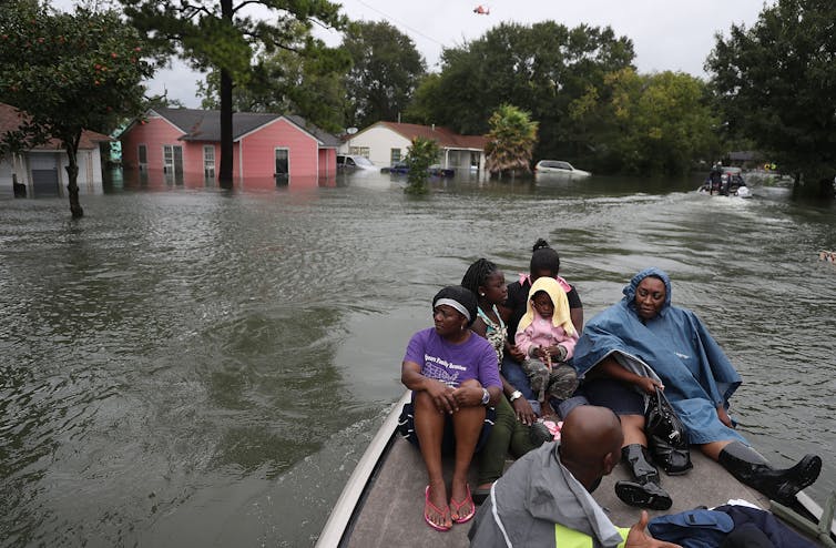
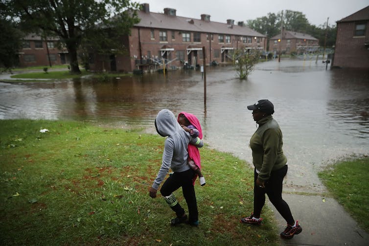
Living in this mundane landscape, I find it hard to believe that we live on a turbulent, roiling planet. But the Earth is not flat or still! Natural events happen daily, and extreme climatic events continue to escalate – although all we see in England is a rainy July. Some people are more vulnerable to the Earth’s vicissitudes than others. Since 2021 began, volcanoes in the Democratic Republic of Congo, Italy, Guatemala, and Iceland have erupted, and hurricanes have already gathered pace in the Atlantic. Many of these events have caused disaster for people living in these areas, losing homes, livelihoods, and lives.

Disasters erode and destroy, they leave scars and memories. We are fascinated by them: we seek to understand and to explain. How can we best do that? The case study is one way. Because of its in-depth nature, a case study is well-suited to describe disasters caused by natural hazards (earthquakes, volcanoes, landslides, floods, droughts), allowing us to tell a rich and nuanced story of events. However, we have to be prudent. There are many more natural hazards than we have scope to investigate. A good subject for a case study offers the possibility of new insights that other, limited methods have missed. Many, many times an earthquake or flood does not cause disaster. In choosing a good subject for a case study, we are looking for that event which is particularly interesting to us, and which we hope can tell us new things.

I am currently working on three case studies of disasters in Guatemala. Why and how did the disasters happen?

Coming from an Earth Sciences background, I’m not sure where to begin. There are no obvious blueprints. Why is there so little guidance on how to do a case study in our field? I think there are two reasons. Earth Sciences has always generously included other physical and social sciences (physics, chemistry, mathematics, geography), while a disaster caused by natural hazards involves both physical and social factors. So while this supports disaster’s suitability to the case study method, both science and subject use multiple philosophies and methods. It’s harder to make a cookbook with mixed methods. Secondly, Earth Sciences looks at the mutual interaction between people and nature, who operate on different timescales. Tracing a disaster through a case study requires uniting these timescales in a single narrative. That union is a difficult task and often context-specific, so not generalizable to a single blueprint. (Strangely, in an interdisciplinary case study of a disaster it’s the physical scientists who seem to study events over shorter timescales, for example on the physical triggers of a volcanic eruption. A few years ago in my undergraduate I remember tracing the story of Earth’s evolution across billions of years; now we’re operating over days and hours!)

There have been many criticisms levelled at case study research: that you can’t generalize from a single case, that theoretical knowledge is more valuable than practical knowledge, that case studies tend to confirm the researcher’s biases [1]. I have also read that case studies are excellent for qualitative research (e.g., on groups or individuals), but less so for quantitative research (e.g. on events or phenomena) [2]. I think these points are rubbish.

“You can’t generalize from a single case”, goes the argument against case studies. But generalization is not the point of a case study. We want to go deeper, to know more intimately, to sense in full colour. “Particularization, not generalization” is the point [1], and  intimate knowledge is worthwhile in itself. However, I also think the argument is false. Because it is such a rich medium, the case study affords us a wealth of observations and thus interpretations that allow us to modify our existing beliefs. As an example, a case study of the Caribbean island of Montserrat during an eruptive crisis showed Montserratians entering the no-go zone, risking their lives from the volcano to care for their crops and cattle [3]. This strongly changed the existing reasoning that people would prioritize their life over their livelihood during a volcanic eruption. How could you deny that this finding is not applicable beyond the specific case study? True, it isn’t certain to happen elsewhere, but the finding reminds us to research with caution and to challenge our assumptions. A case study might not give us a totally new understanding of an event, but it might refine our understanding – and that’s how most science progresses, both social and natural. This ‘refinement’ is also a balm for people like me who might be approaching a new case study with trepidation, concerned we might be going over old ground. Sure we might, but here we might forge a new path, there dig up fresh insights.

On the grounds of theoretical versus practical knowledge – we learn by doing! We are practical animals!

Context-dependent knowledge and experience are at the very heart of expert activity.

(Flyvbjerg, 2006) 

Does a case study confirm what we already expect to find? I think the possibility of refining our existing understanding can encourage researchers to keep our eyes open to distortions and bias. I think this final criticism comes from a false separation between the physical and social sciences. Qualitative research is held up as a contrast to “objective” quantitative research in the physical sciences, focussed on hypothesis-testing and disinterested truth. But any PhD student will tell you that the scientific process doesn’t quite work that way. Hypotheses are revised, created, and abandoned with new data, similar to how grounded theory works. And you can find any number of anecdotes where two scientists with the same data and methods came to two different interpretations. There is always some subjective bias as a researcher because (a) you’re also a human, and (b) because the natural world is inherently uncertain. (I wonder if this is an appeal for those who study pure maths – it’s the only discipline I can think of that is really objective and value-free).  Maybe qualitative/quantitative has some difference in the degree of researcher subjectivity. This would be a fascinating subject to explicitly include in those interdisciplinary case studies that involve both types of researcher – how does each consider their inherent bias towards the subject?

After flattening those objections above, I really want to make three points as to why case studies are so great.

First, they have a narrative element that we find irresistible. As Margaret Atwood said,

You’re never going to kill storytelling because it’s built into the human plan. We come with it.

A case study is not just a story, but it does have a story woven into its structure. Narratives are always partial and partisan; our case studies will be too. That’s not to say they can’t be comprehensive, just that they cannot hope to be omniscient. I love this quotation:

A story has no beginning or end: arbitrarily one chooses that moment of experience from which to look back or from which to look ahead.

Graham Greene, The End Of The Affair 

It certainly applies to case studies, too. We may find the roots of a disaster in political machinations which began decades before, or that the journey of a mudslide was hastened by years of deforestation. Attempting to paint the whole picture is futile, but you have to start somewhere.

Second, a case study provides a beautiful chance to both understand and to explain – the aims of the qualitative and the quantitative researcher, respectively. Each may approach truth and theory differently: the first sees truth as value-laden and theory to be developed in the field; the second, as objective and to be known before work is begun. It’s precisely because it’s difficult to harmonize these worldviews that we should be doing it – and the disaster case study provides an excellent arena.

Finally, the process of building a case study creates a space for dialogue. Ideas grow through conversation and criticism, and the tangle of researchers trying to reconcile their different worldviews, and of researchers reconciling their priorities with other interested people, seems both the gristle and the fat of case study research. In the case of disasters, I think this is the most important point which case study research wins. Research can uncover the most wonderful things but if it is not important to the people who are at risk of disaster, we cannot hope to effect positive change. How can we understand, and then how can we make ourselves understood? For all the confusion and frustration that it holds, we need dialogue [4]. A really beautiful example of this is the dialogue between volcano-watchers and scientists at Tungurahua volcano in Ecuador: creating a shared language allowed for early response to volcanic hazards and a network of friendships [5].

I’ve grappled with what products we should make out of these case studies. What are we making, and who are we making it for? From the above point, a valuable product of a case study can be a new relationship between different groups of people. This is not really tangible, which is hard to deal with for the researchers (how do you publish a friendship?) But a case study can produce a relationship that benefits both parties and outlasts the study itself. I think I’ve experienced this personally, through my work at Fuego volcano. I have found the opportunity to share my research and also to be transformed in my workings with local people. This has lasted longer than my PhD, I am still in touch with some of these people.

I believe in the power of case study to its own end, to create dialogue, and to mutually transform researcher and subject. And, if a new relationship is a valuable product of the case study, it is made stronger still by continued work in that area. To do that, the relationships and the ties that bind need to be supported financially and socially across years and uncertainty, beyond the current grey skies and monotony. When we are out, we will be able to renew that dialogue in person and the fruits of our labour will blossom.

[1] Flyvbjerg, 2006

[2] Stake, 1995

[3] Haynes et al., 2005

[4] Barclay et al., 2015

[5] Armijos et al., 2017

——————————-

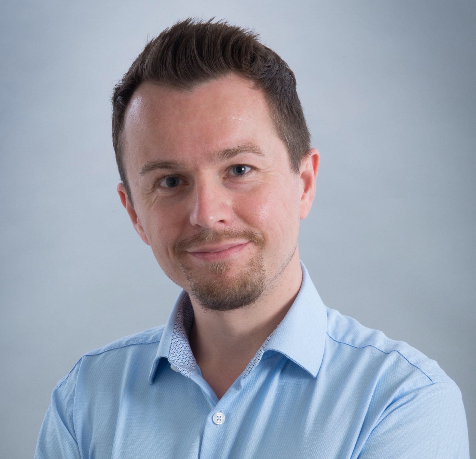
This blog is written by Cabot Institute for the Environment member Ailsa Naismith from the School of Earth Sciences at the University of Bristol. Ailsa studies volcanic hazards in Central America.

Ailsa Naismith


Predicting the hazards of weather and climate; the partnering of Bristol and the Met Office

Image credit Federico Respini on Unsplash

When people think of the University of Bristol University, or indeed any university, they sometimes think of academics sitting in their ivy towers, researching into obscurities that are three stages removed from reality, and never applicable to the world they live in. Conversely, the perception of the Met Office is often one of purely applied science, forecasting the weather; hours, days, and weeks ahead of time. The reality is far from this, and today, on the rather apt Earth Day 2020, I am delighted to announce a clear example of the multidisciplinary nature of both institutes with our newly formed academic partnership.

This new and exciting partnership brings together the Met Office’s gold standard weather forecasts and climate projections, with Bristol’s world leading impact and hazard models. Our partnership goal is to expand on the advice we already give decision makers around the globe, allowing them to make evidence-based decisions on weather-related impacts, across a range of timescales.

By combining the weather and climate data from the Met Office with our hazard and impact models at Bristol, we could, for instance, model the flooding impact from a storm forecasted a week ahead, or estimate the potential health burden from heat waves in a decade’s time. This kind of advanced knowledge is crucial for decision makers in many sectors. For instance, if we were able to forecast which villages might be flooded from an incoming storm, we could prioritise emergency relief and flood defenses in that area days ahead of time. Or, if we projected that hospital admissions would increase by 10% due to more major heatwaves in London in the 2030s, then decision makers could include the need for more resilient housing and infrastructure in their planning. Infrastructure often lasts decades, so these sorts of decisions can have a long memory, and we want our decision makers to be proactive, rather than reactive in these cases.

While the examples I give are UK focussed, both the University of Bristol and the Met Office are internationally facing and work with stakeholders all over the world. Only last year, while holding a workshop in the Caribbean on island resilience to tropical cyclones; seeing the importance of our work the prime minister of Jamaica invited us to his residence for a celebration. While I don’t see this happening with Boris Johnson anytime soon, it goes to show the different behaviours and levels of engagement policy makers have in different countries. It’s all very well being able to do science around the world, but if you don’t get the culture, they won’t get your science. It is this local knowledge and connection that is essential for an international facing partnership to work, and that is where both Bristol and the Met Office can pool their experience.

To ensure we get the most out of this partnership we will launch a number of new joint Bristol-Met Office academic positions, ranging from doctoral studentships all the way to full professorships. These positions will work with our Research Advisory Group (RAP), made up of academics across the university, and be associated with both institutes. The new positions will sit in this cross-disciplinary space between theory and application; taking a combined approach to addressing some of the most pressing environmental issues of our time.

As the newly appointed Met Office Joint Chair I will be leading this partnership at Bristol over the coming years, and I welcome discussions and ideas from academics across the university; some of the best collaborations I’ve had have come from a random knock on the door, so don’t be shy in sharing your thoughts.

———————————
This blog is written by Dr Dann Mitchell – Met Office Joint Chair and co-lead of the Cabot Institute for the Environment’s Natural Hazards and Disaster Risk research.
You can follow him on Twitter @ClimateDann.

Dann Mitchell

The social animals that are inspiring new behaviours for robot swarms

File 20190326 36252 wdqi1n.jpg?ixlib=rb 1.1
Termite team.
7th Son Studio/Shutterstock

From flocks of birds to fish schools in the sea, or towering termite mounds, many social groups in nature exist together to survive and thrive. This cooperative behaviour can be used by engineers as “bio-inspiration” to solve practical human problems, and by computer scientists studying swarm intelligence.

“Swarm robotics” took off in the early 2000s, an early example being the “s-bot” (short for swarm-bot). This is a fully autonomous robot that can perform basic tasks including navigation and the grasping of objects, and which can self-assemble into chains to cross gaps or pull heavy loads. More recently, “TERMES” robots have been developed as a concept in construction, and the “CoCoRo” project has developed an underwater robot swarm that functions like a school of fish that exchanges information to monitor the environment. So far, we’ve only just begun to explore the vast possibilities that animal collectives and their behaviour can offer as inspiration to robot swarm design.

Swarm behaviour in birds – or robots designed to mimic them?
EyeSeeMicrostock/Shutterstock

Robots that can cooperate in large numbers could achieve things that would be difficult or even impossible for a single entity. Following an earthquake, for example, a swarm of search and rescue robots could quickly explore multiple collapsed buildings looking for signs of life. Threatened by a large wildfire, a swarm of drones could help emergency services track and predict the fire’s spread. Or a swarm of floating robots (“Row-bots”) could nibble away at oceanic garbage patches, powered by plastic-eating bacteria.

A future where floating robots powered by plastic-eating bacteria could tackle ocean waste.
Shutterstock

Bio-inspiration in swarm robotics usually starts with social insects – ants, bees and termites – because colony members are highly related, which favours impressive cooperation. Three further characteristics appeal to researchers: robustness, because individuals can be lost without affecting performance; flexibility, because social insect workers are able to respond to changing work needs; and scalability, because a colony’s decentralised organisation is sustainable with 100 workers or 100,000. These characteristics could be especially useful for doing jobs such as environmental monitoring, which requires coverage of huge, varied and sometimes hazardous areas.

Social learning

Beyond social insects, other species and behavioural phenomena in the animal kingdom offer inspiration to engineers. A growing area of biological research is in animal cultures, where animals engage in social learning to pick up behaviours that they are unlikely to innovate alone. For example, whales and dolphins can have distinctive foraging methods that are passed down through the generations. This includes forms of tool use – dolphins have been observed breaking off marine sponges to protect their beaks as they go rooting around for fish, like a person might put a glove over a hand.

Bottlenose dolphin playing with a sponge. Some have learned to use them to help them catch fish.
Yann Hubert/Shutterstock

Forms of social learning and artificial robotic cultures, perhaps using forms of artificial intelligence, could be very powerful in adapting robots to their environment over time. For example, assistive robots for home care could adapt to human behavioural differences in different communities and countries over time.

Robot (or animal) cultures, however, depend on learning abilities that are costly to develop, requiring a larger brain – or, in the case of robots, a more advanced computer. But the value of the “swarm” approach is to deploy robots that are simple, cheap and disposable. Swarm robotics exploits the reality of emergence (“more is different”) to create social complexity from individual simplicity. A more fundamental form of “learning” about the environment is seen in nature – in sensitive developmental processes – which do not require a big brain.

‘Phenotypic plasticity’

Some animals can change behavioural type, or even develop different forms, shapes or internal functions, within the same species, despite having the same initial “programming”. This is known as “phenotypic plasticity” – where the genes of an organism produce different observable results depending on environmental conditions. Such flexibility can be seen in the social insects, but sometimes even more dramatically in other animals.
Most spiders are decidedly solitary, but in about 20 of 45,000 spider species, individuals live in a shared nest and capture food on a shared web. These social spiders benefit from having a mixture of “personality” types in their group, for example bold and shy.

Social spider (Stegodyphus) spin collective webs in Addo Elephant Park, South Africa.
PicturesofThings/Shutterstock

My research identified a flexibility in behaviour where shy spiders would step into a role vacated by absent bold nestmates. This is necessary because the spider colony needs a balance of bold individuals to encourage collective predation, and shyer ones to focus on nest maintenance and parental care. Robots could be programmed with adjustable risk-taking behaviour, sensitive to group composition, with bolder robots entering into hazardous environments while shyer ones know to hold back. This could be very helpful in mapping a disaster area such as Fukushima, including its most dangerous parts, while avoiding too many robots in the swarm being damaged at once.

The ability to adapt

Cane toads were introduced in Australia in the 1930s as a pest control, and have since become an invasive species themselves. In new areas cane toads are seen to be somewhat social. One reason for their growth in numbers is that they are able to adapt to a wide temperature range, a form of physiological plasticity. Swarms of robots with the capability to switch power consumption mode, depending on environmental conditions such as ambient temperature, could be considerably more durable if we want them to function autonomously for the long term. For example, if we want to send robots off to map Mars then they will need to cope with temperatures that can swing from -150°C at the poles to 20°C at the equator.

Cane toads can adapt to temperature changes.
Radek Ziemniewicz/Shutterstock

In addition to behavioural and physiological plasticity, some organisms show morphological (shape) plasticity. For example, some bacteria change their shape in response to stress, becoming elongated and so more resilient to being “eaten” by other organisms. If swarms of robots can combine together in a modular fashion and (re)assemble into more suitable structures this could be very helpful in unpredictable environments. For example, groups of robots could aggregate together for safety when the weather takes a challenging turn.

Whether it’s the “cultures” developed by animal groups that are reliant on learning abilities, or the more fundamental ability to change “personality”, internal function or shape, swarm robotics still has plenty of mileage left when it comes to drawing inspiration from nature. We might even wish to mix and match behaviours from different species, to create robot “hybrids” of our own. Humanity faces challenges ranging from climate change affecting ocean currents, to a growing need for food production, to space exploration – and swarm robotics can play a decisive part given the right bio-inspiration.The Conversation

—————————————–
This blog was written by Cabot Institute member Dr Edmund Hunt, EPSRC Doctoral Prize Fellow, University of BristolThis article is republished from The Conversation under a Creative Commons license. Read the original article.

Edmund Hunt

Learning about cascading hazards at the iRALL School in China

Earlier this year, I wrote about my experiences of attending an interdisciplinary workshop in Mexico, and how these approaches foster a rounded approach to addressing the challenges in communicating risk in earth sciences research. In the field of geohazards, this approach is increasingly becoming adopted due to the concept of “cascading hazards”, or in other words, recognising that when a natural hazard causes a human disaster it often does so as part of a chain of events, rather than as a standalone incident. This is especially true in my field of research; landslides. Landslides are, after all, geological phenomena studied by a wide range of “geoscientists” (read: geologists, geomorphologists, remote sensors, geophysicists, meteorologists, environmental scientists, risk assessors, geotechnical and civil engineers, disaster risk-reduction agencies, the list goes on). Sadly, these natural hazards affect many people across the globe, and we have had several shocking reminders in recent months of how landslides are an inextricable hazard in areas prone to earthquakes and extremes of precipitation.

The iRALL, or the ‘International Research Association on Large Landslides’, is a consortium of researchers from across the world trying to adopt this approach to understanding cascading hazards, with a particular focus on landslides. I was lucky enough to attend the ‘iRALL School 2018: Field data collection, monitoring and modelling of large landslides’ in October this year, hosted by the State Key Laboratory of Geohazard Prevention and Geoenvironment Protection (SKLGP) at Chengdu University of Technology (CDUT), Chengdu, China. The school was attended by over 30 postgraduate and postdoctoral researchers working in fields related to landslide and earthquake research. The diversity of students, both in terms of subjects and origins, was staggering: geotechnical and civil engineers from the UK, landslide specialists from China, soil scientists from Japan, geologists from the Himalaya region, remote sensing researchers from Italy, earthquake engineers from South America, geophysicists from Belgium; and that’s just some of the students! In the two weeks we spent in China, we received presentations from a plethora of global experts, delivering lectures in all aspects of landslide studies, including landslide failure mechanisms, hydrology, geophysics, modelling, earthquake responses, remote sensing, and runout analysis amongst others. Having such a well-structured program of distilled knowledge delivered by these world-class researchers would have been enough, but one of the highlights of the school was the fieldwork attached to the lectures.

The scale of landslides affecting Beichuan County is difficult to grasp: in this photo of the Tangjiwan landslide, the red arrow points to a one story building. This landslide was triggered by the 2008 Wenchuan earthquake, and reactivated by heavy rainfall in 2016.

The first four days of the school were spent at SKLGP at CDUT, learning about the cascading hazard chain caused by the 2008 Wenchuan earthquake, another poignant event which demonstrates the interconnectivity of natural hazards. On 12th May 2008, a magnitude 7.9 earthquake occurred in Beichuan County, China’s largest seismic event for over 50 years. The earthquake triggered the immediate destabilisation of more than 60,000 landslides, and affected an area of over 35,000 km2; the largest of these, the Daguangbao landslide, had an estimated volume of 1.2 billion m3 (Huang and Fan, 2013). It is difficult to comprehend numbers on these scales, but here’s an attempt: 35,000 km2 is an area bigger than the Netherlands, and 1.2 billion m3 is the amount of material you would need to fill the O2 Arena in London 430 times over. These comparisons still don’t manage to convey the scale of the devastation of the 2008 Wenchuan earthquake, and so after the first four days in Chengdu, it was time to move three hours north to Beichuan County, to see first-hand the impacts of the earthquake from a decade ago. We would spend the next ten days here, continuing a series of excellent lectures punctuated with visits to the field to see and study the landscape features that we were learning about in the classroom.

The most sobering memorial of the 2008 Wenchuan earthquake is the ‘Beichuan Earthquake Historic Site’, comprising the stabilised remains of collapsed and partially-collapsed buildings of the town of Old Beichuan. This town was situated close to the epicentre of the Wenchuan earthquake, and consequently suffered huge damage during the shaking, as well as being impacted by two large landslides which buried buildings in the town; one of these landslides buried a school with over 600 students and teachers inside. Today, a single basketball hoop in the corner of a buried playground is all that identifies it as once being a school. In total, around 20,000 people died in a town with a population of 30,000. Earth science is an applied field of study, and as such, researchers are often more aware of the impact of their research on the public than in some other areas of science. Despite this, we don’t always come this close to the devastation that justifies the importance of our research in the first place.

River erosion damaging check-dams designed to stop debris flows is still a problem in Beichuan County, a decade after the 2008 Wenchuan earthquake.

It may be a cliché, but seeing is believing, and the iRALL School provided many opportunities to see the lasting impacts of large slope failures, both to society and the landscape. The risk of debris flows resulting from the blocking of rivers by landslides (a further step in the cascading hazard chain surrounding earthquakes and landslides) continues to be a hazard threatening people in Beichuan County today. Debris flow check-dams installed after the 2008 Wenchuan earthquake are still being constantly maintained or replaced to provide protection to vulnerable river valleys, and the risk of reactivation of landslides in a seismically active area is always present. But this is why organisations such as the iRALL, and their activities such as the iRALL School are so important; it is near impossible to gain a true understanding of the impact of cascading hazards without bringing the classroom and the field together. The same is true when trying to work on solutions to lessen the impact of these cascading hazard chains. It is only by collaborating with people from a broad range of backgrounds, skills and experiences can we expect to come up with effective solutions that are more than the sum of their parts.

—————
This blog has been reposted with kind permission from James Whiteley.  View the original blog on BGS Geoblogy.   This blog was written by James Whiteley, a geophysicist and geologist at University of Bristol, hosted by British Geological Survey. Jim is funded through the BGS University Funding Initiative (BUFI). The aim of BUFI is to encourage and fund science at the PhD level. At present there are around 130 PhD students who are based at about 35 UK universities and research institutes. BUFI do not fund applications from individuals.

Participating and coaching at a risk communication ‘pressure cooker’ event

Anna Hicks (British Geological Survey) and BUFI Student (University of Bristol) Jim Whiteley reflect on their experiences as a coach and participant of a NERC-supported risk communication ‘pressure cooker’, held in Mexico City in May.

Jim’s experience….

When the email came around advertising “the Interdisciplinary Pressure Cooker on Risk Communication that will take place during the Global Facility for Disaster Reduction and Recovery (GFDRR; World Bank) Understanding Risk Forum in May 2018, Mexico City, Mexico” my thoughts went straight to the less studious aspects of the description:

‘Mexico City in May?’ Sounds great!
‘Interdisciplinary risk communication?’ Very à la mode! 
‘The World Bank?’ How prestigious! 
‘Pressure Cooker?’ Curious. Ah well, I thought, I’ll worry about that one later…

As a PhD student using geophysics to monitor landslides at risk of failure, communicating that risk to non-scientists isn’t something I am forced to think about too often. This is paradoxical, as the risk posed by these devastating natural hazards is the raison d’être for my research. As a geologist and geophysicist, I collect numerical data from soil and rocks, and try to work out what this tells us about how, or when, a landslide might move. Making sense of those numbers is difficult enough as it is (three and a half years’ worth of difficult to be precise) but the idea of having to take responsibility for, and explain how my research might actually benefit real people in the real world? Now that’s a daunting prospect to confront.

However, confront that prospect is exactly what I found myself doing at the Interdisciplinary Pressure Cooker on Risk Communication in May this year. The forty-odd group of attendees to the pressure cooker were divided in to teams; our team was made up of people working or studying in a staggeringly wide range of areas: overseas development in Africa, government policy in the US, town and city planning in Mexico and Argentina, disaster risk reduction (DRR) in Colombia, and of course, yours truly, the geophysicist looking at landslides in Yorkshire.

Interdisciplinary? Check.

One hour before the 4am deadline.

The possible issues to be discussed were as broad as overfishing, seasonal storms, population relocation and flooding. My fears were alleviated slightly, when I found that our team was going to be looking at hazards related to ground subsidence and cracking. Easy! I thought smugly. Rocks and cracks, the geologists’ proverbial bread and butter! We’ll have this wrapped up by lunchtime! But what was the task? Develop a risk communication strategy, and devise an effective approach to implementing this strategy, which should be aimed at a vulnerable target group living in the district of Iztapalapa in Mexico City, a district of 1.8 million people. Right.

Risk communication? Check.

It was around this time I realised that I glossed over the most imperative part of the email that had been sent around so many months before: ‘Pressure Cooker’. It meant exactly what it said on the tin; a high-pressure environment in which something, in this case a ‘risk communication strategy’ needed to be cooked-up quickly. Twenty-four hours quickly in fact. There would be a brief break circa 4am when our reports would be submitted, and then presentations were to be made to the judges at 9am the following morning. I checked the time. Ten past nine in the morning. The clock was ticking.

Pressure cooker? Very much check.

Anna’s experience….

What Jim failed to mention up front is it was a BIG DEAL to win a place in this event. 440 people from all over the world applied for one of 35 places. So, great job Jim! I was also really grateful to be invited to be a coach for one of the groups, having only just ‘graduated’ out of the age bracket to be a participant myself! And like Jim, I too had some early thoughts pre-pressure cooker, but mine were a mixture of excitement and apprehension in equal measures:

‘Mexico City in May?’ Here’s yet another opportunity to show up my lack of Spanish-speaking skills…
‘Interdisciplinary risk communication?’ I know how hard this is to do well…
‘The World Bank?’ This isn’t going to be your normal academic conference! 
‘Pressure Cooker?’ How on earth am I going to stay awake, let alone maintain good ‘coaching skills’?!

As an interdisciplinary researcher working mainly in risk communication and disaster risk reduction, I was extremely conscious of the challenges of generating risk communication products – and doing it in 24 hours? Whoa. There is a significant lack of evidence-based research about ‘what works’ in risk communication for DRR, and I knew from my own research that it was important to include the intended audience in the process of generating risk communication ‘products’. I need not have worried though. We had support from in-country experts that knew every inch of the context, so we felt confident we could make our process and product relevant and salient for the intended audience. This in part was also down to the good relationships we quickly formed in our team, crafted from patience, desire and ability to listen to each other, and for an unwavering enthusiasm for the task!

The morning after the night before.

So we worked through the day and night on our ‘product’ – a community based risk communication strategy aimed at women in Iztapalapa with the aim of fostering a community of practice through ‘train the trainer’ workshops and the integration of art and science to identify and monitor ground cracking in the area.

The following morning, after only a few hours’ sleep, the team delivered their presentation to fellow pressure-cooker participants, conference attendees, and importantly, representatives of the community groups and emergency management teams in the geographical areas in which our task was focused. The team did so well and presented their work with confidence, clarity and – bags of the one thing that got us through the whole pressure cooker – good humour.

It was such a pleasure to be part of this fantastic event and meet such inspiring people, but the icing on the cake was being awarded ‘Best Interdisciplinary Team’ at the awards ceremony that evening. ‘Ding’! Dinner served.

—————
This blog has been reposted with kind permission from James Whiteley.  View the original blog on BGS Geoblogy.   This blog was written by James Whiteley, a geophysicist and geologist at University of Bristol, hosted by British Geological Survey and Anna Hicks from the British Geologial Survey.

Geology for Global Development: 4th Annual Conference

Sustainable mining, solar energy, seismic risk; the 4th Geology for Global Development Conference held at the Geological Society in London had it all.  Geology for Global Development is a charity set up to with the aim of relieving poverty through the power of geology. The charity is chasing the UN’s sustainable developing goals by inspiring a generation of young geologists to use their training as a tool for positive global change.

Figure 1. The UN’s sustainable Development goals (source:  http://www.unfoundation.org/features/globalgoals/the-global-goals.html
The charity is closely linked to several universities meaning the one-day event was awash with bright ideas from young geologists from every corner of the UK. Add to the mix experts in policy and communication including BBC presenter and academic Professor Iain Stewart and you have the recipe for a fascinating day.
Figure 2: GFGD founder Dr Joel Gill gives the opening address on Geology and the sustainable development goals
The programme was impressively diverse, jumping effortlessly from panel discussions on mining and sustainability to group discussions on exploring best practice. There were so many important messages I couldn’t regurgitate everything into a short blog, so I’ve made a super-summary of my favourite points:

Trade not Aid

This topic surfaced several times, and it’s something that I felt reflected the changing attitudes of many NGOs discussed on the day. It was mentioned by The Geological Society’s Nic Bilham in his opening remarks and raised in the groups discussions on best practice. In these discussions, ‘Scene’ Co-director Vijay Bhopal, related his experiences of delivering solar power supply to off-grid Indian villages. He emphasised the necessity to sell the solar technologies to those who need it, even if it is heavily subsidised, as opposed to gifting it. The only way to ensure longevity of solar powered systems was to build a market from the bottom up, he said, training technicians and providing a platform to sell and replace broken parts.  I this capacity, I felt geology has much to offer, developing industry in areas where help is needed is a more effective and sustainable way to provide aid- whether it be by sustainable mining, maintaining boreholes or lighting villages.

The opportunities are out there

The day wasn’t just about discussion, it was about getting involved. Representatives came from all over the country to encourage young geologists to sign up to schemes and events. Here’s a summary of just a few of the opportunities mentioned, along with the people in charge (more information can be found on the GfGd website):

Hazard communication and Geologists: a help or hindrance?

This topic was addressed by Professor Stewart in his keynote on the ethics of seismic risk communication. His core theme addressed the role geologist should play in saving lives in the event of a natural hazard. He used the example of his work in Istanbul, where a large and devastating earthquake is geologically likely in the future. He explored the role of the psyche in resident’s attitudes to the seismic risk they face. In many areas of high-risk, the picture is a complex one and the situation is often politically charged. In the case of Istanbul, the demolition of ‘dangerous’ buildings in high-risk areas was negated by the construction of reportedly unaffordable, earthquake-proof housing. Many residents believed that seismic risk was being used as a political tool to remove them from their neighbourhoods.

So where, asked Stewart, should the geologist slot into the picture? Are they only responsible for reporting the scientific information and exempt from decision-making and education? Or should they shoulder a sense of responsibility to ensure their results reach the people at risk? Should they help by educating about risk or is this really just a hindrance to those involved? In Stewart’s eyes, the geologist has an important part to play, but she must be appropriately trained in the method and timing of communication in order to be most successful. Hopefully, this is something GFGD may address in its capacity to inspire and influence a new generation of geologists.

Here my far-from-exhaustive summary ends. To finish would like to thoroughly encourage any geologists (or geologists-in-training) to get involved with GFGD. It was a really insightful day organised by a very deserving charity.

This blog is written by Cabot Institute member Keri McNamara, a PhD student in the School of Earth Sciences at the University of Bristol.

Real world risks and extremes

Few locations in London are more appropriate to discuss risk and extremes than the Shard in London. The daring skyscraper, completed in 2012, was among the first high-rise buildings to be designed in the aftermath of 9/11 – terrorism risk mitigation has been a major challenge for the structural engineers working on the project.

The Shard, London

On the 8 April 2016, the Mathematics Institute of the University of Warwick, in partnership with the London Mathematical Laboratory and the Institute of Physics, held the Real World Risks and Extremes meeting at the WBS campus at the Shard.

The invited speakers included Dr Gordon Woo (Risk Management Solutions), Professor Willy Aspinall (University of Bristol Cabot Institute and Aspinall & Associates), Professor Jean-Philippe Bouchaud (École Polytechnique and Capital Fund Management) and Professor Giulia Iori (City University London), as well as the writer Mark Buchanan (author and columnist for Nature and Bloomberg), who chaired the final panel discussion. The objective of the meeting was to foster interdisciplinary discussion on the methodology of extreme risk assessment and management, and this common theme was tackled in the talks from very different angles.

From the left: Professor Aspinall, Dr Woo, Professor Bouchaud and Professor Iori.

The day started with a thought-provoking speech by Dr Woo, who called for a new approach in the treatment of historical extreme events: rather than treating them as the only source of data, we ought to be performing some counterfactual analysis as well. Besides what we have experienced, what could have happened? Asking these type of questions, according to Dr Woo, would improve the robustness of risk assessments, after all, what happened was just one of many possible outcomes. Thinking about what could have been would help us to better prepare for the future.

Professor Aspinall followed with a talk about the use of expert judgement to quantify the uncertainty in mathematical models of natural processes. This is especially important when policy decisions are being taken based on these models, as in the case of climate change. The methodology was used to evaluate the uncertainty in the correlations between the different drivers of sea-level rise, discovering that its extreme values could be higher than previously predicted.

The talks by Professor Bouchaud and Professor Iori focused on the use of statistical mechanics-based and agent-based models to understand complex systems such as economics at a country scale or the global banking system. In particular, they both focused on the possibility of identifying the set of variables which govern crises in these systems. This is especially important for high-dimensional systems, as while there are many variables at play, generally only few of them can shift the system state from stable to unstable.

The Cabot Institute’s Dr Max Werner (Lecturer in Natural Hazards and Risks in the School of Earth Sciences, University of Bristol) was one of the organisers of the event:

“Our main objective for the meeting was to stimulate cross-disciplinary discussion about how to improve uncertainty assessments of risks to society, especially given complex interactions and correlations among the many components of a natural or socio-economic system. The speakers represented such different fields of the risk sciences and industries, and yet their common ground became very clear during the panel discussion chaired by Mark Buchanan: don’t place your trust blindly in quantitative models or in past observations – use expert judgement of what might happen, supported by insights from qualitative models of complex systems and an analysis of near-misses. For most scientists, including myself, that are engaged in quantitative modelling of past and future observations, this consensus was an important lesson in how our science should contribute to policy and decision making.”

What I found most interesting about the meeting was the diversity of the point of views of the speakers and the participants. From mathematics to philosophy, and from engineering to finance, all the way through natural and actuarial sciences, there is a lot of exciting research being done on the risk posed by extreme events and complex systems. How to assess these risks, how to communicate them in an effective way, how to manage them and how to turn them into opportunities are challenges that we as academics need to explore, if we want to help our societies to thrive and flourish.
—————————————-
This blog is written by Cabot Institute member Giulio Galvan from the School of Engineering at the University of Bristol.  Giulio’s research looks at the vulnerability and resilience of infrastructure networks.