Intense downpours in the UK will increase due to climate change – new study

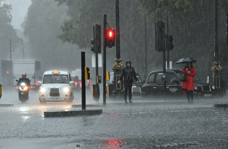
A flash flood in London in October 2019.
D MacDonald/Shutterstock

Elizabeth Kendon, University of Bristol

In July 2021, Kew in London experienced a month’s rain in just three hours. Across the city, tube lines were suspended and stations closed as London experienced its wettest day in decades and flash floods broke out. Just under two weeks later, it happened again: intense downpours led to widespread disruption, including the flooding of two London hospitals.

Colleagues and I have created a new set of 100-year climate projections to more accurately assess the likelihood of heavy rain downpours like these over the coming years and decades. The short answer is climate change means these extreme downpours will happen more often in the UK – and be even more intense.

To generate these projections, we used the Met Office operational weather forecast model, but run on long climate timescales. This provided very detailed climate projections – for every 2.2km grid box over the UK, for every hour, for 100 years from 1981 to 2080. These are much more detailed than traditional climate projections and needed to be run as a series of 20-year simulations that were then stitched together. Even on the Met Office supercomputer, these still took about six months to run.

We ran 12 such 100-year projections. We are not interested in the weather on a given day but rather how the occurrence of local weather extremes varies year by year. By starting the model runs in the past, it is also possible to verify the output against observations to assess the model’s performance.

At this level of detail – the “k-scale” – it is possible to more accurately assess how the most extreme downpours will change. This is because k-scale simulations better represent the small-scale atmospheric processes, such as convection, that can lead to destructive flash flooding.

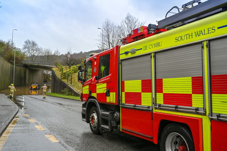
The fire service attending to a vehicle stuck in floodwater.
Flash flooding can be destructive.
Ceri Breeze/Shutterstock

More emissions, more rain

Our results are now published in Nature Communications. We found that under a high emissions scenario downpours in the UK exceeding 20mm per hour could be four times as frequent by the year 2080 compared with the 1980s. This level of rainfall can potentially produce serious damage through flash flooding, with thresholds like 20mm/hr used by planners to estimate the risk of flooding when water overwhelms the usual drainage channels. Previous less detailed climate models project a much lower increase of around two and a half times over the same period.

We note that these changes are assuming that greenhouse gas emissions continue to rise at current rates. This is therefore a plausible but upper estimate. If global carbon emissions follow a lower emissions scenario, extreme rain will still increase in the UK – though at a slower rate. However, the changes are not inevitable, and if we emit less carbon in the coming decades, extreme downpours will be less frequent.

The increases are significantly greater in certain regions. For example, extreme rainfall in north-west Scotland could be almost ten times more common, while it’s closer to three times more frequent in the south of the UK. The greater future increases in the number of extreme rainfall events in the higher resolution model compared with more traditional lower resolution climate models shows the importance of having k-scale projections to enable society to adapt to climate change.

As the atmosphere warms, it can hold more moisture, at a rate of 7% more moisture for every degree of warming. On a simple level, this explains why in many regions of the world projections show an increase in precipitation as a consequence of human-induced climate change. This new study has shown that, in the UK, the intensity of downpours could increase by about 5% in the south and up to about 15% in the north for every degree of regional warming.

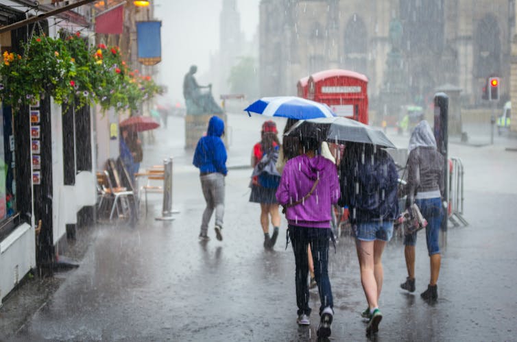
Group of girls with an umbrella walking through a city.
The projected increase in the intensity of rainfall is significantly greater in certain regions.
NotarYES/Shutterstock

However, it is far from a simple picture of more extreme events, decade by decade, as a steadily increasing trend. Instead, we expect periods of rapid change – with records being broken, some by a considerable margin – and periods when there is a pause, with no new records set.

This is simply a reflection of the complex interplay between natural variability and the underlying climate change signal. An analogy for this is waves coming up a beach on an incoming tide. The tide is the long-term rising trend, but there are periods when there are larger waves, followed by lulls.

Despite the underlying trend, the time between record-breaking events at the local scale can be surprisingly long – even several decades.

Our research marks the first time that such a high-resolution data set has spanned over a century. As well as being a valuable asset for planners and policymakers to prepare for the future, it can also be used by climate attribution scientists to examine current extreme rainfall events to see how much more likely they will have been because of human greenhouse gas emissions. The research highlights the importance of meeting carbon emissions targets and also planning for increasingly prevalent extreme rainfall events, which to varying degrees of intensity, look highly likely in all greenhouse gas emissions scenarios.

The tendency for extreme years to cluster poses challenges for communities trying to adapt to intense downpours and risks infrastructure being unprepared, since climate information based on several decades of past observations may not be representative of the following decades.


This blog is written by Cabot Institute for the Environment member Elizabeth Kendon, Professor of Climate Science, University of Bristol. This article is republished from The Conversation under a Creative Commons license. Read the original article.

Lizzie Kendon
Professor Lizzie Kendon

Towards urban climate resilience: learning from Lusaka


“This is a long shot!”

These were the words used by Richard Jones (Science Fellow, Met Office) in August 2021 when he asked if I would consider leading a NERC proposal for a rapid six-month collaborative international research and scoping project, aligned to the COP26 Adaptation and Resilience theme. The deadline was incredibly tight but the opportunity was too good to pass up – we set to work!

Background to Lusaka and FRACTAL

Zambia’s capital city, Lusaka, is one of Africa’s fastest growing cities, with around 100,000 people in the early 1960s to more than 3 million people today. 70% of residents live in informal settlements and some areas are highly prone to flooding due to the low topography and highly permeable limestone sitting on impermeable bedrock, which gets easily saturated. When coupled with poor drainage and ineffective waste management, heavy rainfall events during the wet season (November to March) can lead to severe localised flooding impacting communities and creating serious health risks, such as cholera outbreaks. Evidence from climate change studies shows that heavy rainfall events are, in general, projected to increase in intensity over the coming decades (IPCC AR6, Libanda and Ngonga 2018). Addressing flood resilience in Lusaka is therefore a priority for communities and city authorities, and it became the focus of our proposal.

Lusaka was a focal city in the Future Resilience for African CiTies and Lands (FRACTAL) project funded jointly by NERC and DFID from 2015 to 2021. Led by the Climate System Analysis Group (CSAG) at the University of Cape Town, FRACTAL helped to improve scientific knowledge about regional climate in southern Africa and advance innovative engagement processes amongst researchers, practitioners, decision-makers and communities, to enhance the resilience of southern African cities in a changing climate. I was lucky enough to contribute to FRACTAL, exploring new approaches to climate data analysis (Daron et al., 2019) and climate risk communication (Jack et al., 2020), as well as taking part in engagements in Maputo, Mozambique – another focal city. At the end of FRACTAL there was a strong desire amongst partners to sustain relationships and continue collaborative research.

I joined the University of Bristol in April 2021 with a joint position through the Met Office Academic Partnership (MOAP). Motivated by the potential to grow my network, work across disciplines, and engage with experts at Bristol in climate impacts and risk research, I was excited about the opportunities ahead. So when Richard alerted me to the NERC call, it felt like an amazing opportunity to continue the work of FRACTAL and bring colleagues at the University of Bristol into the “FRACTAL family” – an affectionate term we use for the research team, which really has become a family from many years of working together.

Advancing understanding of flood risk through participatory processes

Working closely with colleagues at Bristol, University of Zambia, University of Cape Town, Stockholm Environment Institute (SEI – Oxford), Red Cross Climate Centre, and the Met Office, we honed a concept building on an idea from Chris Jack at CSAG to take a “deep dive” into the issues of flooding in Lusaka – an issue only partly explored in FRACTAL. Having already established effective relationships amongst those involved, and with high levels of trust and buy-in from key institutions in Lusaka (e.g., Lusaka City Council, Lusaka Water Security Initiative – LuWSI), it was far easier to work together and co-design the project; indeed the project conceived wouldn’t have been possible if starting from scratch. Our aim was to advance understanding of flood risk and solutions from different perspectives, and co-explore climate resilient development pathways that address the complex issue of flood risk in Lusaka, particularly in George and Kanyama compounds (informal settlements). The proposal centred on the use of participatory processes that enable different communities (researchers, local residents, city decision makers) to share and interrogate different types of knowledge, from scientific model datasets to lived experiences of flooding in vulnerable communities.

The proposal was well received and the FRACTAL-PLUS project started in October 2021, shortly before COP26; PLUS conveys how the project built upon FRACTAL but also stands for “Participatory climate information distillation for urban flood resilience in LUSaka”. The central concept of climate information distillation refers to the process of extracting meaning from multiple sources of information, through careful and open consideration of the assumptions, strengths and limitations in constructing the information.

The “Learning Lab” approach

Following an initial evidence gathering and dialogue phase at the end of 2021, we conducted two collaborative “Learning Labs” held in Lusaka in January and March 2022. Due to Covid-19, the first Learning Lab was held as a hybrid event on 26-27 January 2022. It was facilitated by the University of Zambia team with 20 in-person attendees including city stakeholders, the local project team and Richard Jones who was able to travel at short notice. The remainder of the project team joined via Zoom. Using interactive exercises, games (a great way to promote trust and exchange of ideas), presentations, and discussions on key challenges, the Lab helped unite participants to work together. I was amazed at the way participants threw themselves into the activities with such enthusiasm – in my experience, this kind of thing never happens when first engaging with people from different institutions and backgrounds. Yet because trust and relationships were already established, there was no apparent barrier to the engagement and dialogue. The Lab helped to further articulate the complexities of addressing flood risks in the city, and showed that past efforts – including expensive infrastructure investments – had done little to reduce the risks faced by many residents.

One of the highlights of the Labs, and the project overall, was the involvement of cartoon artist Bethuel Mangena, who developed a number of cartoons to support the process and extract meaning (in effect, distilling) the complicated and sensitive issues being discussed. The cartoon below was used to illustrate the purpose of the Lab, as a meeting place for ideas and conversations drawing on different sources of information (e.g., climate data, city plans and policies) and experiences of people from flood-affected communities. All of the cartoons generated in the project, including the feature image for this blog, are available in a Flickr cartoon gallery – well worth a look!

Image: Cartoon highlighting role of Learning Labs in FRACTAL-PLUS by Bethuel Mangena

Integrating scientific and experiential knowledge of flood risk

In addition to the Labs, desk-based work was completed to support the aims of the project. This included work by colleagues in Geographical Sciences at Bristol, Tom O’Shea and Jeff Neal, to generate high-resolution flood maps for Lusaka based on historic rainfall information and for future climate scenarios. In addition, Mary Zhang, now at the University of Oxford but in the School of Policy Studies at Bristol during the project, collaborated with colleagues at SEI-Oxford and the University of Zambia to design and conduct online and in-person surveys and interviews to elicit the lived experiences of flooding from residents in George and Kanyama, as well as experiences of those managing flood risks in the city authorities. This work resulted in new information and knowledge, such as the relative perceived roles of climate change and flood management approaches in the levels of risk faced, that was further interrogated in the second Learning Lab.

Thanks to a reduction in covid risk, the second lab was able to take place entirely in person. Sadly I was unable to travel to Lusaka for the Lab, but the decision to remove the virtual element and focus on in-person interactions helped further promote active engagement amongst city decision-makers, researchers and other participants, and ultimately better achieve the goals of the Lab. Indeed the project helped us learn the limits of hybrid events. Whilst I remain a big advocate for remote technology, the project showed it can be far more productive to have solely in-person events where everyone is truly present.

The second Lab took place at the end of March 2022. In addition to Lusaka participants and members of the project team, we were also joined by the Mayor of Lusaka, Ms. Chilando Chitangala. As well as demonstrating how trusted and respected our partners in Lusaka are, the attendance of the mayor showed the commitment of the city government to addressing climate risks in Lusaka. We were extremely grateful for her time engaging in the discussions and sharing her perspectives.

During the lab the team focused on interrogating all of the evidence available, including the new understanding gained through the project from surveys, interviews, climate and flood data analysis, towards collaboratively mapping climate resilient development pathways for the city. The richness and openness in the discussions allowed progress to be made, though it remains clear that addressing flood risk in informal settlements in Lusaka is an incredibly challenging endeavour.

Photo: Participants at March 2022 Learning Lab in Lusaka

What did we achieve?

The main outcomes from the project include:

  1. Enabling co-exploration of knowledge and information to guide city officials (including the mayor – see quote below) in developing Lusaka’s new integrated development plan.
  2. Demonstrating that flooding will be an ongoing issue even if current drainage plans are implemented, with projections of more intense rainfall over the 21st century pointing to the need for more holistic, long-term and potentially radical solutions.
  3. A plan to integrate flood modelling outputs into the Lusaka Water Security Initiative (LuWSI) digital flood atlas for Lusaka.
  4. Sustaining relationships between FRACTAL partners and building new links with researchers at Bristol to enable future collaborations, including input to a new proposal in development for a multi-year follow-on to FRACTAL.
  5. A range of outputs, including contributing to a FRACTAL “principles” paper (McClure et al., 2022) supporting future participatory projects.

It has been such a privilege to lead the FRACTAL-PLUS project. I’m extremely grateful to the FRACTAL family for trusting me to lead the project, and for the input from colleagues at Bristol – Jeff Neal, Tom O’Shea, Rachel James, Mary Zhang, and especially Lauren Brown who expertly managed the project and guided me throughout.

I really hope I can visit Lusaka in the future. The city has a special place in my heart, even if I have only been there via Zoom!

“FRACTAL-PLUS has done well to zero in on the issue of urban floods and how climate change pressures are making it worse. The people of Lusaka have continually experienced floods in various parts of the city. While the problem is widespread, the most affected people remain to be those in informal settlements such as George and Kanyama where climate change challenges interact with poor infrastructure, poor quality housing and poorly managed solid waste.” Mayor Ms. Chilando Chitangala, 29 March 2022

————————————————————————————-

This blog is written by Dr Joe Daron, Senior Research Fellow, Faculty of Science, University of Bristol;
Science Manager, International Climate Services, Met Office; and Cabot Institute for the Environment member.
Find out more about Joe’s research at https://research-information.bris.ac.uk/en/persons/joe-daron.


Climate change isn’t just making cyclones worse, it’s making the floods they cause worse too – new research

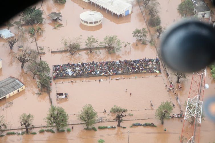
People take refuge on a sports ground following flooding caused by Cyclone Idai in Mozambique.
DFID/Flickr, CC BY-SA

Laurence Hawker, University of Bristol; Dann Mitchell, University of Bristol, and Natalie Lord, University of Bristol

Super cyclones, known as hurricanes or typhoons in different parts of the world, are among the most destructive weather events on our planet.

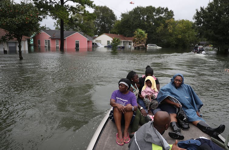
Although wind speeds within these storms can reach 270 km/h, the largest loss of life comes from the flooding they cause – known as a “storm surge” – when sea water is pushed onto the coast. Climate change is predicted to worsen these floods, swelling cyclone clouds with more water and driving rising sea levels that allow storm surges to be blown further inland.

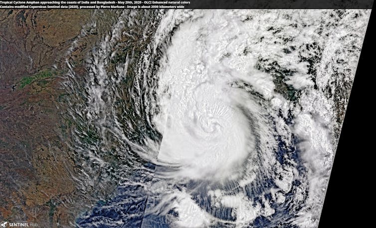
In May 2020, Super Cyclone Amphan hit the India-Bangladesh border, bringing heavy rainfall and strong winds and affecting more than 13 million citizens. The cyclone also caused storm surges of 2-4 metres, flooding coastal regions in the Bay of Bengal.

While over the ocean, this category five storm – that’s a storm’s highest possible rating – became the strongest cyclone to have formed in the Bay of Bengal since 1999, reaching wind speeds of up to 260 km/h. Although it weakened to a category two storm following landfall, it remained the strongest cyclone to hit the Ganges Delta since 2007.

Amphan had severe consequences for people, agriculture, the local economy and the environment. It tragically resulted in more than 120 deaths, as well as damaging or destroying homes and power grids: leaving millions without electricity or communication in the midst of an ongoing pandemic.

Relief and aid efforts were hampered by flood damage to roads and bridges, as well as by coronavirus restrictions. Large areas of crops including rice, sesame and mangos were damaged, and fertile soils were either washed away or contaminated by saline sea water. Overall, Super Cyclone Amphan was the costliest event ever recorded in the North Indian Ocean, resulting in over $13 billion (£10 billion) of damage.

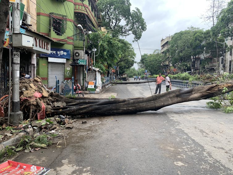
Two people assess a tree that has fallen across a road
In Kolkata, India, Super Cyclone Amphan caused widespread damage.
Indrajit Das/Wikimedia

In a recent study led by the University of Bristol and drawing on research from Bangladesh and France, we’ve investigated how the effects of storm surges like that caused by Amphan on the populations of India and Bangladesh might change under different future climate and population scenarios.

Amphan: Mark II

Rising sea levels – thanks largely to melting glaciers and ice sheets – appear to be behind the greatest uptick in future risk from cyclone flooding, since they allow storm surges to reach further inland. It’s therefore key to understand and predict how higher sea levels might exacerbate storm-driven flooding, in order to minimise loss and damage in coastal regions.

Our research used climate models from CMIP6, the latest in a series of projects aiming to improve our understanding of climate by comparing simulations produced by different modelling groups around the world. First we modelled future sea-level rise according to different future emissions scenarios, then we added that data to storm surge estimates taken from a model of Super Cyclone Amphan.

We ran three scenarios: a low emission scenario, a business-as-usual scenario and a high emission scenario. And in addition to modelling sea-level rise, we also estimated future populations across India and Bangladesh to assess how many more people storm surges could affect. In most cases, we found that populations are likely to rise: especially in urban areas.

Our findings were clear: exposure to flooding from cyclone storm surges is extremely likely to increase. In India, exposure increase ranged from 50-90% for the lowest emission scenario, to a 250% increase for the highest emission scenario. In Bangladesh, we found a 0-20% exposure increase for the lowest emission scenario and a 60-70% increase for the highest emission scenario. The difference in exposure between the two countries is mostly due to declining coastal populations as a result of urban migration inland.

Imagine we’re now in 2100. Even in a scenario where we’ve managed to keep global emissions relatively low, the local population exposed to storm surge flooding from an event like Amphan will have jumped by ~350,000. Compare this to a high emission scenario, where an extra 1.35 million people will now be exposed to flooding. And for flood depths of over one metre – a depth that poses immediate danger to life – almost half a million more people will be exposed to storm surge flooding in a high emission scenario, compared to a low emission scenario.

A composite satellite image of a large white cyclone
A satellite image shows Amphan approaching the coasts of India and Bangladesh.
Pierre Markuse/Wikimedia

This research provides yet more support for rapidly and permanently reducing our greenhouse gas emissions to keep global warming at 1.5°C above pre-industrial levels.

Although we’ve focused on storm surge flooding, other cyclone-related hazards are also projected to worsen, including deadly heatwaves following cyclones hitting land. And in the case of Amphan, interplay between climate change and coronavirus likely made the situation for people on the ground far worse. As the world warms, we mustn’t avoid the reality that pandemics and other climate-related crises are only forecast to increase.

Urgent action on emissions is vital to protect highly climate-vulnerable countries from the fatal effects of extreme weather. Amphan Mark II need not be as destructive as we’ve projected if the world’s governments act now to meet Paris agreement climate goals.The Conversation

—————————–

This blog is written by Cabot Institute for the Environment members Dr Laurence Hawker, Senior Research Associate in Geography, University of Bristol; Professor Dann Mitchell, Professor of Climate Science, University of Bristol, and Dr Natalie Lord, Honorary Research Associate in Climate Science, University of Bristol

This article is republished from The Conversation under a Creative Commons license. Read the original article.

New flood maps show US damage rising 26% in next 30 years due to climate change alone, and the inequity is stark


Coastal cities like Port Arthur, Texas, are at increasing risk from flooding during storms.
Joe Raedle/Getty Images

Climate change is raising flood risks in neighborhoods across the U.S. much faster than many people realize. Over the next three decades, the cost of flood damage is on pace to rise 26% due to climate change alone, an analysis of our new flood risk maps shows.

That’s only part of the risk. Despite recent devastating floods, people are still building in high-risk areas. With population growth factored in, we found the increase in U.S. flood losses will be four times higher than the climate-only effect.

Our team develops cutting-edge flood risk maps that incorporate climate change. It’s the data that drives local risk estimates you’re likely to see on real estate websites.

In the new analysis, published Jan. 31, 2022, we estimated where flood risk is rising fastest and who is in harm’s way. The results show the high costs of flooding and lay bare the inequities of who has to endure America’s crippling flood problem. They also show the importance of altering development patterns now.

The role of climate change

Flooding is the most frequent and costliest natural disaster in the United States, and its costs are projected to rise as the climate warms. Decades of measurements, computer models and basic physics all point to increasing precipitation and sea level rise.

As the atmosphere warms, it holds about 7% more moisture for every degree Celsius that the temperature rises, meaning more moisture is available to fall as rain, potentially raising the risk of inland flooding. A warmer climate also leads to rising sea levels and higher storm surges as land ice melts and warming ocean water expands.

Yet, translating that understanding into the detailed impact of future flooding has been beyond the grasp of existing flood mapping approaches.

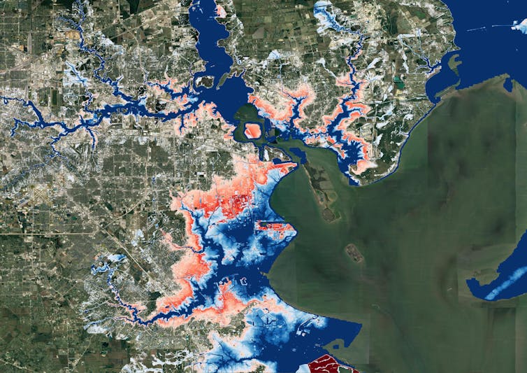
A map of Houston showing flooding extending much farther inland.
A map of Houston shows flood risk changing over the next 30 years. Blue areas are today’s 100-year flood-risk zones. The red areas reflect the same zones in 2050.
Wing et al., 2022

Previous efforts to link climate change to flood models offered only a broad view of the threat and didn’t zoom in close enough to provide reliable measures of local risk, although they could illustrate the general direction of change. Most local flood maps, such as those produced by the Federal Emergency Management Agency, have a different problem: They’re based on historical changes rather than incorporating the risks ahead, and the government is slow to update them.

Our maps account for flooding from rivers, rainfall and the oceans – both now and into the future – across the entire contiguous United States. They are produced at scales that show street-by-street impacts, and unlike FEMA maps, they cover floods of many different sizes, from nuisance flooding that may occur every few years to once-in-a-millennium disasters.

While hazard maps only show where floods might occur, our new risk analysis combines that with data on the U.S. building stock to understand the damage that occurs when floodwaters collide with homes and businesses. It’s the first validated analysis of climate-driven flood risk for the U.S.

The inequity of America’s flood problem

We estimated that the annual cost of flooding today is over US$32 billion nationwide, with an outsized burden on communities in Appalachia, the Gulf Coast and the Northwest.

When we looked at demographics, we found that today’s flood risk is predominantly concentrated in white, impoverished communities. Many of these are in low-lying areas directly on the coasts or Appalachian valleys at risk from heavy rainfall.

But the increase in risk as rising oceans reach farther inland during storms and high tides over the next 30 years falls disproportionately on communities with large African American populations on the Atlantic and Gulf coasts. Urban and rural areas from Texas to Florida to Virginia contain predominantly Black communities projected to see at least a 20% increase in flood risk over the next 30 years.

Historically, poorer communities haven’t seen as much investment in flood adaptation or infrastructure, leaving them more exposed. The new data, reflecting the cost of damage, contradicts a common misconception that flood risk exacerbated by sea level rise is concentrated in whiter, wealthier areas.

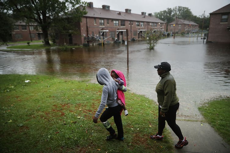
A woman carries a child past an area where flood water surrounds low-rise apartment buildings.
Hurricane Florence’s storm surge and extreme rainfall flooded towns on North Carolina’s Neuse River many miles inland from the ocean in 2018.
Chip Somodevilla/Getty Images

Our findings raise policy questions about disaster recovery. Prior research has found that these groups recover less quickly than more privileged residents and that disasters can further exacerbate existing inequities. Current federal disaster aid disproportionately helps wealthier residents. Without financial safety nets, disasters can be tipping points into financial stress or deeper poverty.

Population growth is a major driver of flood risk

Another important contributor to flood risk is the growing population.

As urban areas expand, people are building in riskier locations, including expanding into existing floodplains – areas that were already at risk of flooding, even in a stable climate. That’s making adapting to the rising climate risks even more difficult.

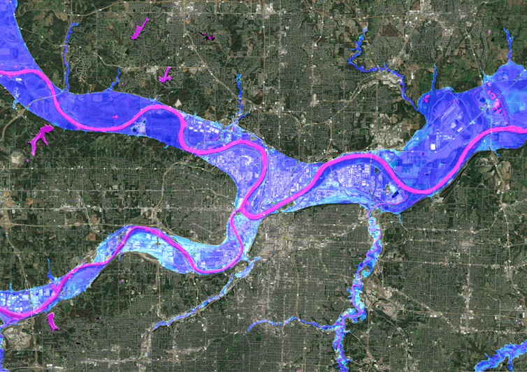
A satellite image of Kansas City showing flood risk overlaid along the rivers.
A Kansas City flood map shows developments in the 100-year flood zone.
Fathom

Hurricane Harvey made that risk painfully clear when its record rainfall sent two reservoirs spilling into neighborhoods, inundating homes that had been built in the reservoirs’ flood zones. That was in 2017, and communities in Houston are rebuilding in risky areas again.

We integrated into our model predictions how and where the increasing numbers of people will live in order to assess their future flood risk. The result: Future development patterns have a four times greater impact on 2050 flood risk than climate change alone.

On borrowed time

If these results seem alarming, consider that these are conservative estimates. We used a middle-of-the-road trajectory for atmospheric greenhouse gas concentrations, one in which global carbon emissions peak in the 2040s and then fall.

Importantly, much of this impact over the next three decades is already locked into the climate system. While cutting emissions now is crucial to slow the rate of sea level rise and reduce future flood risk, adaptation is required to protect against the losses we project to 2050.

[Over 140,000 readers rely on The Conversation’s newsletters to understand the world. Sign up today.]

If future development was directed outside of the riskiest areas, and new construction met higher standards for flood mitigation, some of these projected losses could be avoided. In previous research, we found that for a third of currently undeveloped U.S. floodplains it is cheaper to buy the land at today’s prices and preserve it for recreation and wildlife than develop it and pay for the inevitable flood damages later.

The results stress how critical land use and building codes are when it comes to adapting to climate change and managing future losses from increasing climate extremes. Protecting lives and property will mean moving existing populations out of harm’s way and stopping new construction in flood-risk areas.The Conversation

——————————-

This blog is written by Cabot Institute for the Environment members Dr Oliver Wing, Research Fellow, and Paul Bates, Professor of Hydrology, School of Geographical Sciences, University of Bristol; and Carolyn Kousky, Executive Director, Wharton Risk Center, University of Pennsylvania and Jeremy Porter, Professor of Quantitative Methods in the Social Sciences, City University of New York.

This article is republished from The Conversation under a Creative Commons license. Read the original article.

Canada’s flood havoc after summer heatwave shows how climate disasters combine to do extra damage

People living in British Columbia will feel like they have had more than their fair share of climate disasters in 2021. After a record-breaking heatwave in June, the state in western Canada has been inundated by intense rain storms in November. It’s also likely the long-lasting effects of the heatwave made the results of the recent rainfall worse, causing more landslides – which have destroyed highways and railroads – than would otherwise have happened.

In June 2021, temperature records across western North America were shattered. The town of Lytton in British Columbia registered 49.6°C, breaking the previous Canadian national record by 5°C. The unprecedented weather was caused by a high pressure system, a so-called “heat dome”, which sat over the region for several days.

Heat intensified within the dome as the high pressure compressed the air. Dry ground conditions forced temperatures even higher, as there was less water evaporating to cool things down. Although unconfirmed, it’s estimated that the heatwave caused over 400 deaths in British Columbia alone.

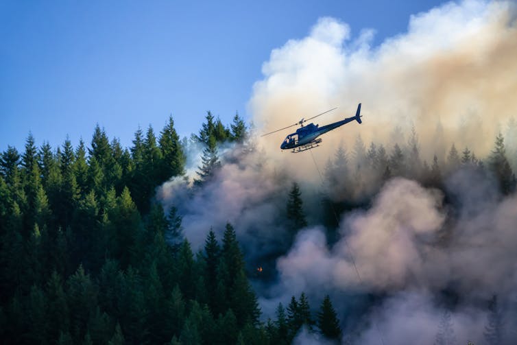
A helicopter flies over a burning pine forest beneath a blue sky.
Wildfires ravaged British Columbia during the hot and dry summer of 2021.
EB Adventure Photography/Shutterstock

The hot and dry weather also sparked wildfires. Just days after recording the hottest national temperature ever, the town of Lytton burned to the ground. The summer’s fires and drought left the ground charred and barren, incapable of absorbing water. These conditions make landslides more likely, as damaged tree roots can no longer hold soil in place. It also ensures water flows over the soil quicker, as it cannot soak into the baked ground.

The huge rain storm which lasted from Saturday November 13 to Monday 15 was caused by an atmospheric river – a long, narrow, band of moisture in the atmosphere stretching hundreds of miles. When this band travels over land it can generate extreme rainfall, and it did: in 48 hours, over 250mm of rain fell in the town of Hope, 100km east of Vancouver.

This much rainfall on its own would probably cause extensive flooding. But combined with the parched soil, the results have been catastrophic. Landslides have destroyed many of the region’s transport links, leaving Vancouver cut off by rail and road. But the bad news doesn’t end there; sediment washed away by these floods could make future floods this winter even worse.

British Columbia is in the grip of what scientists call a compound climate disaster. The effects of one extreme weather event, like a heatwave, amplify the effects of the next one, like a rain storm. Instead of seeing floods and wildfires as discrete events, compound disasters force us to comprehend the cascading crises which are likely to multiply as the planet warms.

How to understand compound climate disasters

The port of Vancouver is the busiest in Canada, moving US$550 million worth of cargo every day. Because rail links are damaged, ships laden with commodities sit offshore. Canada’s mining and farming industries are having to divert exports through the US. Depending on how quickly the rail links recover, significant economic impacts are possible.

Both the June heatwave and the November rainstorm are unprecedented, record-breaking events, but is their occurrence in the same year just bad luck? A rapid attribution study found that the heatwave was virtually impossible without climate change. The atmospheric river which brought the deluge is also likely to become more common and intense in a warming climate.

In British Columbia, future flooding is almost guaranteed to be more frequent and severe. This is life at 1.2°C above the pre-industrial temperature average, yet most politicians don’t seem too worried about taking the necessary action to prevent warming beyond 1.5°C – the limit which countries agreed in 2015 is a threshold beyond which catastrophic climate change becomes more likely.

Western Canada’s year of weather extremes did not come from nowhere. Past trends and future projections tell us to expect hotter summers and wetter winters in this part of the world, and record-shattering climate extremes are on the rise.

Worldwide, compound climate disasters are becoming more common as climate change accelerates. Risk assessments typically measure the impacts of one event at a time, like the damage caused by intense rain storms, without considering how the earlier drought influenced it. This leads to scientists and insurers underestimating the overall damage. With so many combinations of climate extremes – flooding following wildfires, hurricanes passing as cold spells arrive – we must prepare for every possibility.The Conversation

————————-

This blog is written by Cabot Institute for the Environment member Dr Vikki Thompson, Senior Research Associate in Geographical Sciences, University of Bristol.

This article is republished from The Conversation under a Creative Commons license. Read the original article.

Vikki Thompson

Are you a journalist looking for climate experts? We’ve got you covered

We’ve got lots of media trained climate change experts. If you need an expert for an interview, here is a list of Caboteers you can approach. All media enquiries should be made via Victoria Tagg, our dedicated Media and PR Manager at the University of Bristol. Email victoria.tagg@bristol.ac.uk or call +44 (0)117 428 2489.

Climate change / climate emergency / climate science / climate-induced disasters

Dr Eunice Lo – expert in changes in extreme weather events such as heatwaves and cold spells, and how these changes translate to negative health outcomes including illnesses and deaths. Follow on Twitter @EuniceLoClimate.

Professor Daniela Schmidt – expert in the causes and effects of climate change on marine systems. Dani is also a Lead Author on the IPCC reports. Dani will be at COP26.

Dr Katerina Michalides – expert in drylands, drought and desertification and helping East African rural communities to adapt to droughts and future climate change. Follow on Twitter @_kmichaelides.

Professor Dann Mitchell – expert in how climate change alters the atmospheric circulation, extreme events, and impacts on human health. Dann is also a Met Office Chair. Dann will be at COP26. Follow on Twitter @ClimateDann.

Professor Dan Lunt – expert on past climate change, with a focus on understanding how and why climate has changed in the past and what we can learn about the future from the past. Dan is also a Lead Author on IPCC AR6. Dan will be at COP26. Follow on Twitter @ClimateSamwell.

Professor Jonathan Bamber – expert on the impact of melting land ice on sea level rise (SLR) and the response of the ocean to changes in freshwater forcing. Jonathan will be at COP26. Follow on Twitter @jlbamber

Professor Paul Bates CBE – expert in the science of flooding, risk and reducing threats to life and economic losses worldwide. Follow on Twitter @paul_d_bates

Professor Tony Payne – expert in the effects of climate change on earth systems and glaciers.

Dr Matt Palmer – expert in sea level and ocean heat content research at the Met Office Hadley Centre and University of Bristol. Follow on Twitter @mpclimate.

Net Zero / Energy / Renewables

Professor Valeska Ting – Engineer and expert in net zero, low carbon technologies, low carbon energy and flying. Also an accomplished STEM communicator, is an BAME Expert Voice for the BBC Academy. Follow on Twitter @ProfValeskaTing.

Professor Philip Taylor – Expert in net zero, energy systems, energy storage, utilities, electric power distribution. Also Pro-Vice Chancellor at the University of Bristol. Philip will be at COP26. Follow on Twitter @rolyatlihp.

Dr Colin Nolden – expert in sustainable energy policy, regulation and business models and interactions with secondary markets such as carbon markets and other sectors such as mobility. Colin will be at COP26.

Climate finance

Dr Rachel James – Expert in climate finance, damage, loss and decision making. Also has expertise in African climate systems and contemporary and future climate change. Follow on Twitter @_RachelJames

Climate justice

Dr Alix Dietzel – climate justice and climate policy expert. Focusing on the global and local scale and interested in how just the response to climate change is and how we can ensure a just transition. Alix will be at COP26. Follow on Twitter @alixdietzel

Dr Ed Atkins – expert on environmental and energy policy, politics and governance and how they must be equitable and inclusive. Also interested in local politics of climate change policies and energy generation and consumption. Follow on Twitter @edatkins_.

Climate activism / Extinction Rebellion

Dr Oscar Berglund – expert on climate change activism and particularly Extinction Rebellion (XR) and the use of civil disobedience. Follow on Twitter @berglund_oscar.

Air pollution / Greenhouse gases

Dr Aoife Grant – expert in greenhouse gases and methane. Has set up a monitoring station at Glasgow for COP26 to record emissions.

Professor Matt Rigby – expert on sources and sinks of greenhouse gases and ozone depleting substances. Follow on Twitter @TheOtherMRigby.

Land, nature and food

Dr Jo House – expert on land and climate interactions, including emissions of carbon dioxide from land use change (e.g. deforestation), climate mitigation potential from the land (e.g. afforestation, bioenergy), and implications of science for policy. Previously Government Office for Science’s Head of Climate Advice. Follow on Twitter @Drjohouse.
Dr Taro Takahashi – expert on farming, livestock production systems as well as progamme evaluation and general equilibrium modelling of pasture and livestock-based economies.

Climate change and infrastructure

Dr Maria Pregnolato – expert on effects of climate change and flooding on infrastructure. Follow on Twitter @MariaPregnolat1.

Plastic and the environment

Dr Charlotte Lloyd – expert on the fate of chemicals in the terrestrial environment, including plastics, bioplastics and agricultural wastes. Follow on Twitter @DrCharlLloyd.

What else the Cabot Institute for the Environment is up to for COP26

Find out what we’re doing for COP26 on our website at bristol.ac.uk/cabot/cop26.
Watch our Cabot Conversations – 10 conversations between 2 experts on a climate change issue, all whilst an artist listens in the background and interprets the conversation into a beautiful piece of art in real time. Find out more at bristol.ac.uk/cabot/conversations.
——————————
This blog was written by Amanda Woodman-Hardy, Communications and Engagement Officer at the Cabot Institute for the Environment. Follow on Twitter @Enviro_Mand and @cabotinstitute.
 

Flooding in the UK: Understanding the past and preparing for the future

On the 16th of October 2019, Ivan Haigh ­Associate Professor in Coastal Oceanography at the University of Southampton – gave a presentation on the “characteristics and drivers of compound flooding events around the UK coast” at the BRIDGE research seminar in the School of Geographical Sciences. He began by outlining the seriousness of flood risk in the UK – it is the second highest civil emergency risk factor as defined by the Cabinet Office – before moving on to the first section of the talk on his work with the Environment Agency on its Thames Estuary 2100 plan (TE2100)[1].

Thames Estuary 2100 plan: 5-year review

The construction of a Thames barrier was proposed after severe flooding in London in 1953, and it eventually became operational 30 years later in 1983. Annually, the Thames barrier removes around £2bn of flood damage risk from London and is crucial to the future prosperity of the city in a changing environment.

The Thames Barrier in its closed formation. Image source: Thames Estuary 2100 Plan (2012)

Flood defences in the Thames estuary were assessed in the TE2100 plan, which takes an innovative “adaptive pathways management approach” to the future of these flood defences over the coming century. This approach means that a range of flood defence options are devised and the choice of which ones to implement is based upon the current environmental data and the latest models of future scenarios, in particular predictions of future sea level rise.

For this method to be effective, accurate observations of recent sea level changes must be made in order to determine which management pathway to implement and to see if these measurements fit with the predictions of future sea level rise used in the plan. This work is carried out in reviews of the plan at five-year intervals, and it was this work that Ivan and his colleagues were involved with.

There is significant monthly and annual variability in the local tide gauge records that measure changes in sea level, and this can make it difficult to assess whether there is any long-term trend in the record. Using statistical analysis of the tide gauge data, the team was able to filter 91% of the variability that was due to short term changes in atmospheric pressure and winds to reveal a trend of approximately 1.5 mm per year of sea level rise, in line with the predictions of the model that is incorporated into the TE2100 plan.

Compound flood events around the UK Coast

In the second half of his presentation, Ivan went on to discuss a recent paper he was involved with studying compound flood events around the UK (Hendry et al. 2019)[2]. A compound flood occurs when a storm surge, caused by low atmospheric pressure allowing the sea surface to rise locally, combines with river flooding caused by a large rainfall event. These can be the most damaging natural disasters in the UK, and from historical data sets stretching back 50 years at 33 tide gauges and 326 river stations, the team were able to determine the frequency of compound floods across the UK.

Along the west coast, there were between 3 and 6 compound flooding events per decade, whereas on the east coast, there were between 0 and 1 per decade. This difference between east and west is driven by the different weather patterns that lead to these events. On the west coast it is the same type of low-pressure system that causes coastal storm surges and high rainfall. However, on the east coast different weather patterns are responsible for high rainfall and storm surges, meaning it is very unlikely they could occur at the same time.

Number of compound flood events per decade at each of the 326 river stations in the study. Triangle symbols implies rover mouth on West coast, circles East coast and squares South coast. Image Source: Hendry et al. 2019 [2]

There is also significant variability along the west coast of the UK as well, and the team investigated whether the characteristics of the river catchments could impact the possibility of these compound flooding events occurring. They found that smaller river catchments, and steeper terrain within the catchments, increased the probability of these compound flooding events occurring as water from rainfall was delivered to the coast more quickly. From the improved understanding of the weather patterns behind compound flooding events that this work provides, the quality and timeliness of flood warnings could be improved.

From the question and answer session we heard that current flood risk assessments do not always include the potential for compound flood events, meaning flood risk could be underestimated along the west coast of the UK. We also heard that Ivan will be working with researchers in the hydrology group here at the University of Bristol to further the analysis of the impact of river catchment characteristics on the likelihood of compound flooding events, and then extending this analysis to Europe, North America and Asia.

References

[1] Environment Agency (2012), “Thames Estuary 2100 Plan”.
[2] Alistair Hendry, Ivan D. Haigh, Robert J. Nicholls, Hugo Winter, Robert Neal, Thomas Wahl, Amélie Joly-Laugel, and Stephen E. Darby, (2019). “Assessing the characteristics and drivers of compound flooding events around the UK coast”, Hydrology and Earth System Science, 23, 3117-3139.

——————————————-

This blog was written by Cabot Institute member Tom Mitcham. He is a PhD student in the School of Geographical Sciences at the University of Bristol and is studying the ice dynamics of Antarctic ice shelves and their tributary glaciers.

Tom Mitcham

Read Tom’s other blog:
1. Just the tip of the iceberg: Climate research at the Bristol Glaciology Centre

Why do flood defences fail?

More than 40,000 people were forced to leave their homes after Storm Desmond caused devastating floods and wreaked havoc in north-west England. Initial indications were that the storm may have caused the heaviest local daily rainfall on record in the UK. As much as £45m has been spent on flood defences in the region in the previous ten years and yet the rainfall still proved overwhelming. So what should we actually expect from flood defence measures in this kind of situation? And why do they sometimes fail?

We know that floods can and will happen. Yet we live and work and put our crucial societal infrastructure in places that could get flooded. Instead of keeping our entire society away from rivers and their floodplains, we accept flood risks because living in lowlands has benefits for society that outweigh the costs of flood damage. But knowing how much risk to take is a tricky business. And even when there is an overall benefit for society, the consequences for individuals can be devastating.

We also need to calculate risks when we build flood defences. We usually protect ourselves from some flood damage by building structures like flood walls and river or tidal barriers to keep rising waters away from populated areas, and storage reservoirs and canals to capture excess water and channel it away. But these structures are only designed to keep out waters from typical-sized floods. Bigger defences that could protect us from the largest possible floods, which may only happen once every 100 years, would be much more expensive to build and so we choose to accept this risk as less than the costs.

Balancing the costs and benefits

In the UK, the Environment Agency works with local communities to assess the trade off between the costs of flood protection measures, and the benefits of avoiding flood damage. We can estimate the lifetime benefits of different proposed flood protection structures in the face of typical-sized floods, as well as the results of doing nothing. On the other side of the ledger, we can also estimate the structures’ construction and maintenance costs.

In some cases, flood protection measures can be designed so that if they fail, they do the least damage possible, or at least avoid catastrophic damage. For example, a flood protection wall can be built so that if flood waters run over it they run into a park rather than residential streets or commercial premises. And secondary flood walls outside the main wall can redirect some of the overflow back towards the river channel.


Thames Barrier: big costs but bigger benefits.
Ross Angus/Flickr, CC BY-SA

The Environment Agency puts the highest priority on the projects with the largest benefits for the smallest costs. Deciding where that threshold should be set is a very important social decision, because it provides protection to some but not all parts of our communities. Communities and businesses need to be well-informed about the reasons for those thresholds, and their likely consequences.

We also protect ourselves from flood damage in other ways. Zoning rules prevent valuable assets such as houses and businesses being built where there is an exceptionally high flood risk. Through land management, we can choose to increase the amount of wooded land, which can reduce the impact of smaller floods. And flood forecasting alerts emergency services and helps communities rapidly move people and their portable valuables out of the way.

Always some risk

It’s important to realise that since flood protection measures never eliminate all the risks, there are always extra costs on some in society from exceptional events such as Storm Desmond, which produce very large floods that overwhelm protection measures. The costs of damage from these exceptional floods are difficult to estimate. Since these large floods have been rare in the past, our records of them are very limited, and we are not sure how often they will occur in the future or how much damage will they cause. We also know that the climate is changing, as are the risks of severe floods, and we are still quite uncertain about how this will affect extreme rainfall.


At the same time we know that it’s very hard to judge the risk from catastrophic events. For example, we are more likely to be afraid of catastrophic events such as nuclear radiation accidents or terrorist attacks, but do not worry so much about much larger total losses from smaller events that occur more often, such as floods.

Although the process of balancing costs against benefits seems clear and rational, choosing the best flood protection structure is not straightforward. Social attitudes to risk are complicated, and it’s difficult not to be emotionally involved if your home or livelihood are at risk.
The Conversation

————————————–
This blog is written by Cabot Institute member Dr Ross Woods, a Senior Lecturer in Water and Environmental Engineering, University of Bristol.  This article was originally published on The Conversation. Read the original article.

Ross Woods

Why we must Bridge the Gap

Much of the climate change of the past century has been caused by our burning of fossil fuels. And without a change in that fossil fuel use, continued climate change in the next century could have devastating impacts on our society. It is likely to bring increased risk and hazards associated with extreme weather events. Refugee crises could be caused by rising sea levels or droughts that make some nations uninhabitable. Climate change will also make our world a more uncertain place to live, whether that be uncertainty in future rainfall patterns, the magnitude of sea level rise or the response of global fisheries to ocean acidification.  This uncertainty is particularly problematic because it makes it so much harder for industry or nations to plan and thrive.  Or to grapple with the other great challenge facing humanity – securing food, water and energy for 7 billion people (and growing).  Because of this, most nations have agreed that global warming should be held below 2°C.

Flooding on Whiteladies Road, Bristol. Image credit Jim Freer

These climatic and environmental impacts will be felt in the South West of England.  We live in an interconnected world, such that drought in North America will raise the price of our food. The effects of ocean acidification on marine ecosystems and UK fisheries remain worryingly uncertain. The floods of last winter could have been a warning of life in a hotter and wetter world; moreover, it will only become harder to protect our lowlands from not only flooding but also salt water incursions as sea level rises.  The proposed Hinkley Point nuclear power station will have an installation, operating and decommissioning lifetime of over 100 years; what added risks will it face from the combination of more severe weather, storm surges and rising sea level?  Climate change affects us all – globally, nationally and locally in the 2015 European Green Capital.

That requires reductions in emissions over the next decade.  And it then requires cessation of all fossil fuel emissions in the subsequent decades.  The former has been the subject of most negotiations, including the recent discussions in Lima and likely those in Paris at the end of this year. The latter has yet to be addressed by any international treaty. And that is of deep concern because it is the cessation of all fossil fuel emissions that is most difficult but most necessary to achieve.  Carbon dioxide has a lifetime in the atmosphere of 1000s of years, such that slower emissions will only delay climate change.  That can be useful – if we must adapt to a changing world, having more time to do so will be beneficial. However, it is absolutely clear that emissions must stop if we are to meet our target of 2°C.  In fact, according to most climate models as well as the geological history of climate, emissions must stop if we are to keep total warming below 5°C.

In short, we cannot use the majority of our coal, gas and petroleum assets for energy.  They must stay buried.

Can we ‘geoengineer’ our way to alternative solution?  Not according to recent research. Last November, a Royal Society Meeting showcased the results of three UK Research Council Funded investigations of geoengineering feasibility and consequences. They collectively illustrated that geoengineering a response to climate change was at best complicated and at worst a recipe for disaster and widespread global conflict.  The most prominent geoengineering solution is to offset the greenhouse gas induced rise in global temperatures via the injection of stratospheric particles that reflect some of the solar energy arriving at Earth.  However, on the most basic level, a world with elevated CO2 levels and reflective particles in the atmosphere  is not the same as a world with 280 ppm of CO2 and a pristine atmosphere. To achieve the same average global temperature, some regions will be cooler and others warmer.  Rainfall patterns will differ: regional patterns of flood and drought will differ. Even if it could be done, who are the arbitrators of a geoengineered world?  The potential for conflict is profound.

In short, the deus ex machina of geoengineering our climate is neither a feasible nor a just option.  And again, the conclusion is that we cannot use most of our fossil fuels.

One might argue that we can adapt to climate change: why risk our economy now when we can adapt to the consequences of climate change later? Many assessments suggest that this is not the best economic approach, but I understand the gamble: be cautious with a fragile economy now and deal with consequences later.  This argument, however, ignores the vast inequity associated with climate change.  It is the future generations that will bear the cost of our inaction.  Moreover, it appears that the most vulnerable to climate change are the poorest – and those who consume the least fossil fuels.  Those of us who burn are not those who will pay.  Arguably then, we in the UK have a particular obligation to the poor of the world and of our own country, as well as to our children and grandchildren, to soon cease the use of our fossil fuels.

Energy is at the foundation of modern society and it has been the basis for magnificent human achievement over the past 150 years, but it is clear that obtaining energy by burning fossil fuels is warming our planet and acidifying our oceans.  The consequences for our climate, from extreme weather events to rising sea levels, is profound; even more worrying are the catastrophic risks that climate change poses for the food and water resources on which society depends.  It is now time for us to mature beyond the 19th and 20th century fossil-fuel derived energy to a renewable energy system of the 21st century that is sustainable for us and our planet.

We must bridge the gap.

—————————————–

How much money should we spend to protect ourselves from climate change?

Investing in climate change resilience

 
The February floods left many asking how the damage could have been avoided and why we weren’t better prepared. The government came under attack from all sides; David Cameron said “money is no object” for the relief effort, but angry residents asked why this wasn’t the case when funding was cut to flood protection a few years before.


Peter Gist, an economist and Director of Arup Management Consultancy, visited the University of Bristol this week to give a lecture asking why we aren’t more resilient to climate change and what we can do about it.

It is a complicated question. Spending millions of pounds of taxpayers’ money is not without its risks. In April, a report was released showing that the £473 million stash of Tamiflu was essentially useless.  It was stockpiled against the risk of a flu pandemic that never happened.  Was this money wasted?  Only because the problem didn’t arise.  The risk to public health was too high to leave to chance.

The same can be said of resilience to climate change. You’re damned if you do and you’re damned if you don’t. Gist nailed it when he said, “the huge costs of not getting it right tend to lead to people acting like rabbits stuck in the headlights”.

Investment returns

Diverting resources to resilience measures is an investment, and Gist explained that this means trying to get the best return for your pound, in this case by limiting losses. It’s extremely difficult to calculate this for climate change, thanks to a lack of information, inherent uncertainties about the frequency and impact of the problem, and a decision process divided between numerous groups with different priorities.

An important economic technique when calculating the cost:benefit of different resilience methods is discounting. A price paid in today’s money cannot be directly compared with the future benefit of the scheme, so the value of the future benefit (prevention of loss) is transformed into today’s prices. An event predicted to occur far in the future will be severely discounted, making it unlikely to seem worth the cost to us today.

The problem with discounting is similar to that of politics; the focus is on short-term pressing concerns not future problems, even if they are predicted to have a huge impact. Gist explained, “in the case of severe weather events, we are almost always bound to discover that we haven’t done enough”.

Uncertainty


The Dawlish train line was damaged in winter storms.
Image credit: BBC News

Even if the risks were quantifiable, it would still be difficult to know where to channel resources because of the uncertainty in forecasting models. Would it be better, for example, to improve the resilience of the Dawlish train line to flooding, or to build an entirely new route to avoid the problem entirely? We need to know how often the line is likely to flood in the future, especially with regards to climate change, but Gist noted how difficult it is to confidently link global warming to specific extreme weather predictions.

Improving the decision

Value for money is still the aim of the game. How can we make better decisions on climate change resilience in the future?

Reducing the discount rate for long term effects is vital. Gist agrees with Lord Nicholas Stern that we should hold the impacts on the next generation with greater or equal importance than our own, rather than passing the problems on to them.

To counteract the uncertainty, of course we must keep collecting data and improving the models, but Gist believes we should go further. We need to consider more “no regrets” options, for example trees in a new development provide shade and enhance water run off, as well as making the area a more desirable place to live. He urged, “uncertainty should be an imperative to act, not an excuse not to”.

Consulting the wider public is vital in improving spending decisions. Gist described how difficult it is to factor in non-monetary benefits into the investment planning models. An area of moorland or forest might have incalculable value to people living nearby, but the property developers in the next town might see it as cut price real estate. Only by talking to a large range of people, institutions and regulatory bodies can you understand the different priorities in play and begin to factor in benefits that aren’t measured in pounds and pence. Pragmatically, Gist believes that all politicians should consult the people involved, whether in local councils or at the national level, because everyone takes part of the responsibility for the consequences and by removing the blame it clears the path to making decisions.

Get involved

Limited resources mean that we can’t always have the perfect solution for every problem. Money must be spent in the most beneficial way possible, so we can’t avoid making these investment choices. Gist urged the audience to get involved in decisions, make your voice heard and for the scientists among us to keep up the research that might yield more information. On the other hand, it is vital that we don’t fall victim to “analysis-paralysis”. If you’re waiting for the perfect data set before making a decision, you’ll be waiting a long time.

——————————————————–

This blog is written by Sarah JoseCabot Institute, Biological Sciences, University of Bristol

Sarah Jose