Arctic Ocean could be ice-free in summer by 2030s, say scientists – this would have global, damaging and dangerous consequences

Ice in the Chukchi Sea, north of Alaska and Siberia.
NASA Goddard Space Flight Center

The Arctic Ocean could be ice-free in summer by the 2030s, even if we do a good job of reducing emissions between now and then. That’s the worrying conclusion of a new study in Nature Communications.

Predictions of an ice-free Arctic Ocean have a long and complicated history, and the 2030s is sooner than most scientists had thought possible (though it is later than some had wrongly forecast). What we know for sure is the disappearance of sea ice at the top of the world would not only be an emblematic sign of climate breakdown, but it would have global, damaging and dangerous consequences.

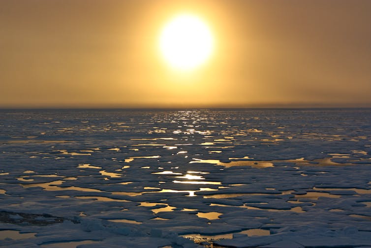
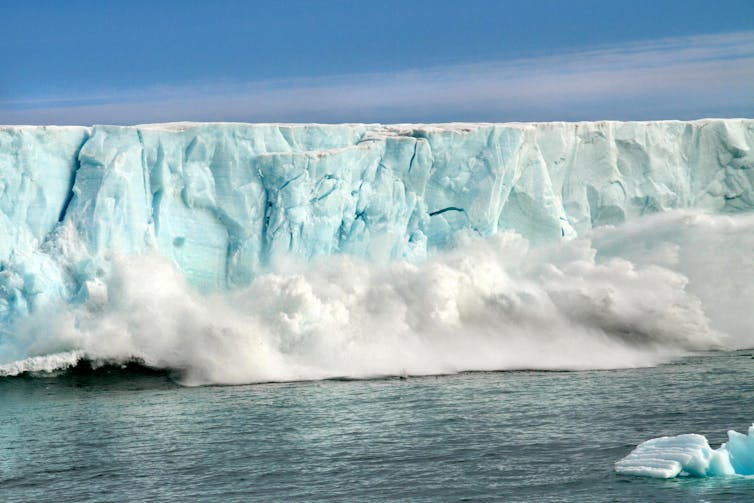
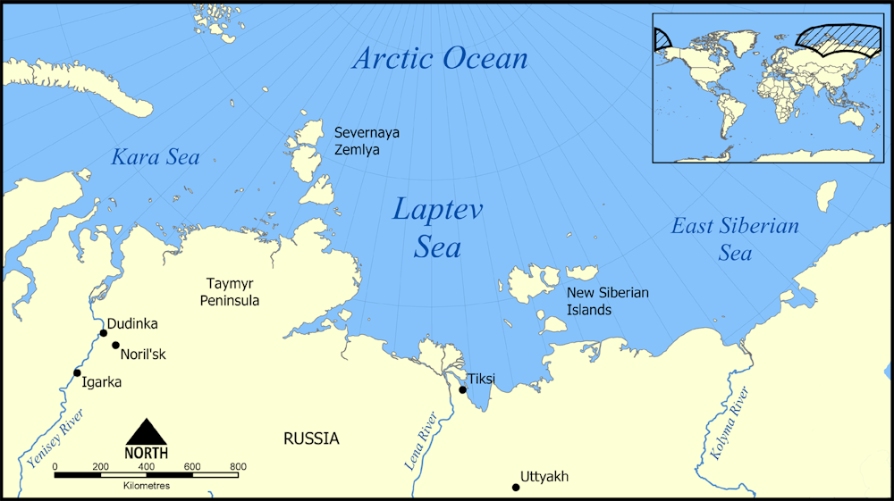
The Arctic has been experiencing climate heating faster than any other part of the planet. As it is at the frontline of climate change, the eyes of many scientists and local indigenous people have been on the sea ice that covers much of the Arctic Ocean in winter. This thin film of frozen seawater expands and contracts with the seasons, reaching a minimum area in September each year.

Animation of Arctic sea ice from space
Arctic sea ice grows until March and then shrinks until September.
NASA

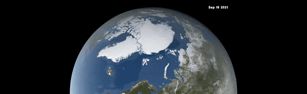
The ice which remains at the end of summer is called multiyear sea ice and is considerably thicker than its seasonal counterpart. It acts as barrier to the transfer of both moisture and heat between the ocean and atmosphere. Over the past 40 years this multiyear sea ice has shrunk from around 7 million sq km to 4 million. That is a loss equivalent to roughly the size of India or 12 UKs. In other words, it’s a big signal, one of the most stark and dramatic signs of fundamental change to the climate system anywhere in the world.

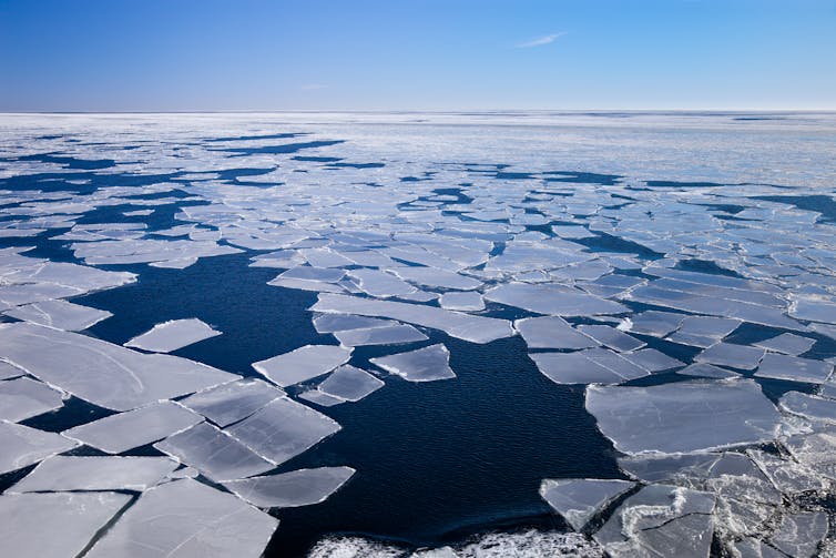
As a consequence, there has been considerable effort invested in determining when the Arctic Ocean might first become ice-free in summer, sometimes called a “blue ocean event” and defined as when the sea ice area drops below 1 million sq kms. This threshold is used mainly because older, thicker ice along parts of Canada and northern Greenland is expected to remain long after the rest of the Arctic Ocean is ice-free. We can’t put an exact date on the last blue ocean event, but one in the near future would likely mean open water at the North Pole for the first time in thousands of years.

Annotated map of Arctic
The thickest ice (highlighted in pink) is likely to remain even if the North Pole is ice-free.
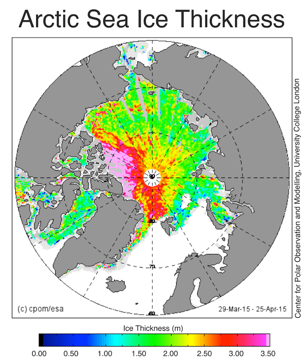
NERC Center for Polar Observation and Modelling, CC BY-SA

One problem with predicting when this might occur is that sea ice is notoriously difficult to model because it is influenced by both atmospheric and oceanic circulation as well as the flow of heat between these two parts of the climate system. That means that the climate models – powerful computer programs used to simulate the environment – need to get all of these components right to be able to accurately predict changes in sea ice extent.

Melting faster than models predicted

Back in the 2000s, an assessment of early generations of climate models found they generally underpredicted the loss of sea ice when compared to satellite data showing what actually happened. The models predicted a loss of about 2.5% per decade, while the observations were closer to 8%.

The next generation of models did better but were still not matching observations which, at that time were suggesting a blue ocean event would happen by mid-century. Indeed, the latest IPCC climate science report, published in 2021, reaches a similar conclusion about the timing of an ice-free Arctic Ocean.

As a consequence of the problems with the climate models, some scientists have attempted to extrapolate the observational record resulting in the controversial and, ultimately, incorrect assertion that this would happen during the mid 2010s. This did not help the credibility of the scientific community and its ability to make reliable projections.

Ice-free by 2030?

The scientists behind the latest study have taken a different approach by, in effect, calibrating the models with the observations and then using this calibrated solution to project sea ice decline. This makes a lot of sense, because it reduces the effect of small biases in the climate models that can in turn bias the sea ice projections. They call these “observationally constrained” projections and find that the Arctic could become ice-free in summer as early as 2030, even if we do a good job of reducing emissions between now and then.

Walruses on ice floe
Walruses depend on sea ice. As it melts, they’re being forced onto land.
outdoorsman / shutterstock

There is still plenty of uncertainty around the exact date – about 20 years or so – because of natural chaotic fluctuations in the climate system. But compared to previous research, the new study still brings forward the most likely timing of a blue ocean event by about a decade.

Why this matters

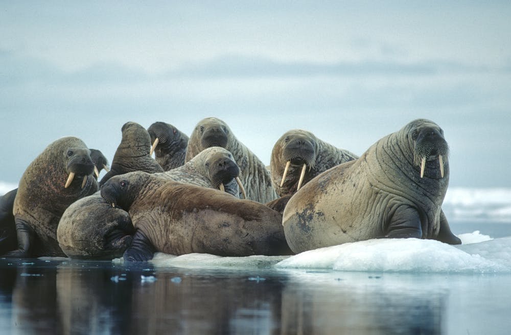
You might be asking the question: so what? Other than some polar bears not being able to hunt in the same way, why does it matter? Perhaps there are even benefits as the previous US secretary of state, Mike Pompeo, once declared – it means ships from Asia can potentially save around 3,000 miles of journey to European ports in summer at least.

But Arctic sea ice is an important component of the climate system. As it dramatically reduces the amount of sunlight absorbed by the ocean, removing this ice is predicted to further accelerate warming, through a process known as a positive feedback. This, in turn, will make the Greenland ice sheet melt faster, which is already a major contributor to sea level rise.

The loss of sea ice in summer would also mean changes in atmospheric circulation and storm tracks, and fundamental shifts in ocean biological activity. These are just some of the highly undesirable consequences and it is fair to say that the disadvantages will far outweigh the slender benefits.


This blog is written by Cabot Institute for the Environment member Jonathan Bamber, Professor of Physical Geography, University of Bristol. This article is republished from The Conversation under a Creative Commons license. Read the original article.

Jonathan Bamber
Jonathan Bamber

Arctic is warming nearly four times faster than the rest of the world – new research

New research estimates that the Arctic may be warming four times faster than the rest of the world.
Netta Arobas/Shutterstock

The Earth is approximately 1.1℃ warmer than it was at the start of the industrial revolution. That warming has not been uniform, with some regions warming at a far greater pace. One such region is the Arctic.

A new study shows that the Arctic has warmed nearly four times faster than the rest of the world over the past 43 years. This means the Arctic is on average around 3℃ warmer than it was in 1980.

This is alarming, because the Arctic contains sensitive and delicately balanced climate components that, if pushed too hard, will respond with global consequences.

Why is the Arctic warming so much faster?

A large part of the explanation relates to sea ice. This is a thin layer (typically one metre to five metres thick) of sea water that freezes in winter and partially melts in the summer.

The sea ice is covered in a bright layer of snow which reflects around 85% of incoming solar radiation back out to space. The opposite occurs in the open ocean. As the darkest natural surface on the planet, the ocean absorbs 90% of solar radiation.

When covered with sea ice, the Arctic Ocean acts like a large reflective blanket, reducing the absorption of solar radiation. As the sea ice melts, absorption rates increase, resulting in a positive feedback loop where the rapid pace of ocean warming further amplifies sea ice melt, contributing to even faster ocean warming.

This feedback loop is largely responsible for what is known as Arctic amplification, and is the explanation for why the Arctic is warming so much more than the rest of the planet.

Blocks of melting sea ice revealing a deep blue sea.
Melting sea ice in the Arctic Ocean.
Nightman1965/Shutterstock

Is Arctic amplification underestimated?

Numerical climate models have been used to quantify the magnitude of Arctic amplification. They typically estimate the amplification ratio to be about 2.5, meaning the Arctic is warming 2.5 times faster than the global average. Based on the observational record of surface temperatures over the last 43 years, the new study estimates the Arctic amplification rate to be about four.

Rarely do the climate models obtain values as high that. This suggests the models may not fully capture the complete feedback loops responsible for Arctic amplification and may, as a consequence, underestimate future Arctic warming and the potential consequences that accompany that.

How concerned should we be?

Besides sea ice, the Arctic contains other climate components that are extremely sensitive to warming. If pushed too hard, they will also have global consequences.

One of those elements is permafrost, a (now not so) permanently frozen layer of the Earth’s surface. As temperatures rise across the Arctic, the active layer, the topmost layer of soil that thaws each summer, deepens. This, in turn, increases biological activity in the active layer resulting in the release of carbon into the atmosphere.

Arctic permafrost contains enough carbon to raise global mean temperatures by more than 3℃. Should permafrost thawing accelerate, there is the potential for a runaway positive feedback process, often referred to as the permafrost carbon time bomb. The release of previously stored carbon dioxide and methane will contribute to further Arctic warming, subsequently accelerating future permafrost thaw.

A second Arctic component vulnerable to temperature rise is the Greenland ice sheet. As the largest ice mass in the northern hemisphere, it contains enough frozen ice to raise global sea levels by 7.4 metres if melted completely.

A man and woman standing on the edge of a flooded coastal road.
The Greenland ice sheet contains enough frozen ice to raise global sea levels by 7.4 metres if completely melted.
MainlanderNZ/Shutterstock

When the amount of melting at the surface of an ice cap exceeds the rate of winter snow accumulation, it will lose mass faster than it gains any. When this threshold is exceeded, its surface lowers. This will quicken the pace of melting, because temperatures are higher at lower elevations.

This feedback loop is often called the small ice cap instability. Prior research puts the required temperature rise around Greenland for this threshold to be be passed at around 4.5℃ above pre-industrial levels. Given the exceptional pace of Arctic warming, passing this critical threshold is rapidly becoming likely.

Although there are some regional differences in the magnitude of Arctic amplification, the observed pace of Arctic warming is far higher than the models implied. This brings us perilously close to key climate thresholds that if passed will have global consequences. As anyone who works on these problems knows, what happens in the Arctic doesn’t stay in the Arctic.The Conversation

——————————

This blog is written by Cabot Institute for the Environment member, Jonathan Bamber, Professor of Physical Geography, University of Bristol.

This article is republished from The Conversation under a Creative Commons license. Read the original article.

Arctic Ocean: why winter sea ice has stalled, and what it means for the rest of the world

Ice floes in the Laptev Sea, Russia.
Olenyok/Shutterstock

Arctic sea ice plays a crucial role in the Earth’s energy balance. It is covered for most of the year by snow, which is the brightest natural surface on the planet, reflecting about 80% of the solar radiation that hits it back out to space.

Meanwhile, the ocean it floats on is the darkest natural surface on the planet, absorbing 90% of incident solar radiation. For that reason, changes in sea ice cover have a big impact on how much sunlight the planet absorbs, and how fast it warms up.

Each year a thin layer of the Arctic Ocean freezes over, forming sea ice. In spring and summer this melts back again, but some of the sea ice survives through the summer and is known as multi-year ice. It’s thicker and more resilient than the sea ice that forms and melts each year, but as the Arctic climate warms – at a rate more than twice that of the rest of the world – this multi-year ice is under threat.

In the last 40 years, multi-year ice has shrunk by about half. At some time in the next few decades, scientists expect the world will see an ice-free Arctic Ocean throughout the summer, with worrying consequences for the rest of the climate system. That prospect got much closer in 2020, due in part to the exceptional summer heatwave that roiled the Russian Arctic.

Shutting down the sea ice factory

The oceans have a large thermal capacity, which means they can store huge amounts of heat. In fact, the top metre of the oceans has about the same thermal capacity as the whole of the atmosphere. Many of us have experienced a balmy afternoon in autumn by the coast even though the air temperature inland is only a few degrees above freezing. That’s because the oceans accumulate heat slowly over the summer, releasing it equally slowly during winter.

So it is with the Laptev Sea, lying north of the Siberian coast. This part of the Arctic Ocean is usually a factory for new sea ice in autumn and winter as air temperatures dip below zero and surface water starts to freeze. That new ice is carried westward by persistent offshore winds in a kind of conveyor belt.

A map of the Laptev Sea with an inset world map.
The Laptev Sea lies off the coast of northern Siberia.
NormanEinstein/Wikipedia, CC BY-SA

This process is powered by the formation of polynyas: areas of open water surrounded by sea ice. Polynas act as engines of new sea ice production by exchanging heat with the colder atmosphere, causing the water to freeze. But if there is no sea ice to start with, the polynya cannot form and the whole process shuts down.

Sea ice in the Laptev Sea reached a record low in 2020, with no new ice through October, later than any previous year in the satellite record. The exceptional summer heatwave across Siberia will have resulted in heat accumulating in the adjacent ocean, which is now delaying the regrowth of sea ice.

In the 1980s, there was as much as 600,000 square kilometres of multi-year ice covering around two thirds of the Laptev Sea. In 2020, it has been ice-free for months with no multi-year ice left at all. The whole Arctic Ocean is heading for ice-free conditions in the future, defined as less than one million square kilometres of ice cover. That’s down from about 8 million square kilometres just 40 years ago. This year’s new record delay in ice formation in the Laptev Sea takes it a step closer.

A rapidly changing Arctic is a global cause for concern. Thawing permafrost releases methane, a greenhouse gas that is about 84 times more potent than CO₂ when measured over 20 years.

Meanwhile, the Greenland Ice Sheet, the largest ice mass in the northern hemisphere, is currently contributing more to sea levels rising than any other source, and has enough ice in it to raise global sea level by 7.4 metres. And if the machinations of a warming Arctic still seem remote, evidence suggests that even the weather across much of the northern hemisphere is heavily influenced by what happens in the rapidly changing roof of the world.The Conversation

————————————-

This blog is written by Cabot Institute member Jonathan Bamber, Professor of Physical Geography, University of BristolThis article is republished from The Conversation under a Creative Commons license. Read the original article.


Jonathan Bamber


Siberia heatwave: why the Arctic is warming so much faster than the rest of the world

Smoke from wildfires cloaks the skies over Siberia, June 23 2020.
EPA-EFE/NASA

On the eve of the summer solstice, something very worrying happened in the Arctic Circle. For the first time in recorded history, temperatures reached 38°C (101°F) in a remote Siberian town – 18°C warmer than the maximum daily average for June in this part of the world, and the all-time temperature record for the region.

New records are being set every year, and not just for maximum temperatures, but for melting ice and wildfires too. That’s because air temperatures across the Arctic have been increasing at a rate that is about twice the global average.

All that heat has consequences. Siberia’s recent heatwave, and high summer temperatures in previous years, have been accelerating the melting of Arctic permafrost. This is the permanently frozen ground which has a thin surface layer that melts and refreezes each year. As temperatures rise, the surface layer gets deeper and structures embedded in it start to fail as the ground beneath them expands and contracts. This is what is partly to blame for the catastrophic oil spill that occurred in Siberia in June 2020, when a fuel reservoir collapsed and released more than 21,000 tonnes of fuel – the largest ever spill in the Arctic.

So what is wrong with the Arctic, and why does climate change here seem so much more severe compared to the rest of the world?

The warming models predicted

Scientists have developed models of the global climate system, called general circulation models, or GCMs for short, that reproduce the major patterns seen in weather observations. This helps us track and predict the behaviour of climate phenomena such as the Indian monsoon, El Niño, Southern Oscillations and ocean circulation such as the gulf stream.

GCMs have been used to project changes to the climate in a world with more atmospheric CO₂ since the 1990s. A common feature of these models is an effect called polar amplification. This is where warming is intensified in the polar regions and especially in the Arctic. The amplification can be between two and two and a half, meaning that for every degree of global warming, the Arctic will see double or more. This is a robust feature of our climate models, but why does it happen?

Fresh snow is the brightest natural surface on the planet. It has an albedo of about 0.85, which means that 85% of solar radiation falling on it is reflected back out to space. The ocean is the opposite – it’s the darkest natural surface on the planet and reflects just 10% of radiation (it has an albedo of 0.1). In winter, the Arctic Ocean, which covers the North Pole, is covered in sea ice and that sea ice has an insulating layer of snow on it. It’s like a huge, bright thermal blanket protecting the dark ocean underneath. As temperatures rise in spring, sea ice melts, exposing the dark ocean underneath, which absorbs even more solar radiation, increasing warming of the region, which melts even more ice. This is a positive feedback loop which is often referred to as the ice-albedo feedback mechanism.

Melting Arctic sea ice is increasing warming in the region.
Jonathan Bamber, Author provided

This ice-albedo (really snow-albedo) feedback is particular potent in the Arctic because the Arctic Ocean is almost landlocked by Eurasia and North America, and it’s less easy (compared to the Antarctic) for ocean currents to move the sea ice around and out of the region. As a result, sea ice that stays in the Arctic for longer than a year has been declining at a rate of about 13% per decade since satellite records began in the late 1970s.

In fact, there is evidence to indicate that sea ice extent has not been this low for at least the last 1,500 years. Extreme melt events over the Greenland Ice Sheet, that used to occur once in every 150 years, have been seen in 2012 and now 2019. Ice core data shows that the enhanced surface melting on the ice sheet over the past decade is unprecedented over the past three and a half centuries and potentially over the past 7,000 years.

In other words, the record-breaking temperatures seen this summer in the Arctic are not a “one-off”. They are part of a long-term trend that was predicted by climate models decades ago. Today, we’re seeing the results, with permafrost thaw and sea ice and ice sheet melting. The Arctic has sometimes been described as the canary in the coal mine for climate breakdown. Well it’s singing pretty loudly right now and it will get louder and louder in years to come.The Conversation

——————————-
This blog is written by Cabot Institute member Jonathan Bamber, Professor of Physical Geography, University of BristolThis article is republished from The Conversation under a Creative Commons license. Read the original article.

Professor Jonathan Bamber

UK science policy in a changing Arctic: The Arctic Circle Assembly 2019

Arctic Circle – the largest international gathering on Arctic issues. Image by Kate Hendry

The Arctic is one of the most rapidly changing regions on Earth. Its lands and oceans are undergoing unprecedented transitions, from permafrost melting to sea ice thinning, and its people are vulnerable to the knock-on effects of climate change.

At the same time, Arctic governments (state, regional and local) are looking towards the future of economic development, broadened participation and connectivity, and improved health and education. All of these socioeconomic and environmental challenges are going on against the background of a complex governance structure and heightened geopolitical pressures.

Harpa, Reykjavik, the location of the Arctic Circle Assembly

Unlike the Antarctic, there is no one treaty or agreement that underpins Arctic governance, which is instead reliant on the Arctic Council and a plethora of bilateral and multilateral agreements.

The Arctic Circle is a not-for-profit organisation that forms the largest “network of international dialogue and cooperation on the future of the Arctic”, with the ambitious aim to promote open discussion between state and non-state players, including the private sector, universities, think tanks, environmental and conservation associations, Indigenous communities, and interested members of the public.

L-R: Henry Burgess, Head of the UK Arctic Office; Rosa Degerman, UK Science and Innovation Network in Finland; and Tatiana Iakovleva UK Science and Innovation Network in Russia

As part of a PolicyBristol project, joint with the UK Arctic Office (under the Natural Environment Research Council) and UK Science and Innovation, I was fortunate to attend the Arctic Circle Assembly in Reykjavik this October. I was thrust into a steep learning curve of Arctic governance and policy strategies from representatives of governments (from Arctic states, to non-Arctic countries such as Switzerland, Singapore and Japan), devolved authorities (including the first ever panel discussion with Greenland’s first generation of representative diplomats, and the announcement of Scotland’s Arctic policy document), and NGOs.

All of these policy announcements and discussions were focused around the dual themes of sustainable development and environmental protection, with the ever present shadow of rapid climatic change.

Private sector representatives with an interest in the Arctic included companies promoting their climate change solutions, from renewables to climate altering technologies (or geoengineering), from manipulating glaciers, to restoring Arctic sea ice, to fixing carbon dioxide in rocks.

There were also powerful and inspiring talks from Indigenous peoples’ representatives, emphasising the desire for self-determination (“Nothing about us without us”) and the essential need to co-produce strategies towards sustainable development and scientific endeavours, embracing full collaboration with Indigenous rights holders and respecting their cultural heritage.

And scientists can play their part. The IPPC special report on the oceans and cryosphere in a changing climate (SROCC published in September 2019) brought together thousands of peer-reviewed publications across natural and social sciences, highlighting the current threats to the polar regions. The SROCC featured heavily in the Assembly – mentioned by most policy makers’ presentations – and a focus of a dedicated discussion session with the leading authors of the polar regions chapter.

However, one of the challenges faced by the report authors was the limitation within the IPCC framework of using only peer-reviewed materials. The vast majority of Indigenous Knowledge (IK) is not written in peer-reviewed journal articles, leaving us with the question of how these vital approaches can be incorporated in the future.

The changing Arctic will have profound impacts not only on the ecosystems and communities of the Arctic states, but will be felt globally through climate teleconnections and an growing global economy. The solutions to climatic change are complex, and need multiple strategies, unified international cooperation, co-production with local communities, evidence-based policy decisions, and scientific diplomacy.

However, different stakeholders and rights holders have different governance structure and different priorities. Forums such as the Arctic Circle Assembly can start to bring everyone together to the debating table, but there is still a need to make sure that the good intentions are followed through with substantive action.

——————————–
This blog was written by Cabot Institute member Kate Hendry, an Associate Professor in Geochemistry at the University of Bristol, School of Earth Sciences, and member of the UK Arctic and Antarctic Partnership. With thanks to Henry Burgess (UK Arctic Office) and Michael Meredith (British Antarctic Survey). This blog was republished with kind permission from PolicyBristol. View the original blog.

Unless we regain our historic awe of the deep ocean, it will be plundered

File 20171107 1017 1vsenhn.jpg?ixlib=rb 1.1
Image credit: BBC Blue Planet

In the memorable second instalment of Blue Planet II, we are offered glimpses of an unfamiliar world – the deep ocean. The episode places an unusual emphasis on its own construction: glimpses of the deep sea and its inhabitants are interspersed with shots of the technology – a manned submersible – that brought us these astonishing images. It is very unusual and extremely challenging, we are given to understand, for a human to enter and interact with this unfamiliar world.The most watched programme of 2017 in the UK, Blue Planet II provides the opportunity to revisit questions that have long occupied us. To whom does the sea belong? Should humans enter its depths? These questions are perhaps especially urgent today, when Nautilus Minerals, a mining company registered in Vancouver, has been granted a license to extract gold and copper from the seafloor off the coast of Papua New Guinea. Though the company has suffered some setbacks, mining is still scheduled to begin in 2019.

Blue Planet’s team explore the deep. Image credit BBC/Blue Planet

This marks a new era in our interaction with the oceans. For a long time in Western culture, to go to sea at all was to transgress. In Seneca’s Medea, the chorus blames advances in navigation for having brought the Golden Age to an end, while for more than one Mediterranean culture to travel through the Straits of Gibraltar and into the wide Atlantic was considered unwisely to tempt divine forces. The vast seas were associated with knowledge that humankind was better off without – another version, if you will, of the apple in the garden.

If to travel horizontally across the sea was to trespass, then to travel vertically into its depths was to redouble the indiscretion. In his 17th-century poem Vanitie (I), George Herbert writes of a diver seeking out a “pearl” which “God did hide | On purpose from the ventrous wretch”. In Herbert’s imagination, the deep sea is off limits, containing tempting objects whose attainment will damage us. Something like this vision of the deep resurfaces more than 300 years later in one of the most startling passages of Thomas Mann’s novel Doctor Faustus (1947), as a trip underwater in a diving bell figures forth the protagonist’s desire for occult, ungodly knowledge.

An early diving bell used by 16th century divers. National Undersearch Research Program (NURP)

Mann’s deep sea is a symbolic space, but his reference to a diving bell gestures towards the technological advances that have taken humans and their tools into the material deep. Our whale-lines and fathom-lines have long groped into the oceans’ dark reaches, while more recently deep-sea cables, submarines and offshore rigs have penetrated their secrets. Somewhat paradoxically, it may be that our day-to-day involvement in the oceans means that they no longer sit so prominently on our cultural radar: we have demystified the deep, and stripped it of its imaginative power.

But at the same time, technological advances in shipping and travel mean that our culture is one of “sea-blindness”: even while writing by the light provided by oil extracted from the ocean floor, using communications provided by deep-sea cables, or arguing over the renewal of Trident, we perhaps struggle to believe that we, as humans, are linked to the oceans and their black depths. This wine bottle, found lying on the sea bed in the remote Atlantic, is to most of us an uncanny object: a familiar entity in an alien world, it combines the homely with the unhomely.

Wine bottle found in the deep North Atlantic. Laura Robinson, University of Bristol, and the Natural Environment Research Council. Expedition JC094 was funded by the European Research Council.

For this reason, the activities planned by Nautilus Minerals have the whiff of science fiction. The company’s very name recalls that of the underwater craft of Jules Verne’s adventure novel Twenty Thousand Leagues under the Seas (1870), perhaps the most famous literary text set in the deep oceans. But mining the deep is no longer a fantasy, and its practice is potentially devastating. As the Deep Sea Mining Campaign points out, the mineral deposits targeted by Nautilus gather around hydrothermal vents, the astonishing structures which featured heavily in the second episode of Blue Planet II. These vents support unique ecosystems which, if the mining goes ahead, are likely to be destroyed before we even begin to understand them. (Notice the total lack of aquatic life in Nautilus’s corporate video: they might as well be drilling on the moon.) The campaigners against deep sea mining also insist – sounding not unlike George Herbert – that we don’t need the minerals located at the bottom of the sea: that the reasons for wrenching them from the deep are at best suspect.

So should we be leaving the deep sea well alone? Sadly, it is rather too late for that. Our underwater cameras transmit images of tangled fishing gear, cables and bottles strewn on the seafloor, and we find specimens of deep sea animals thousands of metres deep and hundreds of kilometres away from land with plastic fibres in their guts and skeletons. It seems almost inevitable that deep sea mining will open a new and substantial chapter on humanity’s relationship with the oceans. Mining new resources is still perceived to be more economically viable than recycling; as natural resources become scarcer, the ocean bed will almost certainly become of interest to global corporations with the capacity to explore and mine it – and to governments that stand to benefit from these activities. These governments are also likely to compete with one another for ownership of parts of the global ocean currently in dispute, such as the South China Sea and the Arctic. The question is perhaps not if the deep sea will be exploited, but how and by whom. So what is to be done?

A feather star in the deep waters of the Antarctic. BBC NHU
Rather than declaring the deep sea off-limits, we think our best course of action is to regain our fascination with it. We may have a toe-hold within the oceans; but, as any marine scientist will tell you, the deep still harbours unimaginable secrets. The onus is on both scientists and those working in what has been dubbed the “blue humanities” to translate, to a wider public, the sense of excitement to be found in exploring this element. Then, perhaps, we can prevent the deep ocean from becoming yet another commodity to be mined – or, at least, we can ensure that such mining is responsible and that it takes place under proper scrutiny.
The sea, and especially the deep sea, will never be “ours” in the way that tracts of land become cities, or even in the way rivers become avenues of commerce. This is one of its great attractions, and is why it is so easy to sit back and view the deep sea with awed detachment when watching Blue Planet II. But we cannot afford to pretend that it lies entirely beyond our sphere of activity. Only by expressing our humility before it, perhaps, can we save it from ruthless exploitation; only by acknowledging and celebrating our ignorance of it can we protect it from the devastation that our technological advances have made possible.-
——————————-
This blog is written by Laurence Publicover, Lecturer in English, University of Bristol and Katharine Hendry, Reader in Geochemistry, University of Bristol and both members of the University’s Cabot Institute. This article was originally published on The Conversation. Read the original article.

Good Mooring!

Since the late 1990s, scientists at the Norwegian Polar Institute (NPI) have conducted annual cruises across the Fram Strait: the widest, deepest and most important exit point for sea ice in the Arctic. One of the main aims of the Fram Strait cruise (FS2015) is to recover, service and redeploy a sprinkling of oceanographic moorings- current profiling instruments and buoys tethered to hundreds of meters of cable, anchored to the seafloor. These have been continuously measuring the velocities of water masses within the East Greenland Current at preset depths. With continuous data over decadal timescales, the NPI are hoping to understand how the nature of the Arctic freshwater budget changes in an increasingly warming climate, how this will impact biological processes, and how it will affect other water masses on a broader scale as they interact in new ways.

1 of 6 oceanographic moorings being recovered for
servicing on FS2015.  Image credit: Laura de Steur /
Norwegian Polar Institute

I was lucky enough to lend a helping hand this September; my second cruise with the NPI after having had a blast working on the Norwegian Young Sea ICE 2015 (N-ICE2015) cruise for a month back in April 2015. After flying into Longyearbyen, Svalbard, and seeing the Research Vessel Lance waiting in the harbour for a second time, it felt very odd not seeing the ship surrounded by 1.3m thick pack-ice, which is how I’d left it after N-ICE2015. It wasn’t until I dropped my bag off in my cosy cabin and heard the familiar roar of the engines warming up (and having my room located right at the back of the ship I really mean roar…) that it felt like I was returning to my home away from home.

The mooring aspect of the cruise this time introduced a different dimension of risks that had to be accommodated: namely by the presence of sea ice above many of the moorings that needed to be recovered. This gave us an occupational risk that obviously only presents itself at the poles! On the N-ICE2015 cruise the engine didn’t have a huge part to play as we were passively drifting with the Arctic pack ice. This time round, whilst navigating the ice floes across Fram Strait towards Eastern Greenland, the Lance was actively smashing through and breaking up the ice above mooring sites to ensure that the mooring returned to the surface without being blocked on its ascent. As ice coverage can alter rapidly, it’s up to chance whether or not these moorings will be readily accessible. In the best case, there will be little to no coverage, so one only has to send a command to the mooring via radio signaling and the cable is released and brought to the surface- buoys and instruments attached. In a moderate case, ice will be extensive enough that the ship will have to meander round, breaking up the ice floes as best it can. For this reason underlying current speed and ascent rate of the mooring has to be considered carefully. It’s always a tense minute or two waiting for the buoys and expensive instrumentation to reach the surface, knowing it may never arrive if it gets stuck on an unfortunately located ice floe! In the worst case, the floes will be so thick and expansive that the mooring recovery process may have to be abandoned all together. For this reason, daily satellite images of ice extent were a very valuable necessity.

As well as observing the physical properties of the Atlantic and Polar Waters spilling southward into the Atlantic, extensive tracer sampling took place at and around the mooring locations by way of collecting water at standard depths. While it is common practice for oceanographers to measure parameters like salinity soon after the water is collected (the on-board salinometer quickly became a very close friend of mine, with 528 samples needing to be analysed during the cruise!) other tracers such as coloured dissolved organic matter (CDOM), nutrients, and 18Oxygen isotope will be analysed ashore. These tracers can tell us something about the source of this water, and by looking at its isotopic composition whether it comes from melted sea ice or from other meteoric sources- that is, water derived from precipitation and runoff. Precipitated water at high latitudes is strongly depleted in 18O, while sea ice meltwater is slightly enriched in it. By looking at the mass of ice loss in the Arctic and how much of it is flowing through the Fram Strait year after year, we’re able to gauge how much is entering the Atlantic or staying in the Arctic basin [1].

The thickness of the ice flowing through Fram Strait has decreased by about 1/3 since 1990 [2]. Part of this melting is related to inflowing, relatively warm Atlantic waters travelling northwards via the West Spitsbergen Current. However, the amount of melt-water that is exported through Fram Strait hasn’t changed very significantly in the past decade. Evidence suggests that the melt water is being stored in the Beaufort gyre- a clockwise-rotating mass of water in the Arctic [3]. While the flux of melt-water into the Arctic Basin has increased in the past couple of decades, tracer analyses tell us the main mechanisms by which fresh water is supplied is by runoff from North American and Eurasian rivers, and by relatively fresh Pacific inflow through the Bering Strait, between Russia and Alaska [1].

The large-scale circulation around the Arctic Ocean.
Figure: Paul Dodd / Norwegian Polar Institute.

It is possible that with inter-annual changes in Arctic wind forcing this growing reservoir of cold, fresh water could be directed southwards across Fram Strait, where it could disrupt the thermohaline circulation of the Atlantic.

Routine sea ice stations were also carried out on suitable ice floes, giving us the chance to stretch our legs and take some ice cores for further tracer sampling. Once analysed, these will allow us to see how the chemical compositions compare with that of the underlying waters. Working 6-hours on, 6-hours off could get pretty exhausting, so it was nice to unwind with the occasional sled race across the floe or by sharpening our ‘selfie skills’ to let the world of social media know how our research was going. All in the name of science…
The FS2015 team and I (centre), exploring an ice floe.
———————————————
This blog is by Adam Cooper, Earth Sciences graduate at the University of Bristol.

Floes, leads and CTD’s: The state of the ice at 83°

The air at 82° 23’ North is crisp and still, and the afternoon sun blazes down on the ice floe we hope to call home for the next three months. The gentle hum of the Research Vessel (R/V) Lance’s engine some 300 metres away, and the regular click of the winch deploying our oceanographic profilers below the ice sheet, breaks the all-consuming silence in this seemingly barren wilderness. A walkie-talkie crackles into life from my pocket; a message from the ship! Norwegian isn’t my strong point, but one word in particular causes my ears to prick up in concern: ‘Isbjørn’, or, ‘Polar Bear’. For those aboard the Lance, this is a prime opportunity to grab a camera and be the envy of all their friends back home. For those of us ambling about on the ice, away from the cosy confines of our floating laboratory, pulses quicken as we try to withdraw our equipment without compromising the all-important data…

Constructing hole for on-ice CTD (Image
credit: Torbjørn Taskjelle, UiB)

The Norwegian Young Sea Ice Cruise (N-ICE2015) is a truly international effort, with researchers from over a dozen institutions coming together to gather data from the Arctic ice cap, as well as the surrounding atmospheric and oceanic currents. Initiated by the Norwegian Polar Institute, the R/V Lance plans to drift with the sea ice for six months, from January to June 2015. After a brief hiatus in Svalbard to change crew in March, I was able to join the ship as it steamed back into the ice, where it would get ‘refrozen’ for the remainder of the expedition.

It was never going to be plain sailing from Longyearbyen to our target latitude of 83° North. Battling against the wind, snow and pack ice in increasingly treacherous conditions had left those seeking warmer climes to put the ship’s impressive DVD collection to good use! That being said, efforts to measure this dynamic polar wilderness were already being undertaken from the offset.

Atmospheric scientists have been releasing weather balloons twice per day to profile the troposphere and stratosphere. Biologists collected water samples as we skimmed over the continental shelf off Svalbard, in order to divulge information on the bloom of primary producers found in shallower waters at this time of year. I managed to get better acquainted with my new friend for the month: the Conductivity-Temperature-Depth instrument, or CTD, which is deployed through the water to measure parameters such as salinity and temperature. With this information we can look at the width and depth of contrasting water masses, allowing us to track their progress at specific points.

As a member of the physical oceanography work package, I’m interested in how warm, salty Atlantic water, formed in the tropics off the eastern United States, travels north into the Arctic basin, and how its heat is distributed in the colder Arctic waters. By measuring the turbulence and temperature flux of this relatively shallow ‘tongue’ of Atlantic water (approximately 200m deep), I hope to glean information regarding how this may affect the melting of overlying sea ice.

Currently, the oceanographic models we have for the Arctic concern multi-year ice: that is, perennial ice that is built upon year after year. Now that this is being replaced by seasonal, or first-year ice, which is chemically and physically distinct to the longer-lived variety, the existing models are due for renewal. This cruise is particularly exciting, as data throughout the winter months are rare. Seeing how water masses affect, and respond to, a new first-year ice regime over this 6 month timescale is of paramount importance for the synthesis of more up-to-date heat exchange models.

Polar
bear inspecting our (thoroughly displaced!) survey line.
(Image credit: Markus
Kayser, AWI)

Working directly on the sea ice comes with its challenges. The Lance has been drifting in a predominantly southwestern direction towards Fram Strait, between Greenland and Svalbard where the majority of wind and ocean currents leave the Arctic. Accompanied by increasing temperatures, ice floe disintegration is a very real occupational hazard. It is a relief to gaze out the window every morning and see our little world still intact, though occasional cracks (or ‘leads’) through the ice threaten to tear our playground apart in a matter of minutes. Hundreds of metres of power cable have had to be hauled back onto the boat on more than one occasion, over where cracks spread, revealing the inky blue abyss of the ocean below.

Then we have the bears. Curious onlookers for the most part, we’ve managed to avoid any potential run-ins unscathed, thanks to our compulsory bear-guard system (pray that this continues!). Not all our equipment has been so lucky, with chewed cables and scuffed buoys occasionally appearing overnight. Though, with a chance to see these bumbling giants in their rapidly diminishing habitat, I’d still have jumped at the chance to work on the Lance even if it was as the dishwasher!

—————————————
This blog is written by Adam Cooper, recent Earth Sciences graduate at the University of Bristol.
Adam Cooper (right)

More information

Professor Dame Julia Slingo: Modelling climate risk

When Professor Dame Julia Slingo visited the Cabot Institute last week, her message was clear: We need to look at climate risk in real world contexts.

Dame Julia was in the city to receive a Cabot Institute Distinguished Fellowship, which involved giving a talk about her work as a world leading meteorologist and Chief Scientist at the Met Office.

One of the first things she highlighted was that climate change isn’t isolated from other pressures like population growth and limited resources, so we need to understand the risks it poses in a real world context. We need to define the effects it may have on the security of food, water, health and energy around the world, and use the science as a guide to define an evidence-based and cost effective plan of action going forward. This, she said, is “one of the greatest challenges of the 21st century”.

Are we making extreme weather worse?

Today, the huge global population boom is putting an ever increasing strain on limited resources like land and water, which are also at risk from the cyclical climate variations that occur naturally. The big and controversial question is whether climate change caused by human activity has exacerbated the problem.

Dame Julia described an annual report produced by the American Meteorological Society (AMS) that analyses extreme weather events around the world each year, aiming to determine whether the effects were magnified by anthropogenic climate change. As she pointed out, it is important that we recognise that not every bit of bad weather can be attributed to climate change, however the AMS often do find that we have played a role in making the situation worse.

One example she picked out was 2012’s Hurricane Sandy, which killed 233 people across eight countries in central and north America. The AMS report found that if sea level had been at the level that it was 50 years ago, the devastating effects of the storm would not have been as bad. It also suggested that continuing on our current path of climate change will mean minor storms will have increasingly severe impacts, leading to Sandy-level hurricanes more frequently in the future.

“We need a more nuanced discussion”

Last year was the warmest on UK record, making a total of 8 out of 10 of our hottest years having occurred since 2002. While of course there is variability in our climate from year to year and even decade to decade, intricate scientific climate models have shown that these record-breaking UK temperatures are made ten times more likely due to anthropogenic climate change.

While we may prefer a hot summer, temperatures don’t change uniformly across the entire planet. Worryingly, the Arctic is warming twice as fast as the rest of the planet, leading to a huge decrease in the amount of sea ice cover and corresponding sea level rise, which is already threatening communities living on low lying islands. Dame Julia reminded us all that it’s not as simple as trying to prevent a 2°C global temperature increase. The danger that climate change poses depends on who you are and where you live, and we need models to show what the risks will be.

Predicting climate risk

So how can we predict what the effects of climate change will be across the world? It begins with having a sophisticated model of the current global system. The Met Office has led decades of climate modelling, producing incredibly sophisticated simulations of climate systems on both short term (weather) and long term (climate change) scales.

I was absolutely amazed by the intricacy of these models. Millions of lines of computer code recreate the true physical nature of the planet, to the extent where large scale meteorological patterns like El Niño are emergent properties of the model, that is to say that they are a result of the basic physics encoded in the model, rather than being specifically programmed into it.

By altering the model with new data taken from the present extent of climate change or its predicted level in the future, the Met Office can model the global response at incredible resolution, showing the specific risks posed with increasingly detailed clarity (while still incorporating the inherent uncertainties present in all models). These models can then be used to test potential mitigation approaches and of course inform the global communities of the dangers they face.

What can we do?

Dame Julia explained that her role as Chief Scientist is to determine the needs of the people around the world, their risk tolerance and the information they require to make their own decisions. Science, she says, has a lot to offer in enabling governments to make wise, informed and efficient decisions with how best to spend their funds within the wider context of other societal issues, upholding the global securities of food, water, health and energy for the future.

Flooded Pakistan


Image: “There is no evidence to counter the basic premise that a warmer world will lead to more intense daily and hourly rain events” – Professor Dame Julia Slingo


—————————————-
This blog is written by Cabot Institute member Sarah Jose, Biological Sciences, University of Bristol.


Sarah Jose