Equity, diversity and inclusivity at sea

In summer 2017 – for the first time that we know of! – all three of the main UK ships, the RRS Discovery (pictured, with Kate’s ICY-LAB science team!), the RRS James Cook and the RRS James Clark Ross were out at the same time on expeditions, all led by female chief scientists.
Today, we can celebrate a strong representation of women in sea-going science in the United Kingdom, providing positive role models and mentors to encourage and support early career female marine scientists. However, women continue to face challenges to their progression in their careers, especially those who are also members of other underrepresented groups. 

Dr Kate Hendry led a group of women from around the UK from a range of career stages and backgrounds, who are all active or recently active in sea-going research, with the aim of writing a discussion of equity, diversity and inclusivity (EDI) issues in UK marine science. The group has recently published an article in Ocean Challenge with a focus on both successes in gender equality over the last few decades and lessons learned for improving diversity of sea-going science further and more broadly into the future.

Some of the earliest female career marine scientists in the UK started off in fisheries research in the early twentieth century, including Rosa Lee (1884-1976), who was the first woman to graduate in Maths from Bangor University and the first woman to be employed by the Marine Biological Association. She worked at the Lowestoft Laboratory (that later became the Centre for Environment, Fisheries and Aquaculture Science, Cefas), and published highly-renowned articles including in Nature. “All of this, whilst never being allowed to step foot on a research vessel, and having to leave her employment in the civil service when she got married”, commented Dr Hendry.

Rosa Lee, one of the first female UK marine scientists, in a group of staff at the Marine Biological Association’s Lowestoft laboratory in 1907(Photo courtesy of Cefas)

Dr Hendry added: “As a science community, we’ve come a long way in terms of gender balance and representation, not only in the top science jobs but also in other roles at sea including crew and marine technicians. We wanted to document the history of how these changes happened, and whether any of the pathways to gender equity could be transferred to tackling other forms of underrepresentation in UK marine science, at all career levels”.

The article ends with some firm recommendations to the community to improve sea-going EDI into the future, including the formation of a special interest group by the UK marine science organisation, The Challenger Society, and guidance to the Natural Environment Research Council (NERC) for additional training, financial support, and recognition.

—————————-

Cabot Institute member Dr Kate Hendry is an Associate Professor in the School of Earth Sciences at the University of Bristol.

Dr Kate Hendry


Siberia heatwave: why the Arctic is warming so much faster than the rest of the world

Smoke from wildfires cloaks the skies over Siberia, June 23 2020.
EPA-EFE/NASA

On the eve of the summer solstice, something very worrying happened in the Arctic Circle. For the first time in recorded history, temperatures reached 38°C (101°F) in a remote Siberian town – 18°C warmer than the maximum daily average for June in this part of the world, and the all-time temperature record for the region.

New records are being set every year, and not just for maximum temperatures, but for melting ice and wildfires too. That’s because air temperatures across the Arctic have been increasing at a rate that is about twice the global average.

All that heat has consequences. Siberia’s recent heatwave, and high summer temperatures in previous years, have been accelerating the melting of Arctic permafrost. This is the permanently frozen ground which has a thin surface layer that melts and refreezes each year. As temperatures rise, the surface layer gets deeper and structures embedded in it start to fail as the ground beneath them expands and contracts. This is what is partly to blame for the catastrophic oil spill that occurred in Siberia in June 2020, when a fuel reservoir collapsed and released more than 21,000 tonnes of fuel – the largest ever spill in the Arctic.

So what is wrong with the Arctic, and why does climate change here seem so much more severe compared to the rest of the world?

The warming models predicted

Scientists have developed models of the global climate system, called general circulation models, or GCMs for short, that reproduce the major patterns seen in weather observations. This helps us track and predict the behaviour of climate phenomena such as the Indian monsoon, El Niño, Southern Oscillations and ocean circulation such as the gulf stream.

GCMs have been used to project changes to the climate in a world with more atmospheric CO₂ since the 1990s. A common feature of these models is an effect called polar amplification. This is where warming is intensified in the polar regions and especially in the Arctic. The amplification can be between two and two and a half, meaning that for every degree of global warming, the Arctic will see double or more. This is a robust feature of our climate models, but why does it happen?

Fresh snow is the brightest natural surface on the planet. It has an albedo of about 0.85, which means that 85% of solar radiation falling on it is reflected back out to space. The ocean is the opposite – it’s the darkest natural surface on the planet and reflects just 10% of radiation (it has an albedo of 0.1). In winter, the Arctic Ocean, which covers the North Pole, is covered in sea ice and that sea ice has an insulating layer of snow on it. It’s like a huge, bright thermal blanket protecting the dark ocean underneath. As temperatures rise in spring, sea ice melts, exposing the dark ocean underneath, which absorbs even more solar radiation, increasing warming of the region, which melts even more ice. This is a positive feedback loop which is often referred to as the ice-albedo feedback mechanism.

Melting Arctic sea ice is increasing warming in the region.
Jonathan Bamber, Author provided

This ice-albedo (really snow-albedo) feedback is particular potent in the Arctic because the Arctic Ocean is almost landlocked by Eurasia and North America, and it’s less easy (compared to the Antarctic) for ocean currents to move the sea ice around and out of the region. As a result, sea ice that stays in the Arctic for longer than a year has been declining at a rate of about 13% per decade since satellite records began in the late 1970s.

In fact, there is evidence to indicate that sea ice extent has not been this low for at least the last 1,500 years. Extreme melt events over the Greenland Ice Sheet, that used to occur once in every 150 years, have been seen in 2012 and now 2019. Ice core data shows that the enhanced surface melting on the ice sheet over the past decade is unprecedented over the past three and a half centuries and potentially over the past 7,000 years.

In other words, the record-breaking temperatures seen this summer in the Arctic are not a “one-off”. They are part of a long-term trend that was predicted by climate models decades ago. Today, we’re seeing the results, with permafrost thaw and sea ice and ice sheet melting. The Arctic has sometimes been described as the canary in the coal mine for climate breakdown. Well it’s singing pretty loudly right now and it will get louder and louder in years to come.The Conversation

——————————-
This blog is written by Cabot Institute member Jonathan Bamber, Professor of Physical Geography, University of BristolThis article is republished from The Conversation under a Creative Commons license. Read the original article.

Professor Jonathan Bamber

Innovating for sustainable oceans


University of Bristol’s Cabot Institute researchers come together for the oceans’ critical decade

World Oceans Day 2020 – the start of something big

Since 1992, World Oceans Day has been bringing communities and countries together on 8 June to shine a light on the benefits we derive from – and the threats faced by – our oceans. But this year, there’s an even bigger event on the horizon. One that may go a long way to determining our planet’s future, and which researchers at the Cabot Institute for the Environment intend to be an integral part of.

From next year, the United Nations launches its Decade of Ocean Science for Sustainable Development, a major new initiative that aims to “support efforts to reverse the cycle of decline in ocean health”.

Oceans are of enormous importance to humans and all life on our planet – they regulate our climate, provide food, help us breathe and support worldwide economies. They absorb 50 times more carbon dioxide than our atmosphere, and sea-dwelling phytoplankton alone produce at least half the world’s oxygen. The OECD estimates that three billion people, mostly in developing countries, rely on the oceans for their livelihoods and that by the end of the decade, ocean-based industry, including fishing, tourism and offshore wind, may be worth $3 trillion of added economic value.

A decade to decide the future of our oceans

But ocean health is ailing. The first World Ocean Assessment in 2016 underlined the extent of the damaging breakdown of systems vital to life on Earth. As the human population speeds towards nine billion and the effects of our global climate crisis and other environmental stressors take hold, “Adaptation strategies and science-informed policy responses to global [ocean] change are urgently needed,” states the UN.

By announcing a Decade of Ocean Science, the UN recognises the pressing need for researchers everywhere and from all backgrounds to come together and deliver the evidence base and solutions that will tackle these urgent ocean challenges. At the Cabot Institute, we kicked off our support for that vision a year early by holding our first Ocean’s Workshop.

Cabot Institute Ocean’s Workshop – seeing things differently

From our diverse community of hundreds of experts seeking to protect the environment and identify ways of living better with our changing planet, we brought together researchers from a wide range of specialisms to explore how we might confront the challenges of the coming decades. The University of Bristol has recently appointed new experts in geographical, biological and earth sciences, as well as environmental humanities, who are experienced in ocean study, so, excitingly, we had a pool of new, untapped Caboteers to connect with.

During a fast-paced and far-reaching workshop, we shared insights and ideas and initiated some potentially highly valuable journeys together.

Biogeochemists helped us consider the importance of the oceans’ delicately balanced nutrient cycle that influences everything from ecosystems to the atmosphere, biologists shared their work on invertebrate vision and the impact of anthropogenic noise on dolphins and other species, and literature scholars helped us understand how the cultural significance and documentation of the oceans has evolved throughout history, altering our relationship with the seas.

We highlighted how Marine Protected Areas (MPAs) deliver mixed results based on regional differences and outdated assumptions – individual MPAs are siloed, rarely part of a more holistic strategy, and rely on data from the 1980s which fail to account for much faster-than-predicted changes to our oceans since then. Our ocean modellers noted the lack of reliable, consistent and joined-up observational data on which to base their work, as well as the limitations of only being able to model the top layers of the ocean, leaving the vast depths beneath largely unexplored. And the fruitful link between biological and geographical sciences was starkly apparent – scientists measuring the chemical composition of oceans can collaborate with biologists who have specialist knowledge about species tipping points, for example, to mitigate and prioritise society’s responses to a variety of environmental stressors.

Collaboration creates innovation

One overriding message arose again and again though – the power of many, diverse minds coming together in a single mission to engage in pioneering, solutions-focused research for our oceans. Whether it’s the need for ocean scientists to work more closely with the social scientists who co-create with coastal communities or the interdisciplinary thinking that can resolve maritime noise and light pollution, protecting our oceans requires us to operate in more joined-up ways. It is the work we conduct at this intersection that will throw new light on established and emerging problems. We can already see so many opportunities to dive into.

So, as we celebrate World Oceans Day and look ahead to a critical Decade of Ocean Science, it’s our intention to keep connecting inspiring people and innovative ideas from many seemingly disparate disciplines and to keep doing so in a way that delivers the research we need for the oceans we want.

——————————
This blog was written by Chris Parsons on behalf of the Oceans Research Group at the Cabot Institute for the Environment.

Antarctica: Why are we here again?

The ship’s roll reaches 19° and everything falls off the desk, nearly followed by me off my chair if it weren’t for an evasive leap to one side. My roommate wakes with a start as the curtains around his bed have flung themselves open. “What are you doing?” he asks, in a confused state. Aside from the fact that everything falling off the desk was the weather’s fault, not mine, his question is a good one.

What are a team of 20 scientists, mostly from the UK, doing out here in the Southern Ocean? Surely there’s somewhere closer to home we could measure the sea. The main aim of this research cruise is to understand the process of deep water formation around Antarctica. First, let me briefly explain what deep water formation is and why it’s important in about 300 words. To understand this, the most important thing to remember is that water becomes denser when it is colder and/or when it is saltier. I think they teach that in GCSE science; if they don’t, they should.

Deep water formation

Antarctica is pretty cold, obviously. Where we are now, the sea temperature is around 1 °C. If we were to go further south or wait until winter, the sea will approach its freezing point of around -2 °C, forming sea ice. That’s a little colder than normal water, which freezes at 0 °C, because the sea is salty. However, when the sea freezes to form sea ice, the salt from the water is not incorporated into the ice – the salt that was in the sea water is left behind, making the remaining water a little bit saltier. As a result, the water close to the sea ice edge is both cold and salty compared to the rest of the world’s oceans, and therefore is denser than most of the rest of the world’s oceans. Dense water sinks below less dense water, and so the deepest water at the bottom of the oceans around the world all comes from around Antarctica.

Southern Ocean sea ice
Sea ice drifting close to the tip of the Antarctic Peninsula

When the water is at the surface of the sea, it can absorb heat and gases, including carbon dioxide, from the atmosphere. When deep water formation occurs, this heat and carbon dioxide can be drawn down into the depths of ocean, where it will stay for 1000 years or so. The research cruise I am on now wants to measure the amount of deep water formation occurring so we can better understand how much heat and carbon dioxide is being taken up by the ocean, which helps understand how much the climate will change in the future with global warming. That’s why we are here, basically, instead of the Bristol Channel.

Chlorofluorocarbons

Our team, based at the University of Exeter, are specifically measuring CFCs in the water. CFCs (chlorofluorocarbons) are manmade gases that were used for many industrial and commercial processes for a few decades before people realised they were destroying ozone in the atmosphere. This was creating a hole in the Earth’s ozone layer in the stratosphere over Antarctica and the Southern Hemisphere. Ozone is important for absorbing some of the Sun’s strong and damaging ultraviolet radiation before it reaches the Earth’s surface. Excessive ultraviolet radiation causes sunburn and skin cancer in humans, so people were concerned about the ozone hole when it was discovered in the 1980s. As a result, all nations of the world agreed the Montreal Protocol to stop producing CFCs that were destroying the ozone layer. Although this was a geopolitical and diplomatic success story, the ozone hole is only slowly showing signs of recovering and some CFCs still seem to be increasing (presumably suggesting some illegal production of them still occurs). However, luckily the ozone hole is no longer getting bigger and it is mostly contained to the very high Southern Hemisphere. Don’t worry, I brought plenty of factor 50 for my pasty Irish skin.

The reason we are measuring CFCs, however, is not actually to understand what they are doing to the ozone layer. We care about CFCs because they are manmade gases that are not naturally found in the atmosphere or ocean. This allows them to be used to trace ocean circulation and processes such as deep water formation. Let me explain how.

Jetsam

Since setting off from the Falklands five weeks ago, we have seen two manmade things: a ship on the horizon and some rusty metal oil barrels floating around amongst a heavy scattering of icebergs. The ship was a fishing boat, not far from the Falklands or Punta Arenas, so was not too surprising. The oil barrels however, were a bit more unexpected. They were floating right in the middle of the Weddell Sea, almost as far from civilisation as they could be. There were at least four of them, however they weren’t lashed together like some sort of raft made by Tom Hanks, they were all floating individually within a few hours steam of each other.

586B1783
Oil barrel floating in the Weddell Sea, originally dumped around 6,000 km away (image credit: Hugh Venables, BAS)

The most curious thing about these barrels, however, is that when we were able to zoom in on a photo taken of one with a camera with a good telephoto lens, we could see their origin. They had writing and the branding from Operation Deepfreeze, a US mission to set up an Antarctic base in the Ross Sea in the 1950s. After initially being surprised at seeing any litter in the pristine Southern Ocean, we had to question how these barrels got here. The Ross Sea is on the entire other side of the Antarctic continent, around 6,000 km away by sea.

The Operation Deepfreeze base was built on the Ross Ice Shelf. This is thick ice that has flown out from the glaciers on land to create an area the size of France floating over the Ross Sea. Although this ice is very thick and reasonably slow moving, it is not permanent and does break off from time to time to form huge icebergs. The same process has formed some icebergs that have made the news recently, including one berg a quarter of the size of Wales and a potential berg break off that is threatening to take the British Antarctic Survey’s Halley research station with it. Well, presumably the old dumping ground from Operation Deepfreeze has at some stage broken off from the Ross Ice Shelf, floated halfway around the Southern Ocean carried by the Antarctic Circumpolar Current and been taken into the Weddell Sea gyre, where it melted and broke up, scattering all the rubbish into the Weddell Sea.

Just like these oil barrels can be used to trace how the ocean’s surface currents circulate (a similar story involves a spilt shipping container of rubber ducks in the Pacific Ocean in 1992), looking at where manmade gases such as CFCs end up in the deep ocean can tell us how the deep water formation takes water from the surface to depth. To measure the CFCs, we first take samples using a probe known as a CTD (which stands for Conductivity Temperature Depth). This probe has 24 bottles on it as well as instruments for measuring of salinity, temperature and other water properties. The probe is lowered to the bottom of the ocean (which around here can be more than 6 km deep) and as it is brought back up to the surface, the 24 bottles are closed at different depths. When the CTD arrives back on the ship’s deck, we then have samples of water from 24 depths through the ocean at that particular location. Over the course of the cruise, we will be carrying out around 100 CTDs.

CTD sunset
Sampling using the CTD (lowered by winch off the side of the ship) continues morning, noon and night, meaning we work 12 hour shifts

With the water brought up in the bottles, our team takes a 500 ml sample from each and we store them in a walk-in fridge on the ship. We then analyse one sample at a time, which takes about 20 minutes using a custom-built machine that strips all the gases out of the water and calculates the amount of CFCs it contains. This setup for measuring CFCs is in its own portable lab, built in a shipping container that it strapped onto the aft deck of the James Clark Ross. While it’s pretty time-consuming running 100 CTDs with 24 bottles each taking 20 minutes (I calculate that to be more than 33 days of continually running the machine, assuming no delays) at least we have a good view from our container out over the wildlife and icebergs of the Southern Ocean.

JCR container whale watching
Our CFC lab inside a shipping container, strapped onto the aft deck, as we sail by the South Orkney Islands

Other science

Besides our team measuring CFCs, other scientists are also using the water from the CTD to analyse oxygen isotopes, nutrient content, pH and microbes. When the CTD comes on deck, there is usually a bit of a mad scramble as everyone gets water for their own analysis, with a strict pecking order as who gets to take their water first. For maximum inconvenience, usually the CTD comes up just before dinner or lunch, just to make sampling that little bit more frantic.

P1120403
Taking water samples for analysis from the 24 bottles on the CTD once it is back on deck (image credit: Charel Wohl, PML)

As well as measuring water from depth using the CTD, other scientists on the ship also continually measure the air and surface sea water as we sail. The air measurements, taken from the very front of the ship so not to get contaminated by exhaust or air conditioning fumes, must be measuring some of the cleanest air in the world. It’s pretty nice to stand up there and breathe it in, although it’s often accompanied by a blizzard of snow and biting wind, which makes the experience slightly less enjoyable.

We also have deployed some floats that will continue to measure the salinity and temperature of the sea here for the next five years or so. Using a gas bladder, these floats can adjust their density so they rise and sink through the ocean, measuring continually as they go. Every time these floats get back to the surface, they send their data back via a satellite connection. Although they don’t measure as much stuff as the scientists on the ship (for example, they don’t measure CFCs), they will be here all year round so keep making measurements through the winter. The ship on the other hand will have to retreat from the sea ice before the winter sets in, in case we end up repeating Shackleton’s antics with the Endurance. Which is fine with me because, interesting as it is, I don’t really fancy a further 6 months down here in the dark.

JCR float launch 2
A float being deployed, which will continue to make measurements through the winter and for years after we leave

——————————————-
This blog is part of a blog series from Antarctica by Alan Kennedy-Asser, who has recently completed his PhD at the University of Bristol. This blog has been republished with kind permission from Alan. View the original blog. You can follow Alan on Twitter @EzekielBoom.

Alan Kennedy-Asser

Read part one of Alan’s Antarctica blog series – Antarctica: Ship life
Read part two of Alan’s Antarctica blog series – Antarctica: Why are we here again?
Read part three of Alan’s Antarcica blog series: Antarctica: Looking back

Antarctica: Ship life

The RRS James Clark Ross docked in the Falkland Islands

Blinking blurry eyes, I crack open the curtains and gaze out into the bright light of a new day. A hulking white and blue iceberg gazes back at me. Even after a broken night’s sleep being shunted from one side of my bunk to the other as the ship bounces through swell, that still makes a rewarding start to each day. Through an unexpected turn of events, I’ve found myself on the British Antarctic Survey’s RRS James Clark Ross, on a seven-week long research cruise helping researchers from the University of Exeter take samples and measure CFCs in the Weddell Sea. Having just handed in my PhD thesis – after four years of studying and researching Antarctic climate and hearing the question “do you get to go to Antarctica?” countless times – the opportunity to help out on this cruise was too good an opportunity to pass up. Life on a ship gives you plenty of time to think (and write), but I promise to keep these musings brief in three posts: ship life; the science and why we’re here; and how the real thing compares to a PhD. 
—————————————-
This is my first experience of life on a ship. Previously, my most extensive experience of boat life was the eight hours on the Stena Line from Liverpool to Belfast, so I shall use that as my reference frame. Stena Line regularly ask you to fill out feedback forms and rate your experience to have the chance to win back the cost of your trip, so I shall do the same here (although as usual I don’t expect to win anything).

How did you find the booking procedure?

Stena Line have a fast and efficient website for making and managing bookings. Signing up for the research cruise was also pretty straight forward, although that was likely aided by me having done a PhD in Antarctic-related science and knowing someone at the British Antarctic Survey (BAS) who forwarded me the advert. I emailed the lead scientist from Exeter saying I was interested, we had a chat on Skype then I had to confirm that my PhD supervisors at Bristol were happy for me to go.

Generally, however, beyond that point there was a bit more faff than booking the Stena Line. BAS require quite a few forms filling out, some of which require a bit more homework, including passing a medical examination and a sea survival course. The authentic personal sea survival certificate had to be presented on getting on the boat before sailing. In contrast, the Stena Line rarely even ask for ID (although I suppose this might change after Brexit).

Stena Line: 5/5
James Clark Ross: 3/5

How did you find the check-in procedure?

The check-in for the Stena is remarkably simple, and as mentioned they rarely even ask for ID. Getting onto the James Clark Ross was logistically more complicated, requiring flights from Heathrow to Madrid, Madrid to Santiago in Chile, and Santiago to Punta Arenas. Although this journey took more than 24 hours, I still preferred it to driving in the rain up the M5 and M6 from Bristol, as I got free food and could watch films. Punta Arenas is also nicer than Birkenhead and I found the language barrier easier to overcome in Chile (Scouse can be very confusing at times).

Stena Line: 3/5
James Clark Ross: 4/5

Exploring the Magellanic forest above Punta Arenas

How did you find the cabins (if applicable)?

Getting a cabin on the Stena Line is not necessary, particularly if travelling during the day time sailing. The last time I travelled on the night time crossing, however, the cabin was not overly satisfactory with uncomfortable beds, an unclean bathroom and a broken soap dispenser. Stena customer services subsequently refunded the cost of the cabin. On the James Clark Ross, the cabins are slightly smaller than the Stena Line, however, there is ample storage space, the beds are pretty comfortable and there are privacy curtains for each bunk, which is good when you are on slightly different work shifts to your roommate. The biggest complaint about the James Clark Ross is that it makes many strange noises and rocks a lot more in the heavy weather, which can keep you up a lot of the night. These noises include a high-pitched wail which is either the stabiliser system or sirens luring us to our watery graves. The latter seems more likely.

Stena Line: 1/5
James Clark Ross: 3/5

How did you find the food onboard?

The Stena’s Met Grill is renowned for its fried breakfast and hearty lunch and dinner menu. The portion sizes are good, however, the prices are also a bit steep. On the James Clark Ross, three square meals a day are available (including midnight dinner service for those on night shifts), with lunch and dinner both offering 3+ courses. Because of how my shift patterns work out, it doesn’t make sense to get up for breakfast, so I just eat a 3-course lunch and dinner each day. Remarkably, over 4 weeks since we left, there is still fresh fruit and some salad on the go. The variety has been good, and they also have included some of the classics off the Stena Line menu, including fish and chips (most Fridays), curry (every Saturday) and Swedish meatballs. Although I have also had Swedish meatballs on the Stena, I have never tried authentic (Ikea) Swedish meatballs to know which is closer to the real deal.

Stena Line: 4/5
James Clark Ross: 5/5

How did you find the onboard shopping?

The shop onboard the Stena Line is pretty awful. They sell head phones if you forgot yours, which is about the only thing I have ever bought from it. They also sell some magazines and over-priced toys in case you didn’t realise the crossing was 8 hours and find yourself going slightly insane. The shop on the James Clark Ross, called the bond, is stocked with James Clark Ross branded clothing, toiletries, chocolate bars and some odds and ends like postcards and plaques. Unfortunately, as the ship is nearing the end of its working life for BAS, being replaced next year by the RRS Sir David Attenborough (of Boaty McBoatface fame), none of the branded clothing is being restocked. That means the only things that are left are in sizes XXL or age 7-8, neither of which are much use to me.

Stena Line: 1/5
James Clark Ross: 1/5

How did you find the onboard entertainment and facilities?

Both ships have a bar. The James Clark Ross bar is extremely cheap, however, many of the beers are about six months past their best before dates, which can result in ‘bowel roulette’ the following day. A worthwhile sacrifice if you’re unemployed like me. The lounge area is remarkably similar between both boats and is comfortable enough. The internet connection is much better on the Stena, although they possibly harvest your personal data in the process of providing it. On the James Clark Ross, they have to commit some of the internet to facilitate the science (boring), so the bandwidth for personal connections is not as strong.

Besides the gambling machines, the Stena Line’s main attraction is the cinema, which can be good if they have a decent film being shown. On the James Clark Ross, although they do not have a dedicated cinema room, they have a huge selection of DVDs and an endless supply of films available on people’s laptops which can all be put through a projector. There are also loads of board games and a few musical instruments onboard too, which are nice to have a jam on and facilitated a St Patrick’s Day gig and ceilidh dance. Although the James Clark Ross has a greater range of entertainment available, the Stena Line only has to keep you amused for 8 hours, not 7 weeks, so this one is a tight run context. Luckily when you have to work 12 hour shifts, you don’t have much time for entertainment.

Stena Line: 3/5
James Clark Ross: 4/5

St Patrick’s Day decorations in the bar

Would you recommend this crossing to a friend?

Usually my answer to this is ‘yes’ for the Stena Line. It’s a handy way of getting to England from Belfast, saving the drive through North Wales and up from Dublin. Admittedly there’s not much to see in the Irish Sea except the odd shearwater and the Isle of Mann, but generally the crossing is smooth because of the size of the ship (around 185m long) even when the weather is bad. On the James Clark Ross, the research cruise route very much agrees with the old saying ‘The adventure is in the journey, not the destination’. We are analysing a transect through the Southern Ocean and Weddell Sea and end at 57.5°S, 30°E, which is precisely in the middle of nowhere (go ahead and look it up on Google Maps). Although we don’t end anywhere in particular, the route has been spectacular at times: we’ve sailed past a number of sub-Antarctic islands, countless colossal icebergs, seen penguins on land, in the sea and on ice, had dolphins, fin whales, and humpbacks right by the ship (the latter breaching dramatically at times) and had regular, effortless fly-bys from wandering albatrosses and other seabirds great and small. The weather has been mixed and as the ship is 100m long it feels the swell a bit more than the Stena, however, the seas so far have been much more merciful than I had expected.

Humpbacks taking a breath, Coronation Island, South Orkneys

As exciting as it is to see the Isle of Mann and the Mourne Mountains, on the whole, I would say Antarctica just about tops the Irish Sea. Sorry Stena Line. Although, for health and safety reasons I’m sure the crew of the Stena Mersey are happy enough to not have to dodge all of these icebergs.

Stena Line: 4/5
James Clark Ross: 5/5

—————————–
This blog is part of a blog series from Antarctica by Alan Kennedy-Asser, who has recently completed his PhD at the University of Bristol. This blog has been republished with kind permission from Alan. View the original blog. You can follow Alan on Twitter @EzekielBoom.

Alan Kennedy-Asser

Read part one of Alan’s Antarctica blog series – Antarctica: Ship life
Read part two of Alan’s Antarctica blog series – Antarctica: Why are we here again?
Read part three of Alan’s Antarcica blog series: Antarctica: Looking back

Putting algae and seaweed on the menu could help save our seafood

File 20171213 27593 sfv3nk.jpg?ixlib=rb 1.1
Shutterstock
This article was written by Pallavi AnandThe Open University and Daniela SchmidtUniversity of Bristol Cabot Institute. 


If we have to feed 9.8 billion people by 2050, food from the ocean will have to play a major role. Ending hunger and malnutrition while meeting the demand for more meat and fish as the world grows richer will require 60% more food by the middle of the century.But around 90% of the world’s fish stocks are already seriously depleted. Pollution and increasing levels of carbon dioxide (CO₂) in the atmosphere, which is making the oceans warmer and more acidic, are also a significant threat to marine life.There is potential to increase ocean food production but, under these conditions, eating more of the species at the top of the food chain, such as tuna and salmon, is just not sustainable. As a recent EU report highlighted, we should instead be looking at how we can harvest more smaller fish and shellfish, but also species that aren’t as widely eaten such as seaweed and other algae.The oceans have absorbed around one third of the CO₂ emitted into the atmosphere since the Industrial Revolution. The absorbed CO₂ goes through a series of chemical reactions that form carbonic acid and lower the pH of the water. These reactions also reduce the concentration of carbonate ions, which are vital for those creatures that grow external skeletons such as corals and shellfish.

The acid and the lack of carbonate mean these organisms form weaker skeletons and have to use more energy to do so, leaving less energy for growth and reproduction. Consequently, they up smaller in size. Aside from the impact this has on shellfish, several of the species affected, such as corals in the tropics or coralline algae in the waters around the UK, also play a key role in providing food and nursing grounds for fish. And less fish food leads to fewer fish for us to catch.

Climate change is affecting food production

The impact of ocean acidification varies widely across the globe. But it is already affecting marine food production, particularly of shellfish. For example, CO₂-rich water along the west coast of the US means more oysters in local hatcheries are dying when they are still larvae.
Warmer seas due to climate change are also affecting food supplies. Some species are moving towards the poles in search of cooler water, forcing fishermen into more northerly waters or leaving them without stocks altogether. Some fishing fleets in northern locations will find more fish available but many will see the amount of fish available to catch fall by between 6% and 30% depending on the region. The biggest impact will be on areas that are already the most dependent on fishing, such as Southeast Asia and West Africa.

One possible solution is to eat more smaller fish and shellfish such as mussels. Large fish need to eat smaller fish to grow. If we eat smaller fish instead then we remove a step from the food chain and reduce the amount of energy lost in the process. What’s more, it might become easier to farm these smaller fish because the algae, cyanobacteria and other plankton they eat could actually benefit from warmer waters and higher levels of CO₂ in the atmosphere. This is because they get their energy from photosynthesis and so use CO₂ like fuel.

Spirulina, the new seafood cocktail.
Shutterstock

It might also be possible to take this a step further and add some of these organisms directly to our diet, giving us an abundant new source of food. Seaweed, for example, is a type of algae that has been eaten for centuries, but only 35 countries commercially harvest it today. Spirulina cyanobacteria is already eaten as a food supplement and several companies are trying to turn other forms of algae into a human food source.

Farming these organisms in the right way could even help counter some of the effects of climate change on the rest of the food chain. For example, growing more seaweed lowers the amount of CO2 in the surrounding water, reduces acidification, and improves the environment for oysters and other shellfish. Managing seaweed harvest correctly will also maintain the dissolved oxygen and nutrient levels in the water, contributing to the overall health of the ocean.

The ConversationMaking algae a common part of more people’s diets won’t be easy. We need to ensure that any new algae food products on our dinner plates have the needed nutritional value but are also attractive and safe to eat. But sticking with our traditional salmon and tuna diet isn’t sustainable. Expanding our seafood menus could be a vital way of keeping the ocean healthy while it supplies the food we need.
Pallavi Anand, Lecturer in Ocean Biogeochemistry, The Open University and Daniela Schmidt, Professor in Palaebiology, University of Bristol

This article was originally published on The Conversation. Read the original article.

Sea and Sky

I’ve always loved the sea. Pursuing a major in oceanography led me to chose a degree in Physics and it was I realised that studying the atmosphere was just as, amazing, if not more so! I therefore decided to pursue a PhD in atmospheric sciences. But once the sea captures you, it never really lets you go. That is how I found myself between the sea and sky.


Several years ago, a group of like-minded friends and I decided to start an NGO, based in Croatia, called Deep Blue Explorers that would focus on marine and atmospheric sciences and research. That task proved to be extremely challenging as getting the funding we needed to start our adventures seemed to be a little harder than we had anticipated. However, we were fortunate enough and, after a very rough first season, we started to collaborate with Operation Wallacea who design and implement biodiversity and conservation management research expeditions with university and high school students from all over the world.


At the same time, we started collaborating with another Croatian NGO called 20.000 Leagues who have over 10 years of experience in marine research. Together, we are running the Adriatic Ecology Course that aims to bring together scientists and experts from all over the world to give international students a hands-on experience of field work and high-quality research. The course takes place in the National Park of Mljet and the research includes fish, sea urchin and sea grass surveys. Additionally, the students conduct boat monitoring in Lokva bay, three times a day, in order to record the pressure of
boats anchoring in the Bay.
 

The expedition is supported by scientific lectures regarding conservation in the Adriatic; the ecosystem and biodiversity of the island of Mljet; sustainability; research methods and global challenges such as marine pollution. The students also have the opportunity to be involved in workshops to discuss conservation and global challenges issues and to take part in personal and professional development training activities that focus on sustainability and protection of marine life.
 

It is an amazing experience for everyone and the students leave the Island with a new understanding and new appreciation of the ecology Island of Mljet, the contribution of the National Park regarding conservation and the need and importance of supporting the National Park’s efforts.
 

As for me, being able to work both with the sea and the sky, I can just say, I have never been happier!


Blog post by Eleni Michalopoulou. Eleni is currently a PhD student in the department of Chemistry and part of the ACRG Group. Her PhD focuses on studying the PFCs CF4 and C2F6. A physicist by training with a major in Oceanography, environment and meteorology she has spend most of her early career working on marine conservation, microplastics oceanography and Atmospheric dynamics.  She is one of the lecturers of the Sustainable Development open unit and one of the lead educators for Bristol Futures and the Sustainable Futures pathway. Her scientific interests cover a variety of topics such as climate change, conservation, sustainability, marine and Atmospheric Sciences.

Ancient ‘dead seas’ offer a stark warning for our own near future

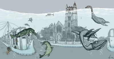
Bristol during the pleiocene as envisaged by Lucas Antics.

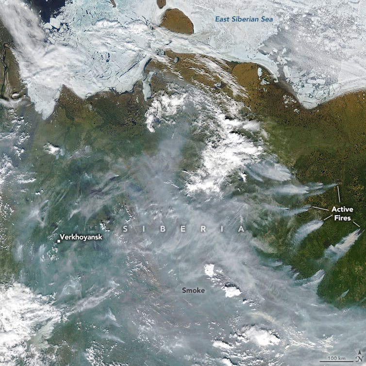
The oceans are experiencing a devastating combination of stresses. Rising CO2 levels are raising temperatures while acidifying surface waters.  More intense rainfall events, deforestation and intensive farming are causing soils and nutrients to be flushed to coastal seas. And increasingly, the oceans are being stripped of oxygen, with larger than expected dead zones being identified in an ever broadening range of settings. These dead zones appear to be primarily caused by the runoff of nutrients from our farmlands to the sea, but it is a process that could be exacerbated by climate change – as has happened in the past.

Recently, our group published a paper about the environmental conditions of the Zechstein Sea, which reached from Britain to Poland 270 million years ago. Our paper revealed that for tens of thousands of years, some parts – but only parts – of the Zechstein Sea were anoxic (devoid of oxygen). As such, it contributes to a vast body of research, spanning the past 40 years and representing the efforts of hundreds of scientists, which has collectively transformed our understanding of ancient oceans – and by extension future ones.

The types of processes that bring about anoxia are relatively well understood. Oxygen is consumed by animals and bacteria as they digest organic matter and convert it into energy. In areas where a great deal of organic matter has been produced and/or where the water circulation is stagnant such that the consumed oxygen cannot be rapidly replenished, concentrations can become very low. In severe cases, all oxygen can be consumed rendering the waters anoxic and inhospitable to animal life.  This happens today in isolated fjords and basins, like the Black Sea.  And it has happened throughout Earth history, allowing vast amounts of organic matter to escape degradation, yielding the fossil fuel deposits on which our economy is based, and changing the Earth’s climate by sequestering what had once been carbon dioxide in the atmosphere into organic carbon buried in sediments.

Red circles show the location and size of many dead zones. Black dots show Ocean dead zones of unknown size. Image source: Wikimedia Commons/NASA Earth Observatory

In some cases, this anoxia appears to have been widespread; for example, during several transient Cretaceous events, anoxia spanned much of what is now the Atlantic Ocean or maybe even almost all of the ancient oceans. These specific intervals were first identified and named oceanic anoxic events in landmark work by Seymour Schlanger and Hugh Jenkyns.  In the 1970s, during the earliest days of the international Deep Sea Drilling Program (now the International Ocean Discovery Program, arguably the longest-running internationally coordinated scientific endeavor), they were the first to show that organic matter-rich deep sea deposits were the same age as similar deposits in the mountains of Italy. Given the importance of these deposits for our economy and our understanding of Earth and life history, scientists have studied them persistently over the past four decades, mapping them across the planet and interrogating them with all of our geochemical and palaeontological resources.

In my own work, I have used the by-products of certain bacterial pigments to interrogate the extent of that anoxia.  The organisms are green sulfur bacteria (GSB), which require both sunlight and the chemical energy of hydrogen sulfide in order to conduct a rather exotic form of bacterial photosynthesis; crucially, hydrogen sulfide is only formed in the ocean from sulfate after the depletion of oxygen (because the latter yields much more energy when used to consume organic matter). Therefore, GSB can only live in a unique niche, where oxygen poor conditions have extended into the photic zone, the realm of light penetration at the very top of the oceans, typically only the upper 100 m.  However, GSB still must compete for light with algae that live in even shallower and oxygen-rich waters, requiring the biosynthesis of light harvesting pigments distinct from those of plants, the carotenoids isorenieratene, chlorobactene and okenone. For the organism, this is an elegant modification of a molecular template to a specific ecological need. For the geochemist, this is an astonishingly fortuitous and useful synthesis of adaptation and environment – the pigments and their degradation products can be found in ancient rocks, serving as molecular fossil evidence for the presence of these exotic and diagnostic organisms.

And these compounds are common in the black shales that formed during oceanic anoxic events.  And in particular, during the OAE that occurred 90 million years ago, OAE2, they are among the most abundant marker compounds in sediments found throughout the Atlantic Ocean and the Tethyan Ocean, what is now the Mediterranean Sea.  It appears that during some of these events anoxia extended from the seafloor almost all the way to the ocean’s surface.

********

Today, the deep sea is a dark and empty world. It is a world of animals and Bacteria and Archaea – and relatively few of those. Unlike almost every other ecosystem on our planet, it is bereft of light and therefore bereft of plants.  The animals of the deep sea are still almost entirely dependent on photosynthetic energy, but it is energy generated kilometres above in the thin photic zone. Beneath this, both animals and bacteria largely live off the scraps of organic matter energy that somehow escape the vibrant recycling of the surface world and sink to the twilight realm below. In this energy-starved world, the animals live solitary lives in emptiness, darkness and mystery. Exploring the deep sea via submersible is a humbling and quiet experience.  The seafloor rolls on and on and on, with only the occasional shell or amphipod or small fish providing any evidence for life.

“Krill swarm” by Jamie Hall – NOAA. Licensed under Public Domain via Wikimedia Commons

And yet life is there.  Vast communities of krill thrive on the slowly sinking marine snow, can appear.  Sperm whales dive deep into the ocean to consume the krill and emerge with the scars of fierce battles with giant squid.  And when one of those great creatures dies and its carcass plummets to the seafloor, within hours it is set upon by sharks and fish, ravenous and emerging from the darkness for the unexpected feast. Within days the carcass is stripped to the bones but even then new colonizing animals arrive and thrive. Relying on bacteria that slowly tap the more recalcitrant organic matter that is locked away in the whale’s bones, massive colonies of tube worms spring to life, spawn and eventually die.

But all of these animals, the fish, whales, tube worms and amphipods, depend on oxygen. And the oceans have been like this for almost all of Earth history, since the advent of multicellular life nearly a billion years ago.

This oxygen-replete ocean is an incredible contrast to the north Atlantic Ocean during at least some of these anoxic events. Then, plesiosaurs, ichthyosaurs and mosasaurs, feeding on magnificent ammonites, would have been confined to the sunlit realm, their maximum depth of descent marked by a layer of surprisingly pink and then green water, pigmented by the sulfide consuming bacteria.  And below it, not a realm of animals but a realm only of Bacteria and Archaea, single-celled organisms that can live in the absence of oxygen, a transient revival of the primeval marine ecosystems that existed for billions of years before more complex life evolved.

We have found evidence for these types of conditions during numerous events in Earth history, often associated with major extinctions, including the largest mass extinction in Earth history – the Permo-Triassic Boundary 252 million years ago.  Stripping the ocean of oxygen and perhaps even pumping toxic hydrogen sulfide gas into the atmosphere is unsurprisingly associated with devastating biological change.   It is alarming to realise that under the right conditions our own oceans could experience this same dramatic change.  Aside from its impact on marine life, it would be devastating for us, so dependent are we on the oceans for our food.

The conventional wisdom has been that such extreme anoxia in the future is unlikely, that Cretaceous anoxia was a consequence of a markedly different geography.  North America was closer to Europe and South America only completely rifted from Africa about 150 million years ago; the ancient Atlantic Ocean was smaller and more restricted, lending itself to these extreme conditions.

And yet questions remain.  What was their trigger?  Was it really a happenstance of geography?  Or was it due to environmental perturbations? And how extensive were they? The geological record preserves only snapshots, limiting the geographical window into ancient oceans, and this is a window that narrows as we push further back in time. In one of our recent papers, we could not simulate such severe anoxia in the Atlantic Ocean without also simulating anoxia throughout the world’s oceans, a truly global oceanic anoxic event.  However, that model can only constrain some aspects of ocean circulation and there are likely alternative mechanisms that confine anoxia to certain areas.

************

Over the past twenty years, these questions have intersected one another and been examined again and again via new models, new geochemical tools and new ideas.  And an emerging idea is that the geography of the Mesozoic oceans was not as important as we have thought.

That classical model is that ancient oceans, through a combination of the aforementioned restricted geography and overall high temperatures, were inherently prone to anoxia.  In an isolated Atlantic Ocean, oxygen replenishment of the deep waters would have been much slower.  This would have been exaggerated by the higher temperatures of the Cretaceous, such that oxygen solubility was lower (i.e. for a given amount of oxygen in the atmosphere, less dissolves into seawater) and ocean circulation was more sluggish. Consequently, these OAEs could have been somewhat analogous to the modern Black Sea.  The Black Sea is a restricted basin with a stratified water column, formed by low density fresh water derived from the surrounding rivers sitting stably above salty and dense marine deep water. The freshwater lid prevents mixing and prevents oxygen from penetrating into deeper waters. Concurrently, nutrients from the surrounding rivers keep algal production high, ensuring a constant supply of sinking organic matter, delicious food for microbes to consume using the last vestiges of oxygen.  The ancient oceans of OAEs were not exactly the same but perhaps similar processes were operating. Crucially, the configuration of ancient continents in which major basins were isolated from one another, suggests a parallel between the Black Sea and the ancient North Atlantic Ocean.

But over the past twenty years, that model has proved less and less satisfactory.  First, it does not provide a mechanism for the limited temporal occurrence of the OAEs.  If driven solely by the shape of our oceans and the location of our continents, why were the oceans not anoxic as the norm rather than only during these events? Second, putative OAEs, such as that at the Permo-Triassic Boundary occur at times when the oceans do not appear to have been restricted.  Third, coupled ocean-atmosphere models indicate that although ocean circulation was slower under these warmer conditions, it did not stop.

But also, as we have looked more and more closely at those small windows into the past, we have learned that during some of these events anoxia was more restricted to coastal settings.  And that brings us back to the Zechstein Sea. We mapped the extent of anoxia at an unprecedented scale in cores drilled by the Polish Geological Survey, and we discovered an increasing abundance of GSB molecular fossils in rocks extending from the carbonate platform and down the continental slope, suggesting that anoxia had extended out into the wider sea.  But when we reached the deep central part of the basin, the fossils were absent.  In fact, the sediments contained the fossils of benthic foraminifera, oxygen dependent organisms living at the seafloor, and the sediments had been bioturbated, churned by ancient animals. The green sulfur bacteria and the anoxia were confined to the edge of the basin, completely unlike the Black Sea.  This is not the first such observation and this is consistent with new arguments mandating not only a different schematic but also a different trigger.  And perhaps that trigger was from outside of the oceans.

If the trigger was not solely a restriction of oxygen supply then the alternative is that it was an excess of organic matter, the degradation of which consumed the limited oxygen. A likely source of that organic matter and one that is consistent with restriction of anoxia to ocean margins is a dramatic increase in nutrients that stimulated algal blooms – much like what is occurring today.  And that increase in nutrients, as elegantly summarized by Hugh Jenkyns, could have been caused by an increase in erosion and chemical weathering, driven by higher carbon dioxide concentrations, global warming and/or changes in the hydrological cycle, all of which we now know occurred prior to several OAEs. And again, similar to what is occurring today.

It is likely that today’s coastal dead zones are due not to climate change but to how we use our land and especially to our excess and indiscriminate use of fertilisers, most of which does not help crops grow or enhance our soil quality but is instead washed away to pollute our rivers and coastal seas. And yet that only underscores the lessons of the past.  They suggest that global warming might exacerbate the impacts of our poor land management, adding yet another pressure to an already stressed ecosystem.

Runoff of soil and fertiliser  during a rain storm. Image source: Wikimedia Commons

The Zechstein Sea study is not the key to this new paradigm (and that ‘paradigm’ is far from settled).  There is probably no single study that marked our change in understanding.  Instead, this new model has been gradually emerging over nearly 20 years, as long as I have been studying these events. New geochemical data, such as the distribution of nutrient elements, suggest that many of these anoxic episodes, whether local or global, were associated with algal blooms.  And other geochemical tools, such as the isotopic composition of trace metals, provide direct evidence for changes in the chemical weathering that liberated the bloom-fueling nutrients.

Science can move in monumental leaps forward but more typically it evolves in small steps. Sometimes, after years of small steps, your understanding has fundamentally changed. And sometimes that change means that your perception of the world, the world you love and on which you depend, has also changed.  You realize that it is more dynamic than you thought – as is its vulnerability to human behaviour.
——————————

This blog is by Prof Rich Pancost, Director of the Cabot Institute at the University of Bristol
A shortened version of this blog can be found on The Conversation.

Prof Rich Pancost

This blog has also appeared in IFL Science and The Ecologist.

Public debates in science: Where’s the balance?

Earth Science PhD student Peter Spooner shares his experiences after working as a science-policy intern at the British Library, struggling to achieve scientific balance in a politically charged debate.

Greenpeace’s Will McCallum talks to Barrie Deas of the NFFO at TalkScience.
© The British Library Board

Anyone who follows any kind of environmental science will be aware of the differences in the ways that science can be portrayed – be it in the news, in TV shows, on the radio or at public events. As an organiser/reporter, a debate is often a good way to make your event/article more interesting, and there are almost always different points of view clamouring to be heard. It is often straightforward for a scientist specialising in a topic to point to a media debate of the issue and say: ‘That debate did not represent the scientific position’. However, as I discovered during my recent internship at the British Library, trying to organise a properly balanced debate is very difficult and may not always be the goal to which every debate aspires.

The British Library’s TalkScience series are discussion-style events focussing on topical issues in science. Past events have included topics such as: climate change and extreme weather; the impact of pesticides on bees; genetic modification on the farm and many more, all topics with relevance to political/social issues as well as science. When designing my event, my oceanographic background (along with having a scuba diver’s love for all things marine) led me to choose the title ‘Fishing and Marine Protection: What’s the Catch?’ The discussion would focus on the increasing pressure under which we are placing our marine environment and the impacts that has on the life beneath the waves and the fishermen above them.

A catchy title and puns galore adorned my mock up flyer for the event. But what about the speakers? Could I (or should I) make this event balanced? How could I (realising that I have a somewhat biased view of the topic) avoid ‘false balance’, especially when I am not a fisheries expert? I was able to invite three speakers and one chair person; a great number for a small discussion event, but hardly enough for a truly fair and balanced debate – a debate not just on the science of fisheries and marine conservation, but the political, economic and social aspects too. It was clear I needed at least one scientist, but since the discussion was not to be simply about science but about policy as well, I couldn’t just have scientists on the panel. Further considerations were whether those I asked to speak could eloquently handle the job, were prominent enough to lend weight to their arguments, and whether it would be possible to get a diverse panel. As if these considerations weren’t enough, I also had to think carefully about how I wanted the event to run. For example, if a conservation scientist were to speak alone opposite a fisheries representative then the conversation may not have been entirely constructive. It was important to me to try and generate a discussion that left people in a positive frame of mind, or with some good ideas to take away.

In the event, this latter goal took precedence over scientific (or political) balance, especially since those are so difficult to achieve with so few speakers and with my non-expert knowledge of the subject. It was important to me to include panellists and audience members from all the stakeholder groups interested in fishing and marine protection, to have a healthy debate, and to get everyone talking in a friendly atmosphere. Dr. Alasdair Harris, director of the charity Blue Ventures and one of our panellists, summed up the event by saying: “Change is about relationships, and change is about dialogue and understanding perspectives.” We certainly heard some different perspectives during the event, from conservation scientist Professor Calum Roberts advocating for strongly protected marine reserves, fisheries representative Barrie Deas highlighting the difficulties that conservation policies can cause fishermen, to Alasdair’s view that engaging with fishermen is the key to ensuring successful ocean protection and sustainable fisheries. The speakers (and audience members) were able to address each of these perspectives leading to a good degree of balance in the discussion.

A very useful inclusion in this regard was that of having a chairperson (Dr. Helen Scales) who was both trained in media communication and an expert in the scientific field. These skills allowed Helen to use her scientific knowledge to make sure any controversial points were challenged, and her communication experience to drive a positive discussion and engage the audience. Perhaps by using this system more often – with a subject expert acting as chair – we could better avoid situations where non-scientists are able to derail debates by simply denying the science. With science seen as the building block and basis of the discussion, rather than as one side of the debate, we could hope to remove the impact of unrealistic scepticism and focus instead on how we use what we know to inform policy and to drive change.

If you would like to learn more about fishing and marine protection, you can listen to the highlights of the event in this British Library podcast below. The whole event is also available as a video on Youtube, and you can learn about the history of fishing in the British Library science blog. If you would like to hear about future TalkScience events you can check the British Library website or follow @ScienceBL on Twitter.


—————————————

This blog is written by Cabot Institute member Peter Spooner from the School of Earth Sciences at the University of Bristol.  Peter’s research focuses on deep-sea corals and climate.

The closing date for applying to next year’s round of RCUK internships is Friday 28 August 2015, apply here if you are interested.

Deep impact – the plastic on the seafloor; the carbon in the air

We live in a geological age defined by human activity.  We live during a time when the landscape of the earth has been transformed by men, its surface paved and cut, its vegetation manipulated, transported and ultimately replaced. A time when the chemical composition of the atmosphere, the rivers and the oceans has been changed – in some ways that are unique for the past million years and in other ways that are unprecedented in Earth history. In many ways, this time is defined not only by our impact on nature but by the redefinition of what it means to be human.

From a certain distance and perspective, the transformation of our planet can be considered beautiful. At night, the Earth viewed from space is a testament to the ubiquitous presence of the human species: cities across the planet glow with fierce intensity but so do villages in Africa and towns in the Midwest; the spotlights of Argentine fishing boats, drawing anchovies to the surface, illuminate the SW Atlantic Ocean; and the flames of flared gas from fracked oil fields cause otherwise vacant tracts of North Dakota to burn as bright as metropolises.

Environmental debates are a fascinating, sometimes frustrating collision of disparate ideas, derived from different experiences, ideologies and perspectives.  And we learn even from those with whom we disagree.  However, one perspective perpetually bemuses and perplexes me: the idea that it is impossible that man could so transform this vast planet. Of course, we can pollute an estuary, cause the Cuyahoga River to catch fire, turn Victorian London black or foul the air of our contemporary cities.  We can turn the Great Plains into cornfields or into dust bowls, the rainforest into palm oil plantations, swamplands into cities and lowlands into nations.  But these are local.  Can we really be changing our oceans, our atmosphere, our Earth that much?

Such doubts underly the statements of, for example, UKIP Energy Spokesman Roger Helmer:

‘The theory of man-made climate change is unproven and implausible’.

It is a statement characterised by a breathless dismissal of scientific evidence but also an astonishingly naive view of man’s capacity to impact our planet.

There are places on Earth where the direct evidence of human intervention is small. There are places where the dominance of nature is vast and exhilarating and awe-inspiring.  And across the planet, few places are entirely immune from reminders – whether they be earthquakes or volcanoes, tsunamis or hurricanes – that nature is vast and powerful.

But the Earth of the 21st century is a planet shaped by humans.

*********

A powerful example of humanity’s impact on our planet is our Plastic Ocean.  We generate nearly 300 billion tons of plastic per year, much of it escaping recycling and much of that escaping the landfill and entering our oceans. One of the most striking manifestations of this is the vast trash vortex in the Northern Pacific Gyre. The size of the vortex depends on assumptions of concentration and is somewhat dependent on methodology, but estimates range from 700 thousand square kilometres to more than 15 million square kilometres.  The latter estimate represents nearly 10% of the entire Pacific Ocean.   Much of the plastic in the trash vortex – and throughout our oceans – occurs as fine particles invisible to the eye.  But they are there and they are apparently ubiquitous, with concentrations in the trash vortex reaching 5.1 kg per square km*.  That’s equivalent to about 200 1L bottles.  Dissolved.  Invisible to the eye.  But present and dictating the chemistry of the ocean.

More recently, colleagues at Plymouth, Southampton and elsewhere illustrated the widespread occurrence of rubbish, mainly plastic, on the ocean floor.  Their findings did not surprise deep sea biologists nor geologists; we have been observing our litter in these supposedly pristine settings since some of the first trips to the abyss.

My first submersible dive was on the Nautile, a French vessel that was part of a joint Dutch-French expedition to mud volcanoes and associated methane seeps in the Mediterranean Sea.  An unfortunate combination of working practice, choppy autumn seas and sulfidic sediments had made me seasick for most of the research expedition, such that my chance to dive to the seafloor was particularly therapeutic. The calm of the deep sea, as soon as we dipped below the wave base, was a moment of profound physical and emotional peace.  As we sank into the depths, the light faded and all that remained was the very rare fish and marine snow – the gently sinking detritus of life produced in the light-bathed surface ocean.

As you descend, you enter a realm few humans had seen…. For a given dive, for a given locale, it is likely that no human has preceded you.

Mud volcanoes form for a variety of reasons, but in the Mediterranean region they are associated with the tectonic interactions of the European and African continents.  This leads to the pressurised extrusion of slurry from several km below the bottom of the sea, along mud diapirs and onto the seafloor. They are commonly associated with methane seeps; in fact a focus of our expedition was to examine the microbes and wider deep sea communities that thrive when this methane is exposed to oxidants at the seafloor – a topic for another essay. In parts of the Mediterranean Sea, they are associated with salty brines, partially derived from the great salt deposits that formed in a partly evaporated ocean about five and a half million years ago.

And all of these factors together create an undersea landscape of indescribable beauty.
On these mud volcanoes are small patches, about 20 cm wide, where methane escapes to the seafloor.  There, methane bubbles from the mud or is capped by thick black, rubbery mats of microorganisms.  Ringing these mats are fields of molluscs, bouquets of tube worms, great concrete slabs of calcium carbonate or white rims of sulphide and the bacteria thriving on it. Streaming from these seeps, down the contours of the mud cones, are ribbons of ultra-dense, hypersaline water.  The rivulets merge into streams and then into great deep sea rivers. Like a photonegative of low-density oil slicking upon the water’s surface, these are white, high-density brines flowing along the seafloor.  Across the Mediterranean Sea, they pool into beautiful ponds and in a few very special cases, form great brine lakes.

And two kilometres below the seafloor, where humans have yet to venture our rubbish has already established colonies. Plastic bottles float at the surface of these lakes; aluminium cans lie in the mud amongst the microbial mats; between those thick slabs of calcium carbonate sprout colonies of tube worms and the occasional plastic bag.

Image from Nautile Dive to the Mediterranean seafloor.  Shown are carbonate crusts that form where methane has escaped to the seafloor as well as tube worms thriving on the chemical energy available in such settings.  Plastic debris has been circled in the upper right corner.

We have produced as much plastic in the past decade as we have in the entirety of the preceding human history.  But the human impact is not new.  On our very first dive, we observed a magnificent amphora, presumably of ancient Greek or Roman origin and nearly a metre across, half buried in the mud.

*********

Today the human footprint is ubiquitous. Nearly 40% of the world’s land is used for agriculture – and over 70% of the land in the UK.  Another 3% of the land is urbanised.  A quarter of arable land has already been degraded.

There are outstanding contradictions and non-intuitive patterns that emerge from a deeper understanding of this modified planet.  Pollinators are more diverse in England’s cities than they are in our rural countryside.  One of the most haunting nature preserves on our planet is the Demilitarized Zone between North and South Korea – fraught with landmines but free from humans, wildlife now dominates. And of course, although global warming will cause vast challenges over the coming centuries, that is largely due to one human impact (greenhouse gas emissions) intersecting with another (our cities in vulnerable, low-lying areas and our borders and poverty preventing migration from harm).   And on longer timescales, we have likely spared our descendants of 10,000 years from now the hassle of dealing with another Ice Age.

Glyptodon, source Wikipedia

But there can be no doubt or misunderstanding –  we have markedly changed the chemical composition of our atmosphere.  Carbon dioxide levels are higher than they have been for the past 800,000 years, perhaps the last 3 million years.  It is likely that the last time the Earth’s atmosphere contained this much carbon dioxide, glyptodons, armadillo-like creatures the size of cars, roamed the American West, and hominids were only beginning the first nervous evolutionary steps towards what would eventually become man. Methane concentrations are three times higher than they were before the agricultural and industrial revolutions.  Also higher are the concentrations of nitrous oxides.  And certain chlorofluorcarbons did not even exist on this planet until we made them.

The manner in which we have changed our planet has – at least until now – allowed us to thrive, created prosperity and transformed lives in ways that would have astonished those from only a few generations in the past.  It is too soon to say whether our collective impact has been or will be, on the whole, either ‘good’ or ‘bad’ for either the planet or those of us who live upon it. It will perhaps never be possible to define such a complex range of impacts in simple black and white terms.  But there is no doubt that our impact has been vast, ubiquitous and pervasive.  And it is dangerous to underestimate even momentarily our tremendous capacity to change our planet at even greater rates and in even more profound ways in the future.

*Moore, C.J; Moore, S.L; Leecaster, M.K;
Weisberg, S.B (2001). “A Comparison of Plastic and Plankton in the North
Pacific Central Gyre”. Marine
Pollution Bulletin
 42 (12): 1297–300. 
doi:10.1016/S0025-326X(01)00114-X. PMID 11827116.


This blog is by Prof Rich Pancost, Director of the Cabot Institute.

Prof Rich Pancost