Real world risks and extremes

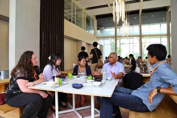
Few locations in London are more appropriate to discuss risk and extremes than the Shard in London. The daring skyscraper, completed in 2012, was among the first high-rise buildings to be designed in the aftermath of 9/11 – terrorism risk mitigation has been a major challenge for the structural engineers working on the project.

The Shard, London

On the 8 April 2016, the Mathematics Institute of the University of Warwick, in partnership with the London Mathematical Laboratory and the Institute of Physics, held the Real World Risks and Extremes meeting at the WBS campus at the Shard.

The invited speakers included Dr Gordon Woo (Risk Management Solutions), Professor Willy Aspinall (University of Bristol Cabot Institute and Aspinall & Associates), Professor Jean-Philippe Bouchaud (École Polytechnique and Capital Fund Management) and Professor Giulia Iori (City University London), as well as the writer Mark Buchanan (author and columnist for Nature and Bloomberg), who chaired the final panel discussion. The objective of the meeting was to foster interdisciplinary discussion on the methodology of extreme risk assessment and management, and this common theme was tackled in the talks from very different angles.

From the left: Professor Aspinall, Dr Woo, Professor Bouchaud and Professor Iori.

The day started with a thought-provoking speech by Dr Woo, who called for a new approach in the treatment of historical extreme events: rather than treating them as the only source of data, we ought to be performing some counterfactual analysis as well. Besides what we have experienced, what could have happened? Asking these type of questions, according to Dr Woo, would improve the robustness of risk assessments, after all, what happened was just one of many possible outcomes. Thinking about what could have been would help us to better prepare for the future.

Professor Aspinall followed with a talk about the use of expert judgement to quantify the uncertainty in mathematical models of natural processes. This is especially important when policy decisions are being taken based on these models, as in the case of climate change. The methodology was used to evaluate the uncertainty in the correlations between the different drivers of sea-level rise, discovering that its extreme values could be higher than previously predicted.

The talks by Professor Bouchaud and Professor Iori focused on the use of statistical mechanics-based and agent-based models to understand complex systems such as economics at a country scale or the global banking system. In particular, they both focused on the possibility of identifying the set of variables which govern crises in these systems. This is especially important for high-dimensional systems, as while there are many variables at play, generally only few of them can shift the system state from stable to unstable.

The Cabot Institute’s Dr Max Werner (Lecturer in Natural Hazards and Risks in the School of Earth Sciences, University of Bristol) was one of the organisers of the event:

“Our main objective for the meeting was to stimulate cross-disciplinary discussion about how to improve uncertainty assessments of risks to society, especially given complex interactions and correlations among the many components of a natural or socio-economic system. The speakers represented such different fields of the risk sciences and industries, and yet their common ground became very clear during the panel discussion chaired by Mark Buchanan: don’t place your trust blindly in quantitative models or in past observations – use expert judgement of what might happen, supported by insights from qualitative models of complex systems and an analysis of near-misses. For most scientists, including myself, that are engaged in quantitative modelling of past and future observations, this consensus was an important lesson in how our science should contribute to policy and decision making.”

What I found most interesting about the meeting was the diversity of the point of views of the speakers and the participants. From mathematics to philosophy, and from engineering to finance, all the way through natural and actuarial sciences, there is a lot of exciting research being done on the risk posed by extreme events and complex systems. How to assess these risks, how to communicate them in an effective way, how to manage them and how to turn them into opportunities are challenges that we as academics need to explore, if we want to help our societies to thrive and flourish.
—————————————-
This blog is written by Cabot Institute member Giulio Galvan from the School of Engineering at the University of Bristol.  Giulio’s research looks at the vulnerability and resilience of infrastructure networks.

Community volcano monitoring: The first weeks at Volcan de Fuego


Volcan de Fuego (Volcano of Fire) is an active volcano close to the Guatemalan city of Antigua. The volcano is one of the most active volcanoes in central America with a lively history of life-threatening eruptions.  It is thought that around 60,000 people are currently at risk from the volcano.

Monitoring the volcano is challenging with a limited availability of resources in the developing country. Bristol volcanology PhD student Emma Liu and colleagues are currently in Guatemala implementing a novel program to monitor ash fall from the volcano using community involvement. Volcanic ash is a hazard to human health, as well as to aviation. Additionally it holds vital clues into the activity of the volcano that can help us to understand past eruptions and predict what it may do in the future.  Once ash falls to the ground it is easily blown or washed away meaning lots of valuable information is lost in the hours and days after an eruption. Collecting ash as it falls can be challenging over a large area so Emma is roping in the local population to help.

Her cleverly designed ‘ashmeters’ are made almost entirely from recycled plastic bottles and are being installed in the gardens of local schools and houses around the volcano.  The components are easily replaceable and can be found locally. The ash falls into the meters and can be then collected and bagged by the residents. So far the meters have been installed in nine locations all around the volcano allowing Emma and her team to sample ash from almost any possible type of eruption.  As well as being indispensible from a scientific perspective, Emma hopes the scheme will help to improve the relationship between scientists and the volcano’s residents as she explains; ‘By engaging local communities directly in volcano monitoring, we hope to improve the two-way dialogue between scientists and residents, thereby increasing resilience to ash hazards’.

The scheme so far has been a great success, with the ashmeters being welcomed into people’s homes and attached to roofs and fencepost. Within a week of the ashmeters being deployed, they were tested by a large eruption on the 1 March 2016. Three ashmeters were installed during this eruption, all of which successfully collected ash. The Bristol volcanologists have now been able collect the ash which will be brought back to the University of Bristol for analysis.  The Bristol group will remain out in Guatemala for another few weeks in the hope they will able to distribute more ashmeters and gather more vital information for the management of volcanic hazard in the area. Emma received funding from the Bristol Cabot Institute Innovation Fund to set up this project.

——————————————————————–

This blog is written by Cabot Institute member Keri McNamara, a PhD student in the School of Earth Sciences at the University of Bristol.

Why is the UK interested in volcanoes? We don’t have any of our own!

Eruption column from the explosive phase of the Eyjafjallajokull eruption drifting over a farm  – image by Bristol volcanologist Susanna Jenkins
The University of Bristol’s volcanology group has been awarded the Queen’s Anniversary Prize for its contribution to research excellenceThe Queens Anniversary Prize is the most prestigious form of national recognition an institution can receive. When I tell members of the public that, not only am I a volcanologist, but that I am part of the one of the largest and most successful volcanology groups in the world, the first reaction is always surprise: ‘Why is the UK interested in volcanoes? We don’t have any of our own!’

They are right of course, the Bristol volcanology group spends its time travelling all over the world to address volcanic risk in many countries, from the first to the third world. When one looks back on volcanic eruptions in recent history, especially the big, memorable ones like Mount St Helens, Eyjafjallajokull and Montserrat one realises that Bristol volcanologists were there at every stage.

There are, of course, many layers to handling a volcanic crisis. First there’s initial monitoring; will this volcano erupt at all? Often this involves going to volcanoes that have been little studied in remote places, or monitoring them from satellites: something which Bristol volcanology has taken in its stride, by trailblazing projects on understudied African volcanism.

InSAR image showing volcanic uplift in the Great Rift Valley as part of research by Bristol volcanologist Juliet Biggs
Then there’s handling eruptions as they happen. Who will be affected? What are the primary risks? How should we respond to the media? Bristol has a glowing history of aiding in volcanic crisis by supplying the information when the world needs it. During the 2010 Eyjafjallajokull ash and aviation crisis, Bristol led the way in supplying expert opinion on managing the situation.

Still there is no rest for our volcanologists. Afterwards there’s the post-eruption work: Working out what made the volcano erupt and understanding the physical processes surrounding an event. How does it fit into the wider setting? Are the volcanoes linked? These questions have been asked and answered by our volcanologists who have also reached out to form a global database with other institutions. This has resulted in more cohesion in the community, and a greater understanding of how volcanoes interact.

A wealth of different specialities have populated the group since it was started by Professor Steve Sparks  including petrologists, geophysicists and geochemists. It is a result of this diverse environment that Bristol has been able to excel in so many areas. With natural hazards occurring on a near-daily basis, it’s safe to say the group has played its part in reducing the uncertainty of volcanic hazard across the globe.  The Queen’s Anniversary Prize is an amazing recognition of the work that has been done over the years and a well-deserved reward for the hard work of the Bristol volcanologists.

——————————————————————–

This blog is written by Cabot Institute member Keri McNamara, a PhD student in the School of Earth Sciences at the University of Bristol.

Uncertain World: Understanding past and future sea level rise

A recent study published in Science Advances suggests that if we burn all attainable fossil fuels (up to 12,000 gigatonnes of carbon), the Antarctic ice sheet is likely to become almost ice-free within 10,000 years. However, what does this mean in terms of sea level rise? To illustrate this we have designed an infographic which shows the likely extent of sea level rise under a range of different scenarios. We have chosen to use the Wills Memorial Building as an example and assume, for the purpose of this exercise, that it resides at sea level (Figure 1).

1) Sea level rise over the next century:

The most recent report by the Intergovernmental Panel on Climate Change (IPCC AR5) indicates that if we continue emitting greenhouse gases under business-as-usual scenarios (i.e. no reduction in emissions), it is likely that global mean sea level will rise between 0.52 and 0.98 m by the year 2100. If we are more optimistic, and we allow greenhouse gas emissions to peak in 2040 and decline thereafter, the range of likely global mean sea level rise is lower, but not insignificant (0.36 to 0.71 m). Both of these estimates are illustrated below and shown alongside the Wills Memorial Building.

Figure 1: An infographic showing the approximate height of sea level rise depending upon a range of different scenarios (Fretwell et al., 2013; IPCC AR5). This assumes the Wills Memorial Building resides at sea level

Although ~30 to 100 cm of sea level rise may seem insignificant, it is worth considering what this means for other regions. For example, “…since 80% of its 1,200 islands are no more than 1m above sea level“, sea level rise has the potential to impact up to 360,000 citizens and lead to widespread migration.

The reason that scientists provide a range of values for sea level rise is that the climate system is very complex. For example, under low emissions scenarios, there is expected to be an increase in moisture content around Antarctica, leading to increased snowfall along the ice sheet margins. However, under higher emissions scenarios, ice sheet discharge overcompensates for an increase in snowfall, leading to a net sea level rise.

2) Sea level rise over 10,000 years:

The variations between these two emission scenarios are less important when looking over longer timescales. Winklemann et al. (2015) have recently simulated changes in the Antarctic ice sheet over the next 10,000 years using a combination of climate and ice sheet models. From these experiments, it is clear that ice loss is driven by two key feedback mechanisms. The first begins with warming and subsequent retreat of the grounding line (Figure 2). The grounding line is the region where ice transitions from a grounded ice sheet to a freely-floating ice shelf. When the grounding line retreats to a point where the ice sheet falls below sea level, then ice sheets can become unstable.

Figure 2: A schematic of an ice sheet showing the position of the grounding line (bottom right). Image credit: www.AntarcticGlaciers.org.

Winklemann et al. (2015) argue that the West Antarctic Ice Sheet (WAIS) becomes unstable when cumulative carbon emissions reach 600 to 800 gigatonnes of carbon (this is equivalent to a 2 degree rise in temperature by 2100). If this part of the Antarctic Ice Sheet becomes unstable, we can expect ~4 m of global sea level rise (Figure 1).Once a specific temperature is reached, a second feedback then kicks in. This destabilises the rest of the Antarctic ice sheet via the so-called surface elevation feedback. On the timescale of 10,000 years this will eventually lead to an almost ice-free Antarctica (Winklemann et al. 2015).

Figure 3: Predicted ice-sheet loss on Antarctica under different carbon emission pathways (Winkelmann et al., 2015: Science Advances).

3) Sea level rise over millions of years:

Palaeoclimatologists can provide insights into the fate of ice sheets over longer timescales. For example, the last time Antarctica was ice-free was during the early Eocene (~56 to 48 million years ago). During this interval, carbon dioxide concentrations were much higher and allowed the development of lush, tropical rainforests along the ancient coastline (Figure 4). Gradual cooling over millions of years eventually culminated in the sudden and rapid establishment of ice-sheets on Antarctica. This occurred ~34 million years ago and was likely driven by a reduction in carbon dioxide (and perhaps some other feedback mechanisms). Although Antarctica has fluctuated in size since then, it has never been completely ice-free since the Eocene. However, under rising carbon emissions, we are rapidly returning to a world that has not been seen for at least 34 million years.

Figure 4: This may be what the East Antarctic coastline looked like during the early Eocene (Pross et al., 2012).

Further reading:

  • www.AntarcticGlaciers.org
  • Fretwell et al. 2013. Bedmap2: improved ice bed, surface and thickness datasets for Antarctica. The Cryosphere. v. 7.
  • Winkelmann et al. 2015 Combustion of available fossil fuel resources sufficient to eliminate the Antarctic Ice Sheet. Science Advances, v.1.
  • Bamber et al., 2009. Reassessment of the Potential Sea-Level Rise from a Collapse of the West Antarctic Ice Sheet. Science. v. 324
  • Church et al. 2013.  Sea Level Change. In: Climate Change 2013: The Physical Science Basis. Contribution of Working Group I to the Fifth Assessment Report of the Intergovernmental Panel on Climate Change. Cambridge University Press, Cambridge, United Kingdom and New York, NY, USA (see Chapter 13; Table 13.5, p. 1182 for 21st Century sea-level rise estimates).
  • Pross et al., 2012. Persistent near-tropical warmth on the Antarctic continent during the early Eocene epoch. Nature. v. 488.

n.b. As with the IPCC, we occasionally use the following terms to indicate the assessed likelihood of an outcome or a result. These are noted in italics: Virtually certain 99–100% probability, Very likely 90–100%, Likely 66–100%, About as likely as not 33–66%, Unlikely 0–33%, Very unlikely 0–10%, Exceptionally unlikely 0–1%.

——

Correction: the original post incorrectly stated that “… more than 80% of the Maldives lie one metre below sea level”. This has since been amended. Thanks to @radicalrodent for spotting this.
——

This blog was written by Gordon Inglis (@climategordon), a palaeoclimatologist working in the Organic Geochemistry Unit within the School of Chemistry. The infographic was created by Catherine McIntyre (@cathmci), an organic geochemistry PhD student working in same group.

How Bristol geologists are contributing to international development

Guatamala.  Credit: Geology for Global Development

It maybe isn’t immediately obvious how a pet-rock-owning earth scientist is able to change the world; the basement labs in the Wills Memorial Building seem a far cry from fighting global poverty. But the study of geology and having a knowledge of the earth and its resources is actually vitally important for the success of many international development projects.

Geology for global development: what is it all about?

Geology for Global Development (GfGD) is a national organisation that wants to bring awareness to the important position that geologists are in, to be able to make a difference. And it’s not just geologists that are involved here; GfGD recognises that through the collaboration of students from a wide range of disciplines, a positive and effective contribution to development can be made. For example, earth scientists can learn a lot from anthropologists about working alongside different communities whilst being sensitive to cultural differences.

This has been the first year for the GfGD society at Bristol and so far we think it has been a great success. We have held talks covering a whole variety of topics: from volcanic hazards in Guatemala, to sustainably procuring our world’s resources, to an overview of what it is actually like to be working in aid and development as a volunteer. We aim to offer earth scientists and geographers, and anyone else who is interested, an alternative view of the opportunities available to them, aside from the more traditional career paths that often flood everybody’s radars. And alongside this, we’re also trying to raise awareness of the social science skills that are necessary for successful and sustainable development projects.

This year’s focus: volcanic hazards in Guatemala

There is one project in particular that the national GfGD group is currently working on: strengthening volcanic resilience in Guatemala. At Bristol we’re perfectly placed to contribute to this because every year students on the MSc Volcanology course spend 3 weeks studying the volcanoes in this country and learning about the agencies that are set up to monitor them. To draw on all of their experiences we held a ‘Noche de Guatemala’ to learn about this beautiful country and hear how the people living in the shadows of volcanoes are in dire need of better resources and escape routes to ensure their safety in case of eruption. As part of this event we also introduced some cultural aspects of the country as well as the current socio-political situation to put the project into context. In the discussion session that followed we saw some great suggestions for strengthening resilience, from ways to make crops that aren’t affected by volcanic eruptions, to ideas for community involvement with volcano monitoring agencies. These ideas have been passed on to the director of the national GfGD group to help inform how the project might proceed.

Noche de Guatamala at the University of Bristol. Credit: Serginio Remmelzwaal.

As well as contributing to the Guatemala project through awareness and discussions, our group has also managed to raise a fantastic £279.36 towards GfGD’s £10,000 target. This money will be used to supply improved resources to the monitoring agencies and provide educational materials for the communities affected by volcanic hazards so the risks and evacuation procedures are better understood.

Mapping for humanitarian crises

As you will probably be aware, over 9,000 miles away from the volcanoes in Guatemala, another type of natural hazard stuck violently on the 25 April this year. The 7.8 magnitude Gorkha earthquake in Nepal caused the death of more than 9,000 people and left hundreds of thousands of people homeless. We wanted to do something that could really contribute to the relief effort so we decided to hold two ‘mapathons.’ This is where a group of people get together and use OpenStreetMap with satellite images to add buildings, roads and waterways to areas where this information doesn’t exist. This work is an enormous help to aid agencies that need to know all of this information to be able to help as many people as possible.


We’ve been busy this year and can’t wait to get even more people involved next year. We’ll be back in September with more talks, mapathons and hopefully some new style events to inspire anyone interested in earth processes to think again about how their knowledge could be used to bring about positive change in the developing world.

————————————————-
This blog has been written by Cabot Institute member Emily White, a postgraduate student in the School of Chemistry at the University of Bristol.

If you want to find out more about this society, request to join our Facebook group.

Email emily.white@bristol.ac.uk to join the mailing list.


Insights from the Natural Systems and Processes Poster Session

The Natural Systems and Processes Poster Session (NSPPS) is a University-wide poster session for postgraduate students within the Faculty of Science aimed at increasing inter-departmental connections within a relaxed and informal environment. This year’s event, which was hosted within the Great Hall of the Wills Memorial Building, was attended by ~90 PhD students from a wide variety of disciplines and hundreds more visitors came from across the University to view the posters. Most participants were interested in tackling the challenges of uncertain environmental change with an emphasis upon climate change, natural hazards and human impacts on the environment.

The Natural Systems and Processes Poster Session 2015 in the Great Hall
in the Wills Memorial Building (Image credit: D. Naafs)
Adam McAleer, a final year PhD student working in the Department of Earth Sciences, is interested in measuring the flux of greenhouse gases from restored peatlands within Exmoor National Park. The Exmoor Mires Project seeks to raise water levels via blocking of old agricultural drains in order to re-saturate the peatlands and recover its peat-forming biogeochemistry. This will potentially lead the mires to become carbon dioxide sinks and methane sources. As wetter plants were found to have a strong association to higher methane emissions, certain plant species have the potential to be used as a proxy for methane fluxes and restoration success. Mark Lunt, a third year PhD student working within the Atmospheric Chemistry Research Group, is interested in the fate of other greenhouse gases, such as hydrofluorocarbons (HFCs). Hydrofluorocarbons are organic compounds that contain fluorine and hydrogen atoms and are used as refrigerants, aerosol propellants, solvents, and fire retardants in the place of chloroflourocarbons (CFCs). Although HFCs do not harm the ozone layer, they can contribute to global warming. In developing countries, demand for HFCs are increasing rapidly; as a result, both the USA and China have agreed to begin work on phasing out hydroflourocarbons.

Felipe (left) discussing his research to staff and students  (Image credit: D. Naafs)
 
Catherine McIntyre (1st year) and John Pemberton (1st year), based within the Organic Geochemistry Unit, presented work from the NERC-funded DOMAINE project. This project aims to look at dissolved organic matter (DOM) in freshwater ecosystems and public water supplies and will focus upon the fate of carbon, nitrogen and phosphorus. Phosphorus, for example, is used to make fertilisers and can be incorporated into lakes and streams via terrestrial run-off. As phosphorus is a key limiting nutrient, it can also stimulate algal blooms and lead to eutrophication (i.e. oxygen starvation). Indeed, the global phosphorus cycle has already been highly perturbed, as shown below. As very little is known about organic phosphorus, the DOMAIN project will investigate this further using via high-resolution molecular techniques.

Four of the nine planetary boundaries  have now been crossed (Steffen et al., 2015; Science)
 
Other students are using the past to explore the future. Matt Carmichael, a final year PhD based within the School of Chemistry, is interested in understanding how the hydrological cycle varied during past warm climates. Of particular interest is the early Eocene (~48 to 56 million years ago), an interval characterised by high atmospheric carbon dioxide, high sea surface temperatures and the absence of continental ice sheets. However, the impact of these changes on the wider Earth system, especially those related to precipitation patterns, vegetation and biogeochemical cycles, remain poorly understood. This is achieved using climate models which can simulate changes in the atmosphere and the ocean during the Eocene. Future climatic change will also have a profound effect upon the hydrological cycle with the potential to make floods and droughts more extreme.

How the East Antarctic coastline might have looked during the early Eocene (Pross et al., 2012; Nature)

Collectively, the NSPPS highlights the wide variety of research undertaken with the Faculty of Science and is a great opportunity for PhD students to present their research in a relaxed setting.


————————–
This blog was written by Gordon Inglis (@climategordon) a final year PhD student within the School of Chemistry. Additional thanks to Adam McAleer, Matt Carmichael, Mark Lunt, Catherine McIntyre and John Pemberton whose work is highlighted here. 

Professor Dame Julia Slingo: Modelling climate risk

When Professor Dame Julia Slingo visited the Cabot Institute last week, her message was clear: We need to look at climate risk in real world contexts.

Dame Julia was in the city to receive a Cabot Institute Distinguished Fellowship, which involved giving a talk about her work as a world leading meteorologist and Chief Scientist at the Met Office.

One of the first things she highlighted was that climate change isn’t isolated from other pressures like population growth and limited resources, so we need to understand the risks it poses in a real world context. We need to define the effects it may have on the security of food, water, health and energy around the world, and use the science as a guide to define an evidence-based and cost effective plan of action going forward. This, she said, is “one of the greatest challenges of the 21st century”.

Are we making extreme weather worse?

Today, the huge global population boom is putting an ever increasing strain on limited resources like land and water, which are also at risk from the cyclical climate variations that occur naturally. The big and controversial question is whether climate change caused by human activity has exacerbated the problem.

Dame Julia described an annual report produced by the American Meteorological Society (AMS) that analyses extreme weather events around the world each year, aiming to determine whether the effects were magnified by anthropogenic climate change. As she pointed out, it is important that we recognise that not every bit of bad weather can be attributed to climate change, however the AMS often do find that we have played a role in making the situation worse.

One example she picked out was 2012’s Hurricane Sandy, which killed 233 people across eight countries in central and north America. The AMS report found that if sea level had been at the level that it was 50 years ago, the devastating effects of the storm would not have been as bad. It also suggested that continuing on our current path of climate change will mean minor storms will have increasingly severe impacts, leading to Sandy-level hurricanes more frequently in the future.

“We need a more nuanced discussion”

Last year was the warmest on UK record, making a total of 8 out of 10 of our hottest years having occurred since 2002. While of course there is variability in our climate from year to year and even decade to decade, intricate scientific climate models have shown that these record-breaking UK temperatures are made ten times more likely due to anthropogenic climate change.

While we may prefer a hot summer, temperatures don’t change uniformly across the entire planet. Worryingly, the Arctic is warming twice as fast as the rest of the planet, leading to a huge decrease in the amount of sea ice cover and corresponding sea level rise, which is already threatening communities living on low lying islands. Dame Julia reminded us all that it’s not as simple as trying to prevent a 2°C global temperature increase. The danger that climate change poses depends on who you are and where you live, and we need models to show what the risks will be.

Predicting climate risk

So how can we predict what the effects of climate change will be across the world? It begins with having a sophisticated model of the current global system. The Met Office has led decades of climate modelling, producing incredibly sophisticated simulations of climate systems on both short term (weather) and long term (climate change) scales.

I was absolutely amazed by the intricacy of these models. Millions of lines of computer code recreate the true physical nature of the planet, to the extent where large scale meteorological patterns like El Niño are emergent properties of the model, that is to say that they are a result of the basic physics encoded in the model, rather than being specifically programmed into it.

By altering the model with new data taken from the present extent of climate change or its predicted level in the future, the Met Office can model the global response at incredible resolution, showing the specific risks posed with increasingly detailed clarity (while still incorporating the inherent uncertainties present in all models). These models can then be used to test potential mitigation approaches and of course inform the global communities of the dangers they face.

What can we do?

Dame Julia explained that her role as Chief Scientist is to determine the needs of the people around the world, their risk tolerance and the information they require to make their own decisions. Science, she says, has a lot to offer in enabling governments to make wise, informed and efficient decisions with how best to spend their funds within the wider context of other societal issues, upholding the global securities of food, water, health and energy for the future.

Flooded Pakistan


Image: “There is no evidence to counter the basic premise that a warmer world will lead to more intense daily and hourly rain events” – Professor Dame Julia Slingo


—————————————-
This blog is written by Cabot Institute member Sarah Jose, Biological Sciences, University of Bristol.


Sarah Jose

Two weeks in the ‘Avenue of Volcanoes’

Workshops, conferences, field work – national and international travel is an essential part of many PhD programs. I’ve been lucky enough to see numerous new parts of the globe during my studies, and, less luckily, numerous different airport layovers (I’m currently writing this post from a corridor between terminals at Washington airport…!).

I’m on my way back to Bristol from a workshop in Ecuador on volcanic unrest, which culminated with an eruption simulation exercise. As my PhD is focused on unravelling the science behind volcanic unrest, these trips (this is the second of three with this specific aim) form a main focus for the real-world application of my research.

This workshop was split into 3 different parts. The first was a series of lectures on how volcanologists, social scientists, emergency managers, civil protection officials, and the general public interact during volcanic crises. Each specialist contributed their individual expertise, in my case as a volcanologist interpreting the signals that the volcano gives off, but the main message was that communication at all times between all parties must be especially clear. As with almost all lectures though, this part of the workshop obviously wasn’t the most exciting – especially with the inevitable jet-lagged tiredness kicking in for the first few days.

The second part of the workshop took us out into the field to explore two of Ecuador’s most famous volcanoes: Cotopaxi and Tungurahua. This was my favourite part! These are two quite epic volcanoes with the classical conical shape you imagine when you think of a volcano. By examining them in situ we learnt about the hazards they pose today to many nearby towns and cities. This really helps to put my research into perspective, as I know that by contributing to a better understanding of how volcanoes work I am helping to protect the people whose livelihood’s depend on the benefits the volcano brings them (for example, the more fertile soil).

Cotopaxi volcano, summit 5897 m ASL

The final part of the workshop took us to the Ecuadorian national centre for crisis management in Quito (cue vigilant security checks!). Here we conducted the volcanic unrest and eruption simulation. This is similar in some ways to a fire drill but a whole lot more complicated. Simulated monitoring ‘data’ from the volcano is fed to a team of volcanologists who have to quickly interpret what the data means and feed that information in a clear, coherent and understandable way to emergency managers, politicians and civil authorities. Upon the advice of the volcanologists, the decision makers can then choose how best to respond and mitigate a potential impending crisis. As this was just an exercise, different stages in the unrest crisis were dealt with all in one very busy day, with ‘data’ from the volcano arriving every couple of hours but representing several weeks or months in simulated time.

The final ‘update’ from the volcano: BIG eruption! I think we all could have predicted that – everyone likes a grand finale.

Despite the Hollywood firework finish, these exercises are crucial to prepare those individuals who will actually be in positions of responsibility when a true volcanic crisis develops. By playing out the different stages in as close to real-life as possible, strengths and weaknesses were highlighted that will allow for improvements to be made in the future. Improvements that may just save extra lives or livelihoods, and foster improved relationships between the public and the scientists trying to help them.

As one of those scientists, I was just happy enough to be able to take part.
——————
Cabot Institute member James Hickey is a final year PhD student in the School of Earth Sciences. His research is focused on unravelling the mechanisms that cause volcanoes to become restless prior to eruptions. Ultimately, the aim is to improve our understanding of precursory signals to enhance forecasting and mitigation efforts.

James Hickey

This blog has been republished with kind permission from the Bristol Doctoral College.  View the original blog post.


If you would like to study a PhD at the University of Bristol, please visit the Univeristy’s scholarships page

Energy supply: Experiences of traditional and environmentally conscious growth models

This September, I travelled to Tohoku University, Japan, to take part in the RENKEI summer school programme on the theme of Energy Supply within Traditional and Environmentally Conscious Growth Models. RENKEI is a Japan-UK collaboration and six universities from each country participate in pilot projects in three key areas: technology and knowledge exchange with industry, student mobility, and universities’ social engagement. Early career researchers, PhD students and taught postgraduates work together within a supported framework to develop critical skills in a dynamic environment.

In my role of Education for Sustainable Development (ESD) Coordinator, I was interested to see the teaching and learning applications of this theme in an interdisciplinary context. I am forever indebted to the University of Bristol for supporting this extraordinary opportunity (thanks to PVC Nick Lieven for funding provided and for accepting my application).

The international contingent visit the Toyota factory.
Image credit: Aisling Tierney

Fieldtrips were an essential component of the experience. At the Sendai municipal incinerator plant we learned how household waste provided energy for the city. I was surprised to hear that the household waste in Sendai is not segregated into recycling and non-recycling. When asked, the lead incinerator engineer commented that this situation was not ideal, but until recycling became widespread, incineration provided an energy benefit to the waste problem. The Miyagi Province Toyota Factory demonstrated how surplus heated water from the manufacturing process could be channelled into community-run glass houses to support local agricultural production. Factory workers were also encouraged to explore sustainable projects on the company’s grounds, for example, planting tree grooves that would serve as a relaxing space for future generations of workers. The implication was that the children of the factory workers would continue to work for Toyota and Toyota would continue to support the community.

The interior of one of the few buildings left
standing after the tsunami.
Image credit: Aisling Tierney

The last fieldtrip of the week was to tsunami-devastated regions to the north of Sendai. The ravaged coastline and high death-toll (estimated in the region of 16,000) three and a half years later was still in the process of recovery. Plant regrowth disguised much of the damage. Construction workers showed us models and videos of the reconstruction plans, including: moving rail lines; flattening hill tops; building sea barriers; and rehousing thousands of displaced families. A boat-ride along the coast showed how the fishing industry was slowly recovering, while the tourism industry, once flourishing, was now in shambles. Over 3,300 locals are still homeless, living in pre-fabricated buildings that are quickly disintegrating. While the press criticises the speed of rebuilding efforts, speaking to the construction team showed that every effort was being made but the scale of the work was a huge undertaking.

Talks and workshops engaged with the theme of energy supply, focusing on applying interdisciplinary knowledge to create “Sustainable City” solutions. Prof. Nakata of Tohoku University acted as our lead academic for the week.

Prof. Bahaj (Southampton) was the first of the week’s speakers. He explored contrasting ideas of refurbishment of cities vs green fields, the consumer society vs equity, and that city planners must consider the ecological footprint, not just carbon. A basic tenant he offered was “everything is driven by money”.  Prof. Nakata (Tohoku) wanted us to think about cities, towns, everything, not just government systems. He noted the importance of economics, resource constraints, environmental constraints, technological systems, and energy system components. The idea of community energy systems that are small scale and less dense in their demand was proposed, summarised as “Global + Local = Glocal”. He also highlighted how a low carbon society leads to sustainable and resilient business.

Mr. Suzuki (Fukushima Prefecture Government, business creation division) spoke on the importance of collaboration, including local company support, collaborative R&D, university support, and human public relations.  Mr. Tsuruoka (HOPE – Higashimatsushima Organisation for Progress & Economy, Education and Energy) startled the room with the shocking facts surrounding the tsunami disaster. Fishing was reduced to 60% of before, tourism was down to a third of pre-disaster, 65% of the city went underwater, resulting in a loss of life of 3% of the population. Simulations of potential tsunami damage were twenty times smaller than reality, meaning that there was a lack of preparation and proper evacuation when alarms were raised.

Discussions continued at break times.
Image credit: Aisling Tierney

Dr. Kunimitstu (NARO – National Agricultural & Food Research Organisation) introduced us to the Japanese concept of Hosaku Binbou, which is the impoverishment of farmers because of a bumper harvest. This relates to market equilibrium and the optimisation of producers. Prof. Shukuya (Tokyo City University) explained the low energy system design and its application to sustainable city design. Dr. Barret (United Nations University) discussed energy equity on a global scale. Prof. Kurokawa (Tokyo Institute of Technology) showed how 10 countries are using 50% of world’s capacity for carbon and what this means for future sustainability planning. Shuichi Ashina (National Institute for Environmental Studies) discussed planning for future energy demands, adaptation models, and low carbon society scenarios.

The majority of students were from Engineering, with a handful from the Sciences, while I was the only collaborator from an Arts background (Archaeology). This difference was particularly noticeable during questions and discussions, and within the group work sessions. Many students commented on how the Arts approach to problem solving and systems thinking was quite different, but proved beneficial to broadening their perspective.

As I stated, my aim was to see what teaching and learning elements I could take from the experience, and one that stood out was how interdisciplinary approaches to problem solving could be developed much further. In the future, I hope that RENKEI will open itself more to contributions from the Arts and other subject areas to encourage broader views.
————————
This blog is written by Aisling Tierney, Education for Sustainable Development Coordinator, University of Bristol.

Aisling Tierney

The uncertain world

J.G Ballard’s The Drowned World
taken from fantasticalandrewfox.com

Over the next 18 months, in collaboration with Bristol Green Capital 2015 artists, civic leaders and innovative thinkers, the Cabot Institute will be participating in  a series of activities in which we examine how human actions are making our planet a much more uncertain place to live.

Fifty years ago, between 1962 and 1966, J. G. Ballard wrote a trio of seminal environmental disaster novels: The Drowned World, The Burning World and The Crystal World.  These novels remain signposts to our future, the challenges we might face and the way people respond to rapid and unexpected change to their environment. In that spirit and coinciding with the Bristol Green Capital 2015, we introduce The Uncertain World, a world in which profound uncertainty becomes as much of a challenge to society as warming and rising sea levels.

For the past twenty years, the University of Bristol has been exploring how to better understand, mitigate and live with environmental uncertainty, with the Cabot Institute serving as the focus for that effort since its founding in 2010.  Uncertainty is the oft-forgotten but arguably most challenging aspect of mankind’s centuries-long impact on the environment.  We live our lives informed by the power of experience: our own as well as the collective experience of our families, communities and wider society. When my father started dairy farming he sought advice from my mother’s grandfather, our neighbours, and the grizzled veterans at the Middlefield auction house. Experience helps us make intelligent decisions, plan strategically and anticipate challenges.

Similarly, our weather projections, water management and hazard planning are also based on experience: tens to hundreds of years of observation inform our predictions of future floods, drought, hurricanes and heat waves. These records – this experience  – can help us make sensible decisions about where to live, build and farm.

Now, however, we are changing our environment and our climate, such that the lessons of the past have less relevance to the planning of our future.  In fact, many aspects of environmental change are unprecedented not only in human experience but in Earth history. As we change our climate, the great wealth of knowledge generated from human experience is losing capital every day.

The Uncertain World is not one of which we have no knowledge – we have high confidence that temperatures and sea level will rise, although there is uncertainty in the magnitude and speed of change. Nor should we view The Uncertain World with existential fear – we know that warm worlds have existed in the past.  These were not inhospitable and most evidence from the past suggests that a climate ‘apocalypse’ resulting in an uninhabitable planet is unlikely.

Nonetheless, increasing uncertainty arising from human-induced changes to our global environment should cause deep concern.  Crucial details of our climate remain difficult to predict, and it undermines our ability to plan for our future. We do not know whether many regions of the world will become wetter or dryer. This uncertainty propagates and multiplies through complex systems: how do we make sensible predictions of coastal flood risk when there is uncertainty in sea level rise estimates, rainfall patterns and the global warming that will impact both?  We can make predictions even in such complex systems, but the predictions will inevitably come with a degree of uncertainty, a probabilistic prediction.  How do we apply such predictions to decision making? Where can we build new homes, where do we build flood defences to protect existing ones, and where do we abandon land to the sea?

Perhaps most worrying, the consequences of these rapid changes on biological and chemical systems, and the people dependent upon them, are very poorly understood. For example, the synergistic impact of warmer temperatures, more acidic waters, and more silt-choked coastal waters on coral reefs and other marine ecosystems is very difficult to predict. This is particularly concerning given that more than 2.6 billion people  depend on the oceans as their primary source of protein. Similarly, warming of Arctic permafrost could promote the growth of CO2-sequestering plants or the release of warming-accelerating methane – or both. Warm worlds with very high levels of carbon dioxide did exist in the past and these do provide some insight  into the response of the Earth system, but we are accelerating into this new world at a rate that is unprecedented in Earth history, creating additional layers of uncertainty.

During late 2014 and 2015, the Cabot Institute will host a variety of events and collaborate with a variety of partners across Bristol and beyond to explore this Uncertain World and how we can live in it. How do we better explain uncertainty and what are the ‘logical’ decisions to make when faced with uncertainty? One of our first events will explore how uncertainty in climate change predictions should motivate us to action: the more uncertain our predictions the more we should employ mitigation rather than adaptation strategies. Future events will explore how past lessons from Earth history help us better understand potential future scenarios; how future scenario planning can inform the decisions we make today; and most importantly, how we build the necessary flexibility into social structures to thrive in this Uncertain World.

This blog is by Prof Rich Pancost, Director of the Cabot Institute at the University of Bristol.

Prof Rich Pancost