Towards urban climate resilience: learning from Lusaka


“This is a long shot!”

These were the words used by Richard Jones (Science Fellow, Met Office) in August 2021 when he asked if I would consider leading a NERC proposal for a rapid six-month collaborative international research and scoping project, aligned to the COP26 Adaptation and Resilience theme. The deadline was incredibly tight but the opportunity was too good to pass up – we set to work!

Background to Lusaka and FRACTAL

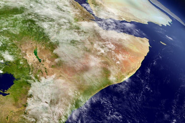
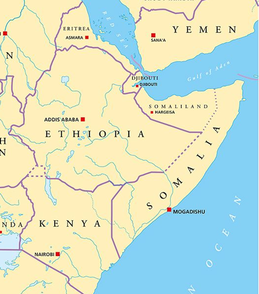
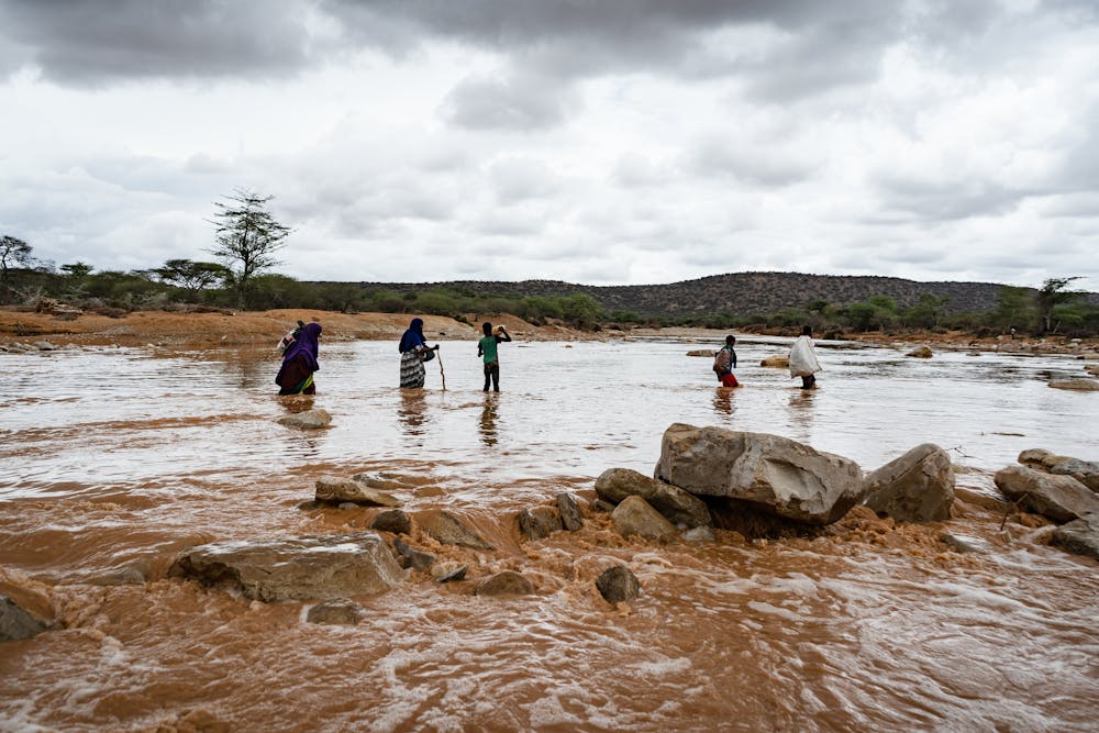
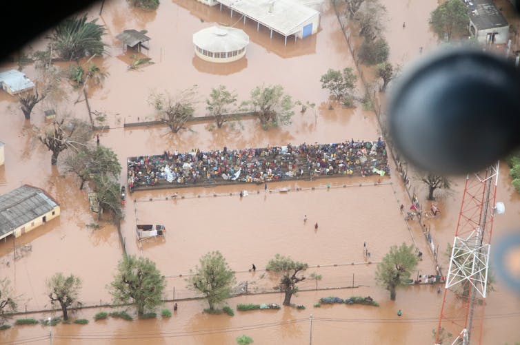
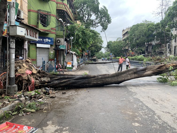
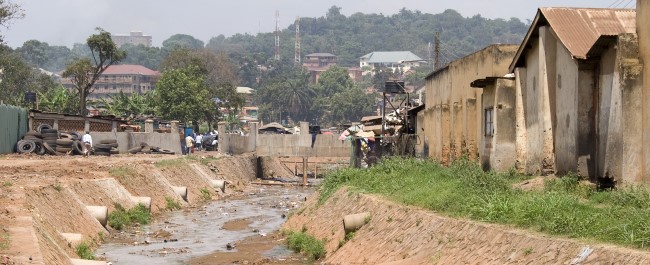
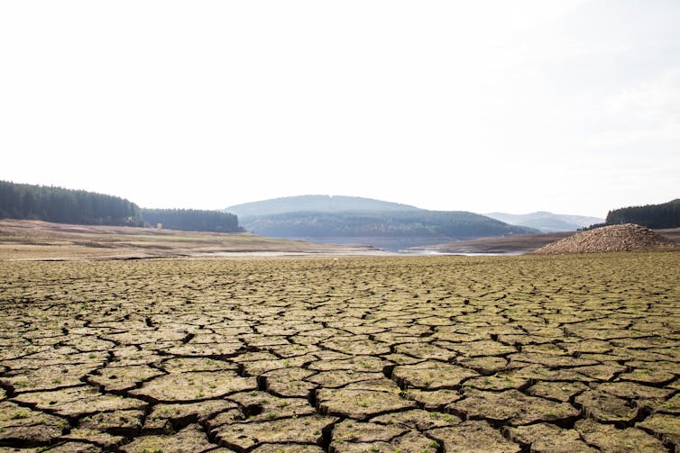
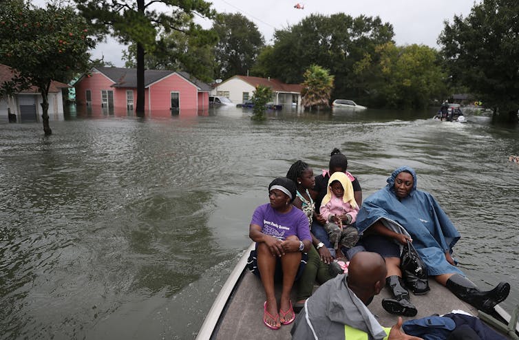
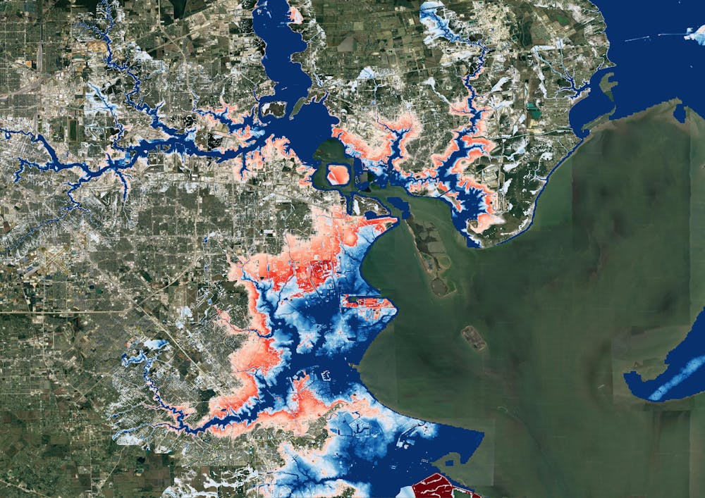
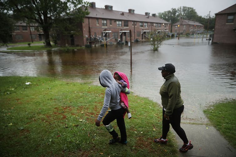
Zambia’s capital city, Lusaka, is one of Africa’s fastest growing cities, with around 100,000 people in the early 1960s to more than 3 million people today. 70% of residents live in informal settlements and some areas are highly prone to flooding due to the low topography and highly permeable limestone sitting on impermeable bedrock, which gets easily saturated. When coupled with poor drainage and ineffective waste management, heavy rainfall events during the wet season (November to March) can lead to severe localised flooding impacting communities and creating serious health risks, such as cholera outbreaks. Evidence from climate change studies shows that heavy rainfall events are, in general, projected to increase in intensity over the coming decades (IPCC AR6, Libanda and Ngonga 2018). Addressing flood resilience in Lusaka is therefore a priority for communities and city authorities, and it became the focus of our proposal.

Lusaka was a focal city in the Future Resilience for African CiTies and Lands (FRACTAL) project funded jointly by NERC and DFID from 2015 to 2021. Led by the Climate System Analysis Group (CSAG) at the University of Cape Town, FRACTAL helped to improve scientific knowledge about regional climate in southern Africa and advance innovative engagement processes amongst researchers, practitioners, decision-makers and communities, to enhance the resilience of southern African cities in a changing climate. I was lucky enough to contribute to FRACTAL, exploring new approaches to climate data analysis (Daron et al., 2019) and climate risk communication (Jack et al., 2020), as well as taking part in engagements in Maputo, Mozambique – another focal city. At the end of FRACTAL there was a strong desire amongst partners to sustain relationships and continue collaborative research.

I joined the University of Bristol in April 2021 with a joint position through the Met Office Academic Partnership (MOAP). Motivated by the potential to grow my network, work across disciplines, and engage with experts at Bristol in climate impacts and risk research, I was excited about the opportunities ahead. So when Richard alerted me to the NERC call, it felt like an amazing opportunity to continue the work of FRACTAL and bring colleagues at the University of Bristol into the “FRACTAL family” – an affectionate term we use for the research team, which really has become a family from many years of working together.

Advancing understanding of flood risk through participatory processes

Working closely with colleagues at Bristol, University of Zambia, University of Cape Town, Stockholm Environment Institute (SEI – Oxford), Red Cross Climate Centre, and the Met Office, we honed a concept building on an idea from Chris Jack at CSAG to take a “deep dive” into the issues of flooding in Lusaka – an issue only partly explored in FRACTAL. Having already established effective relationships amongst those involved, and with high levels of trust and buy-in from key institutions in Lusaka (e.g., Lusaka City Council, Lusaka Water Security Initiative – LuWSI), it was far easier to work together and co-design the project; indeed the project conceived wouldn’t have been possible if starting from scratch. Our aim was to advance understanding of flood risk and solutions from different perspectives, and co-explore climate resilient development pathways that address the complex issue of flood risk in Lusaka, particularly in George and Kanyama compounds (informal settlements). The proposal centred on the use of participatory processes that enable different communities (researchers, local residents, city decision makers) to share and interrogate different types of knowledge, from scientific model datasets to lived experiences of flooding in vulnerable communities.

The proposal was well received and the FRACTAL-PLUS project started in October 2021, shortly before COP26; PLUS conveys how the project built upon FRACTAL but also stands for “Participatory climate information distillation for urban flood resilience in LUSaka”. The central concept of climate information distillation refers to the process of extracting meaning from multiple sources of information, through careful and open consideration of the assumptions, strengths and limitations in constructing the information.

The “Learning Lab” approach

Following an initial evidence gathering and dialogue phase at the end of 2021, we conducted two collaborative “Learning Labs” held in Lusaka in January and March 2022. Due to Covid-19, the first Learning Lab was held as a hybrid event on 26-27 January 2022. It was facilitated by the University of Zambia team with 20 in-person attendees including city stakeholders, the local project team and Richard Jones who was able to travel at short notice. The remainder of the project team joined via Zoom. Using interactive exercises, games (a great way to promote trust and exchange of ideas), presentations, and discussions on key challenges, the Lab helped unite participants to work together. I was amazed at the way participants threw themselves into the activities with such enthusiasm – in my experience, this kind of thing never happens when first engaging with people from different institutions and backgrounds. Yet because trust and relationships were already established, there was no apparent barrier to the engagement and dialogue. The Lab helped to further articulate the complexities of addressing flood risks in the city, and showed that past efforts – including expensive infrastructure investments – had done little to reduce the risks faced by many residents.

One of the highlights of the Labs, and the project overall, was the involvement of cartoon artist Bethuel Mangena, who developed a number of cartoons to support the process and extract meaning (in effect, distilling) the complicated and sensitive issues being discussed. The cartoon below was used to illustrate the purpose of the Lab, as a meeting place for ideas and conversations drawing on different sources of information (e.g., climate data, city plans and policies) and experiences of people from flood-affected communities. All of the cartoons generated in the project, including the feature image for this blog, are available in a Flickr cartoon gallery – well worth a look!

Image: Cartoon highlighting role of Learning Labs in FRACTAL-PLUS by Bethuel Mangena

Integrating scientific and experiential knowledge of flood risk

In addition to the Labs, desk-based work was completed to support the aims of the project. This included work by colleagues in Geographical Sciences at Bristol, Tom O’Shea and Jeff Neal, to generate high-resolution flood maps for Lusaka based on historic rainfall information and for future climate scenarios. In addition, Mary Zhang, now at the University of Oxford but in the School of Policy Studies at Bristol during the project, collaborated with colleagues at SEI-Oxford and the University of Zambia to design and conduct online and in-person surveys and interviews to elicit the lived experiences of flooding from residents in George and Kanyama, as well as experiences of those managing flood risks in the city authorities. This work resulted in new information and knowledge, such as the relative perceived roles of climate change and flood management approaches in the levels of risk faced, that was further interrogated in the second Learning Lab.

Thanks to a reduction in covid risk, the second lab was able to take place entirely in person. Sadly I was unable to travel to Lusaka for the Lab, but the decision to remove the virtual element and focus on in-person interactions helped further promote active engagement amongst city decision-makers, researchers and other participants, and ultimately better achieve the goals of the Lab. Indeed the project helped us learn the limits of hybrid events. Whilst I remain a big advocate for remote technology, the project showed it can be far more productive to have solely in-person events where everyone is truly present.

The second Lab took place at the end of March 2022. In addition to Lusaka participants and members of the project team, we were also joined by the Mayor of Lusaka, Ms. Chilando Chitangala. As well as demonstrating how trusted and respected our partners in Lusaka are, the attendance of the mayor showed the commitment of the city government to addressing climate risks in Lusaka. We were extremely grateful for her time engaging in the discussions and sharing her perspectives.

During the lab the team focused on interrogating all of the evidence available, including the new understanding gained through the project from surveys, interviews, climate and flood data analysis, towards collaboratively mapping climate resilient development pathways for the city. The richness and openness in the discussions allowed progress to be made, though it remains clear that addressing flood risk in informal settlements in Lusaka is an incredibly challenging endeavour.

Photo: Participants at March 2022 Learning Lab in Lusaka

What did we achieve?

The main outcomes from the project include:

  1. Enabling co-exploration of knowledge and information to guide city officials (including the mayor – see quote below) in developing Lusaka’s new integrated development plan.
  2. Demonstrating that flooding will be an ongoing issue even if current drainage plans are implemented, with projections of more intense rainfall over the 21st century pointing to the need for more holistic, long-term and potentially radical solutions.
  3. A plan to integrate flood modelling outputs into the Lusaka Water Security Initiative (LuWSI) digital flood atlas for Lusaka.
  4. Sustaining relationships between FRACTAL partners and building new links with researchers at Bristol to enable future collaborations, including input to a new proposal in development for a multi-year follow-on to FRACTAL.
  5. A range of outputs, including contributing to a FRACTAL “principles” paper (McClure et al., 2022) supporting future participatory projects.

It has been such a privilege to lead the FRACTAL-PLUS project. I’m extremely grateful to the FRACTAL family for trusting me to lead the project, and for the input from colleagues at Bristol – Jeff Neal, Tom O’Shea, Rachel James, Mary Zhang, and especially Lauren Brown who expertly managed the project and guided me throughout.

I really hope I can visit Lusaka in the future. The city has a special place in my heart, even if I have only been there via Zoom!

“FRACTAL-PLUS has done well to zero in on the issue of urban floods and how climate change pressures are making it worse. The people of Lusaka have continually experienced floods in various parts of the city. While the problem is widespread, the most affected people remain to be those in informal settlements such as George and Kanyama where climate change challenges interact with poor infrastructure, poor quality housing and poorly managed solid waste.” Mayor Ms. Chilando Chitangala, 29 March 2022

————————————————————————————-

This blog is written by Dr Joe Daron, Senior Research Fellow, Faculty of Science, University of Bristol;
Science Manager, International Climate Services, Met Office; and Cabot Institute for the Environment member.
Find out more about Joe’s research at https://research-information.bris.ac.uk/en/persons/joe-daron.


The Horn of Africa has had years of drought, yet groundwater supplies are increasing – why?


Harvepino / shutterstock

The Horn of Africa – which includes Somalia, Ethiopia, Kenya and some surrounding countries – has been hit by increasingly frequent and devastating droughts. Despite this, it seems the region has an increasing amount of groundwater. And this water could help support drought-stricken rural communities.

That’s the key finding from our new research, in which we discovered that while overall rainfall is decreasing, an increase in “high-intensity” rainfall has led to more water being stored deep underground. It’s a paradoxical finding, yet one that may help one of the world’s most vulnerable regions adapt to climate change.

In the Horn of Africa, rural communities live in a constant state of water scarcity punctuated by frequent periods of food insecurity. People there rely on the “long rains” between March and May and the “short rains” between October and December to support their lives and livelihoods.

As we write this, the region’s drylands are experiencing a fifth consecutive season of below-average rainfall. This has left 50 million people in acute food insecurity. The droughts have caused water shortages, livestock deaths, crop failures, conflict and even mental health challenges.

The drought is so severe that it is even affecting zebras, giraffes and other wildlife, as all surface waters are drying up and edible vegetation is becoming scarce. Worryingly, a sixth failed rainy season has already been predicted for March to May 2023.

Long rains down, short rains up

In a new paper we investigated changes in seasonal rainfall in the Horn of Africa over the past 30 years. We found the total rainfall within the “long rains” season is declining, perhaps related to the warming of a particular part of the Pacific Ocean. However, rainfall is increasing in the “short rains”. That’s largely due to a climate phenomenon known as the Indian Ocean Dipole, when a warmer-than-usual Indian Ocean produces higher rainfall in east Africa, similar to El Niño in the Pacific.

We then investigated what these rainfall trends mean for water stored below ground. Has it decreased in line with declining “long rains”, or risen due to the increasing “short rains”?

Map of East Africa
The Horn of Africa borders the Red Sea, the Gulf of Aden and the Indian Ocean.
Peter Hermes Furian / shutterstock

To do this we made use of a pair of satellites which orbit repeatedly and detect small changes in the Earth’s gravitational field that can be interpreted as changes in the mass of water storage. If there’s a significant increase in water storage underground, then the satellite will record a stronger gravity field at that location compared to the previous measurement, and vice versa. From this, the mass of water added or lost in that location can be determined.

Using these satellite-derived estimates, we found that water storage has been increasing in recent decades. The increase correlates with the increasing “short rains”, and has happened despite the “long rains” getting drier.

Given that the long rains deliver more seasonal rain than the short rains, we wanted to understand the paradoxical finding that underground water is increasing. A clue is given by examining how rainfall is converted into groundwater in drylands.

When rain is light and drizzly, much of the water that reaches the ground dampens the soil surface and soon evaporates back into the warm, dry atmosphere. To become groundwater, rainfall instead needs to be intense enough so that water will quickly infiltrate deep into the soil. This mostly happens when lots of rain falls at once and causes dry riverbeds to fill with water which can then leak into underground aquifers.

People stand in river, rainy sky.
Heavy rains fill a dry river bed in the Somali region of Ethiopia.
Stanley Dullea / shutterstock

These most intense rainfall events are increasing in the “short rains”, in line with the overall increase in total rain in that season. And despite a decrease in overall rainfall in the “long rains”, intense rainfall has remained consistently high over time. This means that both rainy seasons have enough intense rainfall to increase the amount of water stored underground.

Finally, we demonstrated that the increasing water storage in this region is not connected to any rise in soil moisture near the surface. It therefore represents “banked” water that resides deep below ground and likely contributes to a growing regional groundwater aquifer in this region.

Groundwater can help people adapt to climate change

While early warning networks and humanitarian organisations focus on the urgent impacts of drought, our new research points to a silver lining that may support long-term climate adaptation. Those rising groundwater supplies we have identified may potentially be exploited to support people in rural areas whose food and water are increasingly insecure.

But there are some caveats. First, we have not assessed the depth of the available groundwater across the region, but we suggest that the water table is shallow enough to be affected by seasonal rainfall. This means it may also be shallow enough to support new bore holes to extract it. Second, we do not know anything about the quality of the stored groundwater and whether it can be deemed suitable for drinking. Finally, we do not know exactly what will happen if the most extreme droughts of the past few seasons continue and both long and short rains fail, causing intense rainfall to decrease too.

Nevertheless, our findings point to the need for extensive groundwater surveys across the Horn of Africa drylands to ascertain whether this increasing water resource may be viable enough to offset the devastating droughts. Groundwater could potentially irrigate fields and provide drinking water for humans and livestock, as part of a strategy to help this vulnerable region adapt to the effects of climate change.The Conversation

————————

This blog was written by Cabot Institute for the Environment member Katerina Michaelides, Associate Professor, School of Geographical Sciences, University of BristolMichael Singer, Professor in Physical Geography (Hydrology and Geomorphology), Cardiff University; and Markus Adloff, PostDoctoral Researcher, Earth System Modelling, Université de BerneThis article is republished from The Conversation under a Creative Commons license. Read the original article.

Are you a journalist looking for climate experts? We’ve got you covered

We’ve got lots of media trained climate change experts. If you need an expert for an interview, here is a list of Caboteers you can approach. All media enquiries should be made via Victoria Tagg, our dedicated Media and PR Manager at the University of Bristol. Email victoria.tagg@bristol.ac.uk or call +44 (0)117 428 2489.

Climate change / climate emergency / climate science / climate-induced disasters

Dr Eunice Lo – expert in changes in extreme weather events such as heatwaves and cold spells, and how these changes translate to negative health outcomes including illnesses and deaths. Follow on Twitter @EuniceLoClimate.

Professor Daniela Schmidt – expert in the causes and effects of climate change on marine systems. Dani is also a Lead Author on the IPCC reports.

Dr Vikki Thompson – expert on climate extremes, particularly heat extremes. Follow on Twitter @ClimateVikki

Dr Katerina Michalides – expert in drylands, drought and desertification and helping East African rural communities to adapt to droughts and future climate change. Follow on Twitter @_kmichaelides.

Professor Dann Mitchell – expert in how climate change alters the atmospheric circulation, extreme events, and impacts on human health. Dann is also a Met Office Chair. Follow on Twitter @ClimateDann.

Professor Dan Lunt – expert on past climate change, with a focus on understanding how and why climate has changed in the past and what we can learn about the future from the past. Dan is also a Lead Author on IPCC AR6. Follow on Twitter @ClimateSamwell.

Professor Jonathan Bamber – expert on the impact of melting land ice on sea level rise (SLR) and the response of the ocean to changes in freshwater forcing. Follow on Twitter @jlbamber

Professor Paul Bates CBE – expert in the science of flooding, risk and reducing threats to life and economic losses worldwide. Follow on Twitter @paul_d_bates

Professor Tony Payne – expert in the effects of climate change on earth systems and glaciers.

Dr Matt Palmer – expert in sea level and ocean heat content research at the Met Office Hadley Centre and University of Bristol. Follow on Twitter @mpclimate.

Net Zero / Energy / Renewables

Professor Valeska Ting – Engineer and expert in net zero, low carbon technologies, low carbon energy and flying. Also an accomplished STEM communicator, is an BAME Expert Voice for the BBC Academy. Follow on Twitter @ProfValeskaTing.

Professor Philip Taylor – Expert in net zero, energy systems, energy storage, utilities, electric power distribution. Also Pro-Vice Chancellor at the University of Bristol. Follow on Twitter @rolyatlihp.

Dr Colin Nolden – expert in sustainable energy policyregulation and business models and interactions with secondary markets such as carbon markets and other sectors such as mobility. Colin will be at COP27. Colin will be in attendance in the Blue Zone at COP27.

Professor Charl Faul – expert in novel functional materials for sustainable energy applications e.g. in CO2 capture and conversion and energy storage devices.  Follow on Twitter @Charl_FJ_Faul.

Climate finance

Dr Rachel James – Expert in climate finance, damage, loss and decision making. Also has expertise in African climate systems and contemporary and future climate change. Follow on Twitter @_RachelJames. Rachel will be in attendance in the Blue Zone at COP27.

Climate justice

Dr Alix Dietzel – climate justice and climate policy expert. Focusing on the global and local scale and interested in how just the response to climate change is and how we can ensure a just transition. Alix will be at COP27. Follow on Twitter @alixdietzel. Alix will be in attendance in the Blue Zone at COP27.

Dr Ed Atkins – expert on environmental and energy policy, politics and governance and how they must be equitable and inclusive. Also interested in local politics of climate change policies and energy generation and consumption. Follow on Twitter @edatkins_.

Climate activism / Extinction Rebellion

Dr Oscar Berglund – expert on climate change activism and particularly Extinction Rebellion (XR) and the use of civil disobedience. Follow on Twitter @berglund_oscar.

Air pollution / Greenhouse gases

Dr Aoife Grant – expert in greenhouse gases and methane. Set up a monitoring station at Glasgow for COP26 to record emissions.

Professor Matt Rigby – expert on sources and sinks of greenhouse gases and ozone depleting substances. Follow on Twitter @TheOtherMRigby.

Land, nature and food

Viola Heinrich – expert in emissions and climate mitiagion potential within the land use sector in the tropics, especially the Brazilian Amazon. IPCC author. Follow on Twitter @vh_trees.
Dr Jo House – expert on land and climate interactions, including emissions of carbon dioxide from land use change (e.g. deforestation), climate mitigation potential from the land (e.g. afforestationbioenergy), and implications of science for policy. Previously Government Office for Science’s Head of Climate Advice. Follow on Twitter @Drjohouse.
Dr Taro Takahashi – expert on farminglivestock production systems as well as progamme evaluation and general equilibrium modelling of pasture and livestock-based economies.
Dr Maria Paula Escobar-Tello – expert on tensions and intersections between livestock farming and the environment.

Climate change and infrastructure

Dr Maria Pregnolato – expert on effects of climate change and flooding on infrastructure. Follow on Twitter @MariaPregnolat1.

Plastic and the environment

Dr Charlotte Lloyd – expert on the fate of chemicals in the terrestrial environment, including plasticsbioplastics and agricultural wastes. Follow on Twitter @DrCharlLloyd.

Climate change and health

Dr Dan O’Hare – expert in climate anxiety and educational psychologist. Follow on Twitter @edpsydan.

Cabot Institute for the Environment at COP27

We will have three academics in attendance at the Blue Zone at COP27. These are:
Dr Alix Dietzel, Dr Rachel James and Dr Colin Nolden. All are media-trained and feature in the list above.

Read more about COP on our website at https://bristol.ac.uk/cabot/what-we-do/projects/cop/

Watch our Cabot Conversations – 10 conversations between 2 experts on a climate change issue, all whilst an artist listens in the background and interprets the conversation into a beautiful piece of art in real time. Find out more at bristol.ac.uk/cabot/conversations.
——————————
This blog was written by Amanda Woodman-Hardy, Communications and Engagement Officer at the Cabot Institute for the Environment. Follow on Twitter @Enviro_Mand and @cabotinstitute.

Hydrological hazards across timescales

University of Bristol – Met Office Academic Partnership Meeting 

From droughts and floods to water quality and water resource management, researchers at the University of Bristol and the Met Office are world-leaders in climate and hydrological research. Building on the new academic partnership between Bristol and the Met Office, the goal of this meeting was to foster new collaborations and strengthen existing partnerships between Bristol and the Met Office on the topic of weather, climate and hydrology. 

In total, we had 29 attendees attend the workshop, with 10 from the Met Office, 17 from the University of Bristol and 2 from Fathom including weather and climate scientists, catchment hydrologists and flood modellers at a wide range of career stages. 


The meeting explored two key themes, the first half of the meeting focused on ‘Exploiting convection permitting weather and climate models for flood and drought prediction’, while the second half focused on ‘Quantifying uncertainty in hydrological projections’. For each theme, there were two short plenary talks that highlighted existing research across the Met Office and University of Bristol and then a presentation focused on an exciting piece of research covering topics on exploiting convection permitting models for flood and drought prediction (Lizzie Kendon) and towards large ensembles of km-scale precipitation simulations using AI (Peter Watson and Henry Addison).  We also had eight lighting talks on topics ranging from tropical cyclones to pan-tropics convection-permitting climate simulations to compound wind and flood risk.  


Alongside the talks, there was time for attendees to discuss ideas and opportunities focused around five key discussion topics; uncertainty estimation, compound events and multi-hazard coupling, evaluation of weather and climate driving information for hydrology, exploiting higher resolution capabilities for hydrology and from hydrological predictions to ‘services’. 


Overall, the meeting was a success and we appreciated an in person meeting fuelled by coffee, cake and cheese! Tangible outputs from the day included contributions on a NERC proposal, making new connections, ideas for future collaborations, sharing of data and methodologies and the foundations for a collaborative climate and hydrology community 


Further details from the meeting can be requested from Gemma Coxon (gemma.coxon@bristol.ac.uk). 

Climate change isn’t just making cyclones worse, it’s making the floods they cause worse too – new research

People take refuge on a sports ground following flooding caused by Cyclone Idai in Mozambique.
DFID/Flickr, CC BY-SA

Laurence Hawker, University of Bristol; Dann Mitchell, University of Bristol, and Natalie Lord, University of Bristol

Super cyclones, known as hurricanes or typhoons in different parts of the world, are among the most destructive weather events on our planet.

Although wind speeds within these storms can reach 270 km/h, the largest loss of life comes from the flooding they cause – known as a “storm surge” – when sea water is pushed onto the coast. Climate change is predicted to worsen these floods, swelling cyclone clouds with more water and driving rising sea levels that allow storm surges to be blown further inland.

In May 2020, Super Cyclone Amphan hit the India-Bangladesh border, bringing heavy rainfall and strong winds and affecting more than 13 million citizens. The cyclone also caused storm surges of 2-4 metres, flooding coastal regions in the Bay of Bengal.

While over the ocean, this category five storm – that’s a storm’s highest possible rating – became the strongest cyclone to have formed in the Bay of Bengal since 1999, reaching wind speeds of up to 260 km/h. Although it weakened to a category two storm following landfall, it remained the strongest cyclone to hit the Ganges Delta since 2007.

Amphan had severe consequences for people, agriculture, the local economy and the environment. It tragically resulted in more than 120 deaths, as well as damaging or destroying homes and power grids: leaving millions without electricity or communication in the midst of an ongoing pandemic.

Relief and aid efforts were hampered by flood damage to roads and bridges, as well as by coronavirus restrictions. Large areas of crops including rice, sesame and mangos were damaged, and fertile soils were either washed away or contaminated by saline sea water. Overall, Super Cyclone Amphan was the costliest event ever recorded in the North Indian Ocean, resulting in over $13 billion (£10 billion) of damage.

Two people assess a tree that has fallen across a road
In Kolkata, India, Super Cyclone Amphan caused widespread damage.
Indrajit Das/Wikimedia

In a recent study led by the University of Bristol and drawing on research from Bangladesh and France, we’ve investigated how the effects of storm surges like that caused by Amphan on the populations of India and Bangladesh might change under different future climate and population scenarios.

Amphan: Mark II

Rising sea levels – thanks largely to melting glaciers and ice sheets – appear to be behind the greatest uptick in future risk from cyclone flooding, since they allow storm surges to reach further inland. It’s therefore key to understand and predict how higher sea levels might exacerbate storm-driven flooding, in order to minimise loss and damage in coastal regions.

Our research used climate models from CMIP6, the latest in a series of projects aiming to improve our understanding of climate by comparing simulations produced by different modelling groups around the world. First we modelled future sea-level rise according to different future emissions scenarios, then we added that data to storm surge estimates taken from a model of Super Cyclone Amphan.

We ran three scenarios: a low emission scenario, a business-as-usual scenario and a high emission scenario. And in addition to modelling sea-level rise, we also estimated future populations across India and Bangladesh to assess how many more people storm surges could affect. In most cases, we found that populations are likely to rise: especially in urban areas.

Our findings were clear: exposure to flooding from cyclone storm surges is extremely likely to increase. In India, exposure increase ranged from 50-90% for the lowest emission scenario, to a 250% increase for the highest emission scenario. In Bangladesh, we found a 0-20% exposure increase for the lowest emission scenario and a 60-70% increase for the highest emission scenario. The difference in exposure between the two countries is mostly due to declining coastal populations as a result of urban migration inland.

Imagine we’re now in 2100. Even in a scenario where we’ve managed to keep global emissions relatively low, the local population exposed to storm surge flooding from an event like Amphan will have jumped by ~350,000. Compare this to a high emission scenario, where an extra 1.35 million people will now be exposed to flooding. And for flood depths of over one metre – a depth that poses immediate danger to life – almost half a million more people will be exposed to storm surge flooding in a high emission scenario, compared to a low emission scenario.

A composite satellite image of a large white cyclone
A satellite image shows Amphan approaching the coasts of India and Bangladesh.
Pierre Markuse/Wikimedia

This research provides yet more support for rapidly and permanently reducing our greenhouse gas emissions to keep global warming at 1.5°C above pre-industrial levels.

Although we’ve focused on storm surge flooding, other cyclone-related hazards are also projected to worsen, including deadly heatwaves following cyclones hitting land. And in the case of Amphan, interplay between climate change and coronavirus likely made the situation for people on the ground far worse. As the world warms, we mustn’t avoid the reality that pandemics and other climate-related crises are only forecast to increase.

Urgent action on emissions is vital to protect highly climate-vulnerable countries from the fatal effects of extreme weather. Amphan Mark II need not be as destructive as we’ve projected if the world’s governments act now to meet Paris agreement climate goals.The Conversation

—————————–

This blog is written by Cabot Institute for the Environment members Dr Laurence Hawker, Senior Research Associate in Geography, University of Bristol; Professor Dann Mitchell, Professor of Climate Science, University of Bristol, and Dr Natalie Lord, Honorary Research Associate in Climate Science, University of Bristol

This article is republished from The Conversation under a Creative Commons license. Read the original article.

How water stress impacts on migration

In this special blog series, Migration Mobilities Bristol (MMB) and the Cabot Institute for the Environment bring together researchers from across the University of Bristol to explore connections between movement and the environment from a multi-disciplinary perspective. Their diverse approaches highlight the importance of developing frames that incorporate both migration and environment, and in so doing benefit our understandings of both. 

————————————-

In 2015, Ioane Teitiota and his family were deported from New Zealand to the Pacific island nation of Kiribati. His asylum application had been based on the grounds that water, due to sea level rise, had made the island uninhabitable in various ways: there was a shortage of clean drinking water; the available habitable land had decreased, which had led to increased insecurity because of violent land disputes; and the main activity, subsistence farming, was impeded.

Water has always had a major influence on where we live. Whether drawing us to new locations or forcing us from existing ones, water has always been intricately connected to the movement of people. As soon as it was possible to navigate the wide-open sea, water facilitated exploration to new lands. Later, being on these wide, open seas offered hope to millions fleeing world wars, presenting a somewhat invincible fortress protecting them from persecution, suffering and premature demise. More recently, the drowning of at least 27 men, women and children attempting to make the crossing from France to England brought into sharp focus how some things have not changed since those world wars: many are still crossing seas to flee persecution, suffering and premature demise.

In recent times, it is increasingly recognised that climate change will be a significant driver of migration. Island states such as Tonga and Micronesia already have negative net migration rates and projections are that stressed freshwater resources and water-related extreme events (such as floods) will drive more migration from island states because of food insecurity and habitat loss. Some states are already purchasing land to relocate citizens, as this is considered the only reliable adaptive response. By 2014, Kiribati had purchased 6,000 acres of forest land from Fiji: ahead of the UN climate summit that year, Anote Tong, Kiribati’s president at the time, said that buying land abroad was the way to ensure ‘migration with dignity’. Meanwhile, 6,000 km to the east, the world’s ‘first environmental refugees’ were already setting up new homes in Bougainville, an autonomous island of Papua New Guinea. They had left islands that were becoming increasingly uninhabitable as sea water ingress led to shortages in arable land and clean drinking water.

It is debatable, however, whether the islanders migrating to Bougainville are indeed the world’s first group of people forced to leave their ancestral lands due to climatic changes. Lake Chad, in west Africa was once the sixth largest inland water body, with an open water area of 25,000 km2 in the 1960s. By the 1980s, over 90% of the lake had been lost due to decreased precipitation, sparking significant internal and international migration. By 2015, more than 71,000 people from Nigeria and North Cameroon had moved towards the lake’s receding shores. As the ever-growing numbers scrambled for a portion of the limited water resources to farm, water their livestock and maintain their livelihoods, violence erupted that led to further migration out of the region. With limited non-agricultural skills and no source of capital to engage in alternative livelihood strategies the situation for these people is extremely precarious.

These two case studies challenge the narrative that climate change will drive migration in the future. They show that it already does. The situation is only likely to get worse as more regions of the world are affected, and yet, the impact of water crises on migration is not well documented.

Environmental migrants

No legal definition exists to date, for people on the move due to environmental drivers. However, the International Organisation for Migration put forward the following definition in 2007:

… persons or groups of persons who, predominantly for reasons of sudden or progressive change in the environment that adversely affect their lives or living conditions, are obliged to leave their habitual homes or choose to do so, either temporarily or permanently, and who move either within their country or abroad.

(IOM, 2007:1)

Water scarcity is bound to be a major driver of migration given that 17 countries, home to 25% of the global population, are already experiencing water stress (see Figure 1). The poorest of the global population will be the most adversely affected, but, without the necessary resources, they are also the least able to leave their homelands to seek livelihoods elsewhere. It is therefore unlikely that the world will see waves of impoverished ‘water refugees’ crossing oceans and landing on the shores of wealthy nations. The World Bank estimates that residents of poor countries are four times less likely to move than residents of middle-income countries. But their inability to move will severely impact their chances of survival.

Figure 1: Predicted global water stress between 2030 and 2040 (Image: OpenStreetMap)


Conceptualising water as a driver of migration

Water has always been both a push and pull factor for migration: places with adequate sources will attract migrants while diminishing reserves have the opposite effect. To assess the interconnection between water and migration, a 3D model encompassing water quantity, water quality and water-related extremes has been suggested (see Figure 2). Deterioration of water quality – for example, resulting from chemical contamination or increased salinity – will push people away from habitats due to adverse health impacts. Increased salinity can also significantly impact food security, leading to out-migration. The third factor, water extremes – such as floods or droughts – impact both quality and quantity, but their impact on the nature of migration (whether it is temporary or permanent) depends on how frequently these events occur.

Figure 2: Three-dimensional framework conceptualising the links between water and migration (Image: Nagabhatla et al., 2020).

Which way forward?

It is important to acknowledge the ways in which water migration results in unfair outcomes both for those with means to escape water-scarce areas and those without. In developing countries, wages of workers who move from rural to urban areas due to drier climates may be up to 3.4% lower than that of a typical immigrant – a significant amount for those already on a very low income. For those unable to leave their water-scarce homes, diminished food security and loss of income from agriculture present significant blows to already disadvantaged communities.

In urban areas water supplies are also under threat from climate change. Doing nothing could prove extremely costly to local and global economies, both increasing involuntary migration and severely impacting on communities without resources to fund migration. It is therefore crucial to invest in infrastructure and policies that enhance resilience within cities as well as rural areas. Water recycling, rainwater harvesting and incentives for efficient water use are tools that can be employed to this end. Evidence shows that while people may initially be resistant to using recycled water, their willingness increases when all available options are weighed up.

Finally, protecting livelihoods at the place of origin needs to be a key strategy for addressing water-induced population movement. In rural areas climate-smart agriculture can help towards reducing the vulnerability of communities and their livelihoods to diminished water resources. In Senegal, for example, high yielding, early maturing and drought resistant varieties of sorghum, millet, cowpeas and groundnuts are being developed as an adjustment to the shorter rain seasons. Traditional varieties required at least 120 days and plenty of rain to harvest, but new varieties require less than 110 days and can withstand two to three week stretches without rain. Instead of giving up farming therefore, farmers can stay on their lands and farm in ways that are adaptable to water scarcity and a variable climate.

——————————–

This blog is written by Dr Anita Etale, a Research Associate at the Department of Aerospace Engineering at the University of Bristol. Her research focuses on finding sustainable materials for water treatment using sustainable resources as well as the environmental and social implications of water stress on communities. Anita is MMB’s Early Career Representative.

Equal partnerships in creating an African-centred WASH Research Agenda

Towards the latter part of 2021, I was approached by the Perivoli Africa Research Centre (PARC), to support the process of ‘developing an African WASH (Water, Sanitation, Hygiene) Research Agenda’.  One could say that I wear a couple of ‘hats’ within the African Higher Education Sector and thematic research networks such as water, sanitation, disaster risk reduction and science, technology and innovation (STI). Primarily, I’m the Director of the Centre for Collaboration in Africa at Stellenbosch University, South Africa where we create an enabling environment for Stellenbosch University to partner and collaborate with other African institutions.

In addition, I’m the Programme manager of the Southern African Network of the African Union Development Agency (AUDA)-NEPAD Networks of Water Centres of Excellence and the Lead-Expert of another AUDA-NEPAD Centre of Excellence in Science, Technology and Innovation (STI). In addition, I am also the Director of the PERIPERI-U Network – a network of 13 universities across Africa focusing research and capacity development in the field of Disaster Risk Reduction. It might seem diverse, but this portfolio gives me broad insight into the African Higher Education Sector and various related thematic research topics such as water, sanitation, and STI which could contribute towards a process in developing an African WASH Research Agenda.

With his writing I would like to highlight key aspects I believe we have to consider in our approach in developing and Africa WASH Research Agenda.

‘Africa is not one country’

In a post-colonial era, Africa is too often referred to as one country where problems are generalized and where solutions are proposed as a ‘one size fits all’ approach without considering that local contextualization is required. At a national level, most African countries do have their developmental priorities clearly defined, but it would be impractical to attempt the development of any African Research agenda at this level considering each of the 54 African countries. Over the years, I have had the good fortune to travel to 33 other African countries, and have I experienced a level of regional homogeneity in, first, diversity in climate, topography, precipitation and furthermore diversity in languages, cultures, believes in different regions of the African continent.

To thus attempt a single African WASH Research Agenda would be futile, and could one, as a starting point, consider the delineation of countries within the five regions of the African Union (North, West, Central, East and Southern Africa). This delineation would however be limited, as one should also consider Regional Economic Communities (RECs) and specifically the 13 major trans-boundary River Basins, as many inter-governmental governance arrangements, strategies and implementation plans are coordinated through the RECs and River Basin Organizations (RBOs) across the continent.  One should never forget that for millennia, Africans were connected by waterways and rivers that cut across the continent and transcend national boundaries set during the colonial era.

Indeed, one could argue that there are deficiencies in the functioning of different RECs and RBOs, and the need continue to strengthen and build the capacity of these institutions across the continent. Here, partnerships with institutions in the Global North have played an important role to support RECs and RBOs along with the African Ministers’ Council on Water (AMCOW) – a specialized Committee for Water and Sanitation in the African Union to promote “cooperation, security, social, economic development and poverty eradication among member states through the effective management of the continent’s water resources and provision of water supply services”.

However, it must be said that often inequalities exist in partnerships between African institutions and institutions in the Global North, specifically in relation to research and human capacity development where African institutions often do not reap the full benefits of such partnerships. This debate is nothing new with African institutions often exclaiming how they draw the short straw.

Inequality persists

At a recent webinar hosted by the African Climate Development Initiative (ACDI) at the University of Cape Town (UCT) and the School for Climate Studies (SCS) at Stellenbosch University (SU) the implications for Southern African of the latest Intergovernmental Panel on Climate Change (IPCC) report, titled ‘Climate Change 2022: Impacts, Adaptation and Vulnerability’ were discussed (see https://www.sun.ac.za/english/Lists/news/DispForm.aspx?ID=8959 for detail of the webinar). During the webinar, Dr Chris Trisos, one of the coordinating lead authors on the Africa-chapter, indicated that between 1990 and 2020, “78% of funding for Africa-related climate research flowed to institutions in Europe and the United States – only 14.5% flowed to institutions in Africa”. Moreover, “not only are research agendas shaped by a Global North perspective, but African researchers are positioned primarily as recipients engaged to support these research agendas instead of being equal partners in setting the agenda.” Moreover, an analysis of more than 15 000 climate change publications found that for more that 75% of African countries, 60-100% of the publications did not include a single African author and authorship dominated by researchers from countries beyond Africa.

There are many examples where phrases such as ‘research tourism’ and ‘he who holds the purse is setting the agenda’ are reluctantly whispered in the corridors of African research institutions where partners from the Global North are involved. In addition, local researchers are often left to manage expectations and the associated disappointment of communities in the aftermath of ill-implemented research projects where the promises of a better life did not realize within the communities. Often, research projects land in the lap of many African researchers, knowing that their academic aspiration of promotion and stature lies in the anticipated publications resulting from the research projects, and not necessarily in what benefit the project might have to the societies where they operate in. Moreover, how often do we see how the majority of research funding emanating from institutions in the Global North are allocated to a Principal Investigator at an institution in their backyard, and where the partners in the African countries receive very little of the total funding of projects – often under the guise that the funds will not reach its intended purpose due to corruption and maladministration. Yes, there are improvements where African partners are co-designing research projects and indeed, there are many examples of institutions with challenges, but there are also many African research institutions that have repeatedly shown that they have the capacity to manage large research projects and have the leadership and will to continue improve Research Development Offices and financial controls within their institutions – not to appease partners in the Global North, but out of pure home-grown leadership and good governance.

So, in conclusion, I am of the firm belief that we can create an African WASH Research Agenda, and that we can, through true multi-stakeholder engagements identify, prioritize and create research projects which we can successfully implement that are for the benefit of our societies in which we live. This can only be achieved through true partnerships with the Global North where mutual trust and respect are earned. Personally, I have experienced such partnerships, and do I also realise that we can do so much more.

——————————

This blog is written by Dr. Nico Elema is the Director of the Centre for Collaboration in Africa at Stellenbosch University, South Africa. Read more about his collaborative sustainable water services project with the University of Bristol.

Dr Nico Elema

How ancient plants ‘learnt’ to use water when they moved on to land – new research

Focal point/Shutterstock

“Plants, whether they are enormous, or microscopic, are the basis of all life including ourselves.” This was David Attenborough’s introduction to The Green Planet, the latest BBC natural history series.

Over the last 500 million years, plants have become interwoven into every aspect of our lives. Plants support all other life on Earth today. They provide the oxygen people breathe, as well as cleaning the air and cooling the Earth’s temperature. But without water, plants would not survive. Originally found in aquatic environments, there are estimated to be around 500,000 land plant species that emerged from a single ancestor that floated through the water.

In our recent paper, published in New Phytologist, we investigate, at the genetic level, how plants have learnt to use and manipulate water – from the first tiny moss-like plants to live on land in the Cambrian period (around 500 million years ago) through to the giant trees forming complex forest ecosystems of today.

How plants evolved

By comparing more than 500 genomes (an organism’s DNA), our results show that different parts of plant anatomies involved in the transport of water – pores (stomata), vascular tissue, roots – were linked to different methods of gene evolution. This is important because it tells us how and why plants have evolved at distinct moments in their history.

Plants’ relationship with water has changed dramatically over the last 500 million years. Ancestors of land plants had a very limited ability to regulate water but descendants of land plants have adapted to live in drier environments. When plants first colonised land, they needed a new way to access nutrients and water without being immersed in it. The next challenge was to increase in size and stature. Eventually, plants evolved to live in arid environments such as deserts. The evolution of these genes was crucial for enabling plants to survive, but how did they help plants first adapt and then thrive on land?

Stomata, the minute pores in the surface of leaves and stems, open to allow the uptake of carbon dioxide and close to minimise water loss. Our study found that the genes involved in the development of stomata were in the first land plants. This indicates that the first land plants had the genetic tools to build stomata, a key adaptation for life on land.

The speed in which stomata respond varies between species. For example, the stomata of a daisy close more quickly than those of a fern. Our study suggests that the stomata of the first land plants did close but this ability speeded up over time thanks to gene duplication as species reproduced. Gene duplication leads to two copies of a gene, allowing one of these to carry out its original function and the other to evolve a new function. With these new genes, the stomata of plants that grow from seeds (rather reproducing via spores) were able to close and open faster, enabling them to be more adaptable to environmental conditions.

Images of a plant's stomata, open and closed.
Shutterstock

Old genes and new tricks

Vascular tissue is a plant’s plumbing system, enabling it to transport water internally and grow in size and stature. If you have ever seen the rings of a chopped tree, this is the remnants of the growth of vascular tissue.

We found that rather than evolving by new genes, vascular tissue emerged through a process of genetic tinkering. Here, old genes were repurposed to gain new functions. This shows that evolution does not always occur with new genes but that old genes can learn new tricks.

Before the move to land, plants were found in freshwater and marine habitats, such as the algal group Spirogyra. They floated and absorbed the water around them. The evolution of roots enabled plants to access water from deeper in the soil as well as providing anchorage. We found that a few key new genes emerged in the ancestor of plants that live on land and plants with seeds, corresponding to the development of root hairs and roots. This shows the importance of a complex rooting system, allowing ancient plants to access previously unavailable water.

A dam floor cracked by lack of water.
Hot weather and climate changes left this Bulgarian dam almost empty in 2021.
Minko Peev/Shutterstock

The development of these features at every major step in the history of plants highlights the importance of water as a driver of plant evolution. Our analyses shed new light on the genetic basis of the greening of the planet, highlighting the different methods of gene evolution in the diversification of the plant kingdom.

Planting for the future

As well as helping us make sense of the past, this work is important for the future. By understanding how plants have evolved, we can begin to understand the limiting factors for their growth. If researchers can identify the function of these key genes, they can begin to improve water use and drought resilience in crop species. This has particular importance for food security.

Plants may also hold the key to solving some of the most pressing questions facing humanity, such as reducing our reliance on chemical fertilisers, improving the sustainability of our food and reducing our greenhouse gas emissions.

By identifying the mechanisms controlling plant growth, researchers can begin to develop more resilient, efficient crop species. These crops would require less space, water and nutrients and would be more sustainable and reliable. With nature in decline, it is vital to find ways to live more harmoniously in our green planet.The Conversation

———————-

This blog has been written by Alexander Bowles, research associate, University of Bristol.

This article is republished from The Conversation under a Creative Commons license. Read the original article.

Alexander Bowles


New flood maps show US damage rising 26% in next 30 years due to climate change alone, and the inequity is stark


Coastal cities like Port Arthur, Texas, are at increasing risk from flooding during storms.
Joe Raedle/Getty Images

Climate change is raising flood risks in neighborhoods across the U.S. much faster than many people realize. Over the next three decades, the cost of flood damage is on pace to rise 26% due to climate change alone, an analysis of our new flood risk maps shows.

That’s only part of the risk. Despite recent devastating floods, people are still building in high-risk areas. With population growth factored in, we found the increase in U.S. flood losses will be four times higher than the climate-only effect.

Our team develops cutting-edge flood risk maps that incorporate climate change. It’s the data that drives local risk estimates you’re likely to see on real estate websites.

In the new analysis, published Jan. 31, 2022, we estimated where flood risk is rising fastest and who is in harm’s way. The results show the high costs of flooding and lay bare the inequities of who has to endure America’s crippling flood problem. They also show the importance of altering development patterns now.

The role of climate change

Flooding is the most frequent and costliest natural disaster in the United States, and its costs are projected to rise as the climate warms. Decades of measurements, computer models and basic physics all point to increasing precipitation and sea level rise.

As the atmosphere warms, it holds about 7% more moisture for every degree Celsius that the temperature rises, meaning more moisture is available to fall as rain, potentially raising the risk of inland flooding. A warmer climate also leads to rising sea levels and higher storm surges as land ice melts and warming ocean water expands.

Yet, translating that understanding into the detailed impact of future flooding has been beyond the grasp of existing flood mapping approaches.

A map of Houston showing flooding extending much farther inland.
A map of Houston shows flood risk changing over the next 30 years. Blue areas are today’s 100-year flood-risk zones. The red areas reflect the same zones in 2050.
Wing et al., 2022

Previous efforts to link climate change to flood models offered only a broad view of the threat and didn’t zoom in close enough to provide reliable measures of local risk, although they could illustrate the general direction of change. Most local flood maps, such as those produced by the Federal Emergency Management Agency, have a different problem: They’re based on historical changes rather than incorporating the risks ahead, and the government is slow to update them.

Our maps account for flooding from rivers, rainfall and the oceans – both now and into the future – across the entire contiguous United States. They are produced at scales that show street-by-street impacts, and unlike FEMA maps, they cover floods of many different sizes, from nuisance flooding that may occur every few years to once-in-a-millennium disasters.

While hazard maps only show where floods might occur, our new risk analysis combines that with data on the U.S. building stock to understand the damage that occurs when floodwaters collide with homes and businesses. It’s the first validated analysis of climate-driven flood risk for the U.S.

The inequity of America’s flood problem

We estimated that the annual cost of flooding today is over US$32 billion nationwide, with an outsized burden on communities in Appalachia, the Gulf Coast and the Northwest.

When we looked at demographics, we found that today’s flood risk is predominantly concentrated in white, impoverished communities. Many of these are in low-lying areas directly on the coasts or Appalachian valleys at risk from heavy rainfall.

But the increase in risk as rising oceans reach farther inland during storms and high tides over the next 30 years falls disproportionately on communities with large African American populations on the Atlantic and Gulf coasts. Urban and rural areas from Texas to Florida to Virginia contain predominantly Black communities projected to see at least a 20% increase in flood risk over the next 30 years.

Historically, poorer communities haven’t seen as much investment in flood adaptation or infrastructure, leaving them more exposed. The new data, reflecting the cost of damage, contradicts a common misconception that flood risk exacerbated by sea level rise is concentrated in whiter, wealthier areas.

A woman carries a child past an area where flood water surrounds low-rise apartment buildings.
Hurricane Florence’s storm surge and extreme rainfall flooded towns on North Carolina’s Neuse River many miles inland from the ocean in 2018.
Chip Somodevilla/Getty Images

Our findings raise policy questions about disaster recovery. Prior research has found that these groups recover less quickly than more privileged residents and that disasters can further exacerbate existing inequities. Current federal disaster aid disproportionately helps wealthier residents. Without financial safety nets, disasters can be tipping points into financial stress or deeper poverty.

Population growth is a major driver of flood risk

Another important contributor to flood risk is the growing population.

As urban areas expand, people are building in riskier locations, including expanding into existing floodplains – areas that were already at risk of flooding, even in a stable climate. That’s making adapting to the rising climate risks even more difficult.

A satellite image of Kansas City showing flood risk overlaid along the rivers.
A Kansas City flood map shows developments in the 100-year flood zone.
Fathom

Hurricane Harvey made that risk painfully clear when its record rainfall sent two reservoirs spilling into neighborhoods, inundating homes that had been built in the reservoirs’ flood zones. That was in 2017, and communities in Houston are rebuilding in risky areas again.

We integrated into our model predictions how and where the increasing numbers of people will live in order to assess their future flood risk. The result: Future development patterns have a four times greater impact on 2050 flood risk than climate change alone.

On borrowed time

If these results seem alarming, consider that these are conservative estimates. We used a middle-of-the-road trajectory for atmospheric greenhouse gas concentrations, one in which global carbon emissions peak in the 2040s and then fall.

Importantly, much of this impact over the next three decades is already locked into the climate system. While cutting emissions now is crucial to slow the rate of sea level rise and reduce future flood risk, adaptation is required to protect against the losses we project to 2050.

[Over 140,000 readers rely on The Conversation’s newsletters to understand the world. Sign up today.]

If future development was directed outside of the riskiest areas, and new construction met higher standards for flood mitigation, some of these projected losses could be avoided. In previous research, we found that for a third of currently undeveloped U.S. floodplains it is cheaper to buy the land at today’s prices and preserve it for recreation and wildlife than develop it and pay for the inevitable flood damages later.

The results stress how critical land use and building codes are when it comes to adapting to climate change and managing future losses from increasing climate extremes. Protecting lives and property will mean moving existing populations out of harm’s way and stopping new construction in flood-risk areas.The Conversation

——————————-

This blog is written by Cabot Institute for the Environment members Dr Oliver Wing, Research Fellow, and Paul Bates, Professor of Hydrology, School of Geographical Sciences, University of Bristol; and Carolyn Kousky, Executive Director, Wharton Risk Center, University of Pennsylvania and Jeremy Porter, Professor of Quantitative Methods in the Social Sciences, City University of New York.

This article is republished from The Conversation under a Creative Commons license. Read the original article.

Canada’s flood havoc after summer heatwave shows how climate disasters combine to do extra damage

People living in British Columbia will feel like they have had more than their fair share of climate disasters in 2021. After a record-breaking heatwave in June, the state in western Canada has been inundated by intense rain storms in November. It’s also likely the long-lasting effects of the heatwave made the results of the recent rainfall worse, causing more landslides – which have destroyed highways and railroads – than would otherwise have happened.

In June 2021, temperature records across western North America were shattered. The town of Lytton in British Columbia registered 49.6°C, breaking the previous Canadian national record by 5°C. The unprecedented weather was caused by a high pressure system, a so-called “heat dome”, which sat over the region for several days.

Heat intensified within the dome as the high pressure compressed the air. Dry ground conditions forced temperatures even higher, as there was less water evaporating to cool things down. Although unconfirmed, it’s estimated that the heatwave caused over 400 deaths in British Columbia alone.

A helicopter flies over a burning pine forest beneath a blue sky.
Wildfires ravaged British Columbia during the hot and dry summer of 2021.
EB Adventure Photography/Shutterstock

The hot and dry weather also sparked wildfires. Just days after recording the hottest national temperature ever, the town of Lytton burned to the ground. The summer’s fires and drought left the ground charred and barren, incapable of absorbing water. These conditions make landslides more likely, as damaged tree roots can no longer hold soil in place. It also ensures water flows over the soil quicker, as it cannot soak into the baked ground.

The huge rain storm which lasted from Saturday November 13 to Monday 15 was caused by an atmospheric river – a long, narrow, band of moisture in the atmosphere stretching hundreds of miles. When this band travels over land it can generate extreme rainfall, and it did: in 48 hours, over 250mm of rain fell in the town of Hope, 100km east of Vancouver.

This much rainfall on its own would probably cause extensive flooding. But combined with the parched soil, the results have been catastrophic. Landslides have destroyed many of the region’s transport links, leaving Vancouver cut off by rail and road. But the bad news doesn’t end there; sediment washed away by these floods could make future floods this winter even worse.

British Columbia is in the grip of what scientists call a compound climate disaster. The effects of one extreme weather event, like a heatwave, amplify the effects of the next one, like a rain storm. Instead of seeing floods and wildfires as discrete events, compound disasters force us to comprehend the cascading crises which are likely to multiply as the planet warms.

How to understand compound climate disasters

The port of Vancouver is the busiest in Canada, moving US$550 million worth of cargo every day. Because rail links are damaged, ships laden with commodities sit offshore. Canada’s mining and farming industries are having to divert exports through the US. Depending on how quickly the rail links recover, significant economic impacts are possible.

Both the June heatwave and the November rainstorm are unprecedented, record-breaking events, but is their occurrence in the same year just bad luck? A rapid attribution study found that the heatwave was virtually impossible without climate change. The atmospheric river which brought the deluge is also likely to become more common and intense in a warming climate.

In British Columbia, future flooding is almost guaranteed to be more frequent and severe. This is life at 1.2°C above the pre-industrial temperature average, yet most politicians don’t seem too worried about taking the necessary action to prevent warming beyond 1.5°C – the limit which countries agreed in 2015 is a threshold beyond which catastrophic climate change becomes more likely.

Western Canada’s year of weather extremes did not come from nowhere. Past trends and future projections tell us to expect hotter summers and wetter winters in this part of the world, and record-shattering climate extremes are on the rise.

Worldwide, compound climate disasters are becoming more common as climate change accelerates. Risk assessments typically measure the impacts of one event at a time, like the damage caused by intense rain storms, without considering how the earlier drought influenced it. This leads to scientists and insurers underestimating the overall damage. With so many combinations of climate extremes – flooding following wildfires, hurricanes passing as cold spells arrive – we must prepare for every possibility.The Conversation

————————-

This blog is written by Cabot Institute for the Environment member Dr Vikki Thompson, Senior Research Associate in Geographical Sciences, University of Bristol.

This article is republished from The Conversation under a Creative Commons license. Read the original article.

Vikki Thompson